
Fremont County, Wyoming
Fremont County | |
|---|---|
 Fremont County Courthouse in Lander | |
 Location within the U.S. state ofWyoming | |
 Wyoming's location within theU.S. | |
| Coordinates:43°02′N108°38′W/ 43.03°N 108.63°W | |
| Country | |
| State | |
| Founded | March 5, 1884 |
| Named for | John C. Frémont |
| Seat | Lander |
| Largest city | Riverton |
| Area | |
| • Total | 9,266 sq mi (24,000 km2) |
| • Land | 9,184 sq mi (23,790 km2) |
| • Water | 82 sq mi (210 km2) 0.9% |
| Population (2020) | |
| • Total | 39,234 |
| • Density | 4.2/sq mi (1.6/km2) |
| Time zone | UTC−7(Mountain) |
| • Summer (DST) | UTC−6(MDT) |
| Congressional district | At-large |
| Website | www |

Fremont Countyis acountyin the U.S. state ofWyoming.As of the2020 United States census,the population was 39,234, making it the fifth-most populous county in Wyoming.[1]Itscounty seatisLander.[2]The county was founded in 1884 and is named forJohn C. Frémont,a general, explorer, and politician. It is roughly the size of the state ofVermont.
Fremont County comprises theRiverton,WYMicropolitan Statistical Area.
History
[edit]Fremont County was created on March 5, 1884, by the legislature of theWyoming Territory.[3]The county was created with land ceded bySweetwater County.In 1890,Big Horn Countywas carved out of Fremont,Johnson,andSheridanCounties.Hot Springs Countywas created in 1911 from parts of Fremont,Big Horn,andParkcounties. In 1921,Sublette Countywas created from parts of Fremont andLincolncounties, leaving Fremont County's boundary at its present configuration.
Fremont County was named forJohn Charles Frémont,an explorer of theAmerican West,United States SenatorfromCalifornia,and 1856Republicanpresidential candidate.[4][5]Fremont County is the site of theWind River Indian Reservation,home of theEastern ShoshoneandNorthern Arapahotribes ofNative Americans.
Geography
[edit]According to theU.S. Census Bureau,the county has a total area of 9,266 square miles (24,000 km2), of which 9,184 square miles (23,790 km2) is land and 82 square miles (210 km2) (0.9%) is water.[6]It is the second-largest county by area in Wyoming, as well as in the six Rocky Mountain States. Elevations and climate range from desert at Boysen State Park to glaciers at 13,804-foot (4,207 m)Gannett Peak,the highest point not only in Wyoming but in the three Central Rockies states ofWyoming,IdahoandMontana.The southern end of the county is traversed by theOregon Trailand in the northwest corner liesDubois,a gateway town forYellowstone National ParkandGrand Teton National Park.Although the county seat is Lander, the largest community isRiverton,home ofCentral Wyoming Collegeand the economic hub of the region. A large portion of the western edge of the county follows theContinental Divideat the crest of theWind River Rangeof theRocky Mountains,known for itswilderness areasand home of the largestglaciersin the AmericanRocky Mountains.
Adjacent counties
[edit]
|
|
Major highways
[edit] U.S. Highway 20
 U.S. Highway 26
 U.S. Highway 287
 Wyoming Highway 28
 Wyoming Highway 131
 Wyoming Highway 132
 Wyoming Highway 133
 Wyoming Highway 134
 Wyoming Highway 135
 Wyoming Highway 136
 Wyoming Highway 138
 Wyoming Highway 789
Transit
[edit]National protected areas
[edit]- Bridger National Forest(part)
- Shoshone National Forest(part)
- Teton National Forest(part)
TheBridger National Forestand theTeton National Foresthave been administratively combined into theBridger–Teton National Forest.Fremont County contains portions of both originally-designated forests.
Demographics
[edit]| Census | Pop. | Note | %± |
|---|---|---|---|
| 1890 | 2,463 | — | |
| 1900 | 5,357 | 117.5% | |
| 1910 | 11,822 | 120.7% | |
| 1920 | 11,820 | 0.0% | |
| 1930 | 10,490 | −11.3% | |
| 1940 | 16,095 | 53.4% | |
| 1950 | 19,580 | 21.7% | |
| 1960 | 26,168 | 33.6% | |
| 1970 | 28,352 | 8.3% | |
| 1980 | 38,992 | 37.5% | |
| 1990 | 33,662 | −13.7% | |
| 2000 | 35,804 | 6.4% | |
| 2010 | 40,123 | 12.1% | |
| 2020 | 39,234 | −2.2% | |
| 2023 (est.) | 39,815 | [7] | 1.5% |
| US Decennial Census[8] 1870–2000[9]2010–2020[1] | |||
2000 census
[edit]As of the2000 United States census,[10]there were 35,804 people, 13,545 households, and 9,481 families in Fremont County. The population density was 4 people per square mile (1.5 people/km2). There were 15,541 housing units at an average density of 2 units per square mile (0.77 units/km2). The racial makeup was 76.49%White,0.12%BlackorAfrican American,19.68%Native American,0.30%Asian,0.03%Pacific Islander,1.16% fromother races,and 2.21% from two or more races. 4.37% of the population wereHispanicorLatinoof any race. 22.1% were of German, 9.9% English, 8.2% Irish and 6.3% American ancestry.
There were 13,545 households, out of which 32.20% had children under the age of 18 living with them, 54.30% weremarried couplesliving together, 10.90% had a female householder with no husband present, and 30.00% were non-families. 25.50% of all households were made up of individuals, and 10.00% had someone living alone who was 65 years of age or older. The average household size was 2.58 and the average family size was 3.10.
The county population contained 27.40% under the age of 18, 8.30% from 18 to 24, 25.90% from 25 to 44, 25.00% from 45 to 64, and 13.30% who were 65 years of age or older. The median age was 38 years. For every 100 females there were 98.20 males. For every 100 females age 18 and over, there were 95.40 males.
The median income for a household in the county was $32,503, and the median income for a family was $37,983. Males had a median income of $30,620 versus $19,802 for females. Theper capita incomefor the county was $16,519. About 13.30% of families and 17.60% of the population were below thepoverty line,including 23.70% of those under age 18 and 12.50% of those age 65 or over.
2010 census
[edit]As of the2010 United States census,there were 40,123 people, 15,455 households, and 10,360 families residing in the county.[11]The population density was 4.4 people per square mile (1.7 people/km2). There were 17,796 housing units at an average density of 1.9 units per square mile (0.73 units/km2).[12]The racial makeup of the county was 74.3% white, 21.2% American Indian, 0.4% Asian, 0.3% black or African American, 1.0% from other races, and 2.8% from two or more races. Those of Hispanic or Latino origin made up 5.6% of the population.[11]In terms of ancestry, 21.7% were German, 13.5% were English, 12.2% were Irish, and 7.7% were American.[13]
Of the 15,455 households, 32.3% had children under the age of 18 living with them, 49.3% were married couples living together, 12.2% had a female householder with no husband present, 33.0% were non-families, and 27.0% of all households were made up of individuals. The average household size was 2.54 and the average family size was 3.07. The median age was 38.5 years.[11]
The median income for a household in the county was $46,397 and the median income for a family was $55,531. Males had a median income of $44,087 versus $27,751 for females. The per capita income for the county was $24,173. About 10.3% of families and 14.0% of the population were below thepoverty line,including 20.7% of those under age 18 and 6.4% of those age 65 or over.[14]
Government and infrastructure
[edit]TheWyoming Department of CorrectionsWyoming Honor Farmis located inRiverton.[15]TheWyoming Department of HealthWyoming Life Resource Center (WLRC), originally the Wyoming State Training School (WSTS), a residential facility for physically and mentally disabled people, is located inLander.[16][17]Both facilities were operated by theWyoming Board of Charities and Reformuntil that agency was dissolved as a result of a state constitutional amendment passed in November 1990.[18]
Fremont County voters have been reliably Republican for decades. Since 1936, in only one national election did the county voters select the Democratic Party candidate (as of 2020).
| Year | Republican | Democratic | Third party | |||
|---|---|---|---|---|---|---|
| No. | % | No. | % | No. | % | |
| 2020 | 12,007 | 66.30% | 5,519 | 30.47% | 585 | 3.23% |
| 2016 | 11,167 | 65.60% | 4,200 | 24.67% | 1,656 | 9.73% |
| 2012 | 11,075 | 65.38% | 5,333 | 31.48% | 531 | 3.13% |
| 2008 | 11,083 | 63.00% | 6,016 | 34.20% | 493 | 2.80% |
| 2004 | 11,429 | 66.85% | 5,338 | 31.22% | 329 | 1.92% |
| 2000 | 10,560 | 68.38% | 4,172 | 27.01% | 712 | 4.61% |
| 1996 | 7,554 | 50.28% | 5,445 | 36.24% | 2,025 | 13.48% |
| 1992 | 5,387 | 38.77% | 4,765 | 34.29% | 3,744 | 26.94% |
| 1988 | 7,681 | 59.59% | 5,020 | 38.95% | 188 | 1.46% |
| 1984 | 9,885 | 70.61% | 3,969 | 28.35% | 145 | 1.04% |
| 1980 | 9,077 | 67.72% | 3,307 | 24.67% | 1,019 | 7.60% |
| 1976 | 6,584 | 59.51% | 4,423 | 39.98% | 56 | 0.51% |
| 1972 | 7,359 | 69.12% | 3,248 | 30.51% | 40 | 0.38% |
| 1968 | 5,417 | 57.64% | 3,093 | 32.91% | 888 | 9.45% |
| 1964 | 4,809 | 44.55% | 5,985 | 55.45% | 0 | 0.00% |
| 1960 | 5,738 | 57.46% | 4,248 | 42.54% | 0 | 0.00% |
| 1956 | 4,887 | 65.54% | 2,569 | 34.46% | 0 | 0.00% |
| 1952 | 5,881 | 72.94% | 2,161 | 26.80% | 21 | 0.26% |
| 1948 | 3,357 | 52.45% | 3,019 | 47.17% | 24 | 0.38% |
| 1944 | 3,193 | 59.46% | 2,177 | 40.54% | 0 | 0.00% |
| 1940 | 3,788 | 58.70% | 2,644 | 40.97% | 21 | 0.33% |
| 1936 | 2,357 | 42.60% | 3,050 | 55.12% | 126 | 2.28% |
| 1932 | 1,696 | 38.77% | 2,612 | 59.72% | 66 | 1.51% |
| 1928 | 2,267 | 60.65% | 1,449 | 38.76% | 22 | 0.59% |
| 1924 | 1,986 | 51.73% | 561 | 14.61% | 1,292 | 33.65% |
| 1920 | 2,194 | 67.61% | 994 | 30.63% | 57 | 1.76% |
| 1916 | 1,407 | 43.28% | 1,752 | 53.89% | 92 | 2.83% |
| 1912 | 811 | 33.03% | 993 | 40.45% | 651 | 26.52% |
| 1908 | 1,838 | 58.74% | 1,190 | 38.03% | 101 | 3.23% |
| 1904 | 1,009 | 63.06% | 563 | 35.19% | 28 | 1.75% |
| 1900 | 919 | 63.03% | 539 | 36.97% | 0 | 0.00% |
| 1896 | 535 | 50.28% | 523 | 49.15% | 6 | 0.56% |
| 1892 | 648 | 54.45% | 0 | 0.00% | 542 | 45.55% |
Communities
[edit]Cities
[edit]Towns
[edit]Census-designated places
[edit]Unincorporated communities
[edit]- Dunoir[20]
- Kinnear
- Lost Cabin[21]
- Lysite
- Midval[22]
- Moneta[23]
- St. Stephens
- Sand Draw[24]
- South Pass City
- Sweetwater Crossing (Sweetwater Station)
- Willow Creek[25]
Former communities
[edit]See also
[edit]In popular culture
[edit]In his poemThe Ballad of Jesus Ortiz,Dana Gioiadescribes how his great-grandfather, a Mexican immigrant fromSonora,worked as aWild Westcow-puncherand was later murdered by a disgruntled andracistpatron while working as asaloonkeeper in the Fremont County town ofLost Cabin, Wyomingin 1910.[26]
The movieWind Riveris set on the Wind River Indian Reservation, which is inside Fremont County.
Scenes from the movieTaking Chancewere set in Dubois, a town within Fremont County. The real-lifeChance Phelpsfrom the film was born in Riverton and is buried in Dubois, both in Fremont County.
References
[edit]- ^ab"State & County QuickFacts".
- ^"Find a County".National Association of Counties. Archived fromthe originalon May 31, 2011.RetrievedJune 7,2011.
- ^Long, John H. (2006)."Wyoming: Individual County Chronologies".Wyoming Atlas of Historical County Boundaries.TheNewberry Library.Archived fromthe originalon October 4, 2011.RetrievedSeptember 6,2011.
- ^Urbanek, Mae (1988).Wyoming Place Names.Missoula MT: Mountain Press Pub. Co.ISBN0-87842-204-8.
- ^Gannett, Henry (1905).The Origin of Certain Place Names in the United States.Govt. Print. Off. p.132.
- ^"2010 Census Gazetteer Files".US Census Bureau. August 22, 2012.RetrievedAugust 5,2015.
- ^"Annual Estimates of the Resident Population for Counties: April 1, 2020 to July 1, 2023".United States Census Bureau.RetrievedMarch 24,2024.
- ^"US Decennial Census".US Census Bureau.RetrievedAugust 5,2015.
- ^"Historical Decennial Census Population for Wyoming Counties, Cities, and Towns".Wyoming Department of Administration & Information, Division of Economic Analysis.RetrievedJanuary 25,2014.
- ^"U.S. Census website".US Census Bureau.RetrievedMay 14,2011.
- ^abc"Profile of General Population and Housing Characteristics: 2010 Demographic Profile Data".US Census Bureau. Archived fromthe originalon February 13, 2020.RetrievedJanuary 12,2016.
- ^"Population, Housing Units, Area, and Density: 2010 – County".US Census Bureau. Archived fromthe originalon February 13, 2020.RetrievedJanuary 12,2016.
- ^"Selected Social Characteristics in the US – 2006–2010 American Community Survey 5-Year Estimates".US Census Bureau. Archived fromthe originalon February 13, 2020.RetrievedJanuary 12,2016.
- ^"Selected Economic Characteristics – 2006–2010 American Community Survey 5-Year Estimates".US Census Bureau. Archived fromthe originalon February 13, 2020.RetrievedJanuary 12,2016.
- ^Contact Institutions.Wyoming Department of Corrections.Retrieved on August 22, 2010.
- ^WDH Who We Are – Wyoming Life Resource Center[permanent dead link].Wyoming Department of Health.Retrieved on December 12, 2010.
- ^Lander city, Wyoming[permanent dead link].US Census Bureau. Retrieved on December 12, 2010.
- ^About the Department of Corrections.Wyoming Department of Corrections. Retrieved on August 22, 2010.
- ^Leip, David."Atlas of US Presidential Elections".uselectionatlas.org.RetrievedApril 5,2018.
- ^Dunoir WYGoogle Maps (accessed January 10, 2019)
- ^Lost Cabin WYGoogle Maps (accessed January 10, 2019)
- ^Midval WYGoogle Maps (accessed January 10, 2019)
- ^Moneta WYGoogle Maps (accessed January 10, 2019)
- ^Sand Draw WYGoogle Maps (accessed January 10, 2019)
- ^Willow Creek WYGoogle Maps (accessed January 10, 2019)
- ^John Zheng (2021),Conversations with Dana Gioia,University of Mississippi Press. Pages 234–238.
Places adjacent to Fremont County, Wyoming | ||||||||||||||||
|---|---|---|---|---|---|---|---|---|---|---|---|---|---|---|---|---|
| ||||||||||||||||
Municipalities and communities ofFremont County, Wyoming,United States | ||
|---|---|---|
| Cities | 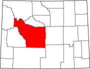 | |
| Towns | ||
| CDPs | ||
| Unincorporated communities | ||
| Ghost town | ||
| Indian reservation | ||
| International | |
|---|---|
| National | |