
Gansu
Gansu
Cam túc | |
|---|---|
| Province of Gansu | |
 Map showing the location of Gansu Province | |
| Coordinates:38°N102°E/ 38°N 102°E | |
| Country | China |
| Named for | Camgān:Ganzhou District,Zhangye Túc/Túcsù:Suzhou District,Jiuquan |
| Capital (and largest city) | Lanzhou |
| Divisions | 14prefectures,86 counties, 1344 townships |
| Government | |
| • Type | Province |
| • Body | Gansu Provincial People's Congress |
| •CCP Secretary | Hu Changsheng |
| • Congress chairman | Hu Changsheng |
| •Governor | Ren Zhenhe |
| •CPPCCchairman | Zhuang Guotai |
| Area | |
| • Total | 453,700 km2(175,200 sq mi) |
| • Rank | 7th |
| Highest elevation | 5,830 m (19,130 ft) |
| Population (2020)[1] | |
| • Total | 25,019,831 |
| • Rank | 22nd |
| • Density | 55/km2(140/sq mi) |
| • Rank | 27th |
| Demographics | |
| • Ethnic composition | Han:91% Hui:5% Dongxiang:2% Tibetan:2% |
| • Languages and dialects | Zhongyuan Mandarin,Lanyin Mandarin,Amdo Tibetan |
| GDP(2023)[3] | |
| • Total | CN¥1,186 billion (27th)
US$168 billion |
| • Per capita | CN¥ 47,867 (31th)
US$ 6,793 |
| ISO 3166 code | CN-GS |
| HDI(2019) | medium·29th |
| Website | Gansu.gov.cn (Simplified Chinese) |


| Gansu | |||||||||||||||||||||||||||||||||||||
|---|---|---|---|---|---|---|---|---|---|---|---|---|---|---|---|---|---|---|---|---|---|---|---|---|---|---|---|---|---|---|---|---|---|---|---|---|---|
 "Gansu" in Simplified (top) and Traditional (bottom) Chinese characters | |||||||||||||||||||||||||||||||||||||
| Chinese name | |||||||||||||||||||||||||||||||||||||
| Simplified Chinese | Cam túc | ||||||||||||||||||||||||||||||||||||
| Traditional Chinese | Cam túc | ||||||||||||||||||||||||||||||||||||
| Literal meaning | "Gan (zhou)andSu (zhou)" | ||||||||||||||||||||||||||||||||||||
| |||||||||||||||||||||||||||||||||||||
| Tibetan name | |||||||||||||||||||||||||||||||||||||
| Tibetan | ཀན་སུའུ་ཞིང་ཆེན། | ||||||||||||||||||||||||||||||||||||
| |||||||||||||||||||||||||||||||||||||
| Mongolian name | |||||||||||||||||||||||||||||||||||||
| Mongolian Cyrillic | Ганьсү муж | ||||||||||||||||||||||||||||||||||||
| Mongolian script | ᠭᠠᠨᠰᠤ ᠮᠤᠵᠢ | ||||||||||||||||||||||||||||||||||||
| |||||||||||||||||||||||||||||||||||||
| Uyghur name | |||||||||||||||||||||||||||||||||||||
| Uyghur | گەنسۇ ئۆلكىسى | ||||||||||||||||||||||||||||||||||||
| |||||||||||||||||||||||||||||||||||||
| Kazakh name | |||||||||||||||||||||||||||||||||||||
| Kazakh | گانسۋ ولكەسى Ганьсу өлкесі Gansu ölkesi | ||||||||||||||||||||||||||||||||||||
Gansu[a]is an inlandprovinceinNorthwestern China.Its capital and largest city isLanzhou,in the southeast part of the province.
The seventh-largest administrative district by area at 453,700 square kilometres (175,200 sq mi), Gansu lies between theTibetanandLoessplateaus and bordersMongolia'sGovi-Altai Province,Inner MongoliaandNingxiato the north,XinjiangandQinghaito the west,Sichuanto the south andShaanxito the east. TheYellow Riverpasses through the southern part of the province. Part of Gansu's territory is located in theGobi Desert.TheQilian mountainsare located in the south of the Province.
Gansu has a population of 26 million, ranking22nd in China.Its population is mostlyHan,along withHui,DongxiangandTibetanminorities. The most common language is Mandarin. Gansu is among the poorest administrative divisions in China,ranking 31st,last place, in GDP per capita as of 2019.
Thestate of Qinoriginated in what is now southeastern Gansu, and later established the first imperial dynasty in Chinese history. TheNorthern Silk Roadran through theHexi Corridor,which passes through Gansu, resulting in it being an important strategic outpost and communications link for the Chinese empire.
The city ofJiayuguan,the second most populated city in Gansu, is known for its section of theGreat Walland theJiayuguan Pass fortress complex.
Name[edit]
Gansu is a compound of the names ofGānzhou(now the mainurban districtandseatofZhangye) andSùzhou(an old name and the modern seat ofJiuquan), formerly the two most important Chinese settlements in theHexi Corridor.
Gansu is abbreviated as "Cam"(Gān) or "Lũng"(Lǒng), and was also known asLongxi(Lũng tây;'[land] west of Long "') orLongyou(Lũng hữu;'[land] right of Long "') prior to earlyWestern Han dynasty,in reference to theLong Mountain(the modern dayLiupan Mountain's southern section) between eastern Gansu and westernShaanxi.[citation needed]
Until 1987, Gansu was rendered in thepostal romanizationandWade-GilesasKansu,which gradually replaced by pinyin starting in 1958.[7]The spelling of the province is also spelled inMandarin Phonetic Symbols II(1986) andTongyong Pinyin(2002) adopted by theGovernment of the Republic of China(ROC) onTaiwan,who would later adopt Hanyu Pinyin in 2009.
History[edit]

Gansu's name is acompound namefirst used during theSong dynasty.It is a combination of the names of two prefectures (Châu) in theSuiandTang dynasty:Gan (aroundZhangye) and Su (aroundJiuquan). Its eastern part forms part of one of the cradles of ancient Chinese civilisation.
Ancient Gansu[edit]
In prehistoric times, Gansu was host toNeolithiccultures. TheDadiwan culture,from where archaeologically significantartifactshave been excavated, flourished in the eastern end of Gansu from about 6000BC to about 3000BC.[8]TheMajiayao cultureand part of theQijia culturetook root in Gansu from 3100 BC to 2700 BC and 2400 BC to 1900 BC respectively.
TheYuezhioriginally lived in the very western part of Gansu until they were forced to emigrate by theXiongnuaround 177 BC.
TheState of Qin,known in China as thefounding stateof theChinese empire,grew out from the southeastern part of Gansu, specifically theTianshuiarea. The Qin name is believed to have originated, in part, from the area.[9][10]Qin tombs and artifacts have been excavated fromFangmatannear Tianshui, including one 2200-year-old map ofGuixian County.[11]
Imperial era[edit]


In imperial times, Gansu was an important strategic outpost and communications link for the Chinese empire, as theHexi Corridorruns along the "neck" of the province. TheHan dynastyextended theGreat Wallacross this corridor, building the strategicYumenguan(Jade Gate Pass, nearDunhuang) andYangguanfort towns along it. Remains of the wall and the towns can be found there. TheMing dynastybuilt theJiayuguanoutpost in Gansu. To the west of Yumenguan and theQilian Mountains,at the northwestern end of the province, theYuezhi,Wusun,and othernomadictribes dwelt (Shiji123), occasionally figuring in regional imperial Chinesegeopolitics.
By the Qingshui treaty, concluded in 823 between theTibetan Empireand the Tang dynasty, China lost much of western Gansu province for a significant period.[12]
After the fall of theUyghur Khaganate,a BuddhistYugur(Uyghur) state called theGanzhou Uyghur Kingdomwas established by migrating Uyghurs from the khaganate in part of Gansu that lasted from 848 to 1036AD.
Along theSilk Road,Gansu was an economically important province, as well as a cultural transmission path. Temples andBuddhistgrottoes[13]such as those atMogao Caves('Caves of the Thousand Buddhas') andMaijishan Cavescontain artistically and historically revealingmurals.[14]An early form of paper inscribed withChinese charactersand dating to about 8BC was discovered at the site of a Western Hangarrisonnear the Yumen pass in August 2006.[15]
The Xixia orWestern Xiadynasty controlled much of Gansu as well asNingxia.
The province was also the origin of theDungan Revoltof 1862–77. Among theQingforces were Muslim generals, includingMa Zhan'aoandMa Anliang,who helped the Qing crush the rebel Muslims. The revolt had spread into Gansu from neighbouring Qinghai.
There was anotherDungan revolt from 1895 to 1896.

Republican China[edit]
As a result of frequent earthquakes, droughts and famines, the economic progress of Gansu was significantly slower than that of other provinces of China until recently. Based on the area's abundant mineral resources it has begun developing into a vital industrial center. Anearthquake in Gansuat 8.6 on theRichter scalekilled around 180,000 people mostly in the present-day area ofNingxiain 1920, andanother with a magnitude of 7.6killed 275 in 1932.[16]
TheMuslim Conflict in Gansu (1927–1930)was a conflict against theGuominjun.
While the Muslim GeneralMa Hongbinwas acting chairman of the province, Muslim GeneralMa Buqingwas in virtual control of Gansu in 1940. Liangzhou District inWuweiwas previously his headquarters in Gansu, where he controlled 15 million Muslims.[17]Xinjiangcame underKuomintang(Nationalist) control after their soldiers entered via Gansu.[18]Gansu'sTienshuiwas the site of a Japanese-Chinese warplane fight.[19]
Gansu was vulnerable to Soviet penetration via Xinjiang.[20]Gansu was a passageway forSoviet war supplies for the Republic of Chinaduring theSecond Sino-Japanese War.[21]Lanzhou was a destination point via a road coming fromDihua(Ürümqi).[22]TheGonxingdun Aerodromewas one of several air bases where theChinese Air Forceoperated in defense of Gansu. Gansu provided wartime China with most of the locallysourced petrolfrom theYumen Laojunmiao oil wellsbeginning in the summer of 1939, producing 250,000 tons ofcrude oilin those war years.[23]Lanzhou andLhasawere designated to be recipients of a new railway.[when?][24]
TheKuomintang Islamic insurgency in China (1950–1958)was a prolongation of theChinese Civil Warin several provinces including Gansu.
Geography[edit]
Gansu has an area of 454,000 square kilometres (175,000 sq mi), and the vast majority of its land is more than 1,000 metres (3,300 ft) abovesea level.It lies between theTibetan Plateauand theLoess Plateau,borderingMongolia(Govi-Altai Province) to the northwest,Inner MongoliaandNingxiato the north,Shaanxito the east,Sichuanto the south, andXinjiangto the west. TheYellow Riverpasses through the southern part of the province. The province contains thegeographical centreof China, marked by the Center of the Country Monument at35°50′40.9″N103°27′7.5″E/ 35.844694°N 103.452083°E.[25]
Part of theGobi Desertis located in Gansu, as well as small parts of theBadain Jaran Desertand theTengger Desert.
TheYellow Rivergets most of its water from Gansu, flowing straight through Lanzhou. The area around Wuwei is part ofShiyang River Basin.[26]
The landscape in Gansu is very mountainous in the south and flat in the north. The mountains in the south are part of theQilian Mountains,while the far westernAltyn-Taghcontains the province's highest point, at 5,830 metres (19,130 ft).
A natural land passage known asHexi Corridor,stretching some 1,000 kilometres (620 mi) from Lanzhou to theJade Gate,is situated within the province. It is bound from north by the Gobi Desert and Qilian Mountains from the south.

Gansu generally has a semi-arid to arid continental climate (KöppenBSkorBWk) with warm to hot summers and cold to very cold winters, althoughdiurnal temperature rangesare often so large that maxima remain above 0 °C (32 °F) even in winter. However, due to extreme altitude, some areas of Gansu exhibit asubarctic climate(Dwc) – with winter temperatures sometimes dropping to −40 °C (−40 °F). Most of the limited precipitation is delivered in the summer months: winters are so dry that snow cover is confined to very high altitudes and thesnow linecan be as high as 5,500 metres (18,040 ft) in the southwest.
-

-

-
 Qilian Mountainssoutheast ofJiuquan
 -

-
 Grasslands inMin County
 -
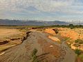
 Wetland by theYellow River,Maqu County


Administrative divisions[edit]
Gansu is divided into fourteenprefecture-level divisions:twelveprefecture-level citiesand twoautonomous prefectures:
| Administrative divisions of Gansu | |||||||||||
|---|---|---|---|---|---|---|---|---|---|---|---|
| Division code[27] | Division | Area in km2[28] | Population 2020[29] | Seat | Divisions[30] | ||||||
| Districts | Counties | Aut. counties | CL cities | ||||||||
| 620000 | Gansu Province | 425,800.00 | 25,019,831 | Lanzhoucity | 17 | 57 | 7 | 5 | |||
| 620100 | Lanzhoucity | 13,103.04 | 4,359,446 | Chengguan District | 5 | 3 | |||||
| 620200 | Jiayuguancity* | 2,935.00 | 312,663 | Shengli Subdistrict | |||||||
| 620300 | Jinchangcity | 7,568.84 | 438,026 | Jinchuan District | 1 | 1 | |||||
| 620400 | Baiyincity | 20,164.09 | 1,512,110 | Baiyin District | 2 | 3 | |||||
| 620500 | Tianshuicity | 14,312.13 | 2,984,659 | Qinzhou District | 2 | 4 | 1 | ||||
| 620600 | Wuweicity | 32,516.91 | 1,464,955 | Liangzhou District | 1 | 2 | 1 | ||||
| 620700 | Zhangyecity | 39,436.54 | 1,131,016 | Ganzhou District | 1 | 4 | 1 | ||||
| 620800 | Pingliangcity | 11,196.71 | 1,848,607 | Kongtong District | 1 | 5 | 1 | ||||
| 620900 | Jiuquancity | 193,973.78 | 1,055,706 | Suzhou District | 1 | 2 | 2 | 2 | |||
| 621000 | Qingyangcity | 27,219.71 | 2,179,716 | Xifeng District | 1 | 7 | |||||
| 621100 | Dingxicity | 19,646.14 | 2,524,097 | Anding District | 1 | 6 | |||||
| 621200 | Longnancity | 27,856.69 | 2,407,272 | Wudu District | 1 | 8 | |||||
| 622900 | Linxia Hui Autonomous Prefecture | 8,116.57 | 2,109,750 | Linxiacity | 5 | 2 | 1 | ||||
| 623000 | Gannan Tibetan Autonomous Prefecture | 38,311.56 | 691,808 | Hezuocity | 7 | 1 | |||||
| * – direct-piped cities – does not contain any county-level divisions | |||||||||||

| Administrative divisions in Chinese and varieties of romanizations | ||||
|---|---|---|---|---|
| English | Chinese | Pinyin | ||
| Gansu Province | Cam túc tỉnh | Gānsù Shěng | ||
| Lanzhoucity | Lan châu thị | Lánzhōu Shì | ||
| Jiayuguancity | Gia dục quan thị | Jiāyùguān Shì | ||
| Jinchangcity | Kim xương thị | Jīnchāng Shì | ||
| Baiyincity | Bạch ngân thị | Báiyín Shì | ||
| Tianshuicity | Thiên thủy thị | Tiānshuǐ Shì | ||
| Wuweicity | Võ uy thị | Wǔwēi Shì | ||
| Zhangyecity | Trương dịch thị | Zhāngyè Shì | ||
| Pingliangcity | Bình lương thị | Píngliáng Shì | ||
| Jiuquancity | Tửu tuyền thị | Jiǔquán Shì | ||
| Qingyangcity | Khánh dương thị | Qìngyáng Shì | ||
| Dingxicity | Định tây thị | Dìngxī Shì | ||
| Longnancity | Lũng nam thị | Lǒngnán Shì | ||
| Linxia Hui Autonomous Prefecture | Lâm hạ hồi tộc tự trị châu | Línxià Huízú Zìzhìzhōu | ||
| Gannan Tibetan Autonomous Prefecture | Cam nam tàng tộc tự trị châu | Gānnán Zàngzú Zìzhìzhōu | ||
The fourteenPrefectureof Gansu are subdivided into 86county-level divisions(17districts,5county-level cities,57counties,and 7autonomous counties).
Urban areas[edit]
| Population by urban areas of prefecture & county cities | ||||
|---|---|---|---|---|
| # | Cities | 2020 Urban area[31] | 2010 Urban area[32] | 2020 City proper |
| 1 | Lanzhou[b] | 3,012,577 | 2,438,595 | 4,359,446 |
| 2 | Tianshui | 752,900 | 544,441 | 2,984,659 |
| 3 | Wuwei | 467,726 | 331,370 | 1,464,955 |
| 4 | Baiyin | 454,323 | 362,363 | 1,512,110 |
| 5 | Pingliang | 332,399 | 248,421 | 1,848,607 |
| 6 | Jiuquan | 327,492 | 255,739 | 1,055,706 |
| 7 | Qingyang | 318,298 | 181,780 | 2,179,716 |
| 8 | Linxia | 315,082 | 220,895 | part ofLinxia Prefecture |
| 9 | Jiayuguan | 295,257 | 216,362 | 312,663 |
| 10 | Zhangye | 278,092 | 216,760 | 1,131,016 |
| 11 | Longnan | 243,502 | 136,468 | 2,407,272 |
| 12 | Jinchang | 237,927 | 195,409 | 438,026 |
| 13 | Dingxi | 222,386 | 158,062 | 2,524,097 |
| 14 | Lanzhou New Area[b] | 167,044 | [c] | see Lanzhou |
| 15 | Dunhuang | 129,853 | 111,535 | see Jiuquan |
| 16 | Huating | 110,695 | [d] | see Pingliang |
| 17 | Yumen | 87,544 | 78,940 | see Jiuquan |
| 18 | Hezuo | 75,650 | 57,384 | seeGannan Prefecture |
Politics[edit]

Secretaries of theChinese Communist Party(CCP) Gansu Committee:The Secretary of the CCP Gansu Committee is the highest-ranking office within Gansu Province.[33]
- Zhang Desheng(Trương đức sinh): 1949–1954
- Zhang Zhongliang(Trương trọng lương): 1954–1961
- Wang Feng(Uông phong): 1961–1966
- Hu Jizong(Hồ kế tông): 1966–1967
- Xian Henghan(Tiển hằng hán): 1970–1977
- Song Ping(Tống bình): 1977–1981
- Feng Jixin(Phùng kỷ tân): 1981–1983
- Li Ziqi(Lý tử kỳ): 1983–1990
- Gu Jinchi(Cố kim trì): 1990–1993
- Yan Haiwang(Diêm hải vượng): 1993–1998
- Sun Ying(Tôn anh): 1998–2001
- Song Zhaosu(Tống chiếu túc): 2001–2003
- Su Rong(Tô vinh): 2003–2007
- Lu Hao(Lục hạo): April 2007 − December 2011
- Wang Sanyun(Vương tam vận): December 2011 − March 2017
- Lin Duo(Lâm đạc): March 2017 − March 2021
- Yin Hong(Doãn hoằng): March 2021 − December 2022
- Hu Changsheng(Hồ xương thăng): December 2022 – present
Governors of Gansu:The Governorship of Gansu is the second highest-ranking official within Gansu, behind the Secretary of the CPC Gansu Committee.[33]The governor is responsible for all issues related toeconomics,personnel,political initiatives, theenvironmentand theforeign affairsof the province.[33]The Governor is appointed by theGansu Provincial People's Congress,which is the province'slegislativebody.[33]
- Wang Shitai(Vương thế thái): 1949–1950
- Deng Baoshan(Đặng bảo san): 1950–1967
- Xian Henghan(Tiển hằng hán): 1967–1977
- Song Ping(Tống bình): 1977–1979
- Feng Jixin(Phùng kỷ tân): 1979–1981
- Li Dengying(Lý đăng doanh): 1981–1983
- Chen Guangyi(Trần quang nghị): 1983–1986
- Jia Zhijie(Giả chí kiệt): 1986–1993
- Yan Haiwang(Diêm hải vượng): 1993
- Zhang Wule(Trương ngô nhạc): 1993–1996
- Sun Ying(Tôn anh): 1996–1998
- Song Zhaosu(Tống chiếu túc): 1998–2001
- Lu Hao(Lục hạo): 2001–2006
- Xu Shousheng(Từ thủ thịnh): January 2007 – July 2010[33]
- Liu Weiping(Lưu vĩ bình): July 2010 – April 2016
- Lin Duo(Lâm đạc): April 2016 – April 2017
- Tang Renjian(Đường nhân kiện): April 2017 − December 2020
- Ren Zhenhe(Nhậm chấn hạc): December 2020 – present
Economy[edit]
Despite recent growth in Gansu and the booming economy in the rest of China, Gansu is still considered to be one of the poorest provinces in China. For several years, it hasranked as one of the provinces with lowest GDP per capita.[34]Its nominal GDP for 2017 was about 767.7 billion yuan (US$113.70 billion) and per capita of 29,326 RMB (US$4,343). The province also has a large difference in wealth between regions and urban versus rural areas. The poorest areas are Dingxi, Longnan, Gannan and Linxia.[35]According to analysts, the local economy failed to gather momentum while other provinces did manage to increase their economic growth.[34]
Agriculture[edit]

Due to poor natural conditions such as aridness, Gansu is one of the Chinese provinces with smallest per capita area of arable land.[35]Agricultural production includescotton,linseed oil,maize,melons(such as thehoneydew melon,known locally as theBailan melon),millet,andwheat.[citation needed]Gansu is known as a source for wild medicinal herbs which are used inChinese medicine.However, pollution by heavy metals, such ascadmiumin irrigation water, has resulted in the poisoning of many acres of agricultural land. The extent and nature of the heavy metal pollution is considered a state secret.[36]
Industry[edit]
The industrial sector in Gansu was developed after completion of theLonghai railwayin 1953 and blueprinted in the firstfive-year plan of China.[37]Until 2014, the industrial sector contributed the most to Gansu's economy.[35]The most important industries are petrochemicals,non-ferrous metallurgy,machinery and electronics. The province is also an important base for wind and solar power.[37]As a result of environmental protection policies, the industry sector is not growing.[38]The manufacturing sector has been shrinking for several years and has low investment numbers.[34]
According to some sources,[who?]the province is also a center of China's nuclear industry.
As stipulated in the country's 12th Five Year Plan, the local government of Gansu hopes to grow the province's GDP by 10% annually by focusing investments on five pillar industries: renewable energy, coal, chemicals, nonferrous metals, pharmaceuticals and services.[citation needed]
Mining[edit]
This sectionneeds additional citations forverification.(April 2021) |
A large part of Gansu's economy is based onminingand the extraction ofminerals,[39]especiallyrare earth elements.The province has significant deposits ofantimony,chromium,coal,cobalt,copper,fluorite,gypsum,iridium,iron,lead,limestone,mercury,mirabilite,nickel,crude oil,platinum,troilite,tungsten,andzincamong others. The oil fields at Yumen and Changqing are considered significant.
Gansu has China's largest nickel deposits accounting for over 90% of China's total nickel reserves.[37]
Services[edit]

Since 2014, the service sector is the largest economic sector of Gansu.[35]Tourism is a sector that is becoming of increased importance.[38]
Economic and technological development zones[edit]
The following economic and technological zones are situated in Gansu:
- Lanzhou National Economic and Technological Development Zone was established in 1993, located in the center of Lanzhou Anning District. The zone has a planned area of 9.53 km2(3.68 sq mi). 17 colleges, 11 scientific research institutions, 21 large and medium-size companies and other 1735 enterprises have been set up in the zone. Main industries include textile mills, rubber, fertilizer plants, oil refinery, petrochemical, machinery, and metallurgical industry.[40]
- Lanzhou New & Hi-Tech Industrial Development Zone, Lanzhou Hi-Tech Industrial Development Zone, one of the first 27 national hi-tech industrial development zones, was established in 1998 covering more than 10 km2(3.9 sq mi). It is expected to expand another 19 km2(7.3 sq mi). The zone mainly focuses on Biotechnology, chemical industry, building decoration materials and information technology.[41]
Demographics[edit]

| Year | Pop. | ±% |
|---|---|---|
| 1912[42] | 4,990,000 | — |
| 1928[43] | 6,281,000 | +25.9% |
| 1936–37[44] | 6,716,000 | +6.9% |
| 1947[45] | 7,091,000 | +5.6% |
| 1954[46] | 12,928,102 | +82.3% |
| 1964[47] | 12,630,569 | −2.3% |
| 1982[48] | 19,569,261 | +54.9% |
| 1990[49] | 22,371,141 | +14.3% |
| 2000[50] | 25,124,282 | +12.3% |
| 2010[51] | 25,575,254 | +1.8% |
| 2020[52] | 25,019,831 | −2.2% |
| 2023 (est.)[53] | 24,650,000 | −1.5% |
| Ningxia Province/AR was part of Gansu Province until 1929 and 1954–1958. | ||
Gansu province is home to a little more than 25 million people.[54]As of 2020, 47.7% of the population was rural, but much relocation in recent years has reduced this. Gansu is 89.4%Han[54]and also hasHui,Tibetan,Dongxiang,Tu,Uyghurs,Yugur,Bonan,Mongolian,SalarandKazakhminorities. Gansu province's community of ChineseHuiMuslims was bolstered by Hui Muslims resettled fromShaanxiprovince during theDungan Revolt.Gansu is also a historical home, along withShaanxi,of thedialectof theDungans,who migrated toCentral Asia.The southwestern corner of Gansu is home to a largeethnic Tibetanpopulation. Modern Gansu is dominated by Lanzhou city and Linxia Hui prefectures, their growth hides the stark fact that much of the rest of the province is rapidly losing population.
Languages[edit]
Most of the inhabitants of Gansu speak dialects of NorthernMandarin Chinese.On the border areas of Gansu one might encounterTu,Tibetan,Mongolian,Uyghurand theKazakh language.Most of the minorities also speak Chinese.
Culture[edit]
A unique variety of Chinese folk music popularly identified with the local peoples of Gansu include the"Hua'er" (flowery melodies),and is popular among the Han and nine ethnic groups of Gansu.[55]The cuisine of Gansu is based on the staple crops grown there:wheat,barley,millet,beans,andsweet potatoes.Within China, Gansu is known for itslamian(pulled noodles), andMuslim restaurantswhich feature authentic Gansu cuisine.
Religion[edit]
Religion in Gansu (2012)[56]
According to a 2012 survey[56]around 12% of the population of Gansu belongs to organised religions, the largest groups beingBuddhistswith 8.2%, followed byMuslimswith 3.4%,Protestantswith 0.4% andCatholicswith 0.1%. Around 88% of the population may be either irreligious or involved inChinese folk religion,Buddhism,Confucianism,Taoism, andfolk religious sects.
Muslim restaurants are common, and feature typical Chinese dishes, but without any pork products, and instead an emphasis onlamb and mutton.Gansu has many works ofBuddhistart, including theMaijishan Grottoes.Dunhuang was a major centre of Buddhism in theMiddle Ages.
|


Tourism[edit]


Jiayuguan Pass of the Great Wall[edit]
Jiayuguan Pass, in Jiayuguan city, is the largest and most intact pass, or entrance, of theGreat Wall.Jiayuguan Pass was built in the earlyMing dynasty,somewhere around the year 1372. It was built near an oasis that was then on the extreme western edge of China. Jiayuguan Pass was the first pass on the west end of the great wall so it earned the name "The First And Greatest Pass Under Heaven".
An extra brick is said to rest on a ledge over one of the gates. One legend holds that the official in charge asked the designer to calculate how many bricks would be used. The designer gave him the number and when the project was finished, only one brick was left. It was put on the top of the pass as a symbol of commemoration. Another account holds that the building project was assigned to a military manager and an architect. The architect presented the manager with a requisition for the total number of bricks that he would need. When the manager found out that the architect had not asked for any extra bricks, he demanded that the architect make some provision for unforeseen circumstances. The architect, taking this as an insult to his planning ability, added a single extra brick to the request. When the gate was finished, the single extra brick was, in fact, extra and was left on the ledge over the gate.[58]
Mogao Grottoes[edit]
The Mogao Grottoes nearDunhuanghave a collection ofBuddhistart. Originally there were a thousand grottoes, but now only 492 cave temples remain. Each temple has a large statue of abuddhaorbodhisattvaand paintings of religious scenes. In 366 AD under theFormer Liang dynasty,a monk named Le Zun (Lo-tsun) came near Echoing Sand Mountain, when he had avision.He started to carve the first grotto. During theFive Dynasties periodthey ran out of room on the cliff and could not build any more grottoes.
Silk Road and Dunhuang City[edit]

The historicSilk Roadstarts inChang'an(present-dayXi'an) and goes toConstantinople(Istanbul). On the way merchants would go to Dunhuang in Gansu. In Dunhuang they would get fresh camels, food and guards for the journey around the dangerousTaklamakan Desert.Before departing Dunhuang they would pray to the Mogao Grottoes for a safe journey, if they came back alive they would thank the gods at the grottoes. Across the desert they would form a train of camels to protect themselves from thieving bandits. The next stop,Kashi (Kashgar),was a welcome sight to the merchants. At Kashi most would trade and go back and the ones who stayed would eat fruit and trade theirBactrian camelsforsingle humpedones. After Kashi they would keep going until they reached their next destination.
Located about 5 km (3.1 mi) southwest of the city, theCrescent Lakeor Yueyaquan is an oasis and popular spot for tourists seeking respite from the heat of the desert. Activities includes camel and 4x4 rides.
Silk Route Museum[edit]
The Silk Route Museum is located inJiuquanalong theSilk Road,a trading route connectingRometo China, used byMarco Polo.It is also built over the tomb of theWestern LiangKing.[59]
Bingling Temple[edit]
Bingling Temple, or Bingling Grottoes, is aBuddhistcave complex in a canyon along theYellow River.Begun in 420 AD during theWestern Qin dynasty,the site contains dozens of caves and caverns filled with outstanding examples of carvings, sculpture, and frescoes. The great Maitreya Buddha is more than 27 meters tall and is similar in style to the great Buddhas that once lined the cliffs ofBamiyan,Afghanistan. Access to the site is by boat fromYongjingin the summer or fall. There is no other access point.
Labrang Monastery[edit]
Labrang Tashikyil Monastery is located inXiahe County,Gannan Tibetan Autonomous Prefecture,located in the southern part of Gansu, and part of the traditional Tibetan province ofAmdo.It is one of the six major monasteries of theGelukpatradition ofTibetan BuddhisminTibet,and the most important one in Amdo. Built in 1710, it is headed by the Jamyang-zhaypa. It has 6dratsang(colleges), and houses over sixty thousand religious texts and other works of literature as well as other cultural artifacts.
Maijishan Grottoes[edit]

TheMaijishan Grottoesare a series of 194cavescut in the side of the hill of Majishan inTianshui.This example ofrock cut architecturecontains over 7,200Buddhistsculptures and over 1,000 square meters ofmurals.Construction began in theLater Qinera (384–417 CE).
Education[edit]
Gansu province is home to the only class ADouble First Class Universityin China's northwest,Lanzhou University.
Colleges and universities[edit]
- Lanzhou University,Lanzhou (Lan châu đại học)
- Northwest Normal University,Lanzhou (Tây bắc sư phạm đại học)
- Lanzhou University of Technology,Lanzhou (Lan châu lý công đại học)
- Lanzhou Jiaotong University,Lanzhou (Lan châu giao thông đại học)
- Northwest University of Nationalities,Lanzhou (Tây bắc dân tộc đại học)
- Gansu Agricultural University,Lanzhou (Cam túc nông nghiệp đại học)
- Lanzhou City University,Lanzhou (Lan châu thành thị học viện)
- Gansu Political Science and Law Institute,Lanzhou (Cam túc chính pháp học viện)
- Gansu University of Technology
- Lanzhou Commercial College
- Lanzhou Polytechnic College
- Hexi University,Zhangye (Hà tây học viện)
- Northwest Minority University
- Tianshui Normal College(Tianshui)
- Longdong College(Qingyang)
Natural resources[edit]

Land[edit]
- 166,400 square kilometres (64,200 sq mi) grassland
- 46,700 square kilometres (18,000 sq mi) mountain slopes suitable for livestock breeding
- 46,200 square kilometres (17,800 sq mi) forests (standing timber reserves of 0.2 cubic kilometres (0.048 cu mi))
- 35,300 square kilometres (13,600 sq mi) cultivated land (1,400 square metres (15,000 sq ft) per capita)
- 66,600 square kilometres (25,700 sq mi) wasteland suitable for forestation
- 10,000 square kilometres (3,900 sq mi) wasteland suitable for farming
Minerals[edit]
Three thousand deposits of 145 different minerals. Ninety-four minerals have been found and ascertained, including nickel, cobalt, platinum,selenium,casting clay, finishing serpentine, whose reserves are the largest in China.[citation needed]Gansu has advantages in getting[clarification needed]nickel, zinc, cobalt, platinum, iridium, copper,barite,andbaudisserite.
Energy[edit]
Among Gansu's most important sources of energy are its water resources: the Yellow River and other inland river drainage basins. Gansu is placed ninth among China's provinces in annual hydropower potential and water discharge. Gansu produces 17.24 gigawatts of hydropower a year. Twenty-nine hydropower stations have been constructed in Gansu, capable of generating 30 gigawatts in total. Gansu has an estimated coal reserve of 8.92 billion tons andpetroleum reserveof 700 million tons.
There is also good potential for wind and solar power development. TheGansu Wind Farmproject – already producing 7.965GW in 2015[60]– is expected to achieve 20GW by 2020, at which time it will likely become the world's biggest collective windfarm.
In November 2017 an agreement between theChinese Academy of Sciencesand Gansu government was announced, to site and begin operations of amolten salt reactorpilot project in the province by 2020.[61]
Flora and fauna[edit]
Gansu has 659 species of wild animals.[62]It has twenty-four rare animals which are under a state protection.
Gansu's mammals include some of the world's most charismatic: thegiant panda,golden monkeys,lynx,snow leopards,sika deer,musk deer,and theBactrian camel.
Among zoologists who studymoles,theGansu moleis of great interest. For a reason that can only be speculated, it is taxologically aNew World moleliving amongOld World moles:that is to say, an American mole living in a sea of Euro-Asians.
Gansu is home to 441speciesofbirds;it is a center ofendemismand home to many species andsubspecieswhich occur nowhere else in the world.
Gansu is China's second-largest producer of medicinal plants and herbs, including some produced nowhere else, such as thehairy asiabellroot,fritillarybulb, andChinese caterpillar fungus.

Environment[edit]
Natural disasters[edit]
On 16 December 1920, Gansu witnessed the deadliest landslide ever recorded. A series of landslides, triggered by a single earthquake, accounted for most of the 180,000 people killed in the event.[63]
Anti-desertification project[edit]
TheAsian Development Bankis working with theState Forestry Administration of Chinaon theSilk Road Ecosystem Restoration Project,designed to prevent degradation anddesertificationin Gansu. It is estimated to cost up to US$150 million.
Space launch center[edit]
TheJiuquan Satellite Launch Center,located in the Gobi desert, is named after the city ofJiuquan,Gansu, the nearest city, although the center itself is in theInner Mongolia Autonomous Region.
See also[edit]
- Huangyangchuan
- List of Major National Historical and Cultural Sites in Gansu
- List of prisons in Gansu
- Silk Road transmission of Buddhism
Notes[edit]
References[edit]
- ^"Communiqué of the Seventh National Population Census (No. 3)".National Bureau of Statistics of China.11 May 2021.Retrieved11 May2021.
- ^"Gansu - China knoema.com".baidu.Retrieved26 December2020.
- ^"National Data".China NBS.March 2024.Retrieved22 June2024.see also"zh: 2023 niên cam túc tỉnh quốc dân kinh tế hòa xã hội phát triển thống kế công báo".gansu.gov.cn. 14 March 2024.Retrieved22 June2024.The average exchange rate of 2023 was CNY 7.0467 to 1 USD dollar"Statistical communiqué of the People's Republic of China on the 2023 national economic and social development"(Press release). China NBS. 29 February 2024.Retrieved22 June2024.
- ^"Sub-national HDI - Subnational HDI".Global Data Lab.Retrieved17 April2020.
- ^Powers, John (2017).The Buddha party: how the people's Republic of China works to define and control Tibetan Buddhism.New York: Oxford University Press. pp. Appendix B, page 6.ISBN9780199358151.OCLC947145370.
- ^"Gansu".LexicoUK English Dictionary.Oxford University Press.Archived fromthe originalon 2 March 2021.
- ^"Thiểm tây vi thập ma bính tác Shaanxi, nhi bất thị Shanxi".Bành phái tân văn.7 July 2016.
- ^Dadiwan Relics Break Archeological Records
- ^Xinhua – EnglishArchived5 March 2012 at theWayback Machine
- ^"People's Daily Online – Chinese surname history: Qin".Archived fromthe originalon 3 March 2016.Retrieved22 February2016.
- ^Over 2,200-Year-old Map Discovered in NW ChinaArchived12 March 2007 at theWayback Machine
- ^Turghun Almas, "Uygurlar", Kashgar, 1989.
- ^English.people.com.cn
- ^"Artistic treasures of Maiji Mountain caves" by Alok Shrotriya and Zhou Xue-ying.Asianart.com
- ^Xinhuanet.com
- ^National Geophysical Data Center / World Data Service (NGDC/WDS): NCEI/WDS Global Significant Earthquake Database. NOAA National Centers for Environmental Information (1972)."Significant Earthquake Information".NOAA National Centers for Environmental Information.doi:10.7289/V5TD9V7K.
- ^Harrison Forman (19 July 1942)."Moslem War Lord Isolated by China; Ma Pu-ching Sent to Swamps of Tibet With the Title of Reclamation Commissioner Member of a Noted Clan Vital Route to Russia Passes Through Area With 15,000,000 Believers in the Koran".The New York Times.
- ^Hsiao-ting Lin (13 September 2010).Modern China's Ethnic Frontiers: A Journey to the West.Routledge.pp. 76–.ISBN978-1-136-92393-7.
- ^Alan Armstrong (2006).Preemptive Strike: The Secret Plan that Would Have Prevented the Attack on Pearl Harbor.Lyons Press. pp.122–.ISBN978-1-59228-913-4.
airfield kansu.
- ^Peter Fleming (19 August 2014).News from Tartary: An Epic Journey Across Central Asia.I.B.Tauris. pp. 264–.ISBN978-0-85773-495-2.
- ^Andrew D. W. Forbes (9 October 1986).Warlords and Muslims in Chinese Central Asia: A Political History of Republican Sinkiang 1911–1949.CUP Archive. pp. 146–.ISBN978-0-521-25514-1.
- ^Tetsuya Kataoka (1974).Resistance and Revolution in China: The Communists and the Second United Front.University of California Press. pp.170–.ISBN978-0-520-02553-0.
airfield kansu.
- ^Địa cầu tri thức cục, hành nghiệp quan sát (9 April 2018)."Tân trung quốc đệ nhất tọa thạch du công nghiệp thành thị dĩ lạc mạc?".OILSNS.China.Retrieved13 February2021.
With the exploration efforts of Sun Jianchu, Yan Shuang and other patriotic scholars, on August 11, 1939, the Laojunmiao oil well blew out the first oil. This moment has also become the starting point of China's petroleum industry. During the Anti-Fascist War against the Imperial Japanese forces, the Yumen oil wells produced a total of 250,000 tons of crude oil, accounting for more than 90% of the country's crude oil output during the same period, making an important contribution to the victory toward the Anti-Fascist War.
- ^Ginsburgs (11 November 2013).Communist China and Tibet: The First Dozen Years.Springer Science & Business Media. pp. 100–.ISBN978-94-017-5057-8.
- ^English.people.com.cn
- ^FutureWater."Groundwater Management Exploration Package".#Wageningen,Netherlands. Archived fromthe originalon 24 July 2011.Retrieved15 June2009.
- ^Trung hoa nhân dân cộng hòa quốc huyện dĩ thượng hành chính khu hoa đại mã(in Simplified Chinese).Ministry of Civil Affairs.
- ^Shenzhen Bureau of Statistics.《 thâm quyến thống kế niên giám 2014》(in Simplified Chinese).China Statistics Print.Archived fromthe originalon 12 May 2015.Retrieved29 May2015.
- ^Census Office of the State Council of the People's Republic of China; Population and Employment Statistics Division of the National Bureau of Statistics of the People's Republic of China (2012).Trung quốc 2010 niên nhân khẩu phổ tra phân hương, trấn, nhai đạo tư liêu(1 ed.). Beijing:China Statistics Print.ISBN978-7-5037-6660-2.
- ^Ministry of Civil Affairs(August 2014).《 trung quốc dân chính thống kế niên giám 2014》(in Simplified Chinese).China Statistics Print.ISBN978-7-5037-7130-9.
- ^Quốc vụ viện nhân khẩu phổ tra bạn công thất, quốc gia thống kế cục nhân khẩu hòa xã hội khoa kỹ thống kế tư biên (2022).Trung quốc 2020 niên nhân khẩu phổ tra phân huyện tư liêu.Beijing:China Statistics Print.ISBN978-7-5037-9772-9.
- ^Quốc vụ viện nhân khẩu phổ tra bạn công thất, quốc gia thống kế cục nhân khẩu hòa xã hội khoa kỹ thống kế tư biên (2012).Trung quốc 2010 niên nhân khẩu phổ tra phân huyện tư liêu.Beijing:China Statistics Print.ISBN978-7-5037-6659-6.
- ^abcde"Xu Shousheng re-elected governor of northwest China's Gansu Province".Xinhua.27 January 2008. Archived fromthe originalon 15 March 2008.Retrieved23 February2008.
- ^abc"Giải độc cam túc kinh tế chỉ tiêu: Tối nan kham đích sổ tự việt lai việt thật đích sổ tự _ cộng thoại lũng nguyên".www.gs.xinhuanet.com.Archived fromthe originalon 19 September 2021.Retrieved5 April2021.
- ^abcdLiyan Xu (December 2018)."Economic Geography Analysis of Gansu Province"(PDF).World Bank.
- ^Liu Hongqiao (1 March 2013)."The Poison Eaters of Gansu Province: Pollution is not a problem some western farmers can choose to ignore, as many say they have suffered from chronic bone pains for decades".Caixin.Retrieved1 March2013.
- ^abc"Gansu Province".Chinafolio.Retrieved5 April2021.
- ^ab"Cam túc kinh tế toàn quốc lạc hậu đích nguyên nhân, cận hữu nhất cá thành thị tại phát triển, kỳ tha thành thị bất tư tiến thủ".www.sohu.com.Retrieved5 April2021.
- ^"Natural resources in Gansu".www.chinadaily.com.cn.Retrieved5 April2021.
- ^RightSite.asiaArchived11 June 2010 at theWayback Machine,Lanzhou Economic and Technological Development Zone
- ^RightSite.asiaArchived17 July 2012 atarchive.today,Lanzhou Hi-Tech Industrial Development Zone
- ^1912 niên trung quốc nhân khẩu.Retrieved6 March2014.
- ^1928 niên trung quốc nhân khẩu.Retrieved6 March2014.
- ^1936–37 niên trung quốc nhân khẩu.Retrieved6 March2014.
- ^1947 niên toàn quốc nhân khẩu.Retrieved6 March2014.
- ^Trung hoa nhân dân cộng hòa quốc quốc gia thống kế cục quan vu đệ nhất thứ toàn quốc nhân khẩu điều tra đăng ký kết quả đích công báo.National Bureau of Statistics of China.Archived fromthe originalon 5 August 2009.
- ^Đệ nhị thứ toàn quốc nhân khẩu phổ tra kết quả đích kỉ hạng chủ yếu thống kế sổ tự.National Bureau of Statistics of China.Archived fromthe originalon 14 September 2012.
- ^Trung hoa nhân dân cộng hòa quốc quốc gia thống kế cục quan vu nhất cửu bát nhị niên nhân khẩu phổ tra chủ yếu sổ tự đích công báo.National Bureau of Statistics of China.Archived fromthe originalon 10 May 2012.
- ^Trung hoa nhân dân cộng hòa quốc quốc gia thống kế cục quan vu nhất cửu cửu 〇 niên nhân khẩu phổ tra chủ yếu sổ cư đích công báo.National Bureau of Statistics of China.Archived fromthe originalon 19 June 2012.
- ^Hiện tương 2000 niên đệ ngũ thứ toàn quốc nhân khẩu phổ tra khoái tốc hối tổng đích nhân khẩu địa khu phân bố sổ cư công bố như hạ.National Bureau of Statistics of China.Archived fromthe originalon 29 August 2012.
- ^"Communiqué of the National Bureau of Statistics of People's Republic of China on Major Figures of the 2010 Population Census".National Bureau of Statistics of China.Archived fromthe originalon 27 July 2013.
- ^"FACTBOX-Key takeaways from China's 2020 population census".Reuters.11 May 2021.
- ^"Cam túc cử hành 2023 niên kinh tế vận hành tình huống tân văn phát bố hội"(Press release). China SCIO. 19 January 2024.Retrieved27 January2024.
- ^ab"How Much Does Beijing Control the Ethnic Makeup of Tibet?".ChinaFile.2 September 2021.Retrieved8 May2023.
- ^Zhou, Jasmine."Folk Songs of Qinghai and Gansu".NAXOS.Retrieved15 February2021.
Hua'er is a form of Chinese folk music that is widely disseminated in the Gansu, Qinghai, Ningxia, and Xinjiang Provinces located in north-western China. It is performed among the Han and nine other ethnic minorities...
- ^abĐương đại trung quốc tông giáo trạng huống báo cáo —— cơ vu CFPS ( 2012 ) điều tra sổ cư[China Family Panel Studies 2012](PDF)(in Chinese).Chinese Academy of Social Sciences.Archived fromthe original(PDF)on 9 August 2014.Retrieved7 July2014..p. 013
- ^Wang Xudang,Li Zuixiong,and Zhang Lu (2010). "Condition, Conservation, and Reinforcement of the Yumen Pass and Hecang Earthen Ruins Near Dunhuang", in Neville Agnew (ed),Conservation of Ancient Sites on the Silk Road: Proceedings of the Second International Conference on the Conservation of Grotto Sites, Mogao Grottoes, Dunhuang, People's Republic of China, 28 June – 3 July 2004,351–357. Los Angeles: The Getty Conservation Institute, J. Paul Getty Trust.ISBN978-1-60606-013-1,pp 351–352.
- ^"The Great Wall in Gansu".Archived fromthe originalon 8 December 2015.Retrieved4 December2015.
- ^Silk Route Museum China Tourist InformationArchived9 April 2013 at theWayback MachineTourist Link.
- ^"South Africa's biggest wind farms vs the world".BusinessTech. 22 July 2015.Retrieved22 November2016.
- ^Trung khoa viện dữ cam túc tỉnh thiêm thự thổ cơ dung diêm đôi hạch năng hệ thống hạng mục chiến lược hợp tác khuông giá hiệp nghị ---- trung quốc khoa học viện(in Chinese).Chinese Academy of Sciences.10 November 2017. Archived fromthe originalon 13 November 2017.Retrieved13 September2021.
- ^Gansu.gov.cnArchived15 November 2009 at theWayback Machine
- ^Glenday, Craig (2013).Guinness world records 2014.The Jim Pattison Group. pp.015.ISBN978-1-908843-15-9.
External links[edit]
- Gansu Government official websiteArchived15 October 2016 at theWayback Machine
- .Encyclopædia Britannica(11th ed.). 1911.
Places adjacent to Gansu | |
|---|---|

| International | |
|---|---|
| National | |
| Geographic | |