Garba Tula
Garba Tula
(shortened toGarba) | |
|---|---|
Town | |
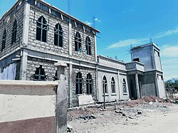
 Jamia Mosque being built in Garba Tula town | |
| Nickname: El Borte(From Borana Bitter Well) | |
| Coordinates:0°31′36″N38°30′54″E/ 0.52654°N 38.51492°E | |
| Country | |
| County | Isiolo County |
| Time zone | UTC+3(EAT) |
Garba Tula(also spelled Garbatulla) and popularly nicknamed by the localsEl Borte(meaningBitter Well,probably due to its salty water) is a town inIsiolo County,NorthernKenya.The town has an urban population of about 5,500.[1] In 2007 it was up-graded to a District status. But with the new administrative sub-divisions of Kenya, Garba Tula is a sub-county of Isiolo County, as well as an administrative ward.[2]
The First Settlement of Indians was back in 1900. In the 1940s Garba Tulla was a very small village and only had three shops on the main road. Mr. Joseph Onyango became the first District Commissioner on 17 November 2007. The town has been known for its famous National School run by NCCK.
Garba Tula is located 120 km East ofIsiolotown. The urban center ofMado Gashiis located about 100 km North East of Garba Tula. It is about 90 km toMauatown viaKinna,up to which the road is an all-weather one, and then tarmac which starts right at the gates ofMeru National Parkwhich is about 60 km away from Garba Tula town and about 14 km from Kinna town. The locals of the town are theSakuye peoplewho are ofBimaalorigin.
References[edit]
- ^https://web.archive.org/web/20110718022538/http://www.ilri.cgiar.org/html/Urban%20Poverty%20all%20Kenya%20Province%20through%20Location%20Final.xls
- ^"Isiolo County Integrated Development Plan, CIDP 2018-2022"(PDF).County Government of Isiolo.Archived fromthe original(PDF)on 2 August 2019.Retrieved2 August2019.

