
Gran Colombia


| History ofColombia | ||||||||||||||||||||
|---|---|---|---|---|---|---|---|---|---|---|---|---|---|---|---|---|---|---|---|---|
 | ||||||||||||||||||||
| Timeline | ||||||||||||||||||||
|
||||||||||||||||||||
|
| ||||||||||||||||||||
Gran Colombia(Spanish pronunciation:[ˈɡɾaŋkoˈlombja],"GreatColombia"), orGreater Colombia,officially theRepublic of Colombia(Spanish:República de Colombia), was a state that encompassed much of northernSouth Americaand part of southern North America (aka southernCentral America) from 1819 to 1831. It included present-dayColombia,mainlandEcuador(i.e. excluding theGalápagos Islands),Panama,andVenezuela,along with parts of northernPeru,northwesternBrazil,andclaimedthe Essequibo region. The terms Gran Colombia and Greater Colombia are usedhistoriographicallyto distinguish it from the currentRepublic of Colombia,[4]which is also the official name of the former state.
However,international recognitionof the legitimacy of the Gran Colombian state ran afoul of European opposition to the independence of states in the Americas.Austria,France,andRussiaonly recognized independence in the Americas if the new states accepted monarchs from European dynasties. In addition, Colombia and the international powers disagreed over the extension of the Colombian territory and its boundaries.[5]
Gran Colombia was proclaimed through the Fundamental Law of the Republic of Colombia, issued during theCongress of Angostura(1819), but did not come into being until theCongress of Cúcuta(1821) promulgated theConstitution of Cúcuta.
Gran Colombia was constituted as a unitary centralist state.[6]Its existence was marked by a struggle between those who supported acentralized governmentwith a strong presidency and those who supported a decentralized,federal form of government.At the same time, another political division emerged between those who supported theConstitution of Cúcutaand two groups who sought to do away with the Constitution, either in favor of breaking up the country into smaller republics or maintaining the union but creating an even stronger presidency. The faction that favored constitutional rule coalesced around Vice-PresidentFrancisco de Paula Santander,while those who supported the creation of a stronger presidency were led by PresidentSimón Bolívar.The two of them had been allies in the war against Spanish rule, but by 1825, their differences had become public and were an important part of the political instability from that year onward.
Gran Colombia was dissolved in 1831 due to the political differences that existed between supporters of federalism and centralism, as well as regional tensions among the peoples that made up the republic. It broke into thesuccessor statesof Colombia, Ecuador, and Venezuela; Panamawas separated from Colombiain 1903. Since Gran Colombia's territory corresponded more or less to the original jurisdiction of the formerViceroyalty of New Granada,it also claimed the Caribbean coast of Nicaragua, theMosquito Coast,as well as most ofEsequiba.
Etymology
[edit]Its proclaimed name was the Republic of Colombia.[7]Historians have adopted the term "Gran Colombia" to distinguish this republic from the present-day Republic of Colombia, which began using the name in 1863, although many useColombiawhere the confusion would not arise.[8]
The name "Colombia"is theSpanishversion of the eighteenth-centuryNeo-Latinword "Columbia"which derives from thefamily nameof theGenoeseexplorerChristopher Columbus.It was the term proposed by theVenezuelanrevolutionaryFrancisco de Mirandato denote theNew Worldregion of theWestern Hemisphere,especially to allAmericanterritories and colonies underSpanishrule. He used an improvised, quasi-Greek adjectival version of the name, "Colombia", to mean papers and things "relating to Colombia", as the title of the archive of his revolutionary activities.[9]
Simón Bolívar and otherSpanish American revolutionariesalso used the word "Colombia" in the continental sense. The 1819 proclamation of a country with the name "Colombia" by theCongress of Angosturagave the term a specific geographic and political reference.
Demographics
[edit]
The total population of Gran Colombia afterindependencewas 2,583,799 with Indians numbering 1,200,000 people or 50% of the population.[3]However in the modern-day territory of Colombia, the population was 1,327,000. Including 700,000 Indians which made up 53% of the population of the territory of Colombia.[10]
| District | Total population | |
|---|---|---|

|
Norte (Venezuela) | 686,212 |

|
Centro (New Granada) | 1,373,110 |

|
Sur (Ecuador) | 544,477 |
| Total | Gran Colombia | 2,533,799 |
History
[edit]This sectionneeds additional citations forverification.(December 2016) |

It was proclaimed by theCongress of Cúcutain 1821 in theConstitution of Cúcutaand had been promulgated through the Fundamental Law of the Republic of Colombia during theCongress of Angostura(1819). The territory it claimed loosely corresponded to the former territories of theViceroyalty of New Granada(1739–1777), which it claimed under the legal principle ofuti possidetis.It united the territories of the formerThird Republic of Venezuela,theUnited Provinces of New Granada,the formerRoyal Audiencia of Panama,and thePresidency of Quito(which was still under Spanish rule in 1821).
Since the new country was proclaimed soon after Bolívar's unexpectedvictory in New Granada,its government was temporarily set up as afederalrepublic, made up of three departments headed by a vice-president and with capitals in the cities ofBogotá(Cundinamarca Department),Caracas(Venezuela Department), andQuito(Quito Department).[11]In that year, none of the provinces of Quito, nor many in Venezuela and New Granada, were free yet.
TheConstitution of Cúcutawas drafted in 1821 at theCongress of Cúcuta,establishing the republic's capital in Bogotá. Bolívar and Santander were appointed by the Congress as the country's president and vice-president. A great degree of centralization was established by the assembly at Cúcuta since several New Granadan and Venezuelan deputies of the Congress who formerly had been ardent federalists now came to believe that centralism was necessary to successfully manage the war against theroyalists.To break up regionalist tendencies and to set up efficient central control of local administration, a new territorial division was implemented in 1824. The departments of Venezuela, Cundinamarca, and Quito were split into smaller departments, each governed by anintendantappointed by the central government, with the same powers thatBourbonintendants had.[12]Realizing that not all of the provinces were represented at Cúcuta because many areas of the country remained in royalist hands, the congress called for a new constitutional convention to meet in ten years.
In its first years, it helped other provinces still at war with Spain to become independent: all of Venezuela exceptPuerto Cabellowas liberated at theBattle of Carabobo,Panama joined the federation in November 1821, and the provinces ofPasto,GuayaquilandQuitoin 1822. That year Colombia became the first Spanish American republic recognized by the United States, due to the efforts of diplomatManuel Torres.[13]Its army later consolidated the independence of Peru in 1824.
Bolívar and Santander were re-appointed by the national congress in 1826.
Federalists and separatists
[edit]

Gran Colombia was constituted as a unitary centralist state.[6]Its history was marked by a struggle between those who supported acentralized governmentwith a strong presidency and those who supported a decentralized,federal form of government.At the same time, another political division emerged between those who supported theConstitution of Cúcutaand two groups who sought to do away with the constitution, either in favor of breaking up the country into smaller republics or maintaining the union but creating an even stronger presidency. The faction that favored constitutional rule and a federal state coalesced around vice-presidentFrancisco de Paula Santander,while those who supported the creation of a stronger presidency and national unity were led by PresidentSimón Bolívar.The two of them had been allies in the war against Spanish rule, but by 1825, their differences had become public and were an important part of the political instability from that year onward.
As the war against Spain came to an end in the mid-1820s,federalistandregionalistsentiments that had been suppressed for the sake of the war arose once again. There were calls for a modification of the political division, and related economic and commercial disputes between regions reappeared. Ecuador had important economic and political grievances. Since the end of the eighteenth century, its textile industry had suffered because cheaper textiles were being imported. After independence, it adopted a low-tariff policy, which benefited agricultural regions such as Venezuela. Moreover, from 1820 to 1825, the area was ruled directly by Bolívar because of the extraordinary powers granted to him. His top priority was the war in Peru against the royalists, not solving Ecuador's economic problems.
Having been incorporated later, Ecuador was also underrepresented in all branches of the central government, and Ecuadorians had little opportunity to rise to command positions in its army. Even local political offices were often staffed by Venezuelans and New Granadans. No outright separatist movement emerged in Ecuador, but these problems were never resolved in the ten-year existence of the country.[14]The strongest calls for a federal arrangement instead came from Venezuela, where there was strong federalist sentiment among the region'sliberals,many of whom had not fought in the war of independence but had supportedSpanish liberalismin the previous decade and who now allied themselves with the conservative Commandant General of the Department of Venezuela,José Antonio Páez,against the central government.[15]
In 1826, Venezuela came close toseceding.That year, Congress began impeachment proceedings against Páez, who resigned his post on April 28 but reassumed it two days later in defiance of the central government. Support for Páez and his revolt—which came to be known as theCosiata(a Venezuelancolloquialismof the time meaning "the insignificant thing" ) in Venezuelan history—spread throughout Venezuela, aided by the fact that it did not explicitly stand for anything, except defiance to the central government. Nevertheless, the support Páez received from across the Venezuelan political spectrum posed a serious threat to the unity of the country. In July and August, the municipal government of Guayaquil and ajuntain Quito issued declarations of support for Páez's actions. Bolívar, for his part, used the developments to promote the conservative constitution he had just written forBolivia,which found support among conservative Ecuadorians and the Venezuelan military officialdom, but was generally met with indifference or outright hostility among other sectors of society and, most importantly for future political developments, by vice-president Santander himself.
In November two assemblies met in Venezuela to discuss the future of the region, but no formal independence was declared at either. That same month, skirmishes broke out between the supporters of Páez and Bolívar in the east and south of Venezuela. By the end of the year, Bolívar was inMaracaibopreparing to march into Venezuela with an army, if necessary. Ultimately, political compromises prevented this. In January, Bolívar offered the rebellious Venezuelans a general amnesty and the promise to convene a new constituent assembly before the ten-year period established by the Constitution of Cúcuta, and Páez backed down and recognized Bolívar's authority. The reforms, however, never fully satisfied its different political factions, and no permanent consolidation was achieved. The instability of the state's structure was now apparent to all.[16]
In 1828, the new constituent assembly, the Convention of Ocaña, began its sessions. At its opening, Bolívar again proposed a new constitution based on the Bolivian one, but this suggestion continued to be unpopular. The convention fell apart when pro-Bolívar delegates walked out rather than sign a federalist constitution. After this failure, Bolívar believed that by centralizing his constitutional powers he could prevent the separatists (the New Granadians represented mainly byFrancisco de Paula SantanderandJosé María Obando,and the Venezuelans byJosé Antonio Páez) from bringing down the union. He ultimately failed to do so. As the collapse of the country became evident in 1830, Bolívar resigned from the presidency. Internal political strife between the different regions intensified even as GeneralRafael Urdanetatemporarily took power in Bogotá, attempting to use his authority to ostensibly restore order, but actually hoping to convince Bolívar to return to the presidency and the country to accept him. The federation finally dissolved in the closing months of 1830 and was formally abolished in 1831. Venezuela, Ecuador, and New Granada came to exist as independent states.
War with Peru
[edit]On 3 June 1828 Bolívar declared war on Peru over Gran Colombian claims on the Peruvian territories ofJaénandMaynas.[17]The war ended in the Treaty of Guayaquil, which was signed on 22 September 1829 and went into effect on 27 October 1829.[18]
Aftermath
[edit]Thedissolution of Gran Colombiarepresented the failure of Bolívar's vision. The former republic was replaced by the republics of Venezuela, Ecuador, and New Granada. The former Department of Cundinamarca (as established in 1819 at theCongress of Angostura) became a new country, theRepublic of New Granada.In 1858, New Granada was replaced by theGranadine Confederation.Later in 1863, the Granadine Confederation changed its name officially to theUnited States of Colombia,and in 1886, adopted its present-day name: the Republic of Colombia. Panama, which voluntarily became part of it in 1821, remained a department of the Republic of Colombia until 1903 when, in great part as a consequence of theThousand Days Warof 1899–1902,[19]it became independentunder intense American pressure. The United States wanted territorial rights in the futurePanama Canal Zone,which Colombia had refused.
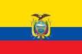
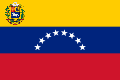
With the exception of Panama (which, as mentioned, achieved independence seven decades later), the countries that were created have similar flags, reminiscent of the flag of Gran Colombia:
- Current flags of Gran Colombia successor states
-

-
-


Government
[edit]Before a new constitution could be written by the 1821Congress of Cúcuta,the 1819Congress of Angosturaappointed Bolívar and Santander president and vice president, respectively. Under theConstitution of Cúcuta,the country was divided into twelvedepartmentseach governed by anintendant.Departments were further divided into thirty-six provinces, each headed by a governor, who had overlapping powers with the intendant. Military affairs at the department level were overseen by acommandant general,who could also be the intendant. All three offices were appointed by the central government. The central government, which temporarily was to reside inBogotá,consisted of a presidency, abicameralcongress, and ahigh court(theAlta Corte).
The president was the head of the executive branch of both the central and local governments. The president could be granted extraordinary powers inmilitary fronts,such as the area that became Ecuador. The vice-president assumed the presidency in case of the absence, death, demotion, or illness of the president. Since President Bolívar was absent from Gran Colombia for the early years of its existence, executive power was wielded by the vice president, Santander. Thevotewas given to persons who owned 100pesosin landed property or had an equivalent income from a profession. Elections wereindirect.[20][21]
Confederation status
[edit]In Peru, the dissolution of Gran Colombia is seen as a country ceasing to exist, giving way to the formation of new nation-states. The significance of this view is that the treaties Peru had signed with Gran Colombia became void when the countersignatory ceased to exist. The three new states, the Republic of New Granada (which later changed its name toRepublic of Colombia), theRepublic of Venezuela,and theRepublic of Ecuador,in the Peruvian view, started with a clean diplomatic slate.[22][23]
An alternative view is that Ecuador and Venezuela separated from the Gran Colombian Federation and inherited all of the treaty obligations that Gran Colombia had assumed, at least to the extent that they apply to their respective territories. There are indications that Colombia itself maintained this position; Gran Colombia and its successor state, the Republic of Colombia, shared a capital city, a subset of the same territory, and much the same citizenry. It would be unnatural to disavow their common histories.[22][23]
The question of the status of treaties and accords dating to the revolutionary period (1809–1819) and Gran Colombia period (1819–1830) has a profound effect on international relations to the present day.[22][23][example needed]
Reunification attempts
[edit]There have been attempts at thereunification of Gran Colombiasince theseparation of Panama from Colombiain 1903. People in favor of reunification are called"unionistas"or unionists. In 2008, the Bolivarian News Agency reported that the then-President of VenezuelaHugo Chávezannounced a proposal for a political restoration of Gran Colombia, under theBolivarian Revolution.[24]
See also
[edit]- Federal Republic of Central America– another post-independence state on the American continent that underwent a similar fate, made up of modernGuatemala,Honduras,Nicaragua,El SalvadorandCosta Rica.
- Flag of Gran Colombia
- Peru–Bolivian Confederation
- Reunification of Gran Colombia
- Campaigns of the South
- History of South America
References
[edit]- ^Bethell, Leslie (1985).The Cambridge History of Latin America.Cambridge University Press. p. 141.ISBN978-0-521-23224-1.RetrievedSeptember 6,2011.
- ^https://biblioteca.dane.gov.co/media/libros/LD_70104_1957_EJ_2.PDF| Author: José Lanz | Page 36
- ^abhttp://commons.wikimedia.org/wiki/Atlas_Geográfico_e_Histórico_de_la_República_de_Colombia_(1890)| Author: Imprenta A. Lahure
- ^"Los nombres de Colombia".Alta Consejería Presidencial para el Bicentenario de la Independencia de Colombia.Archived fromthe originalon September 18, 2016.RetrievedAugust 12,2016.
- ^"La búsqueda del reconocimiento internacional de la Gran Colombia".Biblioteca Nacional de Colombia.Archived fromthe originalon October 11, 2016.RetrievedAugust 12,2016.
- ^abGermán A. de la Reza (2014)."El intento de integración de Santo Domingo a la Gran Colombia (1821-1822)".Secuencia(93). Revista Secuencia: 65–82.RetrievedMarch 1,2016.
- ^"Gran Colombia".Encyclopædia Britannica.June 6, 2007.
- ^Bushnell,The Santander Regime,12. Bushnell uses both "Colombia" and "Gran Colombia."
- ^Miranda, Francisco de; Josefina Rodríguez de Alonso; José Luis Salcedo-Bastardo (1978).Colombeia: Primera parte: Miranda, súbdito español, 1750–1780.Vol. 1. Caracas: Ediciones de la Presidencia de la República. pp. 8–9.ISBN978-84-499-5163-3.
- ^Rosenblat, 1954: 36-56
- ^Bushnell,The Santander Regime,10–13.
- ^Bushnell,The Santander Regime,14–21.
- ^Bowman, Charles H. Jr. (March 1969). "Manuel Torres in Philadelphia and the Recognition of Colombian Independence, 1821–1822".Records of the American Catholic Historical Society of Philadelphia.80(1): 17–38.JSTOR44210719.
- ^Bushnell,The Santander Regime,310–317
- ^Bushnell,The Santander Regime,287–305.
- ^Bushnell,The Santander Regime,325–335, 343–345.
- ^Seckinger, Ron (1976)."South American Power Politics During the 1820s".Hispanic American Historical Review.56(2): 241–267.doi:10.1215/00182168-56.2.241.
- ^Maier, Georg (1969)."The Boundary Dispute between Ecuador and Peru".American Journal of International Law.63(1): 37.doi:10.2307/2197190.ISSN0002-9300.JSTOR2197190.
- ^Arauz, Celestino A; Carlos Manuel Gasteazoro; Armando Muñoz Pinzón (1980).La Historia de Panamá en sus textos.Textos universitarios: Historia (Panamá). Vol. 1. Panama: Editorial Universitaria.
- ^Bushnell,The Santander Regime,ii, 18–21.
- ^Gibson,The Constitutions of Colombia,37–40.
- ^abc"EL PERÍODO DE LA DETERMINACIÓN DE LA NACIONALIDAD: 1820 A 1842".Peru National Library.RetrievedJuly 12,2014.
- ^abc"Reformas de la Constitución de 1886".Miguel De Cervantes Biblioteca Virtual.Archived fromthe originalon January 18, 2013.RetrievedJuly 12,2014.
- ^"Boletin Informativo No.13"(PDF).Consulvenemontreal.org. Archived fromthe original(PDF)on September 23, 2015.RetrievedNovember 12,2015.
Bibliography
[edit]- Bushnell, David (1970).The Santander Regime in Gran Colombia.Westport, CT: Greenwood Press.ISBN0-8371-2981-8.OCLC258393.
- Gibson, William Marion (1948).The Constitutions of Colombia.Durham, NC: Duke University Press.OCLC3118881.
- Lynch, John(2006).Simón Bolívar: a Life.New Haven and London: Yale University Press.ISBN0-300-11062-6.
External links
[edit]- "Gran Colombia,"Flags of The World
| Background |
| ||||
|---|---|---|---|---|---|
| Overview | |||||
| Political history |
| ||||
| Military history |
| ||||
| Colombian figures | |||||
| Venezuelan figures | |||||
| Other figures | |||||
| Other |
| ||||
| History |  | ||||
|---|---|---|---|---|---|
| Geography | |||||
| Politics | |||||
| Economy | |||||
| Society |
| ||||
| International | |
|---|---|
| National | |
- Gran Colombia
- Pan-Americanism
- Former countries in South America
- Former countries in Central America
- Spanish American wars of independence
- Irredentism
- States and territories established in 1821
- States and territories disestablished in 1831
- 1819 establishments in South America
- 1821 establishments in South America
- 1831 disestablishments in South America
- 19th century in Colombia
- 19th century in Venezuela
- 19th century in Ecuador
- 19th century in Panama
- Congress of Angostura