Groene Hart
This article includes alist of references,related reading,orexternal links,but its sources remain unclear because it lacksinline citations.(May 2024) |


TheGroene Hart(Dutch pronunciation:[ˈxrunəˈɦɑrt];English: Green Heart) is a relatively thinly populated area of theNetherlandscovering much of the middle portion of theRandstadmegalopolis. The major Dutch cities ofRotterdam,The Hague,Leiden,Haarlem,Amsterdam,andUtrechtsurround this area. Cities inside the Groene Hart includeZoetermeer,Alphen aan den Rijn,Gouda,Woerden,and the smaller cities ofSchoonhoven,Oudewater,Haastrecht,Nieuwkoop,Montfoort,Waddinxveen,Bodegraven,andBoskoop.
Description
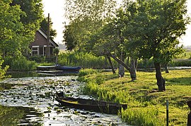
[edit]The Groene Hart has a rural character, which contrasts with the urban areas around it. Agriculture, nature, and recreation are the primary activities in the Groene Hart.[citation needed]Mills, dikes and Dutch cows are the primary sights of this lowland area. The Groene Hart is important Dutch bird habitat. The bird speciesblack-tailed godwit,northern lapwingandEurasian oystercatchercan all be found in the area.[citation needed]
History
[edit]Since theDutch Golden Age,there has been a ring of cities surrounding this green and open central area. This area was given the nickname of "Groene Hart" by the middle of the twentieth century. The Groene Hart developed in the territory between the large cities in the Western Netherlands as an area ofwet meadowsandmarshland.Thesewetlandswere not suitable for building, so they were used foragricultureandpeatproduction.
Geography
[edit]The Groene Hart is a water-rich area, with bodies of water such as theLangeraarse Plassen,Nieuwkoopse Plassen,Reeuwijkse Plassen,Kagerplassen,andBraassemermeer.In addition, rivers such as theHollandse IJssel,Oude Rijn,Lek,Vlist,Loet,Rotte,andMeijerun through the area.
One of theEuropean footpathsruns through the area. In the Netherlands it is known as the Floris V-pad, part of the Dutch LAW 1-3 path. The Limes, the former northern border of the Roman empire in The Netherlands, crosses the Groene Hart.
Government policy
[edit]A government policy was adopted in 2003 to preserve the Groene Hart. It allows for the larger cities on the edge of the Groene Hart to build limited amounts of housing. The government also limits the establishment of greenhouses and other types of commercial buildings within the area.
The plan for the development of the Groene Hart includes four areas:
- Around the outside of the Groene Hart is theRandstad,an urban area that almost completely surrounds the Groene Hart. Between these urban areas lie green environs that connect to other green sections of the Netherlands.
- Connected to the Randstad Ring is an extended area of water and forests. This is used for recreation and as a buffer againsturban sprawl.
- There will be four core areas fornatureandwater sports.There will be extended areas of bogs,marshes,and wet forests. These four areas (De Venen, Krimpenerwaard, Vechtplassen, and Hollandse Plassen) will be connected to each other with grassy berms.
- Between the core areas and the outer areas will be pastures for nature, recreation, and agriculture.
External links
[edit]- Groene Hart tourism and recreation(partially translated in multiple languages)
- Programmabureau Groene HartArchived2010-02-08 at theWayback Machine(in Dutch)
- Groenehart Archieven(in Dutch)
- Van Randstad tot Delta Metropool(in Dutch)
