
Harare
This articleneeds additional citations forverification.(July 2024) |
Harare | |
|---|---|
 Left to right, from top:Harare skyline;Jacarandatrees lining Josiah Chinamano Avenue;Old Parliament House(front) and theAnglican Cathedral(behind); downtown Harare;New Reserve Bank Tower;Heroes' Acremonument | |
 Coat of arms | |
| Nicknames: Sunshine City, H Town | |
Mottoes:
| |
 Location ofHarare Provincein Zimbabwe | |
| Coordinates:17°49′45″S31°3′8″E/ 17.82917°S 31.05222°E | |
| Country | Zimbabwe |
| Province | Harare |
| Founded | 12 September 1890 |
| Incorporated (city) | 1935 |
| Renamed Harare | 18 April 1982 |
| Government | |
| • Type | Mayor–council |
| •Mayor | Jacob Mafume(CCC) |
| •Council | Harare City Council |
| Area | |
| •Capital cityandprovince | 982.3 km2(379.3 sq mi) |
| Elevation | 1,490 m (4,890 ft) |
| Population (2022 census)[1] | |
| •Capital cityandprovince | 1,491,740 |
| • Density | 1,500/km2(3,900/sq mi) |
| •Urban | 1,558,823 |
| •Metro | 1,603,201 |
| Demonym | Hararean |
| Time zone | UTC+2(CAT) |
| Area code | 242 |
| HDI(2018) | 0.645[4] Medium |
| Dialling code 242 (or 0242 from within Zimbabwe) | |

Harare(/həˈrɑːreɪ/hə-RAR-ay),[5]formerly known asSalisbury[6](/ˈsɔːlzbəri/SAWLZ-bər-ee), is thecapitaland largest city ofZimbabwe.Thecity properhas an area of 982.3 km2(379.3 sq mi), a population of 1,849,600 as of the2022 census[7]and an estimated 2,487,209 people in its metropolitan province.[7]The city is situated in north-eastern Zimbabwe in the country'sMashonalandregion. Harare is ametropolitanprovincewhich also incorporates the municipalities ofChitungwizaandEpworth.[8]The city sits on aplateauat an elevation of 1,483 metres (4,865feet)above sea level,and itsclimatefalls into thesubtropical highlandcategory.
The city was founded in 1890 by thePioneer Column,a smallmilitary forceof theBritish South Africa Company,and was namedFort Salisburyafter the British Prime MinisterLord Salisbury.Companyadministratorsdemarcatedthe city and ran it untilSouthern Rhodesiaachievedresponsible governmentin 1923. Salisbury was thereafter the seat of the Southern Rhodesian (laterRhodesian) government and, between 1953 and 1963, the capital of theCentral African Federation.It retained the name Salisbury until 1982 when it was renamed Harare on the second anniversary of Zimbabwe's independence from theUnited Kingdom.The nationalparliamentmoved out of Harare upon completion of theNew Parliament of ZimbabweinMount Hampdenin April 2022.[9]
The commercial capital of Zimbabwe, Harare, has experienced recent economic turbulence.[clarification needed]However, it remains an important centre ofcommerceandgovernment,as well asfinance,real estate,manufacturing,healthcare,education,art,culture,tourism,agriculture,miningand regional affairs.[10]Harare has the second-highest number of embassies in Southern Africa and serves as the location of the African headquarters of theWorld Health Organization,which it shares withBrazzaville.[11]
Harare has hosted multiple internationalconferencesand events, including the1995 All-Africa Gamesand the 2003Cricket World Cup.In 2018, Harare was ranked as a GammaWorld City.It is also home toDynamos FC,the club with the most titles inZimbabwean football.
History
[edit]Early colonial history
[edit]

ThePioneer Column,a military volunteer force of settlers organised byCecil Rhodes,founded the city on 12 September 1890 as a fort.[12][13]They originally named the city Fort Salisbury afterThe 3rd Marquess of Salisbury,then-Prime Minister of the United Kingdom,and it subsequently became known simply as Salisbury. The Salisbury Polo Club was formed in 1896.[14]Salisbury was declared a municipality in 1897, and it became a city in 1935.[15]

At the time of the city's founding, its site and surroundings were poorly drained. The earliest development was on sloping ground along the left bank of a stream, in an area where the Julius Nyerere Way industrial road runs today. The first area to be fully drained was near the head of the stream and was named Causeway. Causeway is now the site of many important government buildings, including theSenateHouse and the Office of the Prime Minister. After the position was abolished in January 1988, the office was renamed for the use of thePresident.[16]

Salisbury was the seat of theBritish South Africa Companyadministrator and became capital of theself-governingBritish colony ofSouthern Rhodesiain 1923.[citation needed]
Post-war period
[edit]In the immediate aftermath of theSecond World War,Salisbury expanded rapidly, boosted by its designation as the capital of theFederation of Rhodesia and Nyasaland.This growth ushered in a wave ofliberalism,investment anddevelopmentalismfrom 1953 to 1963, transforming the city's skyline in the process.[17]This was accompanied by significant post-war immigration by White people, primarily fromGreat Britain,Southern Africaand, to a lesser extent,Southern Europe.[citation needed]The rapid rise of motor vehicle ownership and the investment in road development greatly accelerated the outward sprawl of suburbs such asAlexandra ParkandMount Pleasant.At the same time, mostly black suburbs likeHighfieldsuffered fromovercrowdingas their populations boomed.[citation needed]
The optimism and prosperity of this period proved to be short-lived, as the Federation collapsed, which hindered the city's prosperity.[17][additional citation(s) needed]
1960s and 1970s
[edit]This sectionneeds expansion.You can help byadding to it.(July 2024) |
TheFederation of Rhodesia and Nyasalandwas dissolved in 1963.Ian Smith'sRhodesian Frontgovernmentdeclared Rhodesia independentfrom the United Kingdom on 11 November 1965, with Salisbury retained as the capital. Smith's Rhodesia later became the short-lived state ofZimbabwe Rhodesia;it was not until 18 April 1980 that the country was internationally recognised as independent as theRepublic of Zimbabwe.[citation needed]
Post-independence years
[edit]
The city initially boomed under a wave of optimism and investment that followed the country's independence in 1980. The name of the city was changed to Harare on 18 April 1982, the second anniversary of Zimbabwean independence, taking its name from the village near Harare Kopje of theShonachief Neharawa, whose nickname was "he who does not sleep".[18]Before independence, "Harare" was the name of the black residential area now known asMbare.[citation needed]
Significant investment in education and healthcare produced a confident and growingmiddle class,evidenced by the rise of firms such asEconet Globaland innovative design andarchitecture,exemplified by theEastgate Centre.A notable symbol of this era in Harare's history is theNew Reserve Bank Tower,one of the city's major landmarks.[citation needed]
Harare was the location of several international summits during this period, such as the 8th Summit of the Non-Aligned Movement in September 1986 and theCommonwealth Heads of Government Meeting 1991.[19]The latter produced theHarare Declaration,dictating themembership criteriaof theCommonwealth.In 1998, Harare was the host city of the 8th Assembly of theWorld Council of Churches.[20]
However, by 1992, Harare began to experience an economic downturn and the government responded by enactingneoliberalreforms. These policies provoked a boom inbanking,finance and agriculture, but also led to significant job losses inmanufacturing,thereby greatly increasing unemployment andincome inequality.Domestic firms struggled to compete with foreign imports, leading to the collapse of several institutions, particularly in the textile industry.[17]
Economic difficulties and hyperinflation (1999–2008)
[edit]In the early 21st century, Harare was adversely affected by the political and economic crises that plagued Zimbabwe, particularly following the contested 2002 presidential election and 2005 parliamentary elections. The elected council was replaced by a government-appointed commission due to alleged inefficiency.[citation needed]Still, essential services such as rubbish collection and street repairs rapidly worsened, and are now virtually non-existent in poorer parts of the city.[citation needed]In May 2006, Zimbabwean newspaperFinancial Gazettedescribed the city in an editorial as a "sunshine city-turned-sewage farm".[21]In 2009, Harare was voted the world's toughest city to live in according to the Economist Intelligence Unit's livability poll, which factors in stability, healthcare, culture and environment, education, and infrastructure.[22]The situation was unchanged in 2011, according to the same poll.[23]
Operation Murambatsvina
[edit]In May 2005, the Zimbabwean government demolished shanties, illegal vending sites, and backyard cottages in Harare, Epworth and other cities inOperation Murambatsvina[24]( "Drive Out Trash" ). It was widely alleged[weasel words]that the true purpose of the campaign was to make sure shantie towns would not develop in any urban areas that might favor theMovement for Democratic Change,and to reduce the likelihood of mass action against the government by driving people out of the cities.[citation needed]The government claimed its actions were necessitated by a rise of criminality and disease.[citation needed]This was followed byOperation Garikayi/Hlalani Kuhle(Operation "Better Living" ) a year later, which consisted of building poor-quality concrete housing.[citation needed]
Economic uncertainty
[edit]In late March 2010, Harare's Joina City Tower was finally opened after fourteen years of delayed construction, marketed as 'Harare's New Pride'.[25]Initially, uptake of space in the tower was low, with office occupancy at only 3% in October 2011.[26]By May 2013, office occupancy had risen to around half, with all the retail space occupied.[27][relevant?]
TheEconomist Intelligence Unitrated Harare as the world's least livable city (out of 140 surveyed) in February 2011,[28]rising to 137th out of 140 in August 2012.[29]
In March 2015,Harare City Councilplanned a two-year project to install 4,000solar street lights,starting in the central business district, at a cost of $15,000,000.[30]
In November 2017, the biggest demonstration in the history of the Republic of Zimbabwe was held in Harare, which led to the forced resignation of the long-serving 93-year-oldPresident of Zimbabwe,Robert Mugabe,an event which was part of the first successful coup in Zimbabwe.[31][32]
Contemporary Harare
[edit]Since 2000, Harare has experienced periods of spectacular decline, particularly in the 2000s, but since theGreat Recessionit has stabilised and experienced significant population growth and uneven economic growth.[citation needed][clarification needed]There has nonetheless been substantial international investment and speculation in the city'sfinancialand property markets. Development on the urban fringes of the city has occurred in areas such asBorrowdale,Glen Lorne,The Grange,Mount Pleasant Heights,as well as in the new suburbs of Hogerty Hill, Shawasha Hills,Bloomingdaleand Westlea. Urban sprawl has also expanded into the nearby areas ofMount Hampden,Ruwaand Norton.[33]In addition, inner city areas such asAvondale,Eastlea, Belgravia,Newlandsand Milton Park have seen increasedgentrificationdriven by speculation from expat Zimbabweans. This speculation has also attracted other foreign buyers, resulting in high property prices and widespread rent increases.[34]Harare sustained the highest population increase and urban development of any major Zimbabwean city since 2000, with other cities such asBulawayo,Gweru,andMutarelargely stagnating during the same period.[35]
Beginning in 2006, the city's growth extended into its northern and western fringes, beyond the city'surban growth boundary.Predictions that by 2025 the metropolitan area population will reach 4 to 5 million have sparked concerns over unchecked sprawl and unregulated development.[36][needs update]The concentration of real estate development in Harare has also come at the expense of other Zimbabwean cities such asGweruand particularlyBulawayo,which is increasingly characterized by stagnation and high unemployment due to the collapse of many of its heavy industries. Today, Harare's property market remains highly priced, more so than regional cities such asJohannesburgandCape Town.[citation needed]The top end of the market is completely dominated by wealthy ordual-citizenZimbabweans (seeZimbabwean diasporaandZimbabweans in the United Kingdom), Chinese and South African buyers.[33][36]Despite gentrification and speculation, the country's and city's unemployment rates remain high.[citation needed]
In 2020, Harare was classified as aGamma cityby theGlobalization and World Cities Research Network.[37]
Demographics
[edit]As of 2012, Harare has a population of 2,123,132.[1]Over 90% of people in Harare areShona-speaking people of African descent.Harare is also home to manyNdebeleandKalanga peopleas well. Roughly 25,000white Zimbabweansalso live in the Harare metro area.[38]
Geography
[edit]Topography
[edit]The city sits on one of the higher parts of theHighveldplateau of Zimbabwe at an elevation of 1,483 metres (4,865 feet). The original landscape could be described as a "parkland"[39]or wild place. The soils of Harare are varied: the northern and central areas largely have reddish brown, granular clay; some of the southern parts have gray-brown sand over pale, loamy sand or sandy loam.[40]
Suburbs
[edit]The City of Harare is divided into suburbs, outside of which are independent municipalities such asEpworth,Mount Hampden,Norton,Ruwa, andChitungwiza,which are still located within the greater metropolitan province.[41]
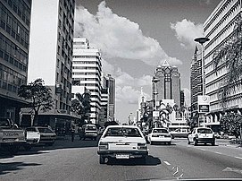
Thecentral business districtof Harare is characterized by wide streets and a mix of historic, post-war, and modern buildings. Downtown sights include the Kopje Africa Unity Square, the Harare Gardens, the National Gallery, the August House parliamentary buildings, and theNational Archives.Causeway,a road and sub-neighbourhood of central Harare, is a busy workaday area that acts as the city's "embassy row" (along with Belgravia to the north-east) in which numerous embassies, diplomatic missions, research institutes, and other international organizations are concentrated.[42]Additionally, many government ministries and museums, such as theZimbabwe Museum of Human Sciences,are located here.[43]
Rotten Rowis a sub-district of downtown Harare that begins at the intersection of Prince Edward Street and Samora Machel Avenue and runs to the flyover where it bordersMbareon Cripps Road.[44]Rotten Row was named after a road inLondonof the same name. The name "Rotten Row" is an altered form of the French phrase "Route du Roi," theKing's Road.[45]It is known as Harare's legal district, home to the Harare Magistrate's Court, the city's central library, and theZANU-PFbuilding, along with numerous law offices.[44]The neighbourhood also lends its name to the eponymous book byPetina Gappahpublished in 2016.[46]
The northern and north-eastern suburbs of Harare are generally home to its more affluent residents, including former presidentRobert Mugabe,who lived in Borrowdale Brooke.[47]These northern suburbs are often referred to as "dales" because of the common suffix "-dale" found in some suburbs such as Avondale, Greendale, and Borrowdale.[citation needed]The dwellings are mostly low-density homes of 3 bedrooms or more, and these are usually occupied by families.[citation needed]Borrowdale in particular is home to some of the most extensive real estate developments in the city.[48]The north-western suburb ofEmerald Hillis named so either due to the green colour of the tree-covered hill or its Irish connections — many of the roads in the suburb have Irish names, such asDublin,Belfast,Wicklow, and Cork.[48]
To the east of Harare's city center, notable suburbs includeArcadia,Newlands,Arlington, and others.Newlandswas named by Colin Duff, Zimbabwe's agricultural secretary in the 1920s. Arlington is a newer suburb adjacent toHarare International Airportand was previously owned by William Harvey Brown, a former mayor of Salisbury. Brown was originally fromIowaand joined the occupyingBritish South Africa Companyforces in the 1890s to collect specimens for theSmithsonian InstitutioninWashington, D.C.[48]
The southern portions of Harare have historically been more industrial areas, often home to most of its African population as well as some lower-class European-descended populations.[49]Willowvale, is perhaps best known for the 1988Willowgatescandal, which implicated several members of theZANU-PFparty in a scheme where automobiles were illegally resold by various government officials.[citation needed]Harare's south-west also contains many high-density townships, which were set up by the government from the 1930s onwards. For example,Highfield,established in 1930, is the second-oldest high-density suburb in Harare. Highfield was created as a place for black workers to settle, providing labor for the industrial areas of Southerton and Workington.[48]
Climate
[edit]
Under theKöppen climate classification,Harare has asubtropical highland climate(KöppenCwb), anoceanic climatevariety. Because the city is situated on a plateau, its high altitude and cool south-easterly airflow cause it to have a climate that is cooler and drier than atropicalorsubtropical climate.
The average annual temperature is 17.95 °C (64.3 °F), rather low for the tropics. This is due to its high altitude position and the prevalence of cool south-easterly airflow.[50]
There are three main seasons: a warm, wet summer from November to March/April; a cool, dry winter from May to August (corresponding to winter in the Southern Hemisphere); and a warm to hot, dry season in September/October. Daily temperature ranges are about 7–22 °C (45–72 °F) in July (the coldest month), about 15–29 °C (59–84 °F) in October (the hottest month) and about 16–26 °C (61–79 °F) in January (midsummer). The hottest year on record was 1914 with 19.73 °C (67.5 °F) and the coldest year was 1965 with 17.13 °C (62.8 °F).
The average annual rainfall is about 825 mm (32.5 in) in the southwest, rising to 855 mm (33.7 in) on the higher land of the northeast (from around Borrowdale to Glen Lorne). Very little rain typically falls during the period of May to September, although sporadic showers occur most years. Rainfall varies a great deal from year to year and follows cycles of wet and dry periods from 7 to 10 years long. Records begin in October 1890 but all three Harare stations stopped reporting in early 2004.[51]
The climate supports the natural vegetation of open woodland. The most common tree of the local region is the msasa orBrachystegia spiciformiswhose wine-red leaves are most visible in the city in late August. Two introduced species of trees, thejacarandaand theflamboyantfrom South America and Madagascar respectively, were introduced during the colonial era and contribute to the city's colour palette with their lilac and red blossoms. The two species flower in October/November and are planted on alternating streets in the capital.Bougainvilleais prevalent in Harare as well. Some trees from Northern Hemisphere middle latitudes are also cultivated, includingAmerican sweetgum,English oak,Japanese oakandSpanish oak.[52]
| Climate data for Harare (1961–1990, extremes 1897–present) | |||||||||||||
|---|---|---|---|---|---|---|---|---|---|---|---|---|---|
| Month | Jan | Feb | Mar | Apr | May | Jun | Jul | Aug | Sep | Oct | Nov | Dec | Year |
| Record high °C (°F) | 33.9 (93.0) |
35.0 (95.0) |
32.3 (90.1) |
32.0 (89.6) |
30.0 (86.0) |
27.7 (81.9) |
28.8 (83.8) |
31.0 (87.8) |
35.0 (95.0) |
36.7 (98.1) |
35.3 (95.5) |
33.5 (92.3) |
36.7 (98.1) |
| Mean daily maximum °C (°F) | 26.2 (79.2) |
26.0 (78.8) |
26.2 (79.2) |
25.6 (78.1) |
23.8 (74.8) |
21.8 (71.2) |
21.6 (70.9) |
24.1 (75.4) |
28.4 (83.1) |
28.8 (83.8) |
27.6 (81.7) |
26.3 (79.3) |
25.5 (77.9) |
| Daily mean °C (°F) | 21.0 (69.8) |
20.7 (69.3) |
20.3 (68.5) |
18.8 (65.8) |
16.1 (61.0) |
13.7 (56.7) |
13.4 (56.1) |
15.5 (59.9) |
18.6 (65.5) |
20.8 (69.4) |
21.2 (70.2) |
20.9 (69.6) |
18.4 (65.1) |
| Mean daily minimum °C (°F) | 15.8 (60.4) |
15.7 (60.3) |
14.5 (58.1) |
12.5 (54.5) |
9.3 (48.7) |
6.8 (44.2) |
6.5 (43.7) |
8.5 (47.3) |
11.7 (53.1) |
14.5 (58.1) |
15.5 (59.9) |
15.8 (60.4) |
12.3 (54.1) |
| Record low °C (°F) | 9.6 (49.3) |
8.0 (46.4) |
7.5 (45.5) |
4.7 (40.5) |
2.8 (37.0) |
0.1 (32.2) |
0.1 (32.2) |
1.1 (34.0) |
4.1 (39.4) |
5.1 (41.2) |
6.1 (43.0) |
10.0 (50.0) |
0.1 (32.2) |
| Averageprecipitationmm (inches) | 190.8 (7.51) |
176.3 (6.94) |
99.1 (3.90) |
37.2 (1.46) |
7.4 (0.29) |
1.8 (0.07) |
2.3 (0.09) |
2.9 (0.11) |
6.5 (0.26) |
40.4 (1.59) |
93.2 (3.67) |
182.7 (7.19) |
840.6 (33.09) |
| Average precipitation days | 17 | 14 | 10 | 5 | 2 | 1 | 0 | 1 | 1 | 5 | 10 | 16 | 82 |
| Averagerelative humidity(%) | 76 | 77 | 72 | 67 | 62 | 60 | 55 | 50 | 45 | 48 | 63 | 73 | 62 |
| Mean monthlysunshine hours | 217.0 | 190.4 | 232.5 | 249.0 | 269.7 | 264.0 | 279.0 | 300.7 | 294.0 | 285.2 | 231.0 | 198.4 | 3,010.9 |
| Mean dailysunshine hours | 7.0 | 6.8 | 7.5 | 8.3 | 8.7 | 8.8 | 9.0 | 9.7 | 9.8 | 9.2 | 7.7 | 6.4 | 8.2 |
| Source 1:World Meteorological Organization,[53]NOAA (sun and mean temperature, 1961–1990),[54] | |||||||||||||
| Source 2:Deutscher Wetterdienst(humidity, 1954–1975),[55]Meteo Climat (record highs and lows)[56] | |||||||||||||
Economy
[edit]This sectionmay beunbalancedtowards certain viewpoints.(July 2024) |
Harare is Zimbabwe's leading financial, commercial, and communications centre, as well as an international trade centre fortobacco,maize,cotton,andcitrusfruits.[citation needed]Manufacturing of products includingtextiles,steel,andchemicalsis also economically significant, as is the trade of precious minerals such asgold,diamondsandplatinum.[citation needed]Early investor optimism following the inauguration of the Mnangagwa government in 2017 has since largely subsided due to the slow pace of reforms aimed at making Harare and Zimbabwe more business-firnedly.[57]The economy suffered high inflation and frequent power outages in 2019, which further hampered investment, and the poor implementation of adequate monetary reforms alongside deficit reduction attempts had a similar effect.[citation needed]Although the government has repeatedly stressed its commitments to improving transparency, increasing the ease of doing business, and fighting corruption, progress remains limited under the Mnangagwa administration.[57]
Harare experienced a real estate boom in the 2000s and early 2010s, particularly in the wealthy northern suburbs, with prices rising dramatically over the last decade despite challenges in other sectors of the economy.[58]This boom was largely fueled by members of theZimbabwean diasporaand by speculation, with investors hedging against the local currency.[58][33]However, the once-growing market began to cool off due to a 2019 hike in interest rates and the economic fallout from theCOVID-19 pandemic,leaving a number of projects unfinished.[59]
Another challenge to Harare's economy is the persistent emigration of highly educated and skilled residents to the United Kingdom, Australia, Canada, Ireland and New Zealand, largely due to the economic downturn and political unrest.[60]The city'sbrain drain,almost unprecedented compared to otheremerging markets,[citation needed]has led to declining numbers of local entrepreneurs, an overstretched and declining middle class, and a dearth of employment opportunities outside the informal andpublic sector.[60]In addition, the city's working-class residents are increasingly moving to nearby South Africa andBotswana,though they are readily replaced by less well-off rural migrants.[61]However, despite over a decade of neglect, the city's infrastructure andhuman capitalstill compares favourably with cities in other parts of Africa and Latin America.[citation needed]It remains to be seen whether the current government can entice its diverse and well-educatedZimbabwean diaspora,numbering some 4 to 7 million people, to invest in the economy, let alone consider returning.[62][60][63]
Shopping and retail
[edit]Locally produced art, handicrafts and souvenirs can be purchased at locations including Doon Estate, Uwminsdale, Avondale Market and Mbare Musika. Msasa Park and Umwinsdale in particular host a number of galleries that produce high-quality Shona soapstone sculptures and textiles, such as Patrick Mavros Studios, which has another gallery inKnightsbridge,London.[64]International brands are generally less common in Harare than in European cities. However, conventional and luxury shopping can be found on Fife Avenue, Sam Nujoma (Union) Avenue, Arundel Village, Avondale, Borrowdale, Eastgate and Westgate.[65]Virtually all luxury shopping is concentrated in the wealthier northern suburbs, particularly Borrowdale.
Transportation
[edit]
Harare is a relatively young city, mostly growing during the country's post-Federationand post-independence booms. It was also segregated along racial and class lines until 1976. As a result, Harare today is a mostly low-density urban area geared towards private motorists, lacking a convenient public transportation system.[66]Very little investment has been made to develop an effective and integrated public transportation system, leaving a significant number of the city's residents dependent on the city's informal minibus taxis.[66]The rise of local ridesharing apps such as GTaxi and Hwindi has partly eased pressure on the city's transportation system, but such rides are still too expensive for most working people to use.[67]In addition, bus services are also available but they are mostly geared towards intercity travel and recreation than journeys within Harare itself.
The city's public transport system includes public and private sector operations. The former consists ofZUPCObuses. Privately owned public transport included licensedstation wagons(nicknamed 'emergency taxis') until 1993, when the government began to replace them with licensed buses and minibuses, referred to officially as 'commuter omnibuses'.[68]Harare has two kinds of taxis,metered taxisand the much more ubiquitousshare taxisor 'kombis'. Unlike many other cities, metered taxis generally do not drive around the city looking for passengers and instead must be called and ordered to a destination. The minibus "taxis" are the de facto day-to-day form of transport relied upon by the majority of Harare's population.[69]

As of May 2023, Harare is not served by anypassenger railservice. TheNational Railways of Zimbabwepreviously operated daily overnight passenger train services toMutareandBulawayousing theBeira–Bulawayo railway.[70]Long-distance rail service was suspended in 2020 due to theCOVID-19 pandemicand has not been restarted. Between 2001 and 2006, threecommuter railroutes operated in Harare, serving Tynwald,MufakoseandRuwa.These commuter rail routes, nicknamed 'Freedom Trains', were reintroduced in 2021, but were suspended again in November 2022 due to payment disputes withZUPCO.[71]
Long-distance bus services link Harare to most parts of Zimbabwe.[citation needed]
The city is crossed byTransafrican Highway 9 (TAH 9),which connects it to the cities ofLusakaandBeira.
The largest airport in Zimbabwe, theRobert Gabriel Mugabe International Airport,serves Harare.
Education
[edit]TheUniversity of Zimbabweis located in Harare. Founded in 1952, the university is the country's oldest and largest, offering a wide range of undergraduate and postgraduate programs. The student population stands at 20,399, with 17,718 undergraduate students and 2,681 postgraduate students.[72]
Sports
[edit]
Harare has long been regarded as Zimbabwe's sporting capital due to its role in developing Zimbabwean sport, the range and quality of its sporting events and venues, and its high rates of spectatorship and participation.[73]The city is also home to more professionalsports teamscompeting at the national and international levels than any other Zimbabwean city.Footballis the most popular sport in Harare, particularly among lower-class residents, with the city producing many footballers who have gone on to play in theEnglish Premier Leagueand elsewhere.[citation needed]Cricketandrugbyare also popular sports with those from middle-class backgrounds.[citation needed]
In 1995, Harare hosted most of the sixthAll-Africa Games,sharing the event with other Zimbabwean cities such asBulawayoandChitungwiza.It hosted some of the matches of2003 Cricket World Cup,which was hosted jointly byKenya,South Africa andZimbabwe.Harare also hosted theICC Cricket2018 World Cup Qualifiermatches in March 2018.[74]
Harare is home toHarare Sports ClubGround, which hosts manyTest,One Day InternationalsandT20ICricket matches. TheZimbabwe Premier Soccer Leagueclubs ofDynamos F.C.,Black Rhinos F.C.,andCAPS United F.C.also call the city home.[75] Harare's main stadiums areNational Sports StadiumandRufaro Stadium.
Popular teams
[edit]This sectionneeds additional citations forverification.(July 2024) |
The following table shows the major sports teams in the Harare area.
| Club | Sport | League | Founded | Venue | Capacity |
|---|---|---|---|---|---|
| Dynamos F.C. | Association football | ZPSL | 1963[a] | Rufaro Stadium (Mbare, Harare) |
40,00 |
| CAPS United F.C. | Association football | ZPSL | 1973[a] | National Sports Stadium (Harare) |
60,000 |
| Old Georgians | Rugby Union | SSRL | 1926[a] | Harare Sports Club | 10,000 |
| Old Hararians | Rugby Union | SSRL | 1898[a] | Harare Sports Club | 10,000 |
| Black Rhinos F.C. | Association football | ZPSL | 1983 | Figaro Stadium | 17,544 |
| Mashonaland Eagles | Cricket | Logan Cup | 2009[a] | Harare Sports club | 10,000 |
| Old Miltonians | Rugby Union | SSRL | 1910[a] | Harare Sports Club | 10,000 |
Football and cricket
The main football stadiums in Harare are theNational Sports StadiumandRufaro Stadium.
Virtually all first-class and internationalcricketmatches are hosted at Harare Sports Club, with most domestic tours occurring in spring and summer. This city is also home to theMashonaland Eaglesin the domesticLogan Cuptournament. The Eagles are coached by renowned formerZimbabwe national cricket teambatsmanGrant Flower.[76]The team are one of the country's strongest sides and last won the Logan Cup in the2022-23 Logan Cupseason.[77]
Rugby
Harare is also the heartland ofrugby unionin Zimbabwe, rivallingWindhoekin Namibia as the strongest rugby region in Africa beyond South Africa.[citation needed]The governing Rhodesia Rugby Football Union was founded in Harare in 1895 and became theZimbabwe Rugby Unionin 1980. The union and national sides are based in the northern suburb ofAlexandra Park.[78]Harare is home to four of the country's national Super Six Rugby League (SSRL) clubs: Harare Sports Club,Old Georgians,Old Hararians and Old Miltonians.[79]Additionally, the Zimbabwe Rugby Academy, the national development side which plays in the second division of theCurrie Cup,is largely made up of players from the city. International rugby test matches tend to be hosted atHarare Sports Club,thePolice Grounds,and atHartsfieldinBulawayo,with a particularly strong rivalry with theNamibia national rugby union team.Traditionally the city hosted tours by theBritish and Irish Lions,Argentina,and theAll-Blackson their respective tours of South Africa. However, this is no longer the case, due to the end of traditional rugby tours and theZimbabwe national rugby union team's decline in the international rugby rankings.[80]Waleswas the last major country to tour Harare, visiting in 1993.[81]
High school teams are generally of a high standard, withPrince Edward School,St. George's College,andSt. John's Collegeall ranking among the country's leading teams and frequently sending their first XV sides to compete against well-knownSouth Africanhigh schools duringCraven Week.[80]After high school, the city's best players unfortunately tend to move on to South Africa or the United Kingdom due to a lack of professionalism and greater educational and earning opportunities abroad, thus depleting the strength of therugby union in Zimbabwe.[82]Notable internationals hailing from Harare includeTendai Mtawarira,Don Armand,andBrian Mujati,among numerous others.[83]
Media
[edit]Harare is host to some of Zimbabwe's leading media outlets. Despite accusations of government censorship and intimidation, the city maintains a robust press, much of which is defiantly critical of the current government.[84][additional citation(s) needed]In print media, the most internationally-famous paper is theHerald,the city's oldest newspaper, founded in 1893 and former paper of record prior to its purchase by the government. The paper is best noted for its heavy censorship during theRhodesian Frontgovernment from 1962 to 1979, with many of its articles appearing as redacted — with black boxes marking the words removed by government censors — before its forced purchase.[85]Today it is largely seen as little more than a government mouthpiece by residents and overwhelmingly supports the government line.[86][additional citation(s) needed]
In contrast, private newspapers continue to adopt a more independent line and enjoy a diverse and vibrant readership.[citation needed]These include theFinancial Gazette,the financialpaper of recordwhich is nicknamed 'the Pink Press' for its tradition of printing on a pink broadsheet. Other newspapers include: theZimbabwe Independent,acentre-leftnewspaper andde factopaper of recordnoted for its investigative journalism; theStandard,a centre-left Sunday paper;NewsDay,a left-wing tabloid;H-Metro,a mass-market tabloid; theDaily News,aleft wingopposition paper; andKwayedza,the leadingShona languagenewspaper in Zimbabwe.[86][additional citation(s) needed]
Online media outlets includeZimOnline,ZimDaily,theZimbabwe GuardianandNewZimbabwe.comamongst others.[87][88][85]
Television and radio
[edit]The state-ownedZBC TVmaintains a monopoly on free-to-air TV channels in the city, with private broadcasters (such as the now-defunct Joy TV) coming and going based on the whims of the government.[89]As such, many households that can afford the cost subscribe to the satellite television distributorDStvfor entertainment, news, and sport from Africa and abroad.
In November 2021, it was announced that six new free-to-air private television stations would go live in Zimbabwe and join ZBC TV after the Broadcasting Authority of Zimbabwe issued licences, ending the 64-year monopoly enjoyed by the state-owned broadcaster. Zimpapers Television Network, a subsidiary of diversified media group Zimbabwe Newspapers Ltd, was one of the channels awarded a free-to-air television licence. The other five were NRTV, 3K TV, Kumba TV, Ke Yona TV, and Channel Dzimbahwe.[90][91]
Harare is also well served by radio, with a number of the country's leading radio stations maintaining a presence in the city. There are currently four state-controlled Zimbabwe Broadcasting Corporation channels (SFM, Radio Zimbabwe, Power FM and National FM), as well as private national commercial free-to-air stations such as Star FM, Capital 100.4 FM, and ZiFM. In addition, Channel Zim (an alternative satellite channel) andVOAZimbabwe both broadcast via inexpensive free-to-air decoders.[92]Eight newly licensed local commercial stations have been commissioned, but were not yet on air as of 2020.[92]
Commercial stations tend to show similar trends in programming, with high percentages of music, talk radio or phone-in programs, and sports, with only infrequent news bulletins. Despite the country's 16 official languages, virtually all broadcasts occur in English, Shona, and Ndebele.[92]
Notable institutions
[edit]Culture
[edit]
Harare has a strong cultural and artistic scene that often responds to ongoing economic and political crises, offering opportunities for satire, experimentation, and reinvention. While authors and musicians such asDoris Lessing,Petina GappahandThomas Mapfumohave long criticized the corruption and shortcomings of the Smith and Mugabe governments, the emergence of protest and critical theatre since 2000 has invigorated the local arts scene.[93]Actors, directors and artists have joined musicians and writers in criticizing political maleficence and audiences have rallied behind them, making the local theatre and art scene one of the most vibrant in thesouthern hemisphere.[94]
The city is also the site of theHarare International Festival of the Arts(HIFA), which has featured such acclaimed artists as Cape Verdean singerSara Tavares.[95]HIFA was cancelled in 2019, and it is unclear whether it has been held in subsequent years.[96]
Harare is home to several notable museums and monuments. TheNational Gallery of Zimbabweexhibits Shona art and stone sculpture. TheZimbabwe Museum of Human SciencesnearRotten Rowdocuments the archaeology ofSouthern Africathrough the Stone Age and into the Iron Age. Artifacts, newspapers, and other items from milestones in Zimbabwe's history can be found at the National Archives. TheHeroes' Acreis a burial ground and national monument, whose purpose is to commemorate both pro-independence fighters killed during the Rhodesian Bush War and contemporary Zimbabweans who have served their country and are buried at the site.[citation needed]
Private cultural institutions includeChapungu Sculpture Parkin the Msasa Park neighborhood, which displays the work of Zimbabwean stone sculptors. It was founded in 1970 by Roy Guthrie, who was instrumental in promoting the work of its sculptors worldwide.[citation needed]One notable example of architecture in Harare is theEastgate Centre,a shopping mall with an innovative design, located equidistant from Unity Square and Borrowdale.
Green spaces
[edit]Harare has been nicknamed Zimbabwe's "Sunshine City" for its abundant parks and outdoor amenities.[41]There is an abundance of parks and gardens across town, many close to the CBD, with a variety of common and rare plant species amid landscaped vistas, pedestrian pathways, and tree-lined avenues.[41][failed verification]Harare's parks are often considered the best public parks in all of Zimbabwe's major cities.[citation needed]There are also many parks in the surrounding suburbs, particularly in the affluent suburbs of Borrowdale, Mount Pleasant, and Glen Lorne, located northeast of the central business district.[citation needed]
Within the city, prominent green spaces include:[citation needed]
- TheNational Botanical GardensinAlexandra Park,which cultivatesSouthern Africanplants in woodland habitats such as themsasa,miombo,or less commonly the Capefynbos.
- The Royal Harare Golf Course, an 18-hole championship course set in msasa woodland that hosts theZimbabwe Openeach year as part of theSunshine Tour.
- Cleveland Dam Recreational Park, which overlooks its namesake dam and is located in msasa woodland along the highway toMutare.
- Mukuvisi Woodlands, which comprises 263 hectares of indigenousmsasaand miombo woodland and is home to zebras, giraffes, eland, wildebeest, ostriches, impalas, and birdlife and indigenous flora.[97]
Other sites near the City of Harare includeLake ChiveroDam andRecreational Park,Epworth'sBalancing Rocks,Ewanrigg Botanical Gardens,DomboshavaNational Monument, Lion and Cheetah Park, and Vaughn Animal Sanctuary.[citation needed]
Places of worship
[edit]Mostplaces of worshipin Harare areChristianchurches and temples.[citation needed]Some of the denominations active in Harare, and their associated places of worship, include:Assemblies of God,Baptist Convention of Zimbabwe(Baptist World Alliance),Reformed Church in Zimbabwe(World Communion of Reformed Churches),Church of the Province of Central Africa(Anglican Communion),Roman Catholic Archdiocese of Harare(Catholic Church).[98]
Sister cities
[edit]Harare has co-operation agreements, partnerships, orsister cityagreements with the following towns:[99]
 Cincinnati,United States[100]
 Guangzhou,China[101]
 Kazan,Russia
 Lago,Italy
 Maputo,Mozambique[102]
 Munich,Germany
 Nakhon Ratchasima,Thailand
 Nottingham,United Kingdom
- Prato,Italy
 Windhoek,Namibia
Gallery
[edit]-
 Sam Nujoma Street,looking south
 -

-
 Downtown Harare, facing the Reserve Bank
 -
 First Street
 -
 Side view of the Parliament Buildings
 -
 Eastgate Centre
 -
 Relief at National Heroes' Acre
 -
 National Heroes' Acre


See also
[edit]References
[edit]- ^abZimstat."2012 Population Census National Report"(PDF).Retrieved20 September2020.
- ^Zimstat."2012 Population Report: Harare"(PDF).Retrieved20 September2020.
- ^Zimstat."2019 Labour Force Report"(PDF).Retrieved20 September2020.
- ^"Sub-national HDI – Area Database – Global Data Lab".hdi.globaldatalab.org.Retrieved20 September2020.
- ^"Harare".Retrieved25 May2015.
- ^"Names (Alteration) Act Chapter 10:14"(PDF).Archived fromthe original(PDF)on 3 December 2013.
- ^ab"2022 national census shows Zim rapidly urbanising".The Herald.Retrieved27 August2023.
- ^Harare Provincial Profile(PDF)(Report). Parliament Research Department. 2011. Archived fromthe original(PDF)on 3 July 2013.Retrieved22 November2013.
- ^"Zimbabwe Celebrates Finish of New Parliament, Built by China".www.voanews.com.Retrieved26 September2023.
- ^Abu Hassan Abu Bakar, Arman Abd Razak, Shardy Abdullah and Aidah Awang."PROJECT MANAGEMENT SUCCESS FACTORS FOR SUSTAINABLE HOUSING: A FRAMEWORK"(PDF).School of Housing, Building and Planning, Universiti Sains Malaysia, Pulau Pinang, Malaysia.Retrieved3 March2022– via eprints.usm.my.
{{cite web}}:CS1 maint: multiple names: authors list (link) - ^"Who we are".www.who.int.Retrieved21 June2021.
- ^Hoste, Skipper (1977). N.S.Davies (ed.).Gold Fever.Salisbury, Rhodesia: Pioneer Head.ISBN0-86918-013-4.
- ^Roman Adrian Cybriwsky,Capital Cities around the World: An Encyclopedia of Geography, History, and Culture,ABC-CLIO, USA, 2013, p. 120
- ^Horace A. Laffaye,Polo in Britain: A History,Jefferson, North Carolina: McFarland & Company, 2012, p. 76
- ^Britannica,Harare,britannica.com, USA, accessed on 7 July 2019
- ^Journal of Frederick Courtney Selous, Rhodesiana Reprint Library, Salisbury, 1969
- ^abcMbiba, Beacon (2017)."Harare: from a European settler-colonial 'sunshine city' to a 'zhing-zhong' African city".International Development Planning Review.39(4): 375–398.doi:10.3828/idpr.2017.13.ISSN1474-6743.
- ^Room, Adrian (2003).Placenames of the World: Origins and Meanings of the Names for Over 5000 Natural Features, Countries, Capitals, Territories, Cities and Historic Sights.McFarland.ISBN9780786418145.
- ^"List of previous CHOGMS".Archived fromthe originalon 31 October 2008.
- ^"8th assembly & 50th anniversary".Retrieved25 May2015.
- ^kdc."The Zimbabwe Situation".zimbabwesituation.com.
- ^Sinoski, Kelly."Vancouver world's most livable city, Harare the worst: Poll".Calgary Herald.The Vancouver Sun. Archived fromthe originalon 11 June 2009.Retrieved8 June2009.
- ^"Least livable cities".Reuters. 21 February 2011.Retrieved19 August2016.
- ^"Zimbabwe – Rhodesia and the UDI".Encyclopedia Britannica.3 January 2024.
- ^"Joina City- Harare's New Pride – Inside Joina City- Facts & Figures".Urbika.com. 31 March 2010. Archived fromthe originalon 20 June 2013.Retrieved17 June2013.
- ^"Joina City Occupancy 3pc".ForBuilder. 16 October 2011. Archived fromthe originalon 9 September 2013.
- ^Moyo, Jason (31 May 2013)."Zimbabwe's Changing Spaces".Mail and Guardian.Retrieved17 June2013.
- ^Koranyi, Balazs (21 February 2011)."Vancouver still world's most livable city: survey".Reuters.Retrieved28 September2012.
- ^The Economist Intelligence Unit(August 2012).Liveabililty Ranking and Overview August 2012(Report).Retrieved17 June2013.
- ^Madalitso Mwando (27 March 2015)."Zimbabwe Capital Turns to Solar Streetlights to Cut Costs, Crime".allAfrica.com – Thomson Reuters Foundation.Retrieved28 March2015.
- ^"Zimbabwe crowds rejoice as they demand end to Mugabe rule".BBC News.
- ^"Zimbabwe leader Mugabe under house arrest as army tightens grip on capital".Market Watch.
- ^abcMcGregor, JoAnn (September 2014)."Sentimentality or speculation? Diaspora investment, crisis economies and urban transformation".Geoforum.56:172–181.doi:10.1016/j.geoforum.2014.07.008.
- ^Staff Writer."A look at Zimbabwe's property market".
- ^"Zimbabwe property market characterised by a high demand and low supply".www.iol.co.za.
- ^ab"Why property is more pricey in Zim than SA".The Standard.
- ^"The World According to GaWC 2020".GaWC – Research Network.Globalization and World Cities.Retrieved31 August2020.
- ^Current Africanist Research: International Bulletin. La Recherche Africaniste en Cours; Bulletin International - International African Institute. Research Information Liaison Unit - pg. 367
- ^TV Bulpin: Discovering South Africa pp 838
- ^https://esdac.jrc.ec.europa.eu/images/Eudasm/Africa/images/maps/download/afr_zw2006_so.jpgProvisional Soil Map of Zimbabwe Rhodesia
- ^abcMatamanda, Abraham R. (2020)."Mugabe's Urban Legacy: A Postcolonial Perspective on Urban Development in Harare, Zimbabwe".Journal of Asian and African Studies.56(4): 804–817.doi:10.1177/0021909620943620.ISSN0021-9096.S2CID225530172.
- ^Page, Kogan Kogan (2003).Africa Review 200 -Op/075.Walden Publishing Limited.ISBN9780749440657.
- ^"Zimbabwe displays 'Biblical Ark'".18 February 2010.Retrieved25 November2020.
- ^abHerald, The."Inside Rotten Row Court 6".The Herald.Retrieved25 November2020.
- ^"History and Architecture".The Royal Parks.Archived fromthe originalon 27 November 2020.Retrieved25 November2020.
- ^Kola, F. T. (19 November 2016)."Rotten Row by Petina Gappah review – buzzing with Zimbabwe life".The Guardian.Retrieved25 November2020.
- ^"Mugabe's Borrowdale Brooke neighbour speaks out".22 June 2014.
- ^abcd"Of suburb names and colonial hangover | Celebrating Being Zimbabwean".Archived fromthe originalon 28 April 2021.Retrieved16 November2020.
- ^McEwan, Peter J. M. (1963)."The European Population of Southern Rhodesia".Civilisations.13(4): 429–444.JSTOR41230768.
- ^Average for years 1965–1995, Goddard Institute of Space Studies World Climate database
- ^Global Historic Climate Network database NGDC
- ^https://www.goldenstairsnursery.co.zw/Golden[permanent dead link]Stairs Nursery
- ^"World Weather Information Service – Harare".World Meteorological Organization. Archived fromthe originalon 29 August 2019.Retrieved10 June2016.
- ^ "Harare Kutsaga Climate Normals 1961–1990".National Oceanic and Atmospheric Administration.Retrieved10 June2016.
- ^ "Klimatafel von Harare-Kutsaga (Salisbury) / Simbabwe"(PDF).Baseline climate means (1961–1990) from stations all over the world(in German). Deutscher Wetterdienst.Retrieved10 June2016.
- ^ "Station Harare"(in French). Meteo Climat.Retrieved10 June2016.
- ^ab"Zimbabwe".United States Department of State.Retrieved21 January2021.
- ^abDzirutwe, MacDonald (15 May 2006)."Zimbabweans ask, who can afford houses? (Published 2006)".The New York Times.
- ^"'Policy flip-flopping crippling real estate' - the Zimbabwe Independent ".Archived fromthe originalon 27 November 2020.Retrieved19 November2020.
- ^abc"The Engagement of the Zimbabwean Medical Diaspora"(PDF).samponline.org.Retrieved21 January2021.
- ^"Unfriendly Neighbours"(PDF).samponline.org.Retrieved21 January2021.
- ^"Zimbabwe's exodus to australia"(PDF).samponline.org.2015.Retrieved21 January2021.
- ^"Zimbabwe: Migration and Brain Drain".ResearchGate.
- ^Pikirayi, Innocent (2006)."The Kingdom, the Power and Forevermore: Zimbabwe Culture in Contemporary Art and Architecture".Journal of Southern African Studies.32(4): 755–770.doi:10.1080/03057070600995681.JSTOR25065149.S2CID145351878.
- ^"Harare, capital of Zimbabwe | Zimbabwe Field Guide".zimfieldguide.com.
- ^ab"Getting Around With Kids, When Even the Grocery Store Is an Onerous Journey".Bloomberg.com.7 January 2019.Retrieved25 November2020.
- ^"Transportation in Harare, Zimbabwe".Lonely Planet.Retrieved25 November2020.
- ^D.A.C. Maunder and T.C. Mbara, "The initial effects of introducing commuter omnibus services in Harare, Zimbabwe",TRL: The Future of Transport123 (January 1995).ISBN1-84608-122-X;andhttps://trl.co.uk/reports/TRL123
- ^"A look At Public Transportation In Zimbabwe".16 February 2020. Archived fromthe originalon 27 November 2020.Retrieved19 November2020.
- ^Mlambo, Alois (2003). "Bulawayo, Zimbabwe". In Paul Tiyambe Zeleza; Dickson Eyoh (eds.).Encyclopedia of Twentieth-Century African History.Routledge.ISBN0415234794.
- ^Chronicle, The."NRZ speaks on return of intercity passenger trains".The Chronicle.Retrieved12 May2023.
- ^"University of Zimbabwe Profile".www.uz.ac.zw.Archived fromthe originalon 19 March 2022.Retrieved3 November2021.
- ^"Sport in Zimbabwe".www.topendsports.com.Retrieved21 June2021.
- ^"ICC World Cup Qualifiers 2018 – Super Sixes Match 8 – Zimbabwe v United Arab Emirates – Preview".Cricket World.
- ^"'Harare among world's worst cities to live in'".DailyNews Live.Archived fromthe originalon 2 August 2018.Retrieved2 August2018.
- ^"Importance of counties' Zimbabwe tours 'cannot be overstated' – Hamilton Masakadza".ESPNcricinfo.
- ^Moyo, Brandon."Eagles crowned Logan Cup champions".Chronicle.Chronicle.Retrieved7 July2024.
- ^"World Rugby".www.world.rugby.
- ^"Zim rugby league suspended".25 April 2019.
- ^abHerald, The."Rugby's forgetable year".The Herald.
- ^"Wild times in Zimbabwe and Namibia".Welsh Rugby Union | Wales & Regions.
- ^"Long Read | Rugby in post-colonial Zimbabwe".New Frame.11 March 2020. Archived fromthe originalon 16 November 2020.Retrieved17 November2020.
- ^"'If you lived in bitterness you wouldn't enjoy anything': Exeter's Zimbabwean rugby exiles ".The Guardian.1 December 2017.
- ^"Critics Decry Zimbabwe's Press Freedom Failures | Voice of America – English".www.voanews.com.26 November 2020.
- ^ab"Zimbabwe: Online News & the Internet | Columbia University Libraries".library.columbia.edu.
- ^ab"More newspapers hit the streets of Harare as Zimbabwe media industry opens up".The National.1 July 2010.
- ^"Muckraker: The hunt for democracy in the land of despotism - the Zimbabwe Independent".Archived fromthe originalon 2 April 2020.Retrieved28 November2020.
- ^"Zimbabwe news".Stanford Libraries.
- ^'MuckRaker: ZBC has taken over the RBC's mantle',Zimbabwe Independent,16 February 2012
- ^"Major milestone as six new TV stations get licences".The Herald.Retrieved4 May2023.
- ^"Zimbabwe awards new TV licences, but only to regime-linked players".The Africa Report.com.30 November 2020.Retrieved4 May2023.
- ^abc"Radio Stations in Zimbabwe".My Guide Zimbabwe.24 July 2019.
- ^"Rest in Power: Oliver Mtukudzi, music legend and pan-African trailblazer".25 January 2019.
- ^"Modern Sculptures from Zimbabwe".Archived fromthe originalon 23 November 2016.Retrieved29 November2020.
- ^"What's Next..." reflecting a sense of positive progress ".hifa.co.zw. Archived fromthe originalon 26 June 2013.Retrieved6 June2013.
- ^Machaya, Prince (15 February 2019)."HIFA cancelled, organisers say Zimbabwe has other 'important issues'".Zimbabwe News Now.Retrieved8 July2024.
- ^"Discover The Rich Zimbabwean Culture In Its Capital | Harare, Zimbabwe Activities".Lonely Planet.[permanent dead link]
- ^Britannica, Zimbabwe – Places.britannica.com.Retrieved 7 July 2019.
- ^Dhedheya, Itai."City of Harare – Twinning Arrangements".City of Harare.Archived fromthe originalon 15 April 2019.Retrieved10 June2017.
- ^Pennick, Faith; Calhoun, Jim (5 August 1990)."Harare newest link: Cincinnati adds sister city in Africa".The Cincinnati Enquirer.Retrieved21 May2018.
- ^"Harare twins Guangzhou".The Herald.22 September 2015.Retrieved23 May2018.
- ^Kalayil, Sheena (2 April 2015).The Beloved Country.Grosvenor House Publishing. p. 29.ISBN9781781484647.
Bibliography
[edit]External links
[edit] Media related toHarareat Wikimedia Commons
African Gameshost cities | |
|---|---|
| International | |
|---|---|
| National | |
| Geographic | |
| Other | |