
Hooghly River
| Hooghly River Bhagirathi | |
|---|---|
 The River Hooghly flowing through Bally, Howrah | |
| Location | |
| Country | India |
| State | West Bengal |
| Districts | Murshidabad, Nadia, Purba Bardhaman, Hooghly, Howrah, North 24 Parganas, Kolkata, South 24 Parganas, East Midnapore |
| Physical characteristics | |
| Source | Ganga |
| Mouth | Bay of Bengal |
• location | SunderbansinWest Bengal |
| Length | 260 kilometres |
| Depth | |
| • maximum | 117 m |
| Basin features | |
| Bridges | Vidyasagar Setu(Second Hooghly Bridge) Rabindra Setu(Howrah Bridge) Nivedita Setu Vivekananda Setu(Bally bridge) Sampreeti Bridge Jubilee Bridge Ishwar Gupta Setu Gourango Setu Nashipur Rail Bridge Ramendra Sundar Tribedi Setu Jangipur Bhagirathi Bridge |
TheHooghly River(Anglicized alternatively spelt asHoogliorHugli) or popularly calledGanga[1]orKati-Gangain thePuranas,is ariverthat rises close toGiria,which lies north ofBaharampurandPalashiinMurshidabad.It is the westerndistributaryof theGanges.[2]The main course of the Ganges then flows intoBangladeshas thePadma.[3]A man-made canal, built in the 1960s and early-1970s atFarakka,connects the Ganges, flowing throughMalda,to the Hooghly (also called Bhagirathi) to bring the abundant waters of the Himalayan river to the comparatively narrow river that rises in eastern West Bengal.
The river flows through theRarhregion, comprising the lower deltaic districts of West Bengal, to meet theBay of Bengal.The upper riparian zone of the river is called the Bhagirathi while the lower riparian zone is called the Hooghly [1]. Major and minor rivers that drain into the Hooghly include theAjay,Falgu,JalangiandChurnito the north andRupnarayan,Mayurakshi,DamodarandHaldito the south. Major cities that stand on the banks of the Hooghly areBaharampur,Kalyani,Tribeni,Saptagram,Bandel,Hugli,Chandannagar,Srirampur,Barrackpur,Rishra,Konnagar,Uttarpara,Titagarh,Kamarhati,Agarpara,Baranagar,Howrah,Kolkata,andUluberia.[4]
The Hooghly has religious significance asHindusconsider the river sacred. The river also plays a major role in the agriculture, industry, and climate of the state.
Course
[edit]The vast majority of the water that flows into the Hooghly River is provided by the man-madeFarakka Feeder Canal,rather than the natural source of the river at Giria. TheFarakka Barrageis a dam that diverts water from theGangesinto the Farakka Feeder Canal near the town of Tildanga inMurshidabad district,located 40 km upstream from Giria. This supplies the Hooghly with water as per the agreement between India and Bangladesh. The feeder canal runs parallel to the Ganges, pastDhulian,until just aboveJahangirpurwhere the canal ends and joins the Bhagirathi river. The Bhagirathi then flows south pastJiaganj Azimganj,MurshidabadandBaharampur.

South of Baharampur and north ofPalashiit used to form the border betweenBardhaman DistrictandNadia District,but while the border has remained the same the river is now often east or west of its former bed. The river then flows south pastKatwa,Nabadwip,KalnaandJirat.At Kalna it originally formed the border between Nadia District andHooghly District,and then further south between Hooghly District andNorth 24 Parganas District.It flows pastHalisahar,Chinsurah,Naihati,Bhatpara,Konnagar,Serampore,andKamarhati.Then, just before entering the twin cities ofKolkata(Calcutta) andHowrah,it turns to the southwest. At Nurpur it enters an old channel of the Ganges, and turns south to empty into theBay of Bengalthrough an estuary about 20 mi (32 km) wide [2].[5]
Ain-i-Akbari,[6]a book byAbu'l-Fazl,describes that the river Ganga and river Sarwasati (Sarsuti) streams of lower Bengal had different flows. According to the footnotes of this book, the colour of the water of the Sarawasati was white, the colour of another stream named Jamuna was blue, and the colour of the Ganga was muddy and yellowish. From Kolkata the main flow of the Hooghly-Bhagirathi (or Ganga) used to run along the side of theKalighattemple,Baruipur,Jaynagar Majilpur,Chhatrabhogand Hatiagarh. At that time, between Khiderpore and Sankrail[7]no flow existed. Presently, the stream between Khiderpore and Sankrail became known asKatiGanga.A channel had been dug at the time of Alibardi Khan in the middle of the 18th century. This happened with the assistance of Dutch traders, who also set up a toll point on the Hooghly river.[8]So the present reach of the Hooghly is the lower part of the historical Saraswati.Kolkatathe capital of West Bengal is located on the banks of the Hoogly river.

Tidal bore
[edit]
The tide runs rapidly on the Hooghly, and produces a remarkable example of the fluvial phenomenon known as atidal bore.This consists of the head-wave of the advancing tide, hemmed in where the estuary narrows suddenly into the river, and often exceeds 7 ft (2.1 m) in height. It is felt as high up asNaihati35 km upstream ofCalcutta,and frequently destroys small boats.[9]A tidal bore which overcame the banks of the river in 1876 was reported to have killed up to a hundred thousand people.[9]The difference from the lowest point of low-water in the dry season to the highest point of high-water in the rains is reported to be 20 ft 10 in (6.35 m). The greatest mean rise of tide, about 16 ft (4.9 m), takes place in March, April or May - with a declining range during the rainy season to a mean of 10 ft (3.0 m), and a minimum duringfreshetsof 3 ft 6 in (1.07 m).
History
[edit]In its upper reaches the river is generally known as the Bhāgirathi, until it reaches Hooghly. The word Bhāgirathi literally means "caused byBhagiratha",aHindu mythologicalSolar dynastyprince who was instrumental in bringing the river Ganges fromheavento the earth, in order to release his 60,000 grand-uncles from a curse of the saintKapila.[10]
In 1974, theFarakka Barragebegan diverting water into the Hooghly during the dry season so as to reduce the silting difficulties at Kolkata's port.
Like the rest of the Ganges, the Bhāgirathi-Hooghly is considered sacred toHindus,[11]and its water is considered holy.
Bridges and tunnels
[edit]
The following bridges currently span the Hooghly River; listed from south to north until the Farakka Feeder Canal meets the river:
- Vidyasagar Setu(Second Hooghly Bridge)- inaugurated in October 1992, connectingHowrahandKolkata
- Rabindra Setu(Howrah Bridge) - inaugurated in February 1943, connecting Howrah and Kolkata
- Nivedita Setu(Second Vivekananda Bridge) - inaugurated in July 2007, connectingBallyandDakhineswar;runs adjacent to Vivekananda Setu
- Vivekananda Setu(Bally Bridge; road and rail bridge) - inaugurated in December 1932, connectingBallyandDakhineswar;runs adjacent to Nivedita Setu
- Sampreeti Setu(New Jubilee Bridge; rail only) - inaugurated in August 2016, connectingBandelandNaihati;replaced the now-decommissionedJubilee Bridge
- Ishwar Gupta Setu(Kalyani Bridge) - inaugurated in 1989, connectingBansberiaandKalyani
- Gouranga Setu- connectingNabadwipandKrishnanagar
- Ramendra Sundar Tribedi Setu - connecting Khagraghat andBaharampur[12]
- Jangipur Bhagirathi Bridge - connectingRaghunathganjandJangipur

The following bridges are under various stages of development:
- Nashipur Rail Bridge(rail only) - partially constructed; connectingAzimganjandMurshidabad
- New Bhagirathi Bridge - constructed on NH 34 atBerhampore[13]
- Kalna - Shantipur Bridge[14]- announced[15]
- Fuleshwar - Budge Budge Bridge[14]- announced
The following tunnels are situated under the Hooghly River:-
- CESC Tunnel- This tunnel is using for electric power transmission between Kolkata and Howrah. It was the firstunderwater tunnelof Asia. The construction of this tunnel was completed in 1931.[16]


- East West Metro Tunnel- The tunnel was completed in 2021. This tunnel is the first underwater river railway tunnel in India. It is a metro railway tunnel, connectingKolkatatoHowrah.
Economics
[edit]
The Bhāgirathi-Hooghly river system is an essential lifeline for the people of West Bengal. It was through this river that the East India company sailed into Bengal and established their trade settlement, Calcutta, the capital of British India. People from other countries such as the French, Dutch, Portuguese, etc. all had their trade settlements by the banks of this river.
The river provides a perennial supply of water to the plain of West Bengal for irrigation and human & industry consumption. The river is navigable and a major transport system in the region with a large traffic flow. For a long time, theCalcutta Portwas the biggest port of India. Although in the past its significance had gone down, recently it has reached the 3rd position in the list of Indian Ports. The modern container port ofHaldia,on the intersection of lower Hooghly and Haldi River, now carries much of the region's maritime trade. One new port will be built in the deep sea to reduce the load on Calcutta port.

Despite the river being polluted, the fish from it are important to the local economy.

The Hooghly river valley was the most important industrial area of the state of Bengal. Despite a decline of thejute industry,the prime industry of this region, it is still one of the biggest industrial areas of India. It has a number of small cities which form theGreater Kolkata agglomeration,the second biggest Indian city and the former capital.
In September 2015, theGovernment of West Bengalannounced that renovation of the Hooghly riverfront in Kolkata will be completed with the help ofWorld Bankfunding under theNational Ganga River Basin Project Scheme.[17]
Hooghly River in arts
[edit]

Literature
[edit]Rudyard Kiplingwrote an article,On the Banks of the Hugli(1888),[18]and a short story set on the Hooghli,An Unqualified Pilot(1895).[19]
Cultural events
[edit]TheSilk Riverproject aims at exploring the artistic relationship between Kolkata andLondonthrough artistic exchange from 10 locations each along the Hooghly River and theRiver Thames.The 10 places along the Hooghly River areMurshidabad,Krishnagar,Chandernagore,Barrackpore,Jorasanko,Bowbazar,Howrah,Kidderpore,Botanical GardensandBatanagar.Ten scrolls, painted in thePatuatradition, depicting the 10 places will be carried along the Hooghly River. The event began at Murshidabad on 7 December 2017 and ended at theVictoria Memorial,Kolkata on 17 December.[20][21]

Gallery
[edit]-
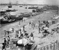
 Boats on Hooghly River
 -
 Hooghly River inKolkata
 -
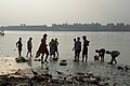
 Boats and men on the banks of the Hooghly river, 1915
 -
 The Floatel inKolkatalocated on the river
 -
 ThePrinsep Ghatwhich is located on the bank of the Hooghly River
 -
 Char on the river atBansberia,Hooghly district
 -
 Boats on the river atShimurali,Nadia district
 -
 The river behindHazarduari PalaceinMurshidabad district
 -
 The city of Kolkata lies along the banks of the Hooghly
 -
 Boat seen from the bank of the Hoogly River atKolkata


See also
[edit]References
[edit]- ^The river is locally called Ganga because it is one of the two distributaries of theGangesand is hence considered to be sacred. ThePuranascall this arm of the Ganges, the Ganges itself. Some more modern sources, relying entirely on the scriptures, suggest that this river is the Ganga itself, 'Hoogly' being just a regional nickname. However, there is no scientific basis of this claim.1,2
- ^The Editors of Encyclopedia Britannica (5 August 2010)."Bhagirathi River".Britannica.Retrieved3 June2023.
- ^Allison, Mead A. (Summer 1998). "Geologic Framework and Environmental Status of the Ganges-Brahmaputra Delta".Journal of Coastal Research.13(3). Coastal Education & Research Foundation, Inc.: 826–836.JSTOR4298836.
- ^"District".Voiceofbengal.com. Archived fromthe originalon 11 November 2014.Retrieved10 May2012.
- ^"Hugli River".Encyclopædia Britannica.Archivedfrom the original on 5 June 2016.Retrieved8 July2016.
- ^https://archive.org/details/ainiakbarivolum00mubgoogThe Ain I Akbary Abul Fazl Allammi Vol-2, Translated by Colonel H.S.Jarrett published by The Asiatic Society of Bengal Printed at the Baptist Mission Press in 1891 Calcutta page-120.
- ^https://cclpworldwide.com/wp-content/uploads/2020/03/Hooghly-Jelar-Itihas-Sudhir-Kumar-Mitra.pdfArchived23 March 2020 at theWayback MachineJelar Itihas Sudhir Kumar Mitra/ page no 792 (original book) internet page 806
- ^Chakraborty, Satyesh C. "The Story of River Port". Kolkata Port Trust. Archived from the original on 2011-07-21. Retrieved 2007-12-10.
- ^abHelen Schreider;Frank Schreider(October 1960). "From The Hair Of Siva".National Geographic.118(4): 445–503.
- ^Narayan, R. K. (29 August 2006).The Ramayana: A Shortened Modern Prose Version of the Indian Epic.Penguin. p. 31.ISBN978-1-4406-2327-1.
- ^"What is the origin of holy river Ganga?".20 March 2020.Archivedfrom the original on 23 March 2020.Retrieved23 March2020.
- ^"সেতুর হালে বাড়ছে আতঙ্ক".Retrieved14 May2024.
- ^"Construction of four lane bridge across River Bhagirathi at 195 + 160 of NH-34 near Berhampur (W.B.) | Inland Waterways Authority of India, Government of India".www.iwai.nic.in.Retrieved25 July2024.
- ^ab"Three river bridges in WB to boost trade, highlight culture".The Indian Express.6 October 2017.Archivedfrom the original on 12 March 2018.Retrieved12 March2018.
- ^"Construction of bridge over river Bhagirathi connecting Kalna, ch.35.447 km of STKK road and Shantipur, ch.96.30 km of NH 34 in the district of Purba Bardhaman & Nadia, Project Length 14.476 Km, length of main bridge including ROB 2.114 Km in Nadia, Purba Bardhaman (West Bengal): Project Updates & Investment Details | IIG".indiainvestmentgrid.gov.in.Retrieved14 May2024.
- ^"Kolkata Metro: 87 years on, boring re-creates CESC feat".The Times of India.18 April 2017.Archivedfrom the original on 22 September 2022.Retrieved29 September2022.
- ^"World Bank to fund Hooghly riverfront revamp - Times of India".The Times of India.3 September 2015.Archivedfrom the original on 7 September 2015.Retrieved3 September2015.
- ^"Chapter IV - City of Dreadful Night - From Sea to Sea - Rudyard Kipling, Book, etext".Telelib.com. 1 February 2003.Archivedfrom the original on 3 March 2016.Retrieved25 August2013.
- ^"An Unqualified Pilot - Land & Sea Tales - For Scouts and Guides - Rudyard Kipling, Book, etext".Telelib.com. 1 March 2003.Archivedfrom the original on 5 April 2016.Retrieved25 August2013.
- ^Chatterjee, Chandreyee (10 November 2016)."Exploring the River Connect".No. Kolkata. ABP. The Telegraph. Archived fromthe originalon 15 January 2018.Retrieved21 July2017.
- ^Basu, Anasuya (21 July 2017)."River Walk to Boost Ties".No. Kolkata. ABP. The Telegraph. Archived fromthe originalon 15 January 2018.Retrieved21 July2017.
- This article incorporates text from a publication now in thepublic domain:Chisholm, Hugh,ed. (1911). "Hugli (river)".Encyclopædia Britannica(11th ed.). Cambridge University Press.
1. Gautam Kumar Das. 2024. River Systems of West Bengal: Water Quality and Environment. In: River Systems of West Bengal. Springer Water. Springer, Cham. 180p.https://doi.org/10.1007/978-3-031-53480-5-1.https://link.springer.com/book/10.1007/978-3-031-53480-5.
2. Gautam Kumar Das. 2015. Estuarine Morphodynamics of the Sunderbans, Springer, Switzerland, 211p.https://doi.org/10.1007/978-3-319-11343-2.https://link.springer.com/book/10.1007/978-3-319-11343-2.
External links
[edit] Media related toHooghly Riverat Wikimedia Commons
- Hugli RiveratNASA Earth Observatory
- Hooghly District Information
| International | |
|---|---|
| National | |