
Interstate 17
Interstate 17 | ||||
|---|---|---|---|---|
| Arizona Veterans Highway | ||||
 I-17 highlighted in red | ||||
| Route information | ||||
| Maintained byADOT | ||||
| Length | 145.93 mi[1](234.85 km) | |||
| Existed | 1957[2]–present | |||
| History | Completed in 1978 | |||
| NHS | Entire route | |||
| Major junctions | ||||
| South end | ||||
| ||||
| North end | ||||
| Location | ||||
| Country | United States | |||
| State | Arizona | |||
| Counties | Maricopa,Yavapai,Coconino | |||
| Highway system | ||||
| ||||
| ||||

Interstate 17(I-17) is a north–southInterstate Highwaylocated entirely within the US state ofArizona.I-17's southern terminus lies inPhoenix,atI-10/US 60and its northern terminus is inFlagstaff,at Milton Road north ofI-40.[1]
Most of I-17 is known as theArizona Veterans Highway.In the Phoenix metropolitan area, it is mostly known as theBlack Canyon Freeway,however, the southern 4.16 miles (6.69 km) are part of theMaricopa Freeway.The portion of the highway south ofCordes Lakeswas built along the alignment ofState Route 69(SR 69), while the northern part was built along oldSR 79's alignment. The final section of I-17 was completed in 1978.
I-17 gains more than one mile (1.6 km) in altitude between Phoenix at 1,117 feet (340 m) and Flagstaff at 7,000 feet (2,100 m). The highway features several scenic view exits along its route that overlook the many mountains and valleys in northern Arizona.
Route description[edit]
I-17 is known as the Black Canyon Freeway from the northern end of thePhoenix Metropolitan Areato a point 2.2 miles (3.5 km) south ofThe Stackinterchange withI-10northwest ofDowntown Phoenix.(It is accompanied byfrontage roadsfor most of this portion, and they carry theBlack CanyonHighwayname to distinguish from thefreewaystatus.) At the Durango Curve southwest of downtown, between the 19th Avenue and Buckeye Road interchanges, it picks up the designation Maricopa Freeway all the way to the southern terminus at the secondI-10junction. It is one of the metropolitan area'sprimary freeways.[3][4]It has two interchanges with I-10 in Phoenix.[4]
The northwestern portion ofValley Metro'slight rail lineruns over a bridge of I-17 from Mountain View Road to Metro Parkway, serving one station atMetro Parkway.
I-17 has the unusual distinction of starting at approximately milepost 194 instead of at milepost 0.[5]This is a holdover from Arizona's old system of marking mileposts, where a branching route would continue the milepost numbering of its original host, instead of starting over at zero.[citation needed]I-17 inherited its milepost locations fromSR 69,which the freeway replaced between Phoenix and Cordes Junction.[6]SR 69's mileposting was such that it coincided withUS 89's mileposting, which was 201.6 where the two routes intersected. When I-17 was constructed, the existing mileposting for SR 69 was retained.[3]
-
 "The Stack",intersection of I-10 and I-17. Looking north up I-17, downtown Phoenix.
 -
-
 View of theRed Rocks of Sedonafrom I-17, just south ofMunds Park
 -
 I-17 nearFlagstaff
 -
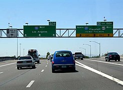
 Northern terminus atI-40as seen from I-40 in Flagstaff


History[edit]
The I-17 corridor roughly follows the first stagecoach route through the Black Canyon, established in 1878 between Cañon (now Black Canyon City) and Prescott. A later highway through White Spar from Wickenburg to Yarnell was improved in 1925 and incorporated into US 89 in 1926.[7]
In 1936, SR 69 was established as a state route from Phoenix north toPrescott.[8][9]The road was completed by 1940 to Prescott. In 1954, a new route north to Flagstaff was established as SR 79. In May 1956, the Black Canyon Highway from Phoenix to Flagstaff was completed,[7]but not to Interstate standards.[10]It was incorporated into the newInterstate Highway System,established by the federal government later that year, and designated as part of I-17.[7]
The first interchange on the Black Canyon Freeway was built in 1950 west of downtown Phoenix and was extended to Grand Avenue in 1957.[2][7]The freeway was extended to McDowell Road by 1971 and out of the Phoenix suburbs by 1974, at a cost of $33 million.[2]By 1971, I-17 had been completed from Phoenix northward to Camp Verde where a short stretch had not been completed to standards. The stretch fromSR 279(nowSR 260) north toSR 179was also complete. The largest section yet to be completed was from SR 179 north to Flagstaff. This segment was still just a two-lane roadway, but it did have full traffic interchanges built at crossroads. The portion from I-40 south to theFlagstaff Municipal Airporthad been completed by this time.[11]The final section of I-17, near Camp Verde and Montezuma Castle, began construction in February 1977 and opened to traffic in August 1978.[7][12]
In 1993, officials in Arizona proposed an extension of I-17 to connect withI-15inUtah.[13][clarification needed]
The existing interchange with Happy Valley Road in Phoenix was converted to adiverging diamond interchange(DDI). The project was finished in the fall of 2020.[14]
Future[edit]
Due to increasing weekend traffic on I-17 between thePhoenix areaandnorthern Arizona,ADOTplans to widen a 34-mile (55 km) section of freeway betweenAnthemand Sunset Point Rest Area. The current span is only four lanes wide and is subject to frequenttraffic jamson weekends as motorists travel to and fromSedona,Flagstaff,or otherhigh countrydestinations. A third lane will be added in both directions between Anthem andBlack Canyon City,but due to the mountainous topography north of Black Canyon City to Sunset Point, twoflex laneswill be added in a separatecarriagewaynext to the existing southbound lanes. The lanes would be allocated depending on peak traffic direction. Gates or a similar mechanism would control access to these lanes.[15]Construction began in 2022 and is scheduled to be completed in 2025.[15][16]
Exit list[edit]
| County | Location | mi[3] | km | Exit | Destinations | Notes |
|---|---|---|---|---|---|---|
| Maricopa | Phoenix | 0.00 | 0.00 | Southern end of US 60 concurrency; southern terminus; Maricopa Freeway continues east as I-10/US 60; I-10 exit 150A | ||
| 0.31 | 0.50 | 194 | Southbound exit and northbound entrance; I-10 exit 150 | |||
| 1.14 | 1.83 | 195A | 16th Street | Southbound exit and northbound entrance | ||
| 2.15 | 3.46 | 195B | 7th Street /Central Avenue | No southbound signage for Central Avenue | ||
| 3.16 | 5.09 | 196 | 7th Avenue /Central Avenue | No northbound signage for Central Avenue | ||
| 4.16 | 6.69 | 197 | 19th Avenue / Durango Street | No northbound signage for Durango Street | ||
| Durango Curve;Maricopa Freewaytransitions to the Black Canyon Freeway | ||||||
| 5.03 | 8.10 | 198 | Buckeye Road (Historic US 80) | Northbound exit only | ||
| 5.34 | 8.59 | 199A | Grant Street / Buckeye Road (Historic US 80) | No northbound signage for Buckeye Road | ||
| 5.73 | 9.22 | 199B | Jefferson Street | Southbound exit only | ||
| 5.88 | 9.46 | Adams Street /Van Buren Street | Northbound exit and entrance only; Van Buren Street is formerI-10 BL | |||
| 6.49 | 10.44 | 200A | The Stack;I-10 exit 143 | |||
| 7.05 | 11.35 | 200B | McDowell Road /Van Buren Street | No northbound signage for Van Buren Street | ||
| 7.84 | 12.62 | — | Grand Avenue | Closed in the 1980s; formerUS 60/US 70/US 89/SR 93 | ||
| 8.09 | 13.02 | 201 | Northern end of US 60 concurrency; no southbound signage for Grand Avenue | |||
| 9.08 | 14.61 | 202 | Indian School Road | |||
| 10.08 | 16.22 | 203 | Camelback Road | |||
| 11.09 | 17.85 | 204 | Bethany Home Road | |||
| 12.09 | 19.46 | 205 | Glendale Avenue | |||
| 13.09 | 21.07 | 206 | Northern Avenue | |||
| 14.14 | 22.76 | 207 | Dunlap Avenue | |||
| 15.13 | 24.35 | 208 | Peoria Avenue | |||
| 16.13 | 25.96 | 209 | Cactus Road | |||
| 17.12 | 27.55 | 210 | Thunderbird Road | |||
| 18.12 | 29.16 | 211 | Greenway Road | |||
| 19.13 | 30.79 | 212 | Bell Road | |||
| 20.15 | 32.43 | 214A-B | Union Hills Drive / Yorkshire Drive | Signed separately as exits 214A (Union Hills) and 214B (Yorkshire) northbound; Union Hills Drive was formerly signed as exit 213 | ||
| 21.11 | 33.97 | 214C | Loop 101 exits 23B-C; northbound entrance includes direct exit ramp onto Deer Valley Road (exit 215B) | |||
| 21.66– 22.16 | 34.86– 35.66 | 215 | Rose Garden Lane / Deer Valley Road | Signed as exit 215A northbound and 215B southbound | ||
| 23.27 | 37.45 | 217 | Pinnacle Peak Road | |||
| 24.19 | 38.93 | 218 | Happy Valley Road | |||
| 25.23 | 40.60 | 219 | Jomax Road | |||
| 27.25 | 43.85 | 220 | Dixileta Drive | Northbound exit and southbound entrance | ||
| 28.19 | 45.37 | 221A | Future flyover interchange; to be signed as exit 221B southbound; Loop 303 exits 138A-B; future clockwise terminus of Loop 303[17] | |||
| 221 | Loop 303 exit 138; current clockwise terminus of Loop 303 | |||||
| Northern terminus of Black Canyon Freeway | ||||||
| 29.17 | 46.94 | 222 | Dove Valley Road | |||
| 30.17 | 48.55 | 223 | Signed as exits 223A (east) and 223B (west) northbound; eastern terminus of SR 74 | |||
| Anthem | 31.70 | 51.02 | 225 | Pioneer Road | ||
| 33.21 | 53.45 | 227 | Daisy Mountain Drive | |||
| 35.24 | 56.71 | 229 | Anthem Way | |||
| New River | 38.20 | 61.48 | 232 | New River | ||
| 42.18 | 67.88 | 236 | Table Mesa Road | |||
| Maricopa–Yavapai county line | Black Canyon City | 48.29 | 77.72 | 242 | Black Canyon City,Rock Springs | Former I-17 BL north |
| Yavapai | 50.56 | 81.37 | 244 | Black Canyon City | Former I-17 BL south | |
| | — | Future south end of reversible Flex lanes | ||||
| | 54.36 | 87.48 | 248 | Bumble Bee,Crown King | No access to or from future Flex Lanes | |
| | — | Future north end of reversible Flex lanes; no access to southbound Flex Lanes from Sunset Point Rest Area | ||||
| | 58.48 | 94.11 | 252 | Sunset PointRest Area and Scenic View | Frontage roads provide all-direction access to a unified Rest Area / Scenic View off west side of freeway | |
| | 61.85 | 99.54 | 256 | Badger Springs Road | ||
| Cordes Lakes | 65.23 | 104.98 | 259 | Bloody Basin Road | ||
| 68.44 | 110.14 | 262 | Northbound exit and southbound entrance | |||
| 68.77 | 110.67 | 263 | Northbound exit signed as Arcosanti Road only | |||
| | 74.53 | 119.94 | 268 | Orme Road / Dugas Road | ||
| | 84.16 | 135.44 | 278 | Northern terminus of SR 169 | ||
| | 89.04 | 143.30 | — | Runaway Truck ramp | Northbound left exit and southbound left entrance | |
| Camp Verde | 91.31 | 146.95 | 285 | General Crook Trail | ||
| 93.06 | 149.77 | 287 | FormerSR 279 | |||
| 95.74 | 154.08 | 289 | Montezuma Castle National Monument | |||
| Lake Montezuma | 99.04 | 159.39 | 293 | Eastern terminus of CR 30 | ||
| | 102.29– 102.36 | 164.62– 164.73 | McGuirevilleRest Areas | |||
| | 104.75 | 168.58 | 298 | Southern terminus of SR 179 | ||
| | 112.09 | 180.39 | 306 | Stoneman Lake Road | ||
| Coconino | | 118.67 | 190.98 | Scenic View (southbound only) | ||
| | 121.37 | 195.33 | 315 | Rocky Park Road | ||
| | 123.65 | 199.00 | 317 | Fox Ranch Road | ||
| | 126.29 | 203.24 | 320 | Schnebly Hill Road | ||
| Munds Park | 128.51 | 206.82 | 322 | Munds Park | ||
| 129.04 | 207.67 | Christensen Rest Areas; closed | ||||
| | 132.01 | 212.45 | 326 | Willard Springs Road | ||
| | 134.55 | 216.54 | 328 | Newman Park Road | ||
| | 136.90 | 220.32 | 331 | Kelly Canyon Road | ||
| Kachina Village | 139.65 | 224.74 | 333 | Kachina Boulevard / Mountainaire Road | ||
| Flagstaff | 143.17 | 230.41 | 337 | Southern end of SR 89A concurrency | ||
| 145.55 | 234.24 | 339 | Lake Mary Road–Mormon Lake | Northbound exit only | ||
| 145.76 | 234.58 | 340 | Northern end of SR 89A concurrency; signed as exits 340A (east) and 340B (west); I-40 exit 195; freeway continues as SR 89A north (former SR 79) | |||
1.000 mi = 1.609 km; 1.000 km = 0.621 mi
| ||||||
Former business route[edit]
State Business Route 17 | |
|---|---|
| Location | Black Canyon City |
| Length | 3 mi (4.8 km) |
| Existed | 2011 |
State Business Route 17(also known asSR 17 Bus.) was a former three-mile (4.8 km) business loop of I-17 that served the west side ofBlack Canyon City,Arizona.SR 17 Bus. followed Old Black Canyon Highway (formerlySR 69before I-17 replaced most of the route betweenPhoenixandCordes Junction) from exit 242 south of town at a diamond interchange to another diamond interchange at exit 244 north of town. The business route was subsequently transferred from state to local maintenance and because of ADOT's policy of not signing business loops on nonstate maintained roadways, the route was decommissioned in 2011.[18]
Major intersections
The entire route was inBlack Canyon City.
| County | mi | km | Destinations | Notes | |
|---|---|---|---|---|---|
| Maricopa–Yavapai county line | 0.000 | 0.000 | Southern terminus; I-17 exit 242 | ||
| Yavapai | 3.000 | 4.828 | Northern terminus; I-17 exit 244 | ||
| 1.000 mi = 1.609 km; 1.000 km = 0.621 mi | |||||
See also[edit]
References[edit]
- ^abArizona Department of Transportation (October 25, 2022)."ADOT National Highway System Map"(Map).ADOT ArcGIS.Arizona Department of Transportation.RetrievedOctober 25,2022.
- ^abcNothaft, Mark (February 21, 2017)."Which freeway came first in the Valley?".The Arizona Republic.RetrievedNovember 6,2022.
- ^abcRoadway Inventory Management Section, Multimodal Planning Division (December 31, 2013)."2013 State Highway System Log"(PDF).Arizona Department of Transportation.RetrievedMay 23,2020.
- ^abGoogle(February 15, 2008)."Overview map of I-17"(Map).Google Maps.Google.RetrievedFebruary 15,2008.
- ^Multimodal Planning Division (January 2014).Phoenix Area Milepost System(PDF)(Map). Arizona Department of Transportation.RetrievedNovember 6,2022.
- ^LaBarbera, John (May 19, 2022)."Throwback Thursday: Future I-17".ADOT Blog.Arizona Department of Transportation.RetrievedNovember 6,2022.
- ^abcdeCorbett, Peter (September 21, 2018)."How the I-17 Black Canyon Freeway evolved from stage route to modern highway".ADOT Blog.Arizona Department of Transportation.RetrievedNovember 6,2022.
- ^Arizona and New Mexico Road Map(Map).Rand McNally.1938.RetrievedNovember 27,2011.
- ^Arizona Department of Transportation."ADOT Right-of-Way Resolution 1936-P-624".RetrievedApril 22,2008.
- ^State Highway Department Road Map of Arizona(Map).Rand McNally.1961.RetrievedNovember 27,2011.
- ^State Highway Department Road Map of Arizona(Map). Arizona State Highway Department. 1971.RetrievedNovember 27,2011.
- ^"Last Link of I-17 To Open in August".The Arizona Republic.May 18, 1978. p. 15.RetrievedNovember 6,2022– viaNewspapers.com.
- ^"Arizona officials seek extension of I-17 into Utah".Deseret News.Associated Press.January 2, 1993.RetrievedJanuary 27,2021.
- ^"Happy Valley Road".www.azdot.gov.RetrievedAugust 26,2019.
- ^ab"Recommended Build Alternative - I-17: Anthem Way to Sunset Point".Arizona Department of Transportation.RetrievedAugust 26,2021.
- ^"First girders installed on Interstate 17 improvement project".KTAR.com.April 4, 2023.RetrievedApril 27,2023.
- ^"Loop 303, Lake Pleasant Parkway to I-17 Improvements".ADOT.Arizona Department of Transportation.RetrievedApril 24,2024.
- ^"Interstate Business Route 17".interstate-guide.com.RetrievedNovember 6,2020.[self-published source?]
External links[edit]
| Signed | |
|---|---|
| Unsigned | |
| Lists | |
| Other | |
Routes initalicsare no longer a part of the system. Major Interstates are highlighted. | |
| International | |
|---|---|
| Geographic | |