
Kailasagiri
| Kailasagiri | |
|---|---|
 Shiva-Parvati statue at Kailasagiri | |
 | |
| Location | Visakhapatnam,Andhra Pradesh,India |
| Coordinates | 17°44′56″N83°20′32″E/ 17.748992°N 83.342236°E |
| Area | 380 acres |
| Elevation | 173 metres (568 ft)[2] |
| Operated by | Visakhapatnam Metropolitan Region Development Authority |
| Visitors | 3500-3600 daily[1] |
| Website | vmrda |
Kailasagiriis a hilltop park in the city ofVisakhapatnamin theIndianstate ofAndhra Pradesh.[3]The park was developed by theVisakhapatnam Metropolitan Region Development Authority(VMRDA) and comprises 380 acres (150 ha) of land covered with flora and tropical trees. The hill, at 173 metres (568 ft), overlooks the city ofVisakhapatnam.
TheGovernment of Andhra Pradeshawarded Kailasagiri as its "Best Tourist Spot" in 2003.[citation needed]On average, around three hundred thousand Indian and foreign tourists visit the park every year. To protect the environment, VMRDA has declared the hill a plastic-free zone.[3]Acable carconnects to the top of the hill, the first of its kind in Andhra Pradesh.[4] Kailasagiri is located around 10 km from theVisakhapatnam Railway Stationand around 8 km from VisakhapatnamDwaraka Bus Station.
View from hilltop
[edit]
Gallery
[edit]-
 Ropeway car at Kailasagiri.
 -
 Ropeway at Kailasagiri.
 -
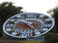 Floral clock at Kailasagiri.
 -
 Namam display at Kailasagiri.
 -
 Telugu Samskruthika Niketanamat Kailasagiri.
 -
 Lord Shiva Temple at Kailasagiri.
 -
 Shiva-Parvati statue at Kailasagiri.


References
[edit]- ^"Kailasagiri Hills reopens to visitors".The Hans India.Retrieved11 February2018.
- ^"Kailasagiri Walkway".Google Maps.Retrieved11 February2018.
- ^ab"VUDA park".Vizag Urban Development Authority. Archived fromthe originalon 31 May 2014.Retrieved31 May2014.
- ^"Rope Way".Visakhapatnam Urban Development Authority. 2010. Archived fromthe originalon 13 August 2014.Retrieved31 August2014.


This garden-related article is astub.You can help Wikipedia byexpanding it. |
This article about a location inVisakhapatnamis astub.You can help Wikipedia byexpanding it. |