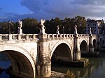
Kharaba Bridge
Appearance
Kharaba Bridge | |
|---|---|
| Coordinates | 32°33′04″N36°26′00″E/ 32.551093°N 36.433285°E |
| Crosses | Wadi Zeidi |
| Locale | Close toBosra,Syria |
| Characteristics | |
| Design | Arch bridge |
| Material | Basaltblocks |
| Width | 4.52 m |
| Longest span | 3.8 m |
| No.of spans | 3 |
| Location | |
 | |
TheKharaba Bridgeis aRoman bridgein the village ofKharabain the fertileHauranregion ofSyria,close to the city ofBosra(ancientBostra).
The bridge crosses theWadi Zeidi,a tributary of theYarmuk,3.5 km northwest of Bosra.[1]It has three semi-circulararches,each 3.8 m clear, that rest on 2.4 m wide piers with a height of 2.5 m to thespringing level.[1]The bridge width is 4.52 m.[2]At the eastern side exists a small squarish floodway which is supported by acolumnwithcapital.[3]Thevaultsand the covering are predominantly built with black greenishbasaltashlar;overall, the ancient structure is still in a fairly good condition.[3]
There are at least two more Roman bridges crossing the Wadi Zeidi: theGemarrin Bridgeand one at At-Tayyibeh.[4]
See also
[edit]References
[edit]- ^abO’Connor 1993,p. 131
- ^Kissel & Stoll 2000,p. 115
- ^abKissel & Stoll 2000,p. 117, Fig. 12
- ^Kissel & Stoll 2000,p. 110, Fig. 1b
Sources
[edit]- Kissel, Theodor; Stoll, Oliver (2000), "Die Brücke bei Nimreh. Ein Zeugnis römischer Verkehrspolitik im Hauran, Syrien",Antike Welt,vol. 31, no. 2, pp. 109–125
- O’Connor, Colin (1993),Roman Bridges,Cambridge University Press, p. 131,ISBN0-521-39326-4

