
Kowloon
Kowloon
Cửu long | |
|---|---|
 Kowloon as viewed fromHong Kong Island | |
 Location withinHong Kong(in green) | |
| Area | |
| • Land | 67 km2(26 sq mi) |
| Population (2011) | |
| • Total | 2,108,419 (2.1 million) |
| • Density | 43,033/km2(111,450/sq mi) |
| Time zone | UTC+8(Hong Kong Time) |
| Kowloon | |||||||||||||||||||||||||||
|---|---|---|---|---|---|---|---|---|---|---|---|---|---|---|---|---|---|---|---|---|---|---|---|---|---|---|---|
 "Kowloon" in Traditional (top) and Simplified (bottom) Chinese characters | |||||||||||||||||||||||||||
| Traditional Chinese | Cửu long | ||||||||||||||||||||||||||
| Simplified Chinese | Cửu long | ||||||||||||||||||||||||||
| Jyutping | gau2 lung4 | ||||||||||||||||||||||||||
| Literal meaning | "NineDragons" | ||||||||||||||||||||||||||
| |||||||||||||||||||||||||||
Kowloon(/ˌkaʊˈluːn/) is an urban area inHong Kongcomprising theKowloon PeninsulaandNew Kowloon.It has a population of 2,019,533 and a population density of 43,033/km2(111,450/sq mi) in 2006. It is one of the threeareas of Hong Kong,along withHong Kong Islandand theNew Territories,and is the smallest, second most populous and most densely populated.
Location
[edit]Kowloon is located directly north ofHong Kong IslandacrossVictoria Harbour.It is bordered by theLei Yue Munstrait to the east,Mei Foo Sun Chuen,Butterfly ValleyandStonecutter's Islandto the west, a mountain range, includingTate's CairnandLion Rockto the north, andVictoria Harbourto the south.
Administration
[edit]Kowloon comprises the followingdistricts:
Name
[edit]The name 'Kowloon' (Chinese:Cửu long;lit.'nine dragons') alludes to eight mountains and a Chinese emperor:Kowloon Peak,Tung Shan,Tate's Cairn,Temple Hill,Unicorn Ridge,Lion Rock,Beacon Hill,Crow's NestandEmperor Bing of Song.[1]It was also spelt 'Kawloong' in some 19th-century sources.[2]
History
[edit]


The part of Kowloon south ofBoundary Street,together withStonecutters Island,was ceded byQingChina to the United Kingdom under theConvention of Pekingof 1860. For many years the area remained largely undeveloped, used by the British mainly for tiger-hunting expeditions.[3][self-published source?] The part of Kowloon north of Boundary Street (New Kowloon) was leased by the British as part of theNew Territoriesunder the 1898Second Convention of Pekingfor 99 years. Within New Kowloon is Kowloon City, anarea of Hong Kongwhere theKowloon Walled Cityused to be located. The Kowloon Walled City itself was demolished in 1993. The same area was called Kwun Fu Cheung (Quan phú tràng) during theSong dynasty(960–1279). "New Kowloon" has remained part of theNew Territories.
Statutorily, "Kowloon" is only the area south of Boundary Street and Stonecutters Island, but in common use, New Kowloon is not regarded as part of the New Territories, but as an integral part of the Kowloon urban area whether north or south of Boundary Street.
Large-scale development of Kowloon began in the early 20th century, with the construction of theKowloon-Canton Railwayand theKowloon Wharf,but because of the close proximity of Kowloon's built-up area toKai Tak Airport,building construction was limited by flight paths. As a result, compared to Hong Kong Island, Kowloon had a much lower skyline.[1]AfterWorld War II,Kowloon became extremely congested whenslumsforrefugeesfrom the newly established People's Republic of China gave way topublic housing estates,mixed with private residential, commercial, and industrial areas.
The area ofreclaimed landnow known asWest Kowloonwas once home to adockyardfor theRoyal Navy.
The 1911 census recorded a population of 7,306, with most beingHakka.[4]Theinvasion of China by Japan in 1937caused the population of Kowloon to grow drastically. Between 1937 and 1939, 750,000 refugees arrived in Kowloon and nearby areas, with many not having residence.[5]
Demographics
[edit]As of 2011[update],2,108,419 people lived in Kowloon.[6]
About 94.2% of Kowloon's residents are ofHan Chinese[citation needed]ethnicity. The largest ethnic minority groups areIndonesians(1.8%),Filipinos(1.5%),Indians(0.5%),Nepalese(0.4%), andBritish(0.3%).[6]Around 86% of Kowloon's residents useCantoneseas their usual language, while 2.3% use English and 1.2% useMandarin.[6]
Localities
[edit]Kowloon comprises these localities of Hong Kong:
- Anderson Roadarea
- Austin
- Cha Kwo Ling
- Cheung Sha Wan
- Diamond Hill
- Jordan
- Hammer Hill
- Hung Hom
- Ho Man Tin
- Kai Tak
- Kowloon Bay
- Kowloon City
- Kowloon Tong
- Kwun Tong
- Lai Chi Kok
- Lam Tin
- Lei Yue Mun
- Ma Tau Wai
- Mong Kok
- Ngau Chi Wan
- Ngau Tau Kok
- Prince Edward
- San Po Kong
- Sau Mau Ping
- Sham Shui Po
- Shek Kip Mei
- Tai Kok Tsui
- To Kwa Wan
- Tsim Sha Tsui
- Tsz Wan Shan
- West Kowloon
- Wong Tai Sin
- Yau Ma Tei
- Yau Tong
Education
[edit]

Lists of primary and secondary schools in Kowloon by district:
- List of schools in Kowloon City District
- List of schools in Kwun Tong District
- List of schools in Sham Shui Po District
- List of schools in Wong Tai Sin District
- List of schools in Yau Tsim Mong District
Tertiary education
[edit]- City University of Hong Kong
- Hong Kong Polytechnic University
- Hong Kong Baptist University
- Open University of Hong Kong
- Tung Wah College
- Hong Kong Nang Yan College of Higher Education
- Gratia Christian College
Notable people
[edit]- Sean Parry(born 1987), cricketer
- Jackson Wang(born 1994), musician
Transport
[edit]
Kowloon is connected to Hong Kong Island by two road-onlytunnels(theCross-Harbour Tunneland theWestern Harbour Crossing), three MTR railway tunnels (Tsuen Wan line,Tung Chung line/Airport ExpressandEast Rail) and one combined road and MTR rail link tunnel (Eastern Harbour Tunnel,containing theTseung Kwan O lineand road traffic in separate parallel conduits). No bridges connect the island and Kowloon.
Gallery
[edit]This sectioncontains an unencyclopedic or excessive gallery of images. |
-
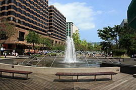 Urban Council Centenary Garden fountain, Tsim Sha Tsui
 -
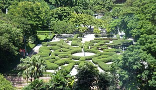 Maze Garden,Kowloon Park,Tsim Sha Tsui
 -
 An Air France Boeing 747 passing above Kowloon, prior to landing at the old airport in 1998.
 -

-

-
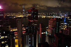 Night view of Kowloon fromHong Kong Island


References
[edit]- ^abFallon, Steve. (2006) Hong Kong and Macau. Lonely Planet Publishing.ISBN981-258-246-0
- ^"KAWLOONG FERRY STATION: Hong Kong postcard (C48147)".eBay.Archived fromthe originalon 12 November 2022.Retrieved27 February2022.
- ^10,000 Chinese Numbers.Lulu.com. p. 207.ISBN9780557006212.Archivedfrom the original on 23 August 2016.[self-published source]
- ^James Hayes,The Hong Kong Region 1850–1911.Hong Kong, 2012.ISBN9888139118
- ^"Hong Kong 2003 – History".www.yearbook.gov.hk.Archivedfrom the original on 26 September 2011.Retrieved28 April2018.
- ^abcDistrict Profiles,Hong Kong Census,2011,archivedfrom the original on 27 September 2013,retrieved27 September2013
External links
[edit] Media related toKowloonat Wikimedia Commons
- Media related toKowloon Westat Wikimedia Commons
| Hong Kong Island | |
|---|---|
| KowloonandNew Kowloon | |
| New Territories(excluding New Kowloon) | |

| International | |
|---|---|
| National | |