
Kuqa, Xinjiang
Kuqa
Kuchar, Kucha, Kuche, Qiuci | |
|---|---|
 | |
 Location of Kuchar County (red) within Aksu Prefecture (yellow) and Xinjiang | |
 Kuqa Location of the seat  Kuqa Kuqa (China) | |
| Coordinates:41°43′N82°58′E/ 41.717°N 82.967°E | |
| Country | China |
| Autonomous region | Xinjiang |
| Prefecture | Aksu |
| Municipal seat | Yengisheher Subdistrict(Xincheng Subdistrict) |
| Area | |
| • Total | 15,200 km2(5,900 sq mi) |
| Elevation | 1,072 m (3,517 ft) |
| Population (2020)[2] | |
| • Total | 530,328 |
| • Density | 35/km2(90/sq mi) |
| Ethnic groups | |
| • Major ethnic groups | Uyghur[3] |
| Time zone | UTC+8(China Standard[a]) |
| Postal code | 842000 |
| Website | www |
| Kuqa, Xinjiang | |||||||||||
|---|---|---|---|---|---|---|---|---|---|---|---|
| Uyghur name | |||||||||||
| Uyghur | كۇچار شەھىرى | ||||||||||
| |||||||||||
| Chinese name | |||||||||||
| Simplified Chinese | Khố xa | ||||||||||
| Traditional Chinese | Khố xa | ||||||||||
| |||||||||||
| Alternative Chinese name | |||||||||||
| Simplified Chinese | Quy tư | ||||||||||
| Traditional Chinese | Quy tư | ||||||||||
| |||||||||||
Kuqa[b](/ˈkuːtʃə/KOO-chə) is acounty-level cityinAksu Prefecture,Xinjiang Uyghur Autonomous Region,China.It was once the homeland of the ancient Buddhist Kingdom ofKucha.
History[edit]
According to theBook of Han(completed in 111 CE), Kucha was the largest of the "Thirty-six Kingdoms of theWestern Regions",with a population of 81,317, including 21,076 persons able to bear arms.[9]: 156
In 630,Xuanzang,a well-known Chinese Buddhist monk, scholar, traveler and translator visited Kucha during the EarlyTang period.
In the book "Hudud ul-'alam min al-mashriq ila al-maghrib",written in 982 by an unknownAraborPersianwriter, and presented toAbu'l Haret Muhammad,the ruler ofGuzgan,the following is written regarding Kucha:
"Kucha is located on the Chinese border and belongs to China, but the indigenous people, Dokuzoguzes, at times are engaged in raids and looting. This city has many advantages."
Mirza Muhammad Haidar Dughlat,a military general, in his historical bookTarikh-i-Rashidiused the word "Kūsān" for Kucha.
Mahmud Kashgari,in hisCompendium of Turkic Languages(Divân-ı Lügati't-Türk), wrote the following about Kucha: "It is one of the cities built byZülqarnayin(Alexander the Macedonian). ".[10]He also wrote that Kucha was aUyghurtown.[11]

In 1758, theQing Dynastytook control of the area, and the Chinese character name 'Kuche' (Khố xa) was made the name of the area.[12]
In 1991, there was a bombing attack at a Kuqa County government office and at anXPCCunit.[13]
In an interview withRadio Free Asia,an officer at the Kuchar County Police Department reported that from June to December 2018, 150 people at theNo. 1 Internment Campin the Yengisher district of Kuchar county had died, corroborating earlier reports attributed to Himit Qari, former area police chief.[6][7]
On December 20, 2019, Kuqa County was disestablished and Kuqa City was created.[14]
Ancient Buddhist kingdom in Kuqa[edit]
Monasteries[edit]
- Ta-mu had 170 priests.
- Around Che-hu-li, on a hill north of the city of Po-shan, there were 50 or 60 monks.
- Another Monastery was founded by King Wen-Su (Uch-Turfan) and had 70 monks.
Convents[edit]
There were two convents in A-li (Avania).
- Liun-jo-kan: 50 nuns
- A-li-po: 30 nuns
Another monastery, Tsio-li, north of Kucha and a famous place where Kumārajīva's mother Jīva retreated.

Priests[edit]
Po-Yen[edit]
Known as Po-Yen, a priest from the royal family who traveled to the Chinese capitalLuoyangbetween 256 and 260 BC. He translated six Buddhist texts into Chinese within the year 258 BC.
Po-Po-Śrīmitra[edit]
Po-Po-Śrīmitra is another priest from Kuqa who traveled Southern China between 307 and 312 BC and translated three Buddhist texts.
Po-Yen[edit]
A second Buddhist priest from Kuqa, known as Po-Yen, also went to Liangzhou (present-day Wuwei district in Gansu). Although not so well known in China, he translated many texts.[15]
Climate[edit]
Geography[edit]

The city is located at the southern periphery of theTian Shanrange, the northern portion of theTarim Basin,and the centre of the autonomous region. It occupies part of the northeastern portion of Aksu Prefecture, bordering Xinhe County, Xayar County, and Luntai County, Heiing County, and Lopnur County in Bayingolin Mongol Autonomous Region.
Kuqa has a continentaldesert climate(KöppenBWk), with an average annual precipitation of 74.6 millimetres (2.94 in), a majority of which occurs in summer. The monthly 24-hour average temperature ranges from −7.2 °C (19.0 °F) in January to 25.3 °C (77.5 °F) in July, and the annual mean is 11.29 °C (52.3 °F). The frost-free period lasts for 266 days on average.[citation needed]With monthly percent possible sunshine ranging from 54% in March to 69% in September and October, sunshine is abundant and the city receives 2,712 hours of bright sunshine annually.
| Climate data for Kuqa, elevation 1,082 m (3,550 ft), (1991–2020 normals) | |||||||||||||
|---|---|---|---|---|---|---|---|---|---|---|---|---|---|
| Month | Jan | Feb | Mar | Apr | May | Jun | Jul | Aug | Sep | Oct | Nov | Dec | Year |
| Record high °C (°F) | 7.8 (46.0) |
14.3 (57.7) |
24.1 (75.4) |
33.2 (91.8) |
35.1 (95.2) |
38.2 (100.8) |
40.8 (105.4) |
39.5 (103.1) |
35.2 (95.4) |
28.5 (83.3) |
20.7 (69.3) |
9.2 (48.6) |
40.8 (105.4) |
| Mean daily maximum °C (°F) | −1.7 (28.9) |
5.3 (41.5) |
14.1 (57.4) |
22.2 (72.0) |
26.9 (80.4) |
30.5 (86.9) |
32.1 (89.8) |
30.9 (87.6) |
26.4 (79.5) |
19.4 (66.9) |
9.7 (49.5) |
0.2 (32.4) |
18.0 (64.4) |
| Daily mean °C (°F) | −7.7 (18.1) |
−0.9 (30.4) |
7.7 (45.9) |
15.4 (59.7) |
19.9 (67.8) |
23.4 (74.1) |
24.9 (76.8) |
23.7 (74.7) |
18.8 (65.8) |
10.9 (51.6) |
2.7 (36.9) |
−5.5 (22.1) |
11.1 (52.0) |
| Mean daily minimum °C (°F) | −12.8 (9.0) |
−6.3 (20.7) |
1.8 (35.2) |
8.9 (48.0) |
13.0 (55.4) |
16.4 (61.5) |
18.0 (64.4) |
16.9 (62.4) |
12.1 (53.8) |
4.4 (39.9) |
−2.6 (27.3) |
−9.9 (14.2) |
5.0 (41.0) |
| Record low °C (°F) | −23.4 (−10.1) |
−20.2 (−4.4) |
−8.4 (16.9) |
−2.0 (28.4) |
0.7 (33.3) |
7.5 (45.5) |
10.4 (50.7) |
7.6 (45.7) |
3.2 (37.8) |
−3.1 (26.4) |
−16.3 (2.7) |
−22.3 (−8.1) |
−23.4 (−10.1) |
| Averageprecipitationmm (inches) | 2.6 (0.10) |
3.1 (0.12) |
1.6 (0.06) |
3.5 (0.14) |
9.3 (0.37) |
19.7 (0.78) |
13.0 (0.51) |
14.6 (0.57) |
6.2 (0.24) |
4.0 (0.16) |
2.7 (0.11) |
1.9 (0.07) |
82.2 (3.23) |
| Average precipitation days(≥ 0.1 mm) | 3.2 | 1.8 | 1.2 | 1.8 | 3.6 | 7.0 | 7.0 | 6.2 | 3.9 | 1.4 | 1.3 | 2.4 | 40.8 |
| Average snowy days | 5.2 | 2.5 | 0.5 | 0.2 | 0 | 0 | 0 | 0 | 0 | 0 | 1.3 | 4.5 | 14.2 |
| Averagerelative humidity(%) | 68 | 55 | 38 | 34 | 38 | 43 | 46 | 49 | 53 | 56 | 60 | 70 | 51 |
| Mean monthlysunshine hours | 186.9 | 198.4 | 231.4 | 245.1 | 278.5 | 280.6 | 291.9 | 277.1 | 255.7 | 247.4 | 204.4 | 166.3 | 2,863.7 |
| Percentpossible sunshine | 63 | 65 | 62 | 60 | 61 | 62 | 64 | 66 | 70 | 74 | 71 | 59 | 65 |
| Source:China Meteorological Administration[16][17][18] | |||||||||||||
Administrative divisions[edit]

Kuqa has 4subdistricts,8towns,6townshipsand one other area under its administration:[19][20][1][21]
| Name | Simplified Chinese | Hanyu Pinyin | Uyghur(UEY) | Uyghur Latin (ULY) | Administrative division code | |
|---|---|---|---|---|---|---|
| Subdistricts | ||||||
| Reste Subdistrict | Nhiệt tư thản nhai đạo | Rèsītǎn Jiēdào | رەستە كوچا باشقارمىسى | reste kocha bashqarmisi | 652902001 | |
| Saqsaq Subdistrict | Tát khắc tát khắc nhai đạo | Sàkèsàkè Jiēdào | ساقساق كوچا باشقارمىسى | saqsaq kocha bashqarmisi | 652902002 | |
| Yengisheher Subdistrict (Xincheng Subdistrict) |
Tân thành nhai đạo | Xīnchéng Jiēdào | يېڭىشەھەر كوچا باشقارمىسى | yëngisheher kocha bashqarmisi | 652902003 | |
| Sherqiy Subdistrict (Dongcheng Subdistrict) |
Đông thành nhai đạo | Dōngchéng Jiēdào | شەرقىي شەھەر كوچا باشقارمىسى | sherqiy sheher kocha bashqarmisi | 652902004 | |
| Towns | ||||||
| Uchar Town | Ô kháp trấn | Wūqià Zhèn | ئۇچار بازىرى | Uchar baziri | 652902101 | |
| Alakaga Town | A lạp cáp cách trấn | Ālāhāgé Zhèn | ئالاقاغا بازىرى | Alaqagha baziri | 652902102 | |
| Chimen Town | Tề mãn trấn | Qímǎn Zhèn | چىمەن بازىرى[22] | chimen baziri | 652902103 | |
| Dongqotan Town | Đôn khoát thản trấn | Dūnkuòtǎn Zhèn | دۆڭقوتان بازىرى | döngqotan baziri | 652902104 | |
| Yaqa Town | Nha cáp trấn | Yáhā Zhèn | ياقا بازىرى[23] | yaqa baziri | 652902105 | |
| Uzun Town | Ô tôn trấn | Wūzūn Zhèn | ئۇزۇن بازىرى | Uzun baziri | 652902106 | |
| Ishxila Town | Y tây cáp lạp trấn | Yīxīhālā Zhèn | ئىشخىلا بازىرى | Ishxila baziri | 652902107 | |
| Erbatey Town | Nhị bát đài trấn | Èrbātái Zhèn | ئەرباتەي بازىرى[24] | Erbatey baziri | 652902108 | |
| Townships | ||||||
| Uchosteng Township | Ngọc kỳ ngô tư đường hương | Yùqíwúsītáng Xiāng | ئۈچئۆستەڭ يېزىسى | Üch'östeng yëzisi | 652902201 | |
| Biyixbag Township[25] | Bỉ tây ba cách hương | Bǐxībāgé Xiāng | بېھىشباغ يېزىسى | bëhishbagh yëzisi | 652902202 | |
| Xanqitam Township | Cáp ni khách tháp mộc hương | Hāníkātǎmù Xiāng | خانقىتام يېزىسى | xanqitam yëzisi | 652902203 | |
| Aqosteng Township | A khắc ngô tư đường hương | Ākèwúsītáng Xiāng | ئاقئۆستەڭ يېزىسى | Aq'östeng yëzisi | 652902204 | |
| Aghi Township | A cách hương | Āgé Xiāng | ئاغى يېزىسى | Aghi yëzisi | 652902205 | |
| Tarim Township | Tháp lí mộc hương | Tǎlǐmù Xiāng | تارىم يېزىسى | tarim yëzisi | 652902206 | |
Economy[edit]
Agricultural products include wheat, corn, rice, cotton as well as pears, apricots, melons, grapes, pomegranates, figs, etc. Specialty products include Sanbei Sheep (Tam bắc dương) lambskin, white apricots and thin-shelled walnuts. Mineral resources include oil and coal. Industries include coal mining, tractor manufacturing and repair, construction and processing for non-staple foods.[26]
As of 1885[update],there was about 99,200 acres (654,476mu) of cultivated land in Kuqa.[27]
Demographics[edit]
| Year | Pop. | ±% p.a. |
|---|---|---|
| 2000 | 388,593 | — |
| 2010 | 462,588 | +1.76% |
| [20] | ||
As of 2015, 440,125 of the 492,535 residents of Kuqa County wereUyghur,49,021 wereHan Chineseand 3,389 were from other ethnic groups.[28]
As of 2002[update],the county had a population of 450,000.[citation needed]
As of 1999, 89.93% of the population of Kuqa County were Uyghur and 9.49% of the population was Han Chinese.[29]
Transportation[edit]
Kuqa is served byChina National Highway 217,China National Highway 314,[26]theSouthern Xinjiang RailwayandKuche Qiuci Airport.
Kuqa Town[edit]

Kuqa is also the name of the central town (Chinese:Khố xa trấn), located in the easternmost area of Kuqa. It is the second largest town ofAksu Prefecture.Its area size is 14,528.74 square meters and population 470,600, composed of fourteen peoples including theUyghurs,Hans,Huis,andMongols.Kuqa is a thriving town ofoilandnatural gasdevelopment of theTarim Basin,and of tourism, as it was once the homeland of the ancient Buddhist Kingdom ofKucha.[citation needed]Its tourist attractions are:
Notable persons[edit]
- Qurban Mamut, former editor-in-chief of the official Xinjiang Cultural Journal (《 tân cương văn hóa 》) and detainee in theXinjiang re-education camps[30][31]
Historical maps[edit]
Historical English-language maps including Kuqa:
-
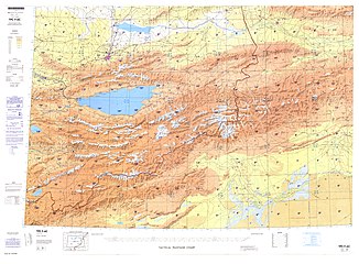
![Map including Kuqa (labeled as K'U-CH'E (KUCHA)) and surrounding region from the International Map of the World (AMS, 1950)[c]](https://upload.wikimedia.org/wikipedia/commons/thumb/9/93/A-k%60o-su_NK-44_%281950%29_-_panoramio.jpg/230px-A-k%60o-su_NK-44_%281950%29_-_panoramio.jpg) Map including Kuqa (labeled as K'U-CH'E (KUCHA)) and surrounding region from theInternational Map of the World(AMS,1950)[c]
Map including Kuqa (labeled as K'U-CH'E (KUCHA)) and surrounding region from theInternational Map of the World(AMS,1950)[c] -
 Map including Kuqa (labeled as Kuga/ Kuche/ Kuqaxian) (DMA,1981)
 -
![From the Operational Navigation Chart; map including Kuqa (K'u-ch'e) (DMA, 1985)[d]](https://upload.wikimedia.org/wikipedia/commons/thumb/7/7e/Operational_Navigation_Chart_F-6%2C_6th_edition.jpg/331px-Operational_Navigation_Chart_F-6%2C_6th_edition.jpg)
-
 Kucha in theKushan EmpireunderKanishkathe Great
![Map including Kuqa (labeled as K'U-CH'E (KUCHA)) and surrounding region from the International Map of the World (AMS, 1950)[c]](/translate/en.wikipedia.org?u=https%3A%2F%2Fen.wikipedia.org%2Fwiki%2FFile%3AA-k%2560o-su_NK-44_%281950%29_-_panoramio.jpg&t=hv)

![From the Operational Navigation Chart; map including Kuqa (K'u-ch'e) (DMA, 1985)[d]](/translate/en.wikipedia.org?u=https%3A%2F%2Fen.wikipedia.org%2Fwiki%2FFile%3AOperational_Navigation_Chart_F-6%2C_6th_edition.jpg&t=hv)

Notes[edit]
- ^Locals in Xinjiang frequently observeUTC+6(Xinjiang Time), 2 hours behind Beijing.
- ^The official spelling is "Kuqa".[4][5]Alternate spellings and names include Kucha, Kuchar,[6][7]Kuche, Kuchi, Kuchu, Kocha, Kuchel, and Kuga.[8]
- ^From map: "THE DELINEATION OF INTERNATIONAL BOUNDARIES ON THIS MAP MUST NOT BE CONSIDERED AUTHORITATIVE"
- ^From map: "The representation of international boundaries is not necessarily authoritative."
References[edit]
- ^abKhố xa thị[Kuqa City] (in Simplified Chinese). Khố xa thị nhân dân chính phủ. 22 January 2019.Retrieved9 June2020.
Tổng diện tích 1.52 vạn bình phương công lí, hạt 8 trấn, 6 hương, 4 cá nhai đạo bạn sự xử,
- ^Xinjiang: Prefectures, Cities, Districts and Counties
- ^Dân tộc nhân khẩu(in Simplified Chinese). Khố xa thị nhân dân chính phủ. 22 March 2019.Retrieved11 June2020.
Khố xa huyện thị dĩ duy ngô nhĩ tộc vi chủ thể đích đa dân tộc tụ cư khu.
- ^Zhōngguó dìmínglùTrung quốc địa danh lục (Beijing,SinoMaps PressTrung quốc địa đồ xuất bản xã 1997);ISBN7-5031-1718-4;p. 306.
- ^Complete Atlas Of The World(3 ed.).Penguin Random House.2016. p.238– viaInternet Archive.
Kuqa
- ^abFred Hiatt (2 December 2019)."These journalists have confounded China's massive propaganda machine".Washington Post.Retrieved10 June2020.
It wasHoshur's Oct. 29 story that confirmed the deaths of 150 people over the course of six months at the No. 1 Internment Camp in the Yengisher district of Kuchar county, "marking the first confirmation of mass deaths since the camps were introduced in 2017," as the story notes.
- ^abShohret Hoshur;Joshua Lipes (29 October 2019)."At Least 150 Detainees Have Died in One Xinjiang Internment Camp: Police Officer".Radio Free Asia.Translated by Mamatjan Juma.Retrieved10 June2020.
- ^Kuqa, China Page(in English)
- ^Hulsewé, Anthony François Paulus Hulsewé(1979).China in Central Asia: The Early Stage: 125 BC – AD 23; an Annotated Transl. of Chapters 61 and 96 of the History of the Former Han Dynasty. With an Introd. by M.A.N.Loewe.Brill Archive.ISBN90-04-05884-2.
- ^Atalay, Besim (2006). Divanü Lügati't – Türk. Ankara: Türk Tarih Kurumu Basımevi.ISBN975-16-0405-2,Cilt I, sayfa 113, Cilt III, sayfa 219 ve 238
- ^Atalay, Besim (2006). Divanü Lügati't – Türk. Ankara: Türk Tarih Kurumu Basımevi.ISBN975-16-0405-2,Cilt III, sayfa 219
- ^Tây vực lịch sử trung đích quy tư.Quy tư võng.15 January 2017.Retrieved11 June2020.
Càn long nhị thập tam niên (1758), quy tư quy nhập thanh triều bản đồ, định danh khố xa.
- ^Justin V. Hastings (December 2011). "Charting the Course of Uyghur Unrest".The China Quarterly(208): 901.JSTOR41447781– viaJSTOR.(Sourced to theXinjiang Public Security Gazette(Tân cương thông chí · công an chí), pages 81–83)
- ^Chen Xinhui (Trần tân huy), Han Ting (Hàn đình), ed. (21 December 2019).Quốc vụ viện phê chuẩn triệt tiêu khố xa huyện thiết lập huyện cấp khố xa thị.People's Daily Online(in Simplified Chinese).Retrieved14 July2020.
- ^Nath Puri, Baij (1987).Buddhism in Central Asia.Delhi: Motilal Banarsidass. pp. 75–85.
- ^Trung quốc khí tượng sổ cư võng – WeatherBk Data(in Simplified Chinese).China Meteorological Administration.Retrieved10 October2023.
- ^ Trung quốc khí tượng sổ cư võng(in Simplified Chinese).China Meteorological Administration.Retrieved10 October2023.
- ^Trung quốc địa diện quốc tế giao hoán trạm khí hầu tiêu chuẩn trị nguyệt trị sổ cư tập ( 1971-2000 niên )(in Chinese).China Meteorological Administration.Archived fromthe originalon September 21, 2013.Retrieved2010-05-04.
- ^2019 niên thống kế dụng khu hoa đại mã hòa thành hương hoa phân đại mã: Khố xa huyện[2019 Statistical Area Numbers and Rural-Urban Area Numbers: Kuqa County] (in Simplified Chinese).National Bureau of Statistics of the People's Republic of China.2019.Retrieved9 June2019.
Thống kế dụng khu hoa đại mã danh xưng 652923001000 nhiệt tư thản nhai đạo 652923002000 tát khắc tát khắc nhai đạo 652923003000 tân thành nhai đạo 652923004000 đông thành nhai đạo 652923101000 ô kháp trấn 652923102000 a lạp cáp cách trấn 652923103000 tề mãn trấn 652923104000 đôn khoát thản trấn 652923105000 nha cáp trấn 652923106000 ô tôn trấn 652923107000 y tây cáp lạp trấn 652923108000 nhị bát đài trấn 652923201000 ngọc kỳ ngô tư đường hương 652923202000 bỉ tây ba cách hương 652923203000 cáp ni khách tháp mộc hương 652923204000 a khắc ngô tư đường hương 652923205000 a cách hương 652923206000 tháp lí mộc hương 652923500000 khố xa kinh tế kỹ thuật khai phát khu
- ^abKhố xa huyện lịch sử duyên cách[Kuqa County Historical Development] (in Simplified Chinese). XZQH.org. 30 January 2015.Retrieved9 June2020.
2010 niên đệ lục thứ nhân khẩu phổ tra, khố xa huyện thường trụ tổng nhân khẩu 462588 nhân, kỳ trung: Nhiệt tư thản nhai đạo 13298 nhân, tát khắc tát khắc nhai đạo 18156 nhân, tân thành nhai đạo 44184 nhân, đông thành nhai đạo 27114 nhân, ô kháp trấn 41557 nhân, a lạp cáp cách trấn 38197 nhân, tề mãn trấn 35871 nhân, đôn khoát thản trấn 17965 nhân, nha cáp trấn 31856 nhân, ô tôn trấn 29243 nhân, y tây cáp lạp trấn 32132 nhân, nhã khắc lạp trấn 1029 nhân, ngọc kỳ ngô tư đường hương 27355 nhân, bỉ tây ba cách hương 26131 nhân, cáp ni khách tháp mộc hương 35430 nhân, a khắc ngô tư đường hương 16027 nhân, a cách hương 6960 nhân, tháp lí mộc hương 3877 nhân, thủy điện nhị xử 2260 nhân, nhị bát đài nông tràng 4413 nhân, lương chủng phồn trụ tràng 2678 nhân, khố tư ông mục tràng 1551 nhân, thảo hồ mục tràng 1136 nhân, khố xa chủng dương tràng 3008 nhân, khố xa giam ngục 360 nhân, khắc kỳ lực khắc nông tràng 800 nhân.
- ^Communication Construction Administration Bureau of Xinjiang Uigur Autonomous Region (September 2007)."PRC: Xinjiang Regional Road Improvement Project (Korla-Kuqa Section)"(PDF).Asian Development Bank.p. 76.Retrieved10 July2020.
Distribution of Rural Poor Population in Kuche County{...}No. Town ( ship ) {...}1 Hanikatamu{...}2 Talimu{...}3 Akewusitang{...}4 Age{...}5 Yuqiwusitang{...}6 Bixibage{...}7 Wuqia{...}8 Yixihala{...}9 Yaha{...}10 Wuzun{...}11 Qiman{...}12 Dunkuotan{...}13 Alahage{...}
- ^چىمەن (Variant Non-Roman Script – VS)atGEOnet Names Server,United States National Geospatial-Intelligence Agency
- ^ياقا (Variant Non-Roman Script – VS)atGEOnet Names Server,United States National Geospatial-Intelligence Agency
- ^ئەرباتەي (Variant Non-Roman Script – VS)atGEOnet Names Server,United States National Geospatial-Intelligence Agency
- ^Biyixbag (Approved – N)atGEOnet Names Server,United States National Geospatial-Intelligence Agency
- ^abHạ chinh nông; trần chí lập, eds. (September 2009).Từ hải: Đệ lục bản thải đồ bổn[Cihai(Sixth Edition in Color)] (in Chinese). Thượng hải.Shanghai:Thượng hải từ thư xuất bản xã.Shanghai Lexicographical Publishing House.p. 1264.ISBN978-7-5326-2859-9.
- ^Herold J. Wiens (November 1966)."Cultivation Development and Expansion in China's Colonial Realm in Central Asia".The Journal of Asian Studies.26(1): 75.doi:10.2307/2051832.JSTOR2051832.S2CID162339064.
- ^3–7 các địa, châu, thị, huyện ( thị ) phân dân tộc nhân khẩu sổ(in Simplified Chinese). Statistic Bureau of Xinjiang Uygur Autonomous Region.Archivedfrom the original on 2017-10-11.Retrieved2017-09-03.
- ^Morris Rossabi,ed. (2004).Governing China's Multiethnic Frontiers(PDF).University of Washington Press.p. 179.ISBN0-295-98390-6.
- ^Shohret Hoshur,Joshua Lipes (9 June 2020)."Prominent Uyghur Journalist Confirmed Detained After Nearly Three Years".Radio Free Asia.Translated by Elise Anderson.Retrieved11 June2020.
- ^Austin Ramzy (5 January 2019)."China Targets Prominent Uighur Intellectuals to Erase an Ethnic Identity".New York Times.Archived fromthe originalon 12 April 2020.Retrieved11 June2020.
External links[edit]
| International | |
|---|---|
| National | |