
La Val
La Val | |
|---|---|
| Comun de La Val Comune di La Valle Gemeinde Wengen | |
 | |
 Coat of arms | |
Location of La Val  | |
 La Val Location of La Val in Italy  La Val La Val (Trentino-Alto Adige/Südtirol) | |
| Coordinates:46°39′31″N11°55′30″E/ 46.65861°N 11.92500°E | |
| Country | Italy |
| Region | Trentino-Alto Adige/Südtirol |
| Province | South Tyrol(BZ) |
| Government | |
| • Mayor | Angel Miribung |
| Area | |
| • Total | 39.0 km2(15.1 sq mi) |
| Population (Nov. 2010)[2] | |
| • Total | 1,307 |
| • Density | 34/km2(87/sq mi) |
| Demonym(s) | Italian: badiotti German: Wengener |
| Time zone | UTC+1(CET) |
| • Summer (DST) | UTC+2(CEST) |
| Postal code | 39030 |
| Dialing code | 0471 |
| Patron saint | St. Genesius |
| Saint day | August 25 |
| Website | Official website |
La Val(Italian:La Valle[laˈvalle];German:Wengen[ˈvɛŋən]) is acomune(municipality) in the province ofSouth Tyrolin northernItaly,located about 45 kilometres (28 mi) northeast of the city ofBolzano.
Geography[edit]
As of 30 November 2010, it had a population of 1,307 and an area of 39.0 square kilometres (15.1 sq mi).[3]
History[edit]
Coat-of-arms[edit]
The emblem consists of avertbranch, placed onbend,with two leaves onargent,it is the emblem of the familyRü.The emblem was adopted in 1969.[4]
Society[edit]
Linguistic distribution[edit]
According to the 2011 census, 97.66% of the population speakLadin,1.53% Italian and 0.81% German as first language.[5]
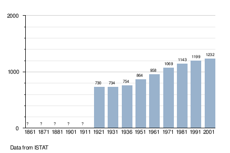
Demographic evolution[edit]
Economy[edit]
Tourism[edit]
In tourist centers people also speak someEnglish.The religion isRoman Catholic.
Tourism (hiking, mountain climbing,mountain biking) is a mainstay of the local economy as is agriculture. There is no locally-centered ski tourism, but in winter shuttle buses transport tourists to the nearby ski resorts such asAlta Badia.Tourism usually peaks in the winter months due to the comunes' location and attractions.
Whereas in earlier decades the agricultural economy was, to a large degree, self-sufficient, it has become, meanwhile, more of a monoculture based on cattle.
Down the valley at theGran Egariver in Pederoa is a handicraft and industrial zone (shoes, textiles).
La Val (Wengen) borders the following municipalities:Badia,MareoandSan Martin de Tor.
-
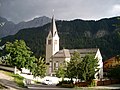 Main Church St. Jenesius
 -
 empty old house in Miribun
 -
 Religious Procession
 -
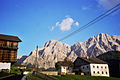
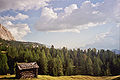 Armentara
 -
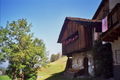 Romanesquehouse in Furnacia
 -
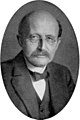 Max Planckwas guest in Rumestluns
 -
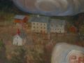 Old Bath Rumestluns "as seen by the chapel itself"
 -
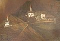 Barbarakapelle (left) and old church (middle) "as seen by the chapel itself"


References[edit]
- ^"Superficie di Comuni Province e Regioni italiane al 9 ottobre 2011".Italian National Institute of Statistics.Retrieved16 March2019.
- ^"Popolazione Residente al 1° Gennaio 2018".Italian National Institute of Statistics.Retrieved16 March2019.
- ^All demographics and other statistics: Italian statistical instituteIstat.
- ^Heraldry of the World: La Val
- ^"Volkszählung 2011/Censimento della popolazione 2011".astat info(38). Provincial Statistics Institute of the Autonomous Province of South Tyrol: 6–7. June 2012.Retrieved2012-06-14.
External links[edit]
- (Ladin)(in German and Italian)Homepage of the municipality

| International | |
|---|---|
| National | |
| Geographic | |