
Lijiang
Lijiang
Lệ giang thị Likiang | |
|---|---|
 Location of Lijiang City jurisdiction in Yunnan | |
 Lijiang Location in China | |
| Coordinates (Lijiang municipal government):26°51′19″N100°13′33″E/ 26.8552°N 100.2259°E | |
| Country | People's Republic of China |
| Province | Yunnan |
| Admin HQ | Gucheng |
| Area | |
| •Prefecture-level city | 20,557 km2(7,937 sq mi) |
| • Urban | 1,264 km2(488 sq mi) |
| • Metro | 1,264 km2(488 sq mi) |
| Elevation | 2,400 m (7,900 ft) |
| Population (2020 census)[1] | |
| •Prefecture-level city | 1,253,878 |
| • Density | 61/km2(160/sq mi) |
| •Urban | 288,787 |
| • Urban density | 230/km2(590/sq mi) |
| •Metro | 288,787 |
| • Metro density | 230/km2(590/sq mi) |
| GDP[2] | |
| •Prefecture-level city | CN¥62 billion US$9.1 billion |
| • Per capita | CN¥ 49,768 US$ 7,340 |
| Time zone | UTC+08:00(China Standard) |
| Postal code | 674100 |
| Area code | 0888 |
| ISO 3166 code | CN-YN-07 |
| Licence plate prefixes | Vân P |
| Website | lijiang |


| Lijiang | |||||||||||||||||||||
|---|---|---|---|---|---|---|---|---|---|---|---|---|---|---|---|---|---|---|---|---|---|
 "Lijiang" in Simplified (top) and Traditional (bottom) Chinese characters | |||||||||||||||||||||
| Simplified Chinese | Lệ giang | ||||||||||||||||||||
| Traditional Chinese | Lệ giang | ||||||||||||||||||||
| |||||||||||||||||||||
Lijiang(Chinese:Lệ giang),formerly romanizedasLikiang,is aprefecture-level cityin the northwest ofYunnan Province,China. It has an area of 21,219 square kilometres (8,193 sq mi) and had a population of 1,253,878 at the 2020 census whom 288,787 lived in the built-up area (metro) made ofGucheng District.Lijiang is famous for itsUNESCO Heritage Site,theOld Town of Lijiang,which contains a mixture of different historical architecture styles and a complex, ancient water-supply system.[3]and bordersLiangshan Yi Autonomous PrefectureandPanzhihua CityinSichuanProvince to the east. It has one municipality and four counties.
Lijiang City is located inYungui PlateauandQinghai-Tibet Plateau.It is one of the key forest areas inYunnan Provinceand one of the west and east power transmission bases of China's hydropower industry. Lijiang City is amulti-ethnicsettlement, except for theHan nationality,there are a total of 22ethnic minorities.
Lijiang is the only prefecture-level city with threeWorld Heritage Sites,rich in tourism resources, 104tourist attractions,such asLijiang AncientCity,Yulong Snow Mountain,Tiger Leaping Gorge,Laojun Mountain,and Shuhe Ancient Town.
History[edit]

As far back as 100,000 years ago, people of the late Paleolithic were active in what is now Lijiang. The discovery of cave paintings in the Jinsha River Valley along with numerous neolithic stone tools and later artifacts of Bronze and Iron Age provenance prove Lijiang to have been one of the most important centres of ancient human activity in southwest China.
Warring States period,it belonged to the Shu Prefecture of theQin state.At the end of the Warring States period, it was part of the territory of theDian Kingdom.
Han Dynasty,the Dian Kingdom submitted to the Han, and today's Lijiang City belonged to the Yuezhi Commandery, known as Suijiu County.
Three Kingdoms,it was part of the Yunnan Prefecture.
Northern and Southern Dynasties,Lijiang still belonged th the Yunnan Prefecture, known as Suijiu County, and it was aeound of theNaxi peoplemigrated here.
Tang Dynasty,it was once the territory of the Yaozhou Governor's Office, later it became part of theTibetan Empire,and the territory ofNanzhao,known as Sangchuan, under the jurisdiction of the Jianchuan Military Commission.
The Baisha Old Town was the political, commercial and cultural center for the localNaxipeople and other ethnic groups for 450 years from the year 658 AD to 1107AD. The Dabaoji Palace of the Baisha Fresco, very close to the Baisha Naxi Hand-made Embroidery Institute, was built in the year 658 AD in theTang dynasty(618 AD to 907 AD).
In ancient times, the Baisha Old Town used to be the center ofsilkembroidery in the southwest of China and the most important place of the Ancient SouthernSilk Road,also called the Ancient Tea and Horse Road orAncient tea route.[4]The Ancient Southern Silk Road started fromBurma,crossed Lijiang,Shangri-La County,Tibet,continued throughIran,theFertile Crescentbefore finally reaching theMediterranean Sea.
The Kingdom of Lijiang submitted toKhubilai Khanas he led his troops against theDali kingdomin 1253.[5]Though the kingdom was incorporated into theMongol empirethen theYuan dynasty,it was given the status oftusi,or indigenous office, which gave autonomy to the local Naxi rulers. During the Ming dynasty, the Naxi were one of the few border peoples to support the Ming immediately.[5]As the Naxi helped the Ming expand in Southwest China the ruler family was given the title of Mu. During this period the Kingdom of Lijiang was able to expand into Sichuan and Tibet bringing many Tibetan peoples into its territory as well as their cultural and religious influence.[5]It was under the rule of the Naxi ruling house of theMu family(Mộc thị) during the Yuan (not yet named Mu),Ming,andQing dynasties.[6]The Mu "held this position until 1723, when Lijiang became directly incorporated under the authority of the Qing central government."[5]
15th year of theMing Dynasty'sHongwu Emperor's reign(1382), A Jia A De, the local chief of Lijiang, "led the people to submit," and the Lijiang Lu XuanfuSi(Lijiang Road's pacification commissioner's office) was restrustured into the Lijiang Prefecture. By the 30th year of the Hongwu Emperor(1397), it was promoted to the Lijiang Junmin Fu(Lijiang Military and Civil Administration), which governed over four states, one county, and one patrol inspection office:Tong'an State, Baoshan State, Ju Jin State, Lin Xi county, and Shimen pass patrol Inspection office.
In the 17th year of theQing Dynasty'sShunzhi Emperor's reign(1660), the Lijiang JunminFu was established again, with the Mu family continuing to hold the hereditary position of the chief. In the first year of theYongzheng Emperor's reign(1723), the implemented the "reform of the native chieftain system"[7]in Lijiang, replacing the hereditary chief with an appointed official from the court, and demoting the Mu family to the position of theQianlong Emperor's reign(1770), Lijiang County was established.
In the second year of theRepublic of China(1912), the Lijiang Prefecture was abolished, retaining only the county, and the county government moved into the former Lijiang Prefecture's office building.
In the 20th year of the Republic of China (1931), three counties were established within the current area of Lijiang: Lijiang, Yongbei, and Huaping.
In 2002 Lijiang City was established, replacing the former Lijiang Naxi Autonomous County.
Geography and climate[edit]
This sectionneeds expansion.You can help byadding to it.(May 2013) |
Geography[edit]

Lijiang is located in the northwestern portion of Yunnan and bordersSichuan.It is within the region encompassed by theHengduan Mountains,where theQinghai-Tibet PlateauandYunnan-Guizhou Plateauconverge. It borders Sichuan Liangshan Yi Autonomous Prefecture and Panzhihua City to the east, and Jianchuan, Heqing and Binchuan three of the Dali Bai Autonomous Prefecture in the south. County and Chuxiong Yi Autonomous Prefecture Dayao and Yongren counties, west and north are adjacent to Lanping County of Nujiang Yi Autonomous Prefecture and Weixi County of Diqing Tibetan Autonomous Prefecture. The city has a total area of 20,600 square kilometers and governs the ancient city, Yulong Naxi Autonomous County, Yongsheng County, Huaping County and Ninglang Yi Autonomous County.[8]
Lijiang City has a terrain that is higher in the northwest and lower in the southeast. The highest point is the main peak ofYulong Snow Mountain,with an elevation of 5,596 meters, and the lowest point is at the mouth of the Tangba River in Shilongba Township,Huaping County,with an elevation of 1,015 meters, resulting in a maximum elevation difference of 4,581 meters. To the west of Yulong Mountain lies the high mountain and gorge sub-region of the Hengduan Mountain Range, characterized by high mountains and deep valleys, with steep and towering mountain ranges and rivers cutting deeply through them. To the east of Yulong Mountain is part of the Dianxi Basin's mountainous plateau region, specifically the northwestern sub-region of the Dian Plateau, which has a higher elevation and more robust mountainous terrain. On both sides of the main mountain range, there are also extensive east-west oriented valleys, creating a complex and intricate landscape of landforms with undulating terrain and a significant difference in elevation. There are 111 large and small basins scattered among the mountain ranges, generally at an elevation of over 2,000 meters, with the Lijiang Basin being the largest, covering an area of about 200 square kilometers and an average elevation of 2,466 meters.
TheJinsha River,which flows through Lijiang City, along with the three major mountain ranges that rise abruptly on both sides—theYunling Mountains'Laojun Mountain,Yulong Mountain, and Mianmian Mountain (commonly known as Xiao Liangshan), form the basic framework and backbone of the topography of Lijiang City. Laojun Mountain stretches like a barrier from north to south on the west side, with its main peak reaching an elevation of 4,247.4 meters. Yulong Snow Mountain, which is located 15 kilometers from the seat of the city government of Lijiang, features high mountain glacier landforms and is covered with snow all year round. Its 13 peaks are connected end to end, pointing towards the sky. To the east lies Mianmian Mountain. There are 12 high mountains in Lijiang City with an elevation ranging from 3,500 to 5,000 meters. Middle mountains with an elevation between 2,500 and 3,500 meters are distributed across all counties. The areas ofNinglangandYongshenghave a particularly high number of these mountains, and low mountainous areas below 2,500 meters are widely distributed in the southeastern and southern parts of the city.
Climate[edit]
Owing to its low latitude and high elevation, the city centre of Lijiang experiences a mildsubtropical highland climate(KöppenCwb). Winters are mild and very dry and sunny (>70% possible sunshine), although average lows in December and January are just below the freezing mark; January, the coolest month, with 24-hour average temperature of 6.7 °C (44.1 °F). Spring begins early and remains dry and sunny until late May, when there is a dramatic uptick in frequency and amount of rainfall that lasts until late September. Summers are warm, rainy (more so than it is sunny) and damp, with June, the warmest month, averaging 19.1 °C (66.4 °F). Autumn sees an abrupt reduction in rainfall and return to sunniness. The annual mean temperature is 13.3 °C (55.9 °F), while precipitation averages 968 mm (38.1 in), around 80% of which occurs from June to September. With monthly percent possible sunshine ranging from 29% in July to 80% in December, the city receives 2,412 hours of bright sunshine annually.
| Climate data for Lijiang (1991–2020 normals, extremes 1971–2010) | |||||||||||||
|---|---|---|---|---|---|---|---|---|---|---|---|---|---|
| Month | Jan | Feb | Mar | Apr | May | Jun | Jul | Aug | Sep | Oct | Nov | Dec | Year |
| Record high °C (°F) | 22.6 (72.7) |
23.6 (74.5) |
26.3 (79.3) |
28.9 (84.0) |
30.8 (87.4) |
32.3 (90.1) |
31.4 (88.5) |
28.2 (82.8) |
28.7 (83.7) |
26.1 (79.0) |
23.6 (74.5) |
22.8 (73.0) |
32.3 (90.1) |
| Mean daily maximum °C (°F) | 14.1 (57.4) |
15.7 (60.3) |
18.0 (64.4) |
20.8 (69.4) |
23.1 (73.6) |
24.5 (76.1) |
23.4 (74.1) |
23.1 (73.6) |
21.8 (71.2) |
20.4 (68.7) |
17.4 (63.3) |
14.9 (58.8) |
19.8 (67.6) |
| Daily mean °C (°F) | 6.7 (44.1) |
8.7 (47.7) |
11.2 (52.2) |
14.2 (57.6) |
17.0 (62.6) |
19.1 (66.4) |
18.4 (65.1) |
17.8 (64.0) |
16.3 (61.3) |
13.7 (56.7) |
9.8 (49.6) |
7.0 (44.6) |
13.3 (56.0) |
| Mean daily minimum °C (°F) | 0.6 (33.1) |
3.1 (37.6) |
5.9 (42.6) |
9.0 (48.2) |
12.0 (53.6) |
14.9 (58.8) |
15.0 (59.0) |
14.3 (57.7) |
12.8 (55.0) |
9.0 (48.2) |
3.8 (38.8) |
0.5 (32.9) |
8.4 (47.1) |
| Record low °C (°F) | −7.0 (19.4) |
−6.0 (21.2) |
−4.0 (24.8) |
−1.3 (29.7) |
3.5 (38.3) |
6.2 (43.2) |
6.9 (44.4) |
6.6 (43.9) |
3.4 (38.1) |
0.9 (33.6) |
−4.5 (23.9) |
−10.3 (13.5) |
−10.3 (13.5) |
| Averageprecipitationmm (inches) | 5.0 (0.20) |
5.4 (0.21) |
12.9 (0.51) |
19.9 (0.78) |
68.8 (2.71) |
146.8 (5.78) |
253.4 (9.98) |
228.7 (9.00) |
157.1 (6.19) |
56.5 (2.22) |
11.6 (0.46) |
2.0 (0.08) |
968.1 (38.12) |
| Average precipitation days(≥ 0.1 mm) | 2.3 | 3.5 | 5.0 | 7.0 | 12.3 | 18.3 | 23.6 | 22.5 | 19.8 | 10.7 | 3.2 | 1.1 | 129.3 |
| Average snowy days | 1.8 | 0.9 | 0.4 | 0.1 | 0 | 0 | 0 | 0 | 0 | 0.1 | 0.3 | 0.3 | 3.9 |
| Averagerelative humidity(%) | 44 | 43 | 45 | 49 | 58 | 70 | 80 | 82 | 82 | 72 | 60 | 51 | 61 |
| Mean monthlysunshine hours | 256.7 | 233.3 | 246.0 | 235.1 | 212.8 | 159.9 | 119.6 | 134.8 | 125.5 | 192.4 | 236.3 | 259.3 | 2,411.7 |
| Percentpossible sunshine | 78 | 73 | 66 | 61 | 51 | 39 | 29 | 34 | 34 | 55 | 74 | 80 | 56 |
| Source 1:China Meteorological Administration[9][10] | |||||||||||||
| Source 2: Weather China[11] | |||||||||||||
Hydrological[edit]
The rivers within Lijiang city are divided into two major river basins and three water systems, namely theJinsha Riversystem and theYalong Riversystem of the Yangtze River basin, and theLancang Riversystem of the Lancang-Mekong River basin. Among them, theYangtze Riverbasin covers an area of 20,799 square kilometers, accounting for 98% of the total area; the Lancang River basin covers an area of 420 square kilometers, accounting for 2% of the total area. There are a total of 93 second-order and above tributaries of the Jinsha River, Yalong River, and Lancang River within Lijiang city, of which there are 21 rivers with a basin area of more than 200 square kilometers.
In addition toLugu Lake,there are two larger natural lakes in Lijiang city,ChenghaiandLashihai.Among them, Chenghai is located in Yongsheng County and is one of the three lakes in the world that are rich in natural spirulina. It is also the only lake in China where spirulina can grow naturally. It covers an area of 77.2 square kilometers, with a water storage capacity of 1.987 billion cubic meters, an average water depth of 25.74 meters, and is the fourth largest lake in Yunnan Province.[12]
Lashihaiis located in Lashi Town,Yulong County,8 kilometers away from the urban area of Lijiang. The lake area is oval-shaped with an altitude of 2450 meters, a water depth of 2.5 to 4.5 meters, a water storage area of 241 square kilometers, and a lake surface area of 8.5 square kilometers. In 1998, it became the first highland wetland nature reserve and a migratory bird habitat in Yunnan Province,[13]and in 2005,it was included in the list of Internationally Important Wetlands.
Natural resources[edit]
Land resources[edit]
By the end of 2022, Lijiang City had a total of 185,745.95 hectares (2,786,189 mu) of arable land. This includes:Paddy fields amounting to 29,283.03 hectares (439,245 mu), accounting for 15.77% of the tota. Irrigated land amounting to 5,857.66 hectares (88,765 mu), accounting for 3.15% of the total. Dry land amounting to 150,605.26 hectares (2,259,079 mu), accounting for 81.08% of the total.
Yongsheng CountyandNinglangYi Autonomous County have relatively larger areas of arable land, making up 64.28% of the total arable land in Lijiang City. All the arable land is located in regions with a double cropping system per year and in areas with an annual precipitation of 800-1200 millimeters (inclusive of 800 millimeters).
Biological resources[edit]
Lijiang City is home to a rich diversity of flora and fauna, with more than 13,000 species of animals and plants, making it one of the country's renowned bases for the protection of these species.[14]It is also one of the key forested areas in Yunnan Province and has been identified by the International Union for Conservation of Nature (IUCN) as one of the 25 global biodiversity hotspots in the Hengduan Mountains region of China. Within its borders, there are several national first-class protected wild animals, such as the Yunnangolden snub-nosed monkey,clouded leopard,andforest musk deer,as well as rare species of national first-class protected wild plants, including theHimalayan yew,high-altitudewater plantain,and Yulongfern.The forest coverage rate in Lijiang City is 72.14%, which makes it one of the key areas for the protection of natural forests in the country.[15]
Lijiang City has recorded a variety of animal species, including:Mammals:112 species across 8 orders, 21 families.Birds:446 species across 17 orders, 46 families.Amphibiansandreptiles:51 species across 3 orders, 14 families, and 35 genera. Fish: Over 70 species across 5 orders, 15 families. In terms ofvascular plants,there are 4,163 species (subspecies), belonging to 224 families and 1,120 genera. The number of seed plants is over 3,200 species across 145 families and 758 genera, with more than 2,000 species of medicinal materials. There are 2,266 species that are endemic to China and 617 species endemic to Yunnan Province.
Yulong Snow Mountain within the city's boundaries is a world-renowned site for plant specimen typification. There are also over a hundred new species and varieties of plants named after Lijiang's landscapes and place names on the international stage. As a result, Lijiang City has been dubbed the "Kingdom of Alpine Plants" and the "Hometown of Medicinal Herbs."[16]
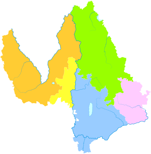
Administrative divisions[edit]
The government of Lijiang City sits in Gucheng District.
Lijiang City comprises onedistrictand fourcounties:
| Map | ||||||
|---|---|---|---|---|---|---|
| # | Name | Hanzi | Hanyu Pinyin | Population (2010) | Area (km2) | Density (/km2) |
| 1 | Gucheng District | Cổ thành khu | Gǔchéng Qū | 211,151 | 1,127 | 187 |
| 2 | Yongsheng County | Vĩnh thắng huyện | Yǒngshèng Xiàn | 392,024 | 5,099 | 77 |
| 3 | Huaping County | Hoa bình huyện | Huápíng Xiàn | 168,028 | 2,266 | 74 |
| 4 | Yulong Nakhi Autonomous County | Ngọc long nạp tây tộc tự trị huyện | Yùlóng Nàxīzú Zìzhìxiàn | 214,697 | 6,521 | 33 |
| 5 | Ninglang Yi Autonomous County | Ninh lang di tộc tự trị huyện | Nínglàng Yízú Zìzhìxiàn | 258,869 | 6,206 | 42 |
Demography[edit]
Lijiang is a multi-ethnic settlement. TheNaxi(originally from northwestern China and with aTibeto-Burmanlanguage and pictographic characters of their own) are mainly distributed in Lijiang, with a population of about 230,000 (includingMosuo,which is different from most Naxi people. They belong to a matrilineal clan, and the locals call itwalking marriage). There are alsoYi,Lisu,Hua Lisu and other nationalities. Lijiang has the onlyNaxiautonomous county in China. The residents in the county are mainly Naxi, and there are alsoBai,Yi,Lisu,Pumiand other minorities. Among them, theDongbaof the Naxi nationality is known as the only "livingpictograph"in the world that has been preserved intact.
Among the resident population in 2010, theHanpopulation was 537,893, accounting for 43.21% of the total population; theethnic minoritiespopulation was 706,876, accounting for 56.79% of the total population.
| National name | Han | Yi | Naxi | Lisu | Bai | Pumi | Dai | Miao | Tibetan | Hui | Others |
|---|---|---|---|---|---|---|---|---|---|---|---|
| Population | 537893 | 243400 | 240580 | 115730 | 52071 | 20400 | 11236 | 6884 | 5199 | 4615 | 6761 |
| Proportion of total population (%) | 43.21 | 19.55 | 19.33 | 9.30 | 4.18 | 1.64 | 0.90 | 0.55 | 0.42 | 0.37 | 0.54 |
| Proportion of minority population (%) | --- | 34.43 | 34.03 | 16.37 | 7.37 | 2.89 | 1.59 | 0.97 | 0.74 | 0.65 | 0.96 |
Local culture[edit]
This article mayrequirecleanupto meet Wikipedia'squality standards.The specific problem is:Unintelligible text, appears to have all been machine translated.(October 2018) |
Minority ethnic culture[edit]
The Naxi people have their own language. The Naxi language belongs to the Tibetan-Burmese language branch of the Sino-Tibetan language family. It is roughly divided into two dialects by the Jinsha River. The dialects cannot talk to each other. The standard language of Naxi language is based on the dialect of the western dialect of Naxi language, and the voice of Dayan Town of Lijiang City is the standard sound. In the long history of the Naxi people, there have been Dongbawen and Gobawen characters. "Dongbawen" is a hieroglyph created by the Naxi people more than a thousand years ago (before the Tang dynasty). It consists of pictographic symbols, phonetic symbols and additional symbols. It is the only living hieroglyph in the world that is still circulating in the folk. The Naxi people generally live in dam areas, river valleys and half-mountain areas. The private housing in the dam area is mostly a tiled house with civil structures. The pattern is mostly "three rooms and one wall", and the mountainous areas are mostly low wooden raft houses, which are covered with wooden boards. The Naxi people love singing and dancing, and there are often mass songs and dances in production labor and national festivals. The "Three Festivals" at the beginning of the lunar calendar in early February is the most traditional festival of the people of Lijiang Naxi.[18]
- Mosuo
Mosuois used to living in the mountains and waters. The houses are all made of wood. The traditional festivals of the Mosuo people include the Spring Festival, the Dragon Boat Festival, the Chaoshan Festival, the Ancestor Festival, the Sacrifice God Festival, and the Festival of Land Festival. Among them, the Spring Festival and the Chaoshan Festival are the most solemn. Mosuo people can sing and dance.[18]
The Yi people have a long history, and their ancestors are "Kunming" people who have a relationship with them. They were called "Wu Man" in the Tang and Song Dynasties. The Yi people have their own language and words. The language belongs to the Tibetan-Burmese language branch of the Sino-Tibetan language family. There are six dialects. The Xiaoliangshan Yi people belong to the northern dialect Shizha. Originally an ancient ideogram, some people think it is a pictographic syllable. In the history of the Yi people, they wrote historical, literary, astronomical and medical books, religious classics and so on. Most of the Yi villages are surrounded by mountains and waters, and the environment is beautiful. Generally, there are two or 30 households, and three or five households or single households are rare. The people living in Xiaoliangshan are generally low in order to avoid the cold of the mountains. Mostly, it is a timber frame with a multi-column landing structure. The four walls are made of wood or fenced with bamboo and wood. There are many festivals for the Yi people, such as the Lunar Festival, the 15th Festival, the February 8th, and the March 3rd Festival, especially the Torch Festival.[18]
The Lisu language belongs to the Sino-Tibetan language family. The Lisu people live in a high-slope area. Due to the influence of the terrain and habits, there are no villages that live in dozens of houses. Generally, there are dozens of households on two or three hills as a village. The villages are far apart, and the houses are mainly wooden rafts. The Lisu people have oral songs and long poems, as well as many myths and legends. Every December, the people of Huaping and other places will hold a grand ceremony to celebrate the "Wide Season" (New Year's Day). There are also the Dragon Boat Festival "Hangshan Festival" and Lixia "Holy Water Festival" in Lijiang Dawn Township.[18]
The language of the Pumi people belongs to the Yi language branch of the Tibetan-Burmese language group of the Sino-Tibetan language family. The local dialects have little difference and generally can talk to each other. There are no words in the Pumi people. The Pumi people inNinglangandMuliused to spell the Pumi language in Tibetan language to record historical legends and songs, but they are not popular and are now widely used in Chinese. The Pumi people live in a multi-clan, mostly on the mountainside, and the houses are mostly the layout of the wooden courtyard. The Pumi people have their own unique culture and art. Among them, the myths, legends and stories are the most numerous. The Pumi people can sing and dance. In the event of a wedding or funeral festival, a "song to the song" competition is held. Pumi men also like sports such as shooting, archery, wrestling, and martial arts. The most popular national traditional festival of the Pumi is the "Ohwa Festival" (the New Year) on the eighth day of the twelfth lunar month. In addition, there is the "Turning Sea Festival" on the 15th of the first month, and the "Taste of the New Festival" in the spring and autumn harvest season.[18]
Cuisine[edit]
- Salad of Jidou Pea Jelly (Kê đậu lương phấn)
Salad of Jidou pea jelly is a traditional food that Naxi loves. It is produced in Lijiangba and belongs to the yellow bean family. Because it is shaped like a chicken head, it is called chicken pea powder. The beans are milled into vermicelli, the color is gray-green, fried, the salad is very tasty, and the fragrance is delicious. It is a dish on the Naxi table.[19]
- Lijiang Baba (Lệ giang ba ba)
Lijiang Baba is the local fine wheat noodles, plus ham, chemical oil, sugar and other condiments, and mix thoroughly to form a layer. Eat a golden crisp, sweet and delicious, oily but not greasy.[19]
- Naxi Barbecue (Nạp tây thiêu khảo)
Naxi barbecue is a traditional carbace dish popular on Lijiang Tea Horse Road. The main ingredient is pork belly. The skin is golden and crisp, fat but not greasy, thin and not firewood, and the taste is crisp.[19]
- Crossing-the-Bridge Noodles (Quá kiều mễ tuyến)
Crossing-the-Bridge Noodles is a rice noodle soup from the Yunnan province, it has over 100 years of history. The dish is served with a large bowl of boiling hot broth and the soup ingredients. The soup is made with chicken, pork bone and seasoning, such as Chinese star anise and ginger. Also, using a layer of chicken fat to insulate the soup and therefore keep it warm for longer.[19]
- Erkuai (Nhị khối)
Erkuai is a type of rice cake, the name literally means "ear piece," a reference to the shape of one of its common forms. It is often served stir-fried with vegetables, and málà sauce, which is a mixture of dried red chilis, Sichuan pepper, and salt.[19]
Transportation[edit]


Airport[edit]
- Lijiang Sanyi International Airport(LJG): Lijiang Airport is located in the south of Lijiang city, 28 km (17 mi) away from downtown. There is an airport shuttle bus service in downtown Lijiang. The airport was opened in July 1995 and has flights toKunming,Chengdu,Xishuangbanna,Beijing,Shanghai,Guangzhou,Wuhan,Shenzhen,Xiamen via Chongqing andGuiyang.It also offers chartered airplane service. There are flights from Kunming to Lijiang every day and is about 30 minutes flight time.
Road[edit]
- G5611 Dali–Lijiang Expressway
- There are bus services to, amongst others,Kunming(8 hrs),Dali(3 hrs), theTiger Leaping GorgeandShangri-La.
- Lijiang has severalbridges over the Jinsha River,including the Jinlong Bridge, built in 1936, the oldest over the Yangtze.
Railway[edit]
Lijiang railway stationis currently the terminus of theDali–Lijiang railway,which heads south. TheLijiang–Shangri-La railway,currently under construction, will extend this line north toShangri-La.
- There is a train service to Kunming with one overnight and two day trains, and one day train to Dali.
- As of early 2019, a high speed train linking Lijiang to Kunming was introduced. Three pairs of high speed trains are operated betweenLijiang railway stationandKunming railway station/Kunming South railway station.It takes around 3–3.5 hours and the ticket fare is CNY 197–220 for a second class seat.
- There are over 5 pairs of conventional speed trains running between Lijiang and Kunming. The distance is about 517 km (321 mi), requiring 8.5 – 9.5 hours for a one-way trip. A hard sleeper costs CNY 186.5.
- TheLijiang–Shangri-La railwayfrom Lijiang toShangri-Lais expected to open in late 2021.
Tram[edit]
- Line 1 of Lijiang Tram started construction in October 2019.[20]
Major tourist attractions[edit]
Old Town of Lijiang[edit]

Old Town of Lijiangis a national historical and cultural city. It was built in the late Song dynasty (late 13th century AD). It is located in the middle of Lijiang Dam. It is the most preserved and most Naxi-style ancient town in China. It is located in the Yunnan-Guizhou Plateau. At an altitude of 2,416 meters, the city covers an area of 3.8 square kilometers. In December 1997, it was included in the “World Cultural Heritage” list by the UNESCO World Heritage Committee.[21]
Lugu Lake[edit]
Lugu Lakeis 2,680 meters above sea level, with an area of more than 50 square kilometers. The average lake depth is 45 meters and the deepest is 93 meters. The lake is clear and blue, with a visibility of 12–14 meters. It is one of the deepest freshwater lakes in China.[22]
Jade Dragon Snow Mountain[edit]

Jade Dragon Snow Mountainis located between 100°4′2” -100°16’30” east longitude and 27°3’2” -27°18’57” north latitude. The scenic area is 415 square kilometers. The main peak fan is 5,596 meters above sea level. It has snow all year round and develops the temperate maritime glaciers closest to the equator in the Eurasian continent. Jade Dragon Snow Mountain is called "Oulu" in Naxi, meaning silvery mountain rock. Its silver-packed, 13 snow peaks are endless, just like a "dragon" flying over the clouds, it is called "Jade Dragon." Because its lithology is mainly limestone and basalt, it is black and white, so it is also called "black and white snow mountain". She is the mountain of the hearts of the Naxi people. It is said that the Naxi people protect the gods of the "three more" incarnation.[23]
Laojun Mountain[edit]
Laojun Mountainis a combination of the three national-level scenic spots in the Jade Dragon Snow Mountain, the Three Rivers Concurrent, and the Cangshan Erhai Lake. It is an important part of the Yulong Snow Mountain Scenic Area. This scenic spot is mainly composed of Laojunshan Jiujiu Longtan, Jinsi Factory Jinshan Yuhu, Dawn Meile Danxia Landform, New Main Natural Alpine Botanical Garden and other areas (attractions), with a total area of 715 square kilometers, which is under planning and development. Ecotourism resort. It echoes with the Jade Dragon Snow Mountain and forms the east and west wings of Lijiang's tourism resources.[24]
Nearby[edit]
Some 35 kilometers north of Lijiang is theBaishui Terrace,an area where spring water flows over a sinter terrace, leaving behindtravertine.
Fifteen kilometers north of Lijiang is the village of Baisha, famous for the Baisha Fresco and the Naxi Hand-made Embroidery Institute. The Fresco was built in the Ming dynasty 600 years ago, the Naxi Hand-made Embroidery Institute was built 800 years ago, it is the headquarters of the Naxi embroideries and also, a school for the Naxi embroiderers. There are many Naxi embroidery masters, teachers, students and local farmers there. Their embroidery arts can be found there.
Education[edit]
Lijiang Teachers College (Lệ giang sư phạm cao đẳng chuyên khoa học giáo;Lìjiāng Shīfàn Gāoděng Zhuānkēxuéxiào) and Lijiang Culture and Tourism College (Lệ giang văn hóa lữ du học viện;Lìjiāng Wénhuà Lǚyóu Xuéyuàn) are located in Lijiang.[25][26]The latter was a branch ofYunnan University(YNU).[27]At one point the teacher's college merged into YNU.[28]
Sister cities[edit]
 Kazan,Tatarstan,Russia[29]
 Roanoke,Virginia,United States
 New Westminster,British Columbia,Canada
 Takayama, Gifu,Japan[citation needed]
 Shepparton, Victoria,Australia
 Whanganui,New Zealand
 Preah Vihear Province,Cambodia[30]
See also[edit]
- Riding Alone for Thousands of Miles:a film byZhang Yimouwhich takes place in the Lijiang area
- Resort town
References[edit]
- ^"China: Yúnnán (Prefectures, Cities, Districts and Counties) - Population Statistics, Charts and Map".
- ^Vân nam tỉnh thống kế cục, quốc gia thống kế cục vân nam điều tra tổng đội (December 2023).《 vân nam thống kế niên giám -2023》.Trung quốc thống kế xuất bản xã.ISBN978-7-5037-9653-1.
- ^"Old Town of Lijiang".UNESCO World Heritage Centre.United Nations, Educational, Scientific, and Cultural Organization.Retrieved4 Apr2021.
- ^Forbes, Andrew; Henley, David (2011).China's Ancient Tea Horse Road.Chiang Mai: Cognoscenti Books. ASIN: B005DQV7Q2
- ^abcdKapstein, Matthew (2009).Buddhism between Tibet and China.Boston: Wisdom Publications.
- ^Học thuật động thái — lệ giang mộc thị thổ tư dữ điền xuyên tàng giao giác khu vực lịch sử văn hóa nghiên thảo hội tổng thuật.iea.cass.cn.Archived fromthe originalon February 15, 2017.RetrievedMay 22,2019.
- ^Herman, John E. (February 1997)."Empire in the Southwest: Early Qing Reforms to the Native Chieftain System".The Journal of Asian Studies.56(1): 47–74.doi:10.2307/2646343.ISSN1752-0401.
- ^Lệ giang thị nhân dân chính phủ môn hộ võng trạm.Lijiang People's Government. Archived fromthe originalon April 15, 2019.RetrievedMay 22,2019.
- ^Trung quốc khí tượng sổ cư võng – WeatherBk Data(in Simplified Chinese).China Meteorological Administration.Retrieved10 April2023.
- ^ "Experience Template"Trung quốc khí tượng sổ cư võng(in Simplified Chinese).China Meteorological Administration.Retrieved10 April2023.
- ^Lệ giang - khí tượng sổ cư - trung quốc thiên khí võng(in Chinese). Weather China.Retrieved26 November2022.
- ^"Top 4 lakes in Yunnan".www.chinaexploration.com.Retrieved2024-05-17.
- ^"Lashihai Lake: A Haven for Wildlife and Natural Beauty | Colorful Yunnan".www.visityunnanchina.com.Retrieved2024-05-17.
- ^Kehui, L. I. U.; Guangluan, L. I.; Chunming, L. I.; Keyi, Zhao; Ningning, Zhang; Jieyi, X. U. E.; Yi, L. I.; Fangming, Y. U.; Min, Duan (2022-02-18)."A Review of Research on Lijiang Ecological Environment Based on Bibliometric and Knowledge Mapping Analysis Over the Past Four Decades".Ecology and Environment.31(2): 409.doi:10.16258/j.cnki.1674-5906.2022.02.022.ISSN1674-5906.
- ^"Local".news.cop15-china.com.cn.Retrieved2024-05-17.
- ^Qian, Li-Shen; Chen, Jia-Hui; Deng, Tao; Sun, Hang (2020-08-01)."Plant diversity in Yunnan: Current status and future directions".Plant Diversity.Safeguarding Our Future by Protecting Biodiversity.42(4): 281–291.doi:10.1016/j.pld.2020.07.006.ISSN2468-2659.PMC7567762.
- ^Yunnan Provincial Census Office, Yunnan Provincial Bureau of Statistics (September 2012)."Yunnan Provincial Census Data in 2010".China Statistics Press.ISBN978-7-5037-6548-3.
- ^abcdeLệ giang thiếu sổ dân tộc - vân nam tỉnh lệ giang thị trung cấp nhân dân pháp viện.ljzy.chinacourt.gov.cn.RetrievedMay 22,2019.[permanent dead link]
- ^abcdeLệ giang bất khả thác quá đích thập đại đặc sắc tiểu cật _ tân lãng lữ du _ tân lãng võng.travel.sina.com.cn.Jul 13, 2017.RetrievedMay 22,2019.
- ^Duyên đồ thiết 5 tọa xa trạm, tối cao thời tốc 70 công lí... Lệ giang hữu quỹ điện xa khai kiến!.The Paper.2019-10-31.
- ^6 nguyệt ngã ái đích lệ giang cổ thành mỗi nhất cá xúc mục năng cập đích địa phương đô thịnh phóng trứ tam giác mai _ lữ du cảnh điểm _ lệ giang lữ du _ lệ giang võng.www.lijiang.cn.Archived fromthe originalon October 30, 2019.RetrievedMay 22,2019.
- ^Lô cô hồ a, ngã tưởng dữ nhĩ đàm nhất tràng luyến ái ~_ lữ du cảnh điểm _ lệ giang lữ du _ lệ giang võng.www.lijiang.cn.Archived fromthe originalon July 6, 2018.RetrievedMay 22,2019.
- ^Ngọc long tuyết sơn.52yulong.com.
- ^Thế giới tự nhiên di sản lệ giang lão quân sơn: Trọng sơn điệp lĩnh khí thế khôi hoành _ lữ du cảnh điểm _ lệ giang lữ du _ lệ giang võng.www.lijiang.cn.Archived fromthe originalon October 20, 2018.RetrievedMay 22,2019.
- ^"Home".Lijiang Teachers College.Retrieved2022-04-22.
Giáo chỉ: Vân nam tỉnh lệ giang thị cổ thành tân đoàn phiến khu bưu biên: 674199
- ^"Home".Lijiang Culture and Tourism College.Retrieved2022-04-22.
Học viện địa chỉ: Vân nam tỉnh lệ giang thị cổ thành khu ngọc tuyền lộ 1 hào bưu biên: 674199
- ^"Học viện giản giới".Lijiang Culture and Tourism College.Retrieved2022-04-22.
Lệ giang văn hóa lữ du học viện ( nguyên vân nam đại học lữ du văn hóa học viện ) [...]
- ^"Historic Perspectives".Yunnan University.2004-06-23. Archived fromthe originalon 23 June 2004.Retrieved2022-04-23.
- ^Successful use of heritage is the pledge of prosperous future of Euro-Asia Cities(DOC file). II International Conference of World Heritage Cities of Euro-Asia. Lijiang. 15–18 October 2006ArchivedFebruary 26, 2009, at theWayback Machine
- ^Lưu dung (2012-05-01).Lệ giang thị dữ giản bộ trại bách uy hạ tỉnh đế kết vi quốc tế hữu hảo thành thị[Lijiang establish international friendly city with Preah Vihear Province of Cambodia].yndaily.yunnan.cn.Yunnan Daily Newspaper.Retrieved2018-05-14.
External links[edit]
- Lijiang City Official websiteArchived2008-09-29 at theWayback Machine
 Lijiangtravel guide from Wikivoyage
- Lijiang Overview and Travel GuideArchived2018-02-24 at theWayback Machine


| International | |
|---|---|
| National | |
| Geographic | |