
Lindale, Georgia
Lindale, Georgia | |
|---|---|
 Location inFloyd Countyand the state ofGeorgia | |
| Coordinates:34°11′37″N85°10′25″W/ 34.19361°N 85.17361°W | |
| Country | United States |
| State | Georgia |
| County | Floyd |
| Area | |
| • Total | 5.60 sq mi (14.50 km2) |
| • Land | 5.48 sq mi (14.19 km2) |
| • Water | 0.12 sq mi (0.32 km2) |
| Elevation | 666 ft (203 m) |
| Population (2020) | |
| • Total | 4,283 |
| • Density | 782.00/sq mi (301.91/km2) |
| Time zone | UTC-5(Eastern (EST)) |
| • Summer (DST) | UTC-4(EDT) |
| ZIP code | 30147 |
| Area code(s) | 706/762 |
| FIPS code | 13-46580[2] |
| GNISfeature ID | 0332220[3] |
Lindaleis anunincorporated communityandcensus-designated place(CDP) inFloyd County,Georgia,United States. It is part of theRome, GeorgiaMetropolitan Statistical Area.The population was 4,191 at the 2010 census.[4]
History
[edit]A post office called Lindale has been in operation since 1883.[5]The name Lindale might have been selected from a novel a resident had read.[6]
Throughout the 20th century, the community formed around theLindale Textile Milllocated in the center of the community. Since the early part of the 21st century, the building is abandoned. The Mill was owned by theWest Point-Pepperellfor the majority of its existence, leading to the Lindale community to be commonly referred to as "Pepperell". The local schools, which are part of theFloyd County School System,are named after the mill and use the West Point-Pepperell (currentlyWestPoint Home) Gryphon as the mascot, under the name "Pepperell Dragons".
Geography
[edit]Lindale is located in southeastern Floyd County at34°11′37″N85°10′25″W/ 34.19361°N 85.17361°W(34.193495, -85.173713).[7]It is bordered to the north by the city ofRome,thecounty seat.
According to theUnited States Census Bureau,the Lindale CDP has a total area of 5.5 square miles (14.3 km2), of which 5.4 square miles (14.0 km2) is land and 0.1 square miles (0.3 km2), or 2.20%, is water.[4]
Lindale's borders follow local and state roads, including Booze Mountain Road (for the southern border) andGeorgia State Route 101(for the easternmost city limits).
Demographics
[edit]| Census | Pop. | Note | %± |
|---|---|---|---|
| 1970 | 2,768 | — | |
| 1980 | 2,958 | 6.9% | |
| 1990 | 4,187 | 41.5% | |
| 2000 | 4,088 | −2.4% | |
| 2010 | 4,191 | 2.5% | |
| 2020 | 4,283 | 2.2% | |
| U.S. Decennial Census[8] 1850-1870[9]1870-1880[10] 1890-1910[11]1920-1930[12] 1940[13]1950[14]1960[15] 1970[16]1980[17]1990[18] 2000[19]2010[20]2020[21] | |||
Lindale first appeared as an unincorporated place in the1970 U.S. Census[16]and was designated acensus designated placein the1980 U.S. Census.[19]
2020
[edit]| Race / Ethnicity(NH = Non-Hispanic) | Pop 2000[22] | Pop 2010[20] | Pop 2020[21] | % 2000 | % 2010 | % 2020 |
|---|---|---|---|---|---|---|
| Whitealone (NH) | 3,835 | 3,711 | 3,502 | 93.81% | 88.55% | 81.77% |
| Black or African Americanalone (NH) | 72 | 178 | 320 | 1.76% | 4.25% | 7.47% |
| Native AmericanorAlaska Nativealone (NH) | 6 | 6 | 9 | 0.15% | 0.14% | 0.21% |
| Asianalone (NH) | 11 | 34 | 33 | 0.27% | 0.81% | 0.77% |
| Pacific Islanderalone (NH) | 0 | 0 | 0 | 0.00% | 0.00% | 0.00% |
| Some Other Race alone (NH) | 1 | 6 | 22 | 0.02% | 0.14% | 0.51% |
| Mixed Race or Multi-Racial(NH) | 51 | 50 | 167 | 1.25% | 1.19% | 3.90% |
| Hispanic or Latino(any race) | 112 | 206 | 230 | 2.74% | 4.92% | 5.37% |
| Total | 4,088 | 4,191 | 4,283 | 100.00% | 100.00% | 100.00% |
As of the2020 United States census,there were 4,283 people, 1,680 households, and 1,227 families residing in the CDP.
2000 census
[edit]As of thecensus[2]of 2000, there were 4,088 people, 1,682 households, and 1,165 families residing in the CDP. The population density was 741.6 inhabitants per square mile (286.3/km2). There were 1,796 housing units at an average density of 325.8 per square mile (125.8/km2). The racial makeup of the CDP was 95.01%White,1.79%African American,0.17%Native American,0.27%Asian,1.32% fromother races,and 1.44% from two or more races.HispanicorLatinopeople of any race were 2.74% of the population.
There were 1,682 households, out of which 29.4% had children under the age of 18 living with them, 52.5% weremarried couplesliving together, 12.4% had a female householder with no husband present, and 30.7% were non-families. 26.5% of all households were made up of individuals, and 12.9% had someone living alone who was 65 years of age or older. The average household size was 2.42 and the average family size was 2.91.
In the CDP, the population was spread out, with 23.8% under the age of 18, 8.3% from 18 to 24, 28.6% from 25 to 44, 21.7% from 45 to 64, and 17.6% who were 65 years of age or older. The median age was 38 years. For every 100 females, there were 94.1 males. For every 100 females age 18 and over, there were 85.8 males.
The median income for a household in the CDP was $28,486, and the median income for a family was $31,563. Males had a median income of $26,657 versus $21,910 for females. Theper capita incomefor the CDP was $15,844. About 10.8% of families and 16.0% of the population were below thepoverty line,including 26.0% of those under age 18 and 11.2% of those age 65 or over.
Education
[edit]It is part of theFloyd County School District.[23]
Pepperell Middle School andPepperell High Schoolserve the Lindale area.[24]
Notable people
[edit]- Eric L. Haney,former soldier and writer
- Randy Johnson,football player
- Willard Nixon,former pitcher forBoston Red Sox
Media recognition
[edit]In 2015, the science fiction filmThe Divergent Series: Allegiant,the third installment of theDivergent (film)series, was filmed in Lindale, at the Lindale Mill. Lindale is credited in the movie's final credits.[25]
References
[edit]- ^"2020 U.S. Gazetteer Files".United States Census Bureau.RetrievedDecember 18,2021.
- ^ab"U.S. Census website".United States Census Bureau.RetrievedJanuary 31,2008.
- ^"US Board on Geographic Names".United States Geological Survey.October 25, 2007.RetrievedJanuary 31,2008.
- ^ab"Geographic Identifiers: 2010 Census Summary File 1 (G001), Lindale CDP, Georgia".American FactFinder.U.S. Census Bureau. Archived fromthe originalon February 13, 2020.RetrievedApril 28,2016.
- ^"Floyd County".Jim Forte Postal History.RetrievedApril 25,2015.
- ^"Floyd County".Calhoun Times.September 1, 2004. p. 69.RetrievedApril 24,2015.
- ^"US Gazetteer files: 2010, 2000, and 1990".United States Census Bureau.February 12, 2011.RetrievedApril 23,2011.
- ^"Decennial Census of Population and Housing by Decade".United States Census Bureau.
- ^"1870 Census of Population - Georgia - Population of Civil Divisions less than Counties"(PDF).United States Census Bureau. 1870.
- ^"1880 Census of Population - Georgia - Population of Civil Divisions less than Counties"(PDF).United States Census Bureau. 1880.
- ^"1910 Census of Population - Georgia"(PDF).United States Census Bureau. 1930.
- ^"1930 Census of Population - Georgia"(PDF).United States Census Bureau. 1930. pp. 251–256.
- ^"1940 Census of Population - Georgia"(PDF).United States Census Bureau. 1940.
- ^"1950 Census of Population - Georgia"(PDF).United States Census Bureau. 1980.
- ^"1960 Census of Population - Population of County Subdivisions - Georgia"(PDF).United States Census Bureau. 1960.
- ^ab"1970 Census of Population - Population of County Subdivisions - Georgia"(PDF).United States Census Bureau. 1970.
- ^"1980 Census of Population - Number of Inhabitants - Georgia"(PDF).United States Census Bureau. 1980.
- ^"1990 Census of Population - Summary Social, Economic, and Housing Characteristics - Georgia"(PDF).United States Census Bureau. 1990.
- ^ab"2000 Census of Population - General Population Characteristics - Georgia"(PDF).United States Census Bureau. 2000.
- ^ab"P2 Hispanic or Latino, and Not Hispanic or Latino by Race - 2010: DEC Redistricting Data (PL 94-171) – Lindale CDP, Georgia".United States Census Bureau.
- ^ab"P2 Hispanic or Latino, and Not Hispanic or Latino by Race - 2020: DEC Redistricting Data (PL 94-171) – Lindale CDP, Georgia".United States Census Bureau.
- ^"P004 Hispanic or Latino, and Not Hispanic or Latino by Race – 2000: DEC Summary File 1 – Lindale CDP, Georgia".United States Census Bureau.
- ^"2020 CENSUS - SCHOOL DISTRICT REFERENCE MAP: Floyd County, GA"(PDF).U.S. Census Bureau.RetrievedJune 25,2021.
- ^"School Distrist's(sic) Feeder Patterns".Floyd County School District.June 1, 2008. Archived fromthe originalon June 1, 2008.RetrievedJuly 16,2022.
- ^Stewart, Jeremy (May 28, 2015)."Lindale set part of growing Ga. film industry; 'Allegiant' to film at old mill".Northwest Georgia News.RetrievedAugust 16,2021.
Municipalities and communities ofFloyd County, Georgia,United States | ||
|---|---|---|
| Cities | 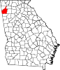 | |
| CDPs | ||
| Unincorporated communities | ||