
List of national parks of Canada

Canada's national parksareprotected areasunder theCanada National Parks Act,owned by theGovernment of Canadaand administered for the benefit, education, and enjoyment of the people ofCanadaand itsfuture generations.[1]National parks are administered byParks Canada,aCrown agencyoperating under the jurisdiction of theMinistry of Environment and Climate Change.The goal of the national parks system is to set aside lands representing the country's 39 distinct natural regions described in theNational Parks System Plan,primarily to protect the ecological integrity of the land, and secondarily to allow the public to explore, learn about and enjoy Canada's natural spaces.[2]
Canada's firstnational parkwas created in 1885 through anOrder-in-Council[3]to reserve 26 km2(10 sq mi) over theCave and Basin Hot Springsto prevent the land from being sold for private development despite claims being made for it. Modelled after the American experience withYellowstone National Park,theRocky Mountains Park Act,adopted in 1887, established the Rocky Mountains Park (nowBanff National Park).[4]The idea of a national park was popular and led to numerous proposals for theMinistry of the Interiorto consider, including additional sites along theCanadian Pacific Railway(e.g. Yoho and Glacier and an expansion of Banff) and theGrand Trunk Pacific Railway(e.g. Jasper). In 1911 theRocky Mountains Park Actwas replaced by theDominion Forest Reserves and Parks Actwhich created the world's first National Park Service, the Dominion Parks Branch, to administer national parks in Canada.[5]These early national parks, including those established under the leadership ofJB Harkinwho was the first commissioner of the Dominion Parks Branch, were set aside to reserve lands principally for tourism and conservation but also had an exclusionary policy prohibitingFirst Nationspeoples from using their traditional lands within the new parks.[6]In 1922,Wood Buffalo National Parkwas the first to allow traditional indigenous activities to continue. In 1972, Parks Canada defined national park reserves as lands administered by the agency intended to become national parks pending settlement ofindigenous land rightsand agreements for continued traditional use of the lands.[7][8]
As of July 2021[update],there are 38 national parks, 10 national park reserves, andone national urban park,covering an area of approximately 342,456 km2(132,223 sq mi),[9]or about 3.3% of the total land area of Canada, and representing 31 of its 39 natural regions. There is at least one park located in every one of the nation's13 provinces and territories.Parks Canada reported attendance of 15,449,249 at all national parks and reserves in 2016–17, including over four million visits to the busiest park (Banff) and only two persons at the least-visited park (Tuktut Nogait).[10]Parks Canada additionally manages threeNational Marine Conservation Areas(NMCAs), a single NMCA Reserve, and the country's loneNational Landmark.TheCanada National Parks Actalso allows for recognition ofNational Historic Sitesthat commemorate events, landmarks, or objects of national importance, and which may include similar levels of protection and administration as national parks.[1]Feasibility studies are underway to establish further national parks in unrepresented regions.[11]
National parks and national park reserves[edit]
National park reserves are indicated by "(Reserve)" after the park name. The national urban park is indicated by "(Urban)" after the park name.
| Name | Photo | Location | Established[12] | Area (2017)[12] | Annual visitors (2022–23)[13] | Natural region[14] | Description |
|---|---|---|---|---|---|---|---|
| Akami−Uapishkᵘ−KakKasuak−Mealy Mountains (Reserve) |

|
Newfoundland and Labrador 53°24′N59°22′W/ 53.400°N 59.367°W |
July 31, 2015 | 10,700 km2(4,131 sq mi) | East coast boreal | The park includes a portion of the glacially-roundedMealy MountainsonLabradorfromLake MelvilletoSandwich Bayand includes some sandy beaches along the coast of theLabrador Sea. | |
| Aulavik | 
|
Northwest Territories 73°42′N119°55′W/ 73.700°N 119.917°W |
1992 | 12,200 km2(4,710 sq mi) | 34 | Western arctic lowlands | Located on the northern part ofBanks Island,the completely treelesspolar desertof Aulavik is home to the world's largest concentration ofmuskoxen,as well as the endangeredPeary caribou.[15] |
| Auyuittuq | 
|
Nunavut 67°53′N65°01′W/ 67.883°N 65.017°W |
2001 | 19,089 km2(7,370 sq mi) | 256 | Northern Davis region | One of Canada's largest parks and located almost entirely within theArctic Circle,Auyuittuq onBaffin Islandpreserves a rugged arctic wilderness featuring some of the highest peaks of theCanadian Shield.[16] |
| Banff* | 
|
Alberta 51°30′N116°0′W/ 51.500°N 116.000°W |
November 25, 1885 | 6,641 km2(2,564 sq mi) | 4,130,081 | Rocky Mountains | The first park established by the federal government of Canada, Banff includes theValley of the Ten Peaks,theWaptaandWaputik Icefields,several ski resorts, and the communities ofLake LouiseandBanff.It is part of theCanadian Rocky Mountain Parks World Heritage Siteand adjacent to Kootenay, Yoho, and Jasper National Parks. |
| Bruce Peninsula† | 
|
Ontario 45°14′N81°37′W/ 45.233°N 81.617°W |
1987 | 125 km2(48 sq mi) | 460,435 | St. Lawrence lowlands | Formed from lands previously designated Ontario's Cyprus Lake Provincial Park, Bruce preserves a unique shoreline formation of theNiagara Escarpmentand forms part of the larger UNESCONiagara Escarpment Biosphere Reserve.TheBruce Trail,one of Canada's longest hiking trails, passes through the park. The locally threatenedmassasauga rattlesnakeis found within the park, as well as Canada's southernmost population ofblack bears.[12]: 142–143 |
| Cape Breton Highlands | 
|
Nova Scotia 46°43′N60°40′W/ 46.717°N 60.667°W |
1936 | 948 km2(366 sq mi) | 277,203 | Maritime Acadian highlands | Atlantic Canada's oldest national park featuresAcadianandboreal forestenvironments in theCape Breton Highlands.One-third of theCabot Trailpasses through the central portion of the park. Most of Nova Scotia's population ofCanada lynxare found in this park, and the endangeredNorth Atlantic right whaleis found in waters off the park's coast.[12]: 42–43 [17]Western moosewere introduced to this park from Alberta's Elk Island National Park between 1947 and 1948, the nativeeastern moosehaving been hunted to near-extinction.[18][19]Parks Canadastarted a four-year project with the Unama'ki Institute of Natural Resources and other partners to begin to restore boreal forest regions within this park in 2014. |
| Elk Island† | 
|
Alberta 53°37′N112°52′W/ 53.617°N 112.867°W |
1913 | 194 km2(75 sq mi) | 409,891 | Southern boreal plains & plateaux | Created as a wildlife sanctuary for elk, the park has become a part of bison conservation, theBeaver Hills Dark Sky Preserve,and theBeaver Hills Biosphere Reserve.[20]Eighteen moose (nine males and nine females) from Elk Island were introduced to Nova Scotia's Cape Breton Highlands National Park between 1947 and 1948.[19] |
| Forillon | 
|
Quebec 48°54′N64°21′W/ 48.900°N 64.350°W |
June 8, 1970 (federal-provincial agreement) | 240 km2(93 sq mi) | 164,130 | Notre Dame & Megantic Mountains | The lands of the first park in Quebec were traditional hunting and fishing grounds for theMi'kmaqandIroquois,and were exploited for their rich supplies of lumber.[12]: 98–99 Two hundred twenty-five families were controversiallyexpropriatedfrom the park lands prior to creation of the park in 1970. In 2011, the Government of Canada issued a formal apology to these families for their mistreatment.[21] |
| Fundy† | 
|
New Brunswick 45°36′N64°57′W/ 45.600°N 64.950°W |
1948 | 206 km2(80 sq mi) | 303,575 | Maritime Acadian highlands | Featuring the highesttidesin the world, theBay of Fundyexposes ocean floor at low tide which is covered by up to 16 m (52 ft) of salt water at high tide.[22]The park forms the core portion of the UNESCOFundy Biosphere Reserve. |
| Georgian Bay Islands† | 
|
Ontario 44°53′N79°52′W/ 44.883°N 79.867°W |
1930 | 14 km2(5 sq mi) | 27,482 | Great Lakes—St.Lawrence precambrian region | Beausoleil Islandis the largest of the small islands which make up the park, which originally includedFlowerpot Island.The islands form part of the UNESCOGeorgian Bay Littoral Biosphere Reserve. |
| Glacier | 
|
British Columbia 51°18′N117°31′W/ 51.300°N 117.517°W |
October 10, 1886 | 1,349 km2(521 sq mi) | 775,190[23] | Columbia Mountains | Representative of the Columbia Mountains natural region, this park includesIllecillewaet Glacier,Rogers Pass,Nakimu Caves,Mount Sir Donald,andMount Dawson.[24] |
| Grasslands | 
|
Saskatchewan 49°12′N107°43′W/ 49.200°N 107.717°W |
1981 | 730 km2(282 sq mi) (905 km2(349 sq mi) proposed) |
19,656 | Prairie grasslands | Located along the borders with the American state ofMontana,the park features an undisturbedmixed-grass prairieecosystem andbadlandswhere fossils from both theFrenchmanandBearpaw Formationswere discovered including those of aTriceratopsand aTyrannosaurus.[25] |
| Gros Morne* | 
|
Newfoundland and Labrador 49°41′N57°44′W/ 49.683°N 57.733°W |
October 1, 2005 (national park) August 1973 (national park reserve) |
1,805 km2(697 sq mi) | - | Western Newfoundland highlands | A World Heritage Site due to its exposedmantleandcrustas an example ofplate tectonics,the park also includesWestern Brook Pond,Lobster Cove,andGros Morne mountainin theLong Range Mountainschain.[26] |
| Gulf Islands (Reserve) |

|
British Columbia 48°51′N123°27′W/ 48.850°N 123.450°W |
May 9, 2003 | 37 km2(14 sq mi) | 28,434 | Strait of Georgia lowlands | Representative of the Strait of Georgia Lowlands, the park includes 6 km2of marine environment and land on 15 islands.[27] |
| Gwaii Haanas*[a] (Reserve) |

|
British Columbia 52°23′N131°28′W/ 52.383°N 131.467°W |
1988 | 1,474 km2(569 sq mi) | 2,651[29] | Pacific coast mountains | Forming the southern end of theHaida Gwaii archipelago,the park is on the far western end of Canada and includes 138 islands, inclusive ofNinstints World Heritage Site,Hotspring Island,and the southern tip ofMoresby Island. |
| Ivvavik[b] | 
|
Yukon 69°31′N139°31′W/ 69.517°N 139.517°W |
1984 | 9,750 km2(3,764 sq mi) | 179 | Northern Yukon | Adjacent to Vuntut National Park and the AmericanArctic National Wildlife Refuge,the park has arctic tundra that was not glaciated during the last ice age and consequently contains the oldest river in Canada, the Firth River. Ivvavik is the first national park created as a result of an aboriginal land claim agreement, theInuvialuit Final Agreement.[31] |
| Jasper* | 
|
Alberta 52°48′N117°54′W/ 52.800°N 117.900°W |
September 14, 1907 | 11,228 km2(4,335 sq mi) | 2,415,463 | Rocky Mountains | Part of theCanadian Rocky Mountain Parks World Heritage Siteand adjacent to the Banff National Parks, as well asMount RobsonandHamber Provincial Parksin British Columbia, this park includes the community ofJasper,Columbia Icefield,Athabasca Falls,Sunwapta Falls,Maligne Lake,andcanyon,and theSnow Dome,a hydrological apex of North America, at its boundary with the Banff National Park. |
| Kejimkujik† | 
|
Nova Scotia 44°24′N65°13′W/ 44.400°N 65.217°W |
1967 | 404 km2(156 sq mi) | 75,284 | Atlantic coast plain | The area aroundKejimikujik Lakewas acquired by the federal government for park purposes in 1967 and added a 22 km2seaside component in 1985. The inland portion was designated a National Historic Site in 1995 recognizing itsMi'kmawcultural landscape and is adjacent to theTobeatic Wilderness Area.The park is part of theSouthwest Nova Biosphere Reserveand adark-sky preserve.[32] |
| Kluane* (Park and Reserve)[c] |

|
Yukon 60°37′N138°20′W/ 60.617°N 138.333°W |
May 29, 1993 (Park) 1972 (Reserve) |
5,900 km2(2,278 sq mi) (Park) 16,080 km2(6,209 sq mi) (Reserve) |
47,098 | Northern coast mountains | Part of aWorld Heritage Siteand adjacent to the U.S.Wrangell–St. Elias National Parkand British ColumbianTatshenshini-Alsek Provincial Park,Kluane features thehighest mountain peaks in Canada,includingMount Logan,and the largest non-polar ice field in the world.[33] |
| Kootenay* | 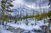
|
British Columbia 50°53′N116°03′W/ 50.883°N 116.050°W |
April 21, 1920 | 1,406 km2(543 sq mi) | 574,126 | Rocky Mountains | Part of theCanadian Rocky Mountain Parks World Heritage Siteand adjacent to the Banff and Yoho National Parks, as well as theMount Assiniboine Provincial Park,the park is representative of the Rocky Mountains natural region and includes theRadium Hot Springspools, an outcrop of theBurgess Shalefossil deposit,Numa Falls,andFloe Lake. |
| Kouchibouguac | 
|
New Brunswick 46°51′N64°58′W/ 46.850°N 64.967°W |
1969 | 239 km2(92 sq mi) | 243,489 | Maritime plain | Located on the coast where theKouchibouguac Riverenters theNorthumberland Strait,across from the north end of Prince Edward Island, the park illustratescoastal dynamics,includingtidal rivers,coastal dunes,salt marshes,bogs,andbarrier islands.[34] |
| La Mauricie | 
|
Quebec 46°48′N72°58′W/ 46.800°N 72.967°W |
August 22, 1970 | 536 km2(207 sq mi) | 278,923 | Great Lakes—St.Lawrence precambrian region | Located north ofShawinigan,and betweenSaint-Maurice River,Matawin River,andMastigouche Wildlife Reserve,the park features acanoe campingcircuit and habitat for thewood turtle.[35] |
| Mingan Archipelago (Reserve) |

|
Quebec 50°13′N63°10′W/ 50.217°N 63.167°W |
1984 | 151 km2(58 sq mi) | 44,017 | St. Lawrence lowlands | Located along theGulf of St. Lawrence,the park consists of theMingan Archipelagowith itslimestoneoutcropsandAtlantic puffinhabitat. |
| Mount Revelstoke | 
|
British Columbia 51°05′N118°04′W/ 51.083°N 118.067°W |
1914 | 262 km2(101 sq mi) | 775,190[23] | Columbia Mountains | Accessible by a trail from theCity of Revelstoke,the park is representative of the Columbia Mountains natural region.[24] |
| Nááts'ihch'oh (Reserve) |

|
Northwest Territories 62°22′N127°58′W/ 62.367°N 127.967°W |
December 18, 2014 | 4,850 km2(1,873 sq mi) | 109 | Mackenzie Mountains | Adjacent to the Nahanni National Park, Nááts'įhch'oh extends the protected area into the Sahtu Settlement Area to include additional land with theSouth Nahanni Riverwatershed to Mount Nááts'įhch'oh and theMoose Ponds.[36] |
| Nahanni* (Reserve) |

|
Northwest Territories 61°33′N125°35′W/ 61.550°N 125.583°W |
1974 | 30,000 km2(11,583 sq mi)[d] | 1,104 | Mackenzie Mountains | Containing the first naturalWorld Heritage Sitein Canada, the park includes theSouth Nahanni River,Virginia Falls,theCirque of the Unclimbables,and a limestone cave system.[38] |
| Pacific Rim[e] (Reserve) |

|
British Columbia 48°38′N124°46′W/ 48.633°N 124.767°W |
1970 | 510 km2(197 sq mi) | 1,163,362 | Pacific coast mountains | Representative of the coastal plain portion of the Pacific Coast Mountains natural region, the park is divided into three separated parts:Long Beach,theBroken Groupislands, and theWest Coast Trail.[39] |
| Point Pelee | 
|
Ontario 41°58′N82°31′W/ 41.967°N 82.517°W |
May 29, 1918 | 15 km2(6 sq mi) | 492,122 | St. Lawrence lowlands | The first national park established for conservation, Point Pelee is the southernmost point of the Canadian mainland, and also includes the southernmost point overall onMiddle Island.The marshy wetland environment is a known stop for migratory birds andmonarch butterflies,[40]and since 1987 is aRamsar ConventionWetland of International Importance.[41] |
| Prince Albert | 
|
Saskatchewan 53°58′N106°22′W/ 53.967°N 106.367°W |
March 24, 1927 | 3,875 km2(1,496 sq mi) | 287,372 | Southern boreal plains & plateaux | Established with arecreation focus,the park includes a small community on the east end ofWaskesiu Lakeand featuresfescuegrasslandswithplains bison,boreal forest,andAjawaan,Lavallée Lake,and other lakes.[42] |
| Prince Edward Island | 
|
Prince Edward Island 46°25′N63°05′W/ 46.417°N 63.083°W |
1937 | 27 km2(10 sq mi) | - | Maritime plain | Sensitive sand beaches and dunes on the island's north shore provide nesting habitat for the endangeredpiping ploverand are designated anImportant Bird Area.An extension added in 1998 protectsparabolic sand dunesand an area with archaeological evidence ofPaleo-Indianoccupation up to 10,000 years ago.[43]The park also encompassesGreen Gables,the inspiration for the popularAnne of Green Gablesnovels.[12]: 62–63 |
| Pukaskwa | 
|
Ontario 48°15′N85°53′W/ 48.250°N 85.883°W |
1971 | 1,878 km2(725 sq mi) | 17,285 | Central boreal uplands | Located on theVoyageur Hiking Trailand the longest stretch of undeveloped shoreline in theGreat Lakes,[44]Pukaskwa protects an area of boreal forest largely untouched by logging and mining industries, owing to the terrain's remarkable ruggedness.[12]A large cluster of thePukaskwa Pitsare located within the park. |
| Qausuittuq | 
|
Nunavut 76°00′N100°00′W/ 76.000°N 100.000°W |
September 1, 2015 | 11,008 km2(4,250 sq mi) | Western high Arctic | Located onBathurst Island,the park is adjacent to thePolar Bear Pass National Wildlife Areaand protectsPeary caribouandmuskoxhabitat. | |
| Quttinirpaaq[f] | 
|
Nunavut 82°13′N72°13′W/ 82.217°N 72.217°W |
1988 | 37,775 km2(14,585 sq mi) | 7 | Eastern high Arctic | Located on thepolar desertofEllesmere Islandat the northern tip of Canada, the park includesTanquary Fiord,Barbeau Peak,Lake Hazen,andFort Conger. |
| Riding Mountain† | 
|
Manitoba 50°52′N100°02′W/ 50.867°N 100.033°W |
May 30, 1933 | 2,968 km2(1,146 sq mi) | 336,560 | Southern boreal plains & plateaux | Part of theRiding Mountain Biosphere Reserve,[46]the park features both boreal and aspen forests among the larger grassland prairie landscape, interspersed withpothole lakesand marshes. The park has anoutdoor recreationfocus and includes the community ofWasagaming,theEast GateNational Historic Site, and formerly theWhitewater prisoners-of-war camp.[47] |
| Rouge (Urban) |

|
Ontario 43°56′N79°14′W/ 43.933°N 79.233°W |
May 15, 2015 | 79.1 km2(31 sq mi) | St. Lawrence lowlands | Located in theGreater Toronto Areabeginning at the mouth of theRouge Riverand through the east end ofTorontoandMarkham,the park includes riparian corridors and wetlands with habitat for theBlanding's turtle,as well asBead Hill National Historic Site. | |
| Sable Island (Reserve) |

|
Nova Scotia 43°57′N59°55′W/ 43.950°N 59.917°W |
June 20, 2013 | 30 km2(12 sq mi) | 806 | Atlantic coast plain | Consisting ofSable Islandat the edge of thecontinental shelfoff the coast ofNova Scotia,the island of sand is home to theSable Island horseand provides habitat forgrey sealsandbeach grass. |
| Sirmilik | 
|
Nunavut 72°59′N81°8′W/ 72.983°N 81.133°W |
2001 | 22,200 km2(8,571 sq mi) | 6 | Eastern Arctic lowlands[48] | Located on the eastern end of Nunavut, Sirmilik consists of theByam Martin MountainsofBylot IslandandBaffin Island'sBorden PeninsulaandOliver Sound. |
| Terra Nova | 
|
Newfoundland and Labrador 48°32′N53°56′W/ 48.533°N 53.933°W |
1957 | 399 km2(154 sq mi) | 45,191 | Eastern Newfoundland Atlantic region | The easternmost national park, Terra Nova is located on the east coast ofNewfoundlandalong theTrans-Canada Highway.The park is characteristic of the Newfoundland landscape of low relief and rounded hills, and a rocky coastline ofarms,sounds,coves,inlets,sea arches,and caves, as well as habitat for theNewfoundland pine marten.[49] |
| Thaidene Nëné (Reserve) |

|
Northwest Territories 62°30′N111°00′W/ 62.500°N 111.000°W |
August 21, 2019 | 14,305 km2(5,523 sq mi)[50] | Northwestern boreal uplands[51] | Thaidene Nëné, which translates in Canadian English as "Land of the Ancestors", is a protected area that spans 6.5 million acres (26,000 km2) at the transition between boreal forest and tundra. It includes the East Arm ofGreat Slave Lake,the deepest freshwater source in North America, and provides habitat for red fox, black bear, wolf packs, grizzly bear, lynx, wolverine,marten,Arctic fox,moose, beaver, muskoxen, and critical wintry weather for the last herds ofbarren-ground caribou. | |
| Thousand Islands† | 
|
Ontario 44°21′N75°57′W/ 44.350°N 75.950°W |
1904 | 24 km2(9 sq mi) | 109,284 | St. Lawrence lowlands | Oldest national park east of thePrairies,it is scattered over all or portions of 26 islands and 80isletsandshoalsin theSt. Lawrence River,as well as several mainland properties inLeeds and Grenville,east ofKingston,and within theFrontenac Arch Biosphere Reserve. |
| Torngat Mountains | 
|
Newfoundland and Labrador 59°26′N63°52′W/ 59.433°N 63.867°W |
July 10, 2008 | 9,700 km2(3,745 sq mi) | Northern Labrador mountains | Located on the northernmost tip ofLabrador,adjacent to Quebec'sKuururjuaq Park,and established as part of Inuit Land Claims Agreements, the park includes theTorngat Mountains,Labrador Seacoastline, andPre-Dorset,Dorset,andThulearchaeological finds.[52] | |
| Tuktut Nogait | 
|
Northwest Territories 68°49′N121°45′W/ 68.817°N 121.750°W |
1998 | 18,181 km2(7,020 sq mi) | 12 | Tundra hills | Within theInuvialuit Settlement Region,the park was created to protect the Bluenose-West caribou herd and harvesting rights for theInuvialuit people.It was expanded in 2005 to include a portion of theSahtu Settlement Area.[53] |
| Ukkusiksalik | 
|
Nunavut 65°21′N87°18′W/ 65.350°N 87.300°W |
August 23, 2003 | 20,880 km2(8,062 sq mi) | Central tundra[54] | Named after theInuitword forsoapstone,the park surroundsWager Baywhich ismaternity denningareas forpolar bearsand includes cultural relics of theDorsetandThuleandAivilingmiutpeople.[54] | |
| Vuntut | 
|
Yukon 68°22′N139°51′W/ 68.367°N 139.850°W |
1993 | 4,345 km2(1,678 sq mi) | Northern Yukon | Adjacent to the Ivvavik National Park and the AmericanArctic National Wildlife Refuge,the park area was not glaciated during the last ice age and now hostsPleistocenefossil sites. Remote and inaccessible by road, the park was established, and is operated, in collaboration with theVuntut Gwitchin First Nationas part of that nation's Final Agreement with Canada.[55] | |
| Wapusk | 
|
Manitoba 57°46′N93°22′W/ 57.767°N 93.367°W |
1996 | 11,475 km2(4,431 sq mi) | 82 | Hudson—James lowlands | Created from a portion of the provincial Churchill Wildlife Management Area, Wapusk helps protect the land base that act asmaternity denningareas forpolar bears.[56] |
| Waterton Lakes‡[g] | 
|
Alberta 49°03′N113°55′W/ 49.050°N 113.917°W |
May 30, 1895 | 505 km2(195 sq mi) | 475,842 | Rocky Mountains | Coupled with American neighbourGlacier National ParkinMontana,theWaterton-Glacier International Peace Parkis both a World Heritage Site and the oldesttransboundary protected areain the world. Anchored byWaterton Lake,home of the historicPrince of Wales Hotel,the park is famous for hiking attractions such as theCrypt Lake Trail. |
| Wood Buffalo* | 
|
Alberta/Northwest Territories 59°23′N112°59′W/ 59.383°N 112.983°W |
1922 | 44,972 km2(17,364 sq mi) | 2,399 | Northern boreal plains | The largest park in Canada, the park protects the habitat of thewood bisonand the breeding grounds of thewhooping craneand much of thePeace–Athabasca Delta.It is also a World Heritage Site and the world's largestdark-sky preserve. |
| Yoho* | 
|
British Columbia 51°24′N116°29′W/ 51.400°N 116.483°W |
October 10, 1886 | 1,313 km2(507 sq mi) | 663,878 | Rocky Mountains | Part of theCanadian Rocky Mountain Parks World Heritage Siteand adjacent to the Banff and Kootenay National Parks, Yoho includes the community ofField,Burgess Shalefossil deposit,Emerald Lake,Takakkaw Falls,andKicking Horse River. |
By province/territory[edit]
Proposed National Park Reserves[edit]
The following are areas which Parks Canada is in the process of evaluating as potential parks. While they may be reserved from alienation or have federal-provincial/territorial agreements, they have not been formally established through legislation as parks.
| Name | Location | Area | Natural region |
|---|---|---|---|
| Manitoba Lowlands[58] | Manitoba 53°46′N99°4′W/ 53.767°N 99.067°W |
Approx.5,000 km2(1,931 sq mi)[59] | Manitoba lowlands |
| Pituamkek[60][61] | Prince Edward Island 46°36′50″N63°47′42″W/ 46.61389°N 63.79500°W |
TBD | Maritime plain |
| South Okanagan—Similkameen[62] | British Columbia 49°4′N119°41′W/ 49.067°N 119.683°W |
Approx.284 km2(110 sq mi)[63] | Interior dry plateau[63] |
There remain six Natural Regions unrepresented by either current or proposed parks.[64]As Parks Canada has a long-term goal of preserving representative areas of all Natural Regions, future parks will likely be established in these areas.[65]These regions are:
- the "Boreal Lake Plateau" region of Newfoundland and Labrador and Quebec
- the "Laurentian Boreal Highlands" region of Newfoundland and Labrador and Quebec
- the "Northern Interior Plateaux and Mountains" region of British Columbia and Yukon
- the "Southampton Plain" region of Nunavut
- the "Ungava Tundra Plateau" region of Quebec and Nunavut
- the "Whale River" region of Newfoundland and Labrador, Nunavut, and Quebec
Abolished national parks[edit]
| Name | Location | Established | Abolished |
|---|---|---|---|
| Brereton Lake Dominion Park[66] | Manitoba | 1922 | 1930 |
| Buffalo National Park[67] | Alberta | March 7, 1908 | July 17, 1947 |
| Menissawok National Park[1] | Saskatchewan | May 31, 1922 | May 30, 1930 |
| Nemiskam National Park[67] | Alberta | 1914 | July 17, 1947 |
| Vidal Point Dominion Park[68] | Saskatchewan | October 31, 1921 | May 30, 1930 |
| Wawaskesy National Park[69] | Alberta | May 31, 1922 | June 24, 1938 |
- Brereton and Vidal were transferred to provincial jurisdiction, both continuing as (renamed) provincial parks.
- Buffalo, Menissawok, Nemiskam and Wawaskesy were created expressly to protect and regenerate dangerously low populations ofbisonandpronghorn,and were delisted when those populations improved.
National Marine Conservation Areas[edit]
National Marine Conservation Areas(NMCAs) is a program established in 2002 with the goal of preserving marine ecosystems representing the 29 marine regions of Canada.[70]They are designed for sustainable use, although they usually also contain areas designed to protectecological integrity.National Marine Conservation Area Reserves are protected areas proposed to be added to the NMCA system pending settlement of indigenous land and water rights. In the interim, they are administered under park rules.[71]
As of 2020[update],established NMCAs and NMCA Reserves protect 14,846 km2(5,732 sq mi) of waters, wetlands, and coastlines, representing five of the 29 identified marine regions with studies underway for protected areas in three additional regions.[70]
| Name | Photo | Location | Established[12] | Area (2017)[12] | Annual visitors (2022–23)[13] | Marine region[70] | Description |
|---|---|---|---|---|---|---|---|
| Fathom Five† | 
|
Ontario 45°19′N81°38′W/ 45.317°N 81.633°W |
July 20, 1987 | 114 km2(44 sq mi) | 227,828 | Georgian Bay | The marine counterpart to Bruce National Park, Fathom Five is named for a line inShakespeare'sThe Tempest.The first marine unit in the national parks system preserves a unique aquatic environment and several small islands includingFlowerpot Island.The unusually clear waters and numerous shipwrecks on theshoalsofGeorgian Baymake the park a popular destination forscuba divers.[12]: 189 |
| Gwaii Haanas (Reserve) |

|
British Columbia 52°0′N131°12′W/ 52.000°N 131.200°W |
June 11, 2010 | 1,500 km2(579 sq mi)[72] | 2,651[29] | Hecate Strait,Queen Charlotte Shelf | Along with the national park reserve of the same name, Gwaii Haanas protects an area extending from the ocean floor of theHecate StraitandQueen Charlotte Basinto the mountains of theHaida Gwaii.The marine reserve preserves theHaida people's traditional use of the waters while protecting the area fromoil explorationand commercial fishing.[12]: 299 |
| Lake Superior | 
|
Ontario 48°26′N89°13′W/ 48.433°N 89.217°W |
September 1, 2015 | 10,880 km2(4,201 sq mi) | Lake Superior | Adjacent to the United States'Isle Royale National Parkand severalOntario provincial parks,Lake Superior NMCA forms part of the world's largestfreshwaterreserve.[73] | |
| Saguenay–St. Lawrence† | 
|
Quebec 48°4′N69°40′W/ 48.067°N 69.667°W |
June 8, 1998 | 1,245 km2(481 sq mi)[74] | 1,070,634 | St. Lawrence Estuary | Located at theconfluenceof theSaguenayandSt.Lawrencerivers and adjacent to Quebec'sSaguenay Fjord National Park,Saguenay–St. Lawrence protects a portion of theSt.Lawrence estuary,a common feeding ground for marine mammals such as the endangered St.Lawrencebeluga whale. |
Proposed National Marine Conservation Areas[edit]
| Study area | Location | Area | Marine region[70] |
|---|---|---|---|
| Magdalen Islands[75][76] | Quebec 47°35′N61°32′W/ 47.583°N 61.533°W |
16,500 km2(6,371 sq mi) | Magdalen shallows |
| Southern Strait of Georgia[77] (Reserve) |
British Columbia 49°18′N123°48′W/ 49.300°N 123.800°W |
1,400 km2(541 sq mi) | Strait of Georgia |
| Tallurutiup Imanga[78] | Nunavut 74°13′N84°0′W/ 74.217°N 84.000°W |
109,000 km2(42,085 sq mi) | Lancaster Sound |
National Landmarks[edit]
TheNational Landmarksprogram was established in 1978 to protect specific natural features considered "outstanding, exceptional, unique, or rare to this country. These natural features would typically be isolated entities and of scientific interest."[79]The enabling legislation expired 10 years later, and was not renewed.Pingo National Landmarkwas the only such unit established in that time.
| Name | Photo | Location | Established[12] | Area (2017)[12] | Description |
|---|---|---|---|---|---|
| Pingo | 
|
Northwest Territories 69°24′N133°05′W/ 69.400°N 133.083°W |
July 25, 1984 | 16 km2(6 sq mi) | Located on the shore of theArctic Ocean,Canada's only National Landmark preserves eight ice-cored mounds known aspingosincluding Canada's largest, Ibyuk Pingo, along with other land and ice formations unique to thepermafrostenvironment. |
Provincial parks categorized as national parks[edit]
Provincial and territorial parks are administered and funded by their respective governments. However, Quebec has named its provincial parks “national parks”, though none are in the national park system.
Some sub-national parks are categorized by theIUCNunder the umbrella termnational parks(Category II) in its global Protected Area Management Categories. As of 2011, there were more than 1500 Category II-listed areas across the country, including nearly 700 in B.C., and at least 500 in Ontario. Only Quebec uses the term “national park” for such provincial areas, using the IUCN's category name as justification.
In addition to the national park system, several federal agencies manage natural, scientific, and recreational areas. In theNational Capital Region,a number of parklands come under the jurisdiction of theNational Capital Commission,includingGatineau ParkinQuebec.None of these are part of the national park system.
See also[edit]
- List of Canadian protected areas
- List of UNESCO Biosphere Reserves in Canada
- List of national historic sites of Canada
- List of World Heritage Sites in Canada
Notes[edit]
- ^South Moresby National Park Reserve was created 12 July 1988, with the signing of the South Moresby Agreement; renamed Gwaii Haanas National Park Reserve and Haida Heritage Site on 28 February 1996. Includes SGaang Gwaii (Anthony Island)World Heritage Site.[28]
- ^Established as Northern Yukon National Park in 1984, renamed Ivvavik National Park in 1992.[30]
- ^Kluane National Park Reserve was set aside in 1976, following the Kluane Game Reserve of the early 1940s. Subsequently, an eastern portion of the Reserve became Kluane National Park in 1993.
- ^In 2007, the government announced that 29,000 km2(11,197 sq mi) of land would be added to Nahanni, making it 33,766 km2(13,037 sq mi). However, these changes have not been fully implemented as of 2017[update].[37]
- ^Only the northwestern end of Pacific Rim National Park Reserve is located withinClayoquot Sound Biosphere Reserve.
- ^Ellesmere Island National Park Reserve was established in 1988, renamed Quttinirpaaq in 1999, and became a national park in 2000.[45]
- ^Waterton Lakes National Park is part ofWaterton-Glacier International Peace Park,aWorld Heritage Sitewhich includes the adjoiningGlacier National ParkinMontana,United States.
References[edit]
- ^abcCanada National Parks Act,S.C.2000, c. 32 (Canada National Parks Actat Justice Laws Website)
- ^"National Parks of Canada – Introduction".Parks Canada.23 May 2017.Archivedfrom the original on 6 April 2017.Retrieved13 December2017.
- ^An act further to amend and to consolidate, as so amended, the several Acts respecting the Public Lands of the Dominion therein mentioned,P.C. 1885-2197, c. 17, s. 26
- ^Lothian, W.F. (1981).A Brief History of Canada's National Parks(PDF).Environment Canada.ISBN0-662-15217-4.Archived(PDF)from the original on 22 January 2017.Retrieved24 January2018.
- ^Irish, Paul (13 May 2011)."Parks Canada celebrates a century of discovery".Toronto Star.Archivedfrom the original on 16 May 2011.Retrieved24 January2018.
- ^Binnema, Theodore; Niemi, Melanie (2006). "'Let the line be drawn now': Wilderness, Conservation, and the Exclusion of Aboriginal People from Banff National Park in Canada ".Environmental History.11(4): 724–50.doi:10.1093/envhis/11.4.724.
- ^Joseph, Bob (13 March 2015)."Can First Nations hunt in national parks?".Indigenous Corporate Training.Archivedfrom the original on 25 January 2018.Retrieved24 January2018.
- ^"Indigenous fact sheet".Parks Canada.23 June 2017. Archived fromthe originalon 11 December 2017.Retrieved13 December2017.
- ^"The system of national parks of Canada".Parks Canada.29 July 2021.Archivedfrom the original on 21 January 2022.Retrieved7 May2022.
- ^"Parks Canada Attendance 2016–17".Parks Canada.11 September 2017.Archivedfrom the original on 22 December 2017.Retrieved25 January2018.
- ^"Creating new national parks".Parks Canada.Archivedfrom the original on 11 December 2017.Retrieved13 December2017.
- ^abcdefghijklmGuide to the National Parks of Canada.Washington, D.C.: National Geographic. 2017.ISBN978-1-4262-1756-2.
- ^abCanada, Parks."Parks Canada attendance 2022_23 - Parks Canada attendance 2022_23 - Open Government Portal".open.canada.ca.Retrieved7 May2024.
- ^Parks Canada (1997).National Parks System Plan(PDF).Parks Canada.ISBN0-662-25334-5.Archived(PDF)from the original on 6 January 2018.Retrieved18 January2018.
- ^"Aulavik National Park – Natural Environment".Parks Canada.8 June 2017.Archivedfrom the original on 12 December 2017.Retrieved13 December2017.
- ^"Auyuittuq National Park – About".Parks Canada.1 December 2017.Archivedfrom the original on 11 December 2017.Retrieved14 December2017.
- ^Ayers, Tom (22 September 2015)."Right whales off Cape Breton going the wrong way for shipping, fishing".The Chronicle Herald.Archivedfrom the original on 31 July 2017.Retrieved10 January2018.
- ^"Moose Management".Nova Scotia Office of Aboriginal Affairs.Province of Nova Scotia.February 2007.Archivedfrom the original on 19 March 2018.Retrieved18 March2018.
- ^ab"Cape Breton Highlands National Park - Moose".Parks Canada.3 January 2018.Archivedfrom the original on 19 March 2018.Retrieved18 March2018.
- ^Elk Island National Park of Canada Management Plan.Parks Canada. 2011.ISBN978-1-100-18107-3.
- ^Rudin, Ronald (2011)."The First French-Canadian National Parks: Kouchibouguac and Forillon in History and Memory".Journal of the Canadian Historical Association.22(1): 161–200.doi:10.7202/1008961ar.
- ^"Where is the highest tide?".National Ocean Service.National Oceanic and Atmospheric Administration.10 October 2017.Archivedfrom the original on 1 February 2018.Retrieved10 January2018.
- ^abofficial Parks Canada figures combine the visitor numbers of Glacier National Park and Mount Revelstoke National Park
- ^abState of the Parks Report – Mount Revelstoke and Glacier National Parks.Parks Canada.2008.
- ^Grasslands National Park Reserve of Canada Management Plan.Parks Canada. 2010.ISBN978-1-100-15723-8.
- ^Gros Morne National Park of Canada Management Plan.Parks Canada. 2009.ISBN978-0-662-44613-2.
- ^"Gulf Islands National Park Reserve".National Geographic.6 July 2011. Archived fromthe originalon 6 January 2018.Retrieved5 January2018.
- ^"Gwaii Haanas National Park Reserve and Haida Heritage Site".The Canadian Encyclopedia.Archived fromthe originalon 28 August 2006.Retrieved7 April2008.
- ^abofficial Parks Canada figures combine the numbers for Gwaii Haanas National Park Reserve, National Marine Conservation Area Reserve and Haida Heritage Site
- ^"Ivvavik National Park".The Canadian Encyclopedia.Archivedfrom the original on 11 January 2018.Retrieved7 April2008.
- ^Ivvavik National Park Management Plan.Parks Canada. 2017.
- ^Kejimkujik National Park and National Historic Site of Canada Management Plan.Parks Canada. 2010.ISBN978-1-100-13549-6.
- ^"Largest non-polar ice field".Guinness World Records.2011.Archivedfrom the original on 7 January 2018.Retrieved6 January2018.
- ^Kouchibouguac National Park of Canada Management Plan.Parks Canada.2010.ISBN978-1-100-13556-4.
- ^La Mauricie National Park of Canada Management Plan.Parks Canada.2010.ISBN978-1-100-14153-4.
- ^Nááts'įhch'oh National Park Reserve of Canada Management Plan.Parks Canada. 2017.ISBN978-0-660-09423-6.
- ^"Tories' expansion of Nahanni park praised".CTV News.8 August 2007.Archivedfrom the original on 17 October 2012.Retrieved7 April2008.
- ^Nahanni National Park Reserve of Canada Nahʔą Dehé Management Plan.Parks Canada. 2010.ISBN978-1-100-15495-4.
- ^State of the Parks Report – Pacific Rim National Park Reserve.Parks Canada.2008.ISBN978-0-662-48932-0.
- ^"Monarch butterflies by the thousands at Point Pelee".CBC News.17 September 2014.Archivedfrom the original on 23 September 2017.Retrieved10 January2018.
- ^"Point Pelee".Ramsar Sites Information Service.Archivedfrom the original on 11 January 2018.Retrieved10 January2018.
- ^Prince Albert National Park Reserve Management Plan.Parks Canada.2017.
- ^Scheller, William G. (December 1999)."A Story Written in Sand".Islands Magazine.19(6): 23–24.Retrieved10 January2018.
- ^Otis, Daniel (8 January 2018)."Trekking the wild shores of Lake Superior in Pukaskwa National Park".Toronto Star.Archivedfrom the original on 19 January 2018.Retrieved18 January2018.
- ^"Quttinirpaaq National Park".The Canadian Encyclopedia.Archivedfrom the original on 14 March 2015.Retrieved7 April2008.
- ^"Biosphere Reserve Information – Canada – Riding Mountain".UNESCO.Archivedfrom the original on 26 May 2024.Retrieved7 April2008.
- ^Riding Mountain National Park of Canada and Riding Mountain Park East Gate Registration Complex National Historic Site of Canada Management Plan.Parks Canada. 2007.ISBN978-0-662-43469-6.
- ^Sirmilik National Park Management Plan.Parks Canada. 2016.Archivedfrom the original on 12 December 2017.Retrieved25 January2018.
- ^Terra Nova National Park of Canada Management Plan.Parks Canada.2009.ISBN978-1-100-10393-8.
- ^"Nature Canada Applauds Federal Government's Renewed Commitment to National Park System".Nature Canada.16 October 2006.Archivedfrom the original on 19 August 2014.Retrieved7 April2008.
- ^"Thaidene Nëné Proposed National Park Reserve Ecological Values Summary".Parks Canada.Archivedfrom the original on 12 December 2017.Retrieved18 January2018.
- ^Torngat Mountains National Park Canada: management plan.Parks Canada. 2010.ISBN978-1-100-13554-0.
- ^Tuktut Nogait National Park of Canada: management plan.Parks Canada. 2007.ISBN978-0-662-42988-3.
- ^abUkkusiksalik National Park of Canada: Management Plan(PDF).Parks Canada. 2017. Archived fromthe original(PDF)on 26 January 2018.Retrieved25 January2018.
- ^Vuntut National Park of Canada Management Plan.Parks Canada. 2010.
- ^Wapusk National Park of Canada Management Plan.Parks Canada. 2007.ISBN978-0-662-47407-4.
- ^abWood Buffalo National Park is split between Alberta and the Northwest Territories.
- ^Glowacki, Laura (22 March 2017)."New Manitoba national park announced in 2017 budget home to white cliffs, turquoise lake".CBC News.Archivedfrom the original on 10 January 2018.Retrieved25 January2018.
- ^"Manitoba National Parks".Manitoba Wildlands.30 May 2014.Archivedfrom the original on 12 August 2003.Retrieved25 January2018.
- ^Canada, Parks (14 August 2019)."Government of Canada and PEI Mi'kmaq First Nations working together to protect the Hog Island Sandhills".gcnws.Archivedfrom the original on 14 August 2021.Retrieved28 October2020.
- ^Parks Canada Agency, Government of Canada (5 February 2020)."Map of Completing Canada's National Parks System - National Parks".www.pc.gc.ca.Archivedfrom the original on 2 January 2018.Retrieved28 October2020.
- ^Gaffney, Blaine (27 October 2017)."Efforts heat up to create a national park reserve in the south Okanagan".Global News.Archivedfrom the original on 27 October 2017.Retrieved18 January2018.
- ^ab"Proposed National Park Reserve in the South Okanagan-Similkameen".Parks Canada.18 January 2018.Archivedfrom the original on 19 January 2018.Retrieved18 January2018.
- ^"Archived copy".Archivedfrom the original on 21 July 2017.Retrieved22 March2019.
{{cite web}}:CS1 maint: archived copy as title (link) - ^"National Parks System Plan - National Parks".August 2019.Archivedfrom the original on 21 March 2019.Retrieved22 March2019.
- ^Hart, E. J. (2010).J. B. Harkin: Father of Canada's National Parks.Edmonton, AB: University of Alberta Press. p.340.ISBN9780888645128.
- ^abFederation of Alberta Naturalists, Fish and Wildlife Historical Society (2005).Fish, Fur & Feathers: Fish and Wildlife Conservation in Alberta 1905–2005.Nature books of Alberta. p. 100.ISBN0-9696134-7-4.
- ^Lothian, W. F. (1977)."Chapter 4: National Parks Administration (1885 to 1973)".A History of Canada's National Parks.Vol. II. Parks Canada. pp. 15–17.Archivedfrom the original on 5 August 2019.Retrieved23 January2018.
- ^Finnamore, Albert T. (Fall 1998)."Project Update: Arthropods of Canadian Grasslands".Newsletter of the Biological Survey of Canada (Terrestrial Arthropods).17(2).University of Alberta.Archivedfrom the original on 12 May 2008.Retrieved7 April2008.
- ^abcd"Completing the National Marine Conservation Areas System".Parks Canada.30 March 2017.Archivedfrom the original on 21 July 2017.Retrieved25 January2017.
- ^"National Marine Conservation Area System".Parks Canada.20 July 2017.Archivedfrom the original on 15 December 2017.Retrieved15 December2017.
- ^"Minister visits, celebrates marine park's creation".Haida Gwaii Observer.14 June 2010.Archivedfrom the original on 15 December 2017.Retrieved15 December2017.
- ^"Canada creates world's biggest water reserve".Agence France-Presse.25 October 2007. Archived fromthe originalon 5 January 2008.Retrieved23 January2018.
- ^Saguenay-St. Lawrence Marine Park(PDF)(Map). Ministère du Développement durable, de l'Environnement et des Parcs du Québec.Archived(PDF)from the original on 18 February 2018.Retrieved17 February2018.
- ^Rochette, Lise (9 May 2012)."Study on the Creation of a Marine Protected Area in Îles-de-la-Madeleine"(Press release). Cap-aux-Meules, QC: Parks Canada & Government of Quebec.Archivedfrom the original on 16 December 2017.Retrieved15 December2017.
- ^Departmental Performance Report 2013-14(Report). Gatineau, QC: Parks Canada. 13 March 2014.Archivedfrom the original on 11 December 2017.Retrieved18 January2018.
- ^Feasibility Study for the Proposed Southern Strait of Georgia National Marine Conservation Area Reserve(Report). Parks Canada. 30 March 2017.Archivedfrom the original on 15 December 2017.Retrieved15 December2017.
- ^Lancaster Sound National Marine Conservation Area Feasibility Assessment Steering Committee (25 August 2017).A National Marine Conservation Area Proposal for Lancaster Sound: Feasibility Assessment Report(Report). Parks Canada. Archived fromthe originalon 26 January 2018.Retrieved25 January2018.
- ^"Pingo Canadian Landmark – Park Management".Parks Canada.15 June 2017.Archivedfrom the original on 20 July 2017.Retrieved15 December2017.
External links[edit]
- National Parksof Canada
- National Marine Conservation Areasof Canada
- World Heritage Sites in Canada
- The Canada Guide
| History |
| ||||
|---|---|---|---|---|---|
| Provinces and territories |
| ||||
| Geography |
| ||||
| Government |
| ||||
| Economy | |||||
| Demographics |
| ||||
| Society | |||||
| Culture |
| ||||
| Contents | |||||
| Research | |||||