
Lypovets
Lypovets
Липовець | |
|---|---|
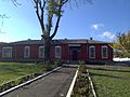
 Lypovets skyline | |
 Coat of arms | |
 Lypovets Map of Ukraine with Lypovets highlighted  Lypovets Lypovets (Ukraine) | |
| Coordinates:49°13′15″N29°03′25″E/ 49.22083°N 29.05694°E | |
| Country | |
| Oblast | Vinnytsia Oblast |
| Raion | Vinnytsia Raion |
| Hromada | Lypovets urban hromada |
| Area | |
| • Total | 10.33 km2(3.99 sq mi) |
| Elevation | 242 m (794 ft) |
| Population (2022) | |
| • Total | 7,958 |
| • Density | 770/km2(2,000/sq mi) |
| Demonym | Lypovets' |
| Time zone | UTC+2(EET) |
| • Summer (DST) | UTC+3(EEST) |
| Postal code | 22500-22505 |
| Area code | +380-4358 |
Lypovets(Ukrainian:Липовець) is a smallcityinVinnytsia Raion,Vinnytsia Oblast,Ukraine.Until the administrative reform of 2020, it served as the administrative center of the formerLypovets Raion.Population:7,958 (2022 estimate).[1]It is located in the historic region ofPodolia.
History
[edit]
Lipowiec, as it was known in Polish, was grantedtown rightsin the early 17th century. It was aprivate town,administratively located in the Winnica County in theBracław Voivodeshipin theLesser Poland Provinceof the Kingdom of Poland.[2]It was annexed by theRussian Empirein theSecond Partition of Polandin 1793. In 1802, it became the administrative center of LypovetsuyezdinKiev Governorate.[3]In the late 19th-century the population was mostly employed in agriculture and grain trade, which was sold mostly toOdesa.[3]
DuringWorld War II,Lypovets was the site ofa battlebetween theSoviet Unionand theSlovak State.The battle ended with a Slovak victory, with a cumulative casualty count of nearly 700. Afterwards it was occupied byNazi Germantroops, from1941,to1944.In a field near Lypovets, from the end of April 1942, over 950 Jews were shot by German security forces with the support of local policemen and buried in two mass graves.[4]To commemorate the extermination, obelisks were erected in the 1950s - on the initiative of Leontii Usharenko, who was pulled out of the pit at the last minute and had to watch his family and acquaintances being murdered. Two memorials were erected at the mass graves of the Jewish victims in 2019 andceremonially inauguratedin September 2019.
Population
[edit]Language
[edit]Distribution of the population by native language according to the2001 census:[5]
| Language | Percentage |
|---|---|
| Ukrainian | 98.41% |
| Russian | 1.4% |
| other/undecided | 0.19% |
| Year | Pop. | ±% |
|---|---|---|
| 1875 | 6,710 | — |
| 1989 | 9,764 | +45.5% |
| 2013 | 8,727 | −10.6% |
| 2022 | 7,958 | −8.8% |
| Sources:[6][7][3] | ||
Gallery
[edit]-
 Lypovets district executive committee
 -
 Sports ground
 -
 Employment centre in Lypovets
 -
 Palace of culture


Notable people
[edit]- Pyotr Stolyarsky(1871 – 1944), Soviet violinist and pedagogue
References
[edit]- ^Чисельність наявного населення України на 1 січня 2022[Number of Present Population of Ukraine, as of January 1, 2022](PDF)(in Ukrainian and English). Kyiv:State Statistics Service of Ukraine.Archived(PDF)from the original on 4 July 2022.
- ^Krykun, Mykola (2012).Воєводства Правобережної України у XVI-XVIII століттях: Статті і матеріали(in Ukrainian and Polish). p. 542.ISBN978-617-607-240-9.
- ^abcSłownik geograficzny Królestwa Polskiego i innych krajów słowiańskich, Tom V(in Polish). Warszawa. 1884. p. 287.
{{cite book}}:CS1 maint: location missing publisher (link) - ^Рей, Брандон."Липовець. Життя та загибель єврейської громади"(PDF).www.holocaust.kiev.ua.Київ: УЦВІГ, 2019.Retrieved20 October2023.
- ^https://socialdata.org.ua/projects/mova-2001/
- ^Всесоюзная перепись населения 1989 г. Численность городского населения союзных республик, их территориальных единиц, городских поселений и городских районов по полу
- ^"Чисельність наявного населення України на 1 січня 2013 року. Державна служба статистики України. Київ, 2013. стор.43"(PDF).Archived fromthe original(PDF)on 12 October 2013.Retrieved3 October2019.