
Mawlamyine
Mawlamyine
မော်လမြိုင် မတ်မလီု | |
|---|---|
City | |
Top to bottom and left to right:Uzina Pagoda,Kyaikthanlan Pagoda,Pa-Auk Forest Monastery,Mahar Myat Muni Pagoda, Shri Shiva Lokanathan Temple,Cathedral of the Holy Family,Moghul Shiah Mosque,Mawlamyine University,Shampoo Islandon theSalween | |
 Mawlamyine Location of Mawlamyine, Myanmar (Burma) | |
| Coordinates:16°29′N97°37′E/ 16.483°N 97.617°E | |
| Country | |
| State | |
| District | Mawlamyine District |
| Township | Mawlamyine Township |
| Population (2014 Census)[1] | |
| • City | 289,388 |
| •Urban | 253,734 |
| •Rural | 35,654 |
| • Ethnicities | Mons Burmans Chinese Indians Karens |
| • Religions | Theravada Buddhism Christianity Islam Hinduism |
| Demonym(s) | Moulmeinian, Mawlamyinian |
| Time zone | UTC+6.30(MST) |
| Area code | 57 |
| [2] | |


Mawlamyine(also spelledMawlamyaing;Burmese:မော်လမြိုင်မြို့;MLCTS:mau la. mruing mrui.,Burmese pronunciation:[mɔ̀ləmjàɪ̯ɰ̃mjo̰];Thai:เมาะลำเลิง;Mon:မတ်မလီု,Mon pronunciation:[mo̤tməlɜ̤m]), formerlyMoulmein,is the fourth-largest city inMyanmar(Burma),[3][4]300 kilometres (190 mi) south east ofYangonand 70 kilometres (43 mi) south ofThaton,at the mouth ofThanlwin(Salween) River. Mawlamyine was an ancient city and the firstcapitalofBritish Burma.The city is currently the capital and largest city ofMon Stateand the maintradingcentre andseaportin south eastern Myanmar.[5]
Etymology and legend[edit]
TheMonname which was previously used for Mawlamyine,Moulmein(မတ်မလီု;[mòtməlɜ̀m]) means "damaged eye" or "one-eyed man."[6][7][8]According to legend, aMonking had a powerful third eye in the centre of his forehead, able to see what was happening in neighbouring kingdoms. The daughter of one of the neighbouring kings was given in marriage to the three-eyed king and managed to destroy the third eye.[9]The Burmese name "Mawlamyine" is believed to be a corruption of the Mon name.
Moulmein was also spelled asMaulmain or Moulmain or Maulmeinin some records of the 19th century. The people of Moulmein were referred asMoulmeinian.[10]
History[edit]

Early history[edit]
Early Mon reigns[edit]
According toKalyani Inscriptionserected by KingDhammazediofHanthawaddy Peguin 1479, Mawlamyine was mentioned among the ‘32 myo’ or thirty-twoMoncities within the Martaban division.[11]Binnya U, a deputy of ViceroySaw Binnya,was one of the notable governors of Mawlamyine in the early history of the city.
Toungoo dynasty[edit]
In May 1541, KingTabinshwehtiand his deputyBayinnaungcaptured Mawlamyine.[12]During the reign of Bayinnaung,Toungoo Empirebecame the largest empire in the history ofSoutheast Asia.After his passing in 1581, his sonNanda Bayinand successors faced with rebellion byLan Na,Siam,Lan Xangand renewed Portuguese incursions. In 1594, the governor of Mawlamyine who being in league with Siamese KingNaresuanrevolted against Toungoo court.[13]Since then, the city became under the control of Siam (present-dayThailand) until 1614.
Konbaung dynasty[edit]
In 1760, GeneralMinkhaung Nawrahtaof theRoyal Burmese Armyrepaired Mawlamyine on his way back fromBurmese–Siamese WarinAyutthaya(former capital of Thailand). Kyaikthanlan Pagoda Inscription hinted that in 1764 (1125 ME), GeneralMaha Nawrahtarepaired Kyaikthanlan Pagoda on his way to captureTavoy,and before finishing the repairment, Mawlamyine faced utter destruction.
Colonial Moulmein (1824–1948)[edit]
Mawlamyine was thefirst capitalofBritish Burmabetween 1826 and 1852 after theTanintharyi(Tenassarim) coast, along withArakan,was ceded toBritainunder theTreaty of Yandaboat the end of theFirst Anglo-Burmese War.[14]After the first Anglo-Burmese war, the British made it their capital between 1826 and 1852, building government offices, churches and a massive prison. They started business enterprises and the country's first newspaper,The Maulmain Chronicle.[15]Between 1826 and 1862, colonial Mawlamyine was the center of British Burma and the firstport citythat became a strategically important area and a geographical nodal point for the newly occupied British territory in Southeast Asia.[16]Ever since the first British occupation in 1824, the growth and prosperity of Mawlamyine had steadily increased due to timber trade. Nevertheless, the decline in prosperity of Mawlamyine began when the supply of marketable timber from Salween Valley started to decrease in the 1890s.[17]
During British colonial times,Germany,Siam,Persia,Denmark,NorwayandSwedenopened and maintainedconsulatesin Mawlamyine led by eitherconsulsor vice-consuls whileItalyandthe United Statesplaced consular agencies in Mawlamyine.[18][19][20]GermanexplorerJohann Wilhelm Helfer's landing at Moulmein shore on 8 February 1837 made him as the first German to arrive Burma in the history.[21][22]
Mawlamyine was the setting ofGeorge Orwell's famous 1936 memoirShooting an Elephant.The essay opens with the striking words:
- "In Moulmein, inLower Burma,I was hated by large numbers of people—the only time in my life that I have been important enough for this to happen to me. "
During colonial times, Moulmein had a substantialAnglo-Burmesepopulation. An area of the city was known as "LittleEngland"due to the large Anglo-Burmese community, many of them running rubber plantations. This has since dwindled to a handful of families as most have left for the UK or Australia.
It was probably best known toEnglishspeakers through the opening lines ofRudyard Kipling's poemMandalay:
- "By the old Moulmein pagoda, lookin' lazy at the sea
- There's a Burma girl a-settin', and I know she thinks o' me ".
DuringWWII,the city and theTanintharyi Regionwere the first objectives during theJapanese invasion of Burma.[23]
"The old Moulmein pagoda" - Kyaik Than Lan[edit]
The "old Moulmein pagoda" Kipling cites is thought to be the Kyaik Than Lan (also spelled Kyaikthanlan) pagoda in Mawlamyine.[24]It stands on a ridge, giving a panoramic view of the city, and is surrounded by 34 smaller temples.[24]Among its sacred treasures is a hair relic ofBuddha,[24][25]received from a hermit in Thaton,[26]as well as a tooth relic conveyed fromSri Lankaby a delegation of monks in ancient times.[26]
Contemporary Mawlamyine[edit]
Soon after Burma's independence in 1948, the city fell into the hands ofKaren insurgents.TheMyanmar militaryretook the city with the help ofUBS Mayuin 1950.[27]Later, many colonial names of streets and parks of the city were changed to more nationalistic Burmese names. Mawlamyine stood as the third-largest city of Myanmar until the recent rise ofNaypyidaw.
Geography[edit]

Mawlamyine is in theSalween Riverdelta,where the mouth of the Salween is sheltered by Bilugyun Island as it enters theGulf of Martabanand theAndaman Sea.It is flanked by low hills dotted with ancient pagodas to the east and west.[14]
Climate[edit]
Mawlamyine has atropical monsoon climate(Köppen:Am) similar to the climates ofDaweiandSittwe.There is a lengthydry seasonbetween mid-November and mid-April, and an extremelywet seasondue to the southwest monsoon between mid-April and mid-November. Between June and August when the surface westerly winds are strongest and supersaturated air is advected onto the nearby mountains, Mawlamyine averages around 1,100 millimetres or 43 inches of rain per month.
| Climate data for Mawlamyine (1991–2020, extremes 1958-1994, 2012-present) | |||||||||||||
|---|---|---|---|---|---|---|---|---|---|---|---|---|---|
| Month | Jan | Feb | Mar | Apr | May | Jun | Jul | Aug | Sep | Oct | Nov | Dec | Year |
| Record high °C (°F) | 37.2 (99.0) |
38.7 (101.7) |
39.7 (103.5) |
40.2 (104.4) |
41.2 (106.2) |
36.1 (97.0) |
35.2 (95.4) |
36.7 (98.1) |
35.3 (95.5) |
37.2 (99.0) |
37.2 (99.0) |
36.8 (98.2) |
41.2 (106.2) |
| Mean daily maximum °C (°F) | 33.0 (91.4) |
34.6 (94.3) |
35.9 (96.6) |
36.2 (97.2) |
33.0 (91.4) |
30.2 (86.4) |
29.2 (84.6) |
29.0 (84.2) |
30.5 (86.9) |
32.9 (91.2) |
33.5 (92.3) |
32.7 (90.9) |
32.5 (90.5) |
| Daily mean °C (°F) | 25.8 (78.4) |
27.2 (81.0) |
29.1 (84.4) |
30.6 (87.1) |
28.8 (83.8) |
27.2 (81.0) |
26.5 (79.7) |
26.3 (79.3) |
27.2 (81.0) |
28.4 (83.1) |
27.9 (82.2) |
26.2 (79.2) |
27.6 (81.7) |
| Mean daily minimum °C (°F) | 18.6 (65.5) |
19.9 (67.8) |
22.4 (72.3) |
24.9 (76.8) |
24.6 (76.3) |
24.1 (75.4) |
23.7 (74.7) |
23.7 (74.7) |
23.9 (75.0) |
23.9 (75.0) |
22.3 (72.1) |
19.8 (67.6) |
22.7 (72.9) |
| Record low °C (°F) | 12.2 (54.0) |
12.2 (54.0) |
16.7 (62.1) |
19.4 (66.9) |
16.7 (62.1) |
21.1 (70.0) |
18.9 (66.0) |
18.9 (66.0) |
21.1 (70.0) |
19.4 (66.9) |
15.0 (59.0) |
11.1 (52.0) |
11.1 (52.0) |
| Averageprecipitationmm (inches) | 8.8 (0.35) |
4.5 (0.18) |
19.3 (0.76) |
59.5 (2.34) |
542.0 (21.34) |
953.1 (37.52) |
1,240.2 (48.83) |
1,224.6 (48.21) |
692.2 (27.25) |
193.1 (7.60) |
27.8 (1.09) |
14.2 (0.56) |
4,979.2 (196.03) |
| Average precipitation days(≥ 1.0 mm) | 0.7 | 0.4 | 1.6 | 4.0 | 19.2 | 26.5 | 27.9 | 28.2 | 23.0 | 11.8 | 2.2 | 0.6 | 146 |
| Source 1:World Meteorological Organization[28] | |||||||||||||
| Source 2: Sistema de Clasificación Bioclimática Mundial (records),[29]NOAA(extremes)[30] | |||||||||||||
Transport[edit]

Airport[edit]
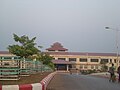
Mawlamyine Airporthas regular flights to Yangon (Rangoon).
Bus and taxis[edit]
Mawlamyine is the main gateway to south eastern Myanmar.Thanlwin Bridge,the longest road and rail bridge in Myanmar is the most prominent landmark in the area. It stretches 11,000 feet (3,400 metres) over the Thanlwin River connecting the country's south eastern region with Yangon.[31]The city has a central highway bus station. The city is connected toPa-anin Kayin State in the north-east andDaweiandMyeikin Tanintharyi Division in the south by road.[32]ViaKawkareik,the city is also connected withThai-Myanmar bordertownMyawaddy.Newly openedBogyoke Aung San Bridge (Bilu Kyun)connects Mawlamyine with nearbyBilu island,lies about 500 metres west off the shore of Mawlamyine.[33][34]
In Mawlamyine, motorcycles andtuk-tuk(Thone Bee in Burmese) motorized tricycles cumulatively registered for use as taxis. Mawlamyine is also served by bus networks which radiate mostly from the north to the south.
Railways[edit]
It was the rail head toYe,linked to Yangon by rail only fromMottama(Martaban) across the river by ferry, but today connected by the Thanlwin Bridge (Mawlamyine) opened in April 2006.[14][35][36]
Mawlamyine Railway Station,which was reportedly built to the standards of an "ASEANrailway station ", is the terminus ofMyanmar Railways'Yangon–Mawlamyine RailwayandTanintharyi Line.
Water transport[edit]
Incolonial era,Mawlamyine (then Moulmein) port was served by European shipping companies includingScottish-ownedBritish-India Steam Navigation CompanyandIrrawaddy Flotilla Company.

The port was important not only for inland navigation but also for international shipping. Rice and teak from sawmills at Mawlamyine were exported worldwide by those shipping companies.[37]The 1880 handbook ofBritish-India Steam Navigation Companylisted:
- Calcutta- Rangoon - Moulmein (started in 1857)[38]
- Moulmein -Penang-Malacca-Singapore(started in 1862)[39]
- Moulmein - Penang -Colombo-Bombaylines in operations.[40]
In 1894, the journey between Barr Street Jetty of Rangoon to the Main Wharf of Moulmein took about nine hours at a fare of 10Rupeesfor second class.[41]
Nowadays, although much diminished from its past prominence, water-based transport still plays an important role in connecting between Mawlamyine and the immediate upstream towns. The Port of Mawlamyine is currently under the management ofMyanma Port Authorityand is located on theThanlwin Riverabout 28 nautical miles inland from the Kyaikkhame point on the Gulf of Martaban, 2 kilometers fromMawlamyine railway station.[42][43]
Cityscape[edit]

Around the city[edit]
Heritage buildings[edit]
- Kyaikthanlan Pagoda:It was built in 875 AD during the reign ofMon KingMutpi Raja,[25]it was raised from its original height of 56 feet (17 metres) to the present 150 feet (46 metres) by successive kings includingWareru,founder of the Kingdom of Hanthawaddy Pegu.[25][44]In 1831, to prevent Moulmein's identity from fading away, Sitke MaungHtaw Lay,who later served as Magistrate of Moulmein restored the pagoda with the funds raised by public subscriptions.[45]Being situated on the range of hill, the pagoda overlooks the city, nearby islands, Gulf of Martaban, surrounding rivers and the limestone mountains ofKayin Statein the east. Rudyard Kipling is believed to have written his famous "Lookin' lazy at the sea" line at this pagoda in 1890.[46]

Magistrate of MoulmeinSitke Maung Htaw Lay(1776–1869) 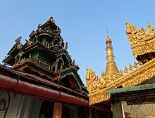
Architecture at Kyaik Than Lan Pagoda in 2014 - U-zina Pagoda:The pagoda is one of the principal pagodas situated on the range of hill. According to legend, the pagoda contains a hair of Buddha and was built during the reign of KingAshoka,the great protector of Buddhism.[47]The U-zina pagoda was named after the sage, U-zina who restored it in 1838. Prior to this the pagoda had been known as Kyaik Pa-dhan pagoda.
- PrincessAshin Hteik Suhpaya's tomb: Princess Ashin Hteik Suhpaya (also known as Princess Myat Phaya Galay) who was the fourth daughter of KingThibaw,the last king ofKonbaung dynastyreturned to Burma from exile in 1915 and lived at her mansion on West Cantonment Road, Mawlamyine until her death in 1936.[48]Her tomb is located near Kyaikthanlan Pagoda. The remains of her son, Prince Taw Phaya Nge and her daughter, Princess Hteik Su Phaya Htwe were also buried in the tomb in the later years.[citation needed]

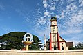
The four daughters of King Thibaw in 1914 (Princess Myat Phaya Galay on the left) - First Baptist Church:The church is Myanmar's first Baptist church and it was initially built in 1827 by the legendaryAdoniram Judson,a 19th-century American missionary who compiled the first Burmese-English dictionary.[49]The church is regarded as a landmark for its significance to the Baptist movement worldwide.[50]
- St Matthew's Church:It was the firstEnglish Church(Anglican Church) built in Myanmar. It was initially erected in 1832 and the current handsome structure was rebuilt in 1887.[51][52]It was designed and restored by the English architectsJames Piers St Aubynand Henry J. Wadling ofLondonand the foundation stone was laid by SirCharles Crosthwaite,thenChief Commissioner of Burma.[53]It is of red brick, the capitals of interior pillars being stone, and is said to be a model of English Church atDresden.George Orwellattended the church during his days as Imperial Policeman in Moulmein in 1926 and the church compound has grave stones of his relatives. During theJapanese conquest of BurmainWWII,the Japanese Army stored salt in the church. Though the church is still in use, it is in a state of decay and is in urgent need ofconservation.[15]
- St Patrick's Church:The St Patrick'sRoman Catholicchurch was built in 1829; theFrench peopleconstructed the clock tower of the church around 1854. St Patrick's school in the church compound was once a boarding school for the children of the elite in colonial times. The tragic love story ofThailand's PrinceSukkasem,the heir to theLannathrone, and a Mon commoner girl started during his time at this school in the 1890s and was immortalised inThai folk songandThai literature.[54][55]
- Police Commissioner Headquarters:Built in 1826 on a hill in Than Lwin Park. The impressive colonial building was the place where George Orwell worked as Assistant District Superintendent in 1926.[56]
- Old Moulmein Prison:The Mawlamyine's colonial-era prison was initially built in the 1830s. SirRichard Hieram Sankey,anIrishmilitary engineer who is credited with designing much of the infrastructure of the Indian city ofBangalore,used to work at this prison as Superintendent of the jail in 1860.[57]George Orwell was believed to have witnessed hanging there and it is the setting of his short story "A Hanging (1931)".[58]During WWII, following theFall of Singaporein 1942,Alliedsoldiers transferred fromChangi Prisonwere held in the Moulmein Prison by theImperial Japanese Armybefore they were sent to the notoriousdeath railwayconstruction.[59]In 2015, the prison was closed and relocated to a new facility near Yedwingone village in Kyaikmawyaw township.[60]
- Yadanabonmyint Monastery:It is also known asQueen SeindonMonastery. It is known for its craftsmanship.[citation needed]


Islands[edit]
- Bilu Island(Belu-kyun): The local meaning of the island's name is Ogre Island. The island is famous for handicraft andMontraditional culture.[61]
- Gaungsay Kyun Island(Shampoo Island): A tiny island lies betweenMottamaand the north bank of Mawlamyine is called Gaungsay Kyun island, literally: "Head Washing Island". In ancient times, the clear pristine water obtained from a small rocky outcrop of the island was carried to the palace and used by Burmese kings at royal hair-washing ceremonies duringThingyan.[62]Incolonial days,the island was known in its European name "Crow Island" for being the home of all the crows in the city.
Others[edit]
- Mon State Cultural Museum(Mon Ethnic Cultural Museum)
- Mottama(formerly Martaban): A small town located opposite to the north bank of Mawlamyine was the first capital of theHanthawaddy Kingdomin the 13th and 14th centuries after the collapse ofPagan(Bagan) Empire in 1287. DuringBurmese–Siamese warsbetween the 16th and 18th centuries, Martaban was an important rallying spot for Burmese troops moving from Upper Burma to sackAyutthaya Kingdom.Between 2nd-century BCE and 15th-century CE, Martaban was a main trading port in the historicMaritime Silk Roadthat connects Korea,China,Southeast Asia,theIndian subcontinent,Ceylon,Arabian peninsula,Horn of Africa and all the way toEgyptand eventuallyRomeorEurope.[63]TheMartaban jarswere imported and got its namesake from this Martaban port city as early as the fourteenth century.[64][65]

The Maritime Silk Road in the 1st century - Pa-Auk Forest Monastery:The mainmonasterycomplex andmeditationcentre is located in a forest near Pa-Aukvillagealong theTaung Nyo Mountain range15 kilometers southeast of Mawlamyine.[66][67]The monastery is known for the practice of meditation. 500–1000 meditators from over 20 countries reside in the monastery.[68][69]
- Win Sein reclining Buddha:29 km south of Mawlamyine is the world's largest reclining Buddha atMudon.It is approached by a roadway with 500 life size statues of Arahant disciples of Buddha and a hall whose chamber walls display scenes of Buddha's lifetime, and the underworld.[26]
- Thanbyuzayat War Cemetery:64 kilometers south of Mawlamyine isprisoners-of-warcemetery and the notoriousdeath railwayconnected withthe Bridge over the River Kwai.The cemetery contains the graves of 3,770 British, Australian, Dutch and other soldiers. It was formally opened on 10 December 1946 by GeneralAung Sanand then Governor SirHubert Rance.[70]

Economy[edit]
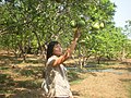
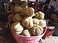
Mawlamyine is famous for its tropical fruits[5]and for itscuisine[14]as indicated in the popular Burmese expression, "Mandalayfor the speaking, Yangon for the bragging, and Mawlamyine for the eating. "(မန္တလေးစကား ရန်ကုန်အကြွား မော်လမြိုင်အစား) Among its tropical fruits, Mawlamyinepomelo,durianandrambutanare traded countrywide.
Mawlamyine had severalsawmillsandrice millsasteakand rice were transported down the Salween. It was once a busyshipbuildingcenter and remains an important port. At least one major British shipping line had some of their ships built here. The teak "country-built" ships generally had a longer service life than those constructed from European hardwoods.[71]The city had a solar-powered plant for extracting salt fromseawaterand adiesel electricplant.[14]On the night of 1 December 2008, a fire that started from afloating restaurantdestroyed the larger of city's two markets called the lowerbazaar.[72]
Industry[edit]
The city has twoindustrial zones.Of two, the newly opened Kyauktan industrial zone features a variety of different business enterprises, including zinc, barbed wire, ready-mix cement, food and drink production, textiles, gold purification, ice factories, shoe production facilities, furniture enterprise, plastic enterprises, cool seafood storage and car accessory businesses.[73]
As a cross-border investment, the state-of-the-art combined-cycle gas power plant in Mawlamyine was constructed by Singapore'sUnited Overseas Bank(UOB) backed Singapore company Asiatech Energy.[74]The Mawlamyine power plant brings a sustainable supply of power to residents and businesses in Mon State.
In July 2017, to make the country'soil and gas industrymore efficient, theMyanmar Investment Commission(MIC) granted an approval to a subsidiary of Singapore-based firm to construct an offshore supply base in the 46 acres of river front land of Mawlamyine.[75][76]It would provide a wide range of services to the operators ofoil and gas fieldsin the waters off the coast in theBay of Bengal.[77]
Transport hub[edit]
Mawlamyine is the western terminus and an important part of theEast-West Economic Corridor.The 1450-kilometre east–west economic corridor links theSouth China SeaatDa Nangto Mawlamyine throughLaosandThailand.[78]By using the East-West Economic Corridor, the travel time betweenBangkokand Yangon is just three days, compared with the two to three weeks needed for conventionalmarine transportationvia theStraits of Malacca.[79]Japan'sNippon Expressstarted land transportation services between Thailand and Myanmar in 2016.
Flora and fauna[edit]
-
-
-

-
 Durian plantation
 -

-

-
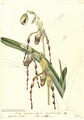 Paphiopedilum parishii,native to Moulmein discovered byCharles Parishand wife in 1867.
 -

-
 Theplain tailless oakbluebutterfly discovered byWilliam Hewitsonin Moulmein in 1869.


Culture[edit]
Mawlamyine provides amulticulturaldimension despite a BuddhistMonmajority.Buddhist culturaldominance is as old as Mawlamyine, but the Britishannexationand American missionaries in the early 19th century introduced Christianity. Many of the relics of theBritish Rajremain along with Hindu temples, Chinese temples, mosques and even a slice ofAmericana,reflecting Mawlamyine's great diversity.[80]

The First Baptist Church in Mawlamyine was constructed in 1827 by the legendaryAdoniram Judson,the first Caucasian Protestant missionary sent fromNorth Americato Myanmar.[81]The building is a masterful blend of Western and local elements, with the materials and building technology speaking directly to Mon cultural traditions and crafts expertise. In 2015,the U.S. Embassy in Myanmarannounced that it gave an award of $125,000 toWorld Monuments Fund (WMF)to restore the historic First Baptist Church in Mawlamyine through theAmbassadors Fund for Cultural Preservation.[82]
The Mon State Cultural Museum exhibits the ancient cultural relics ofMon peopleand divans used by aKonbaung princesswho resided in Mawlamyine.
Education[edit]

Mawlamyine has 13 public high schools, two institutes, a college and three universities.
TheUniversity of Mawlamyine,established in 1953, is the major university for the south eastern region and offers both bachelor's and master's degree programs in liberal arts and sciences. It is the third oldest Arts and Science university in the country after theUniversity of Yangon(est. 1878) and theUniversity of Mandalay(est. 1925). It is one of the few universities in Myanmar that offers a degree in Marine Science. Its Marine Science Laboratory inSetse,a coastal town about 83 km south of Mawlamyine, was the first of its kind in Myanmar.[83]Technological University (Mawlamyine)offers technological and engineering courses. The Mawlamyine campus ofYezin Agricultural University,administered byMinistry of Agriculture, Livestock and Irrigation (MOALI),offers agriculture courses.[84]Government Technical Institute (Mawlamyine)offers vocational engineering courses located in outskirts of the city.Mawlamyine Education CollegeandMawlamyine Institute of Educationare also located in the city.[85]
The St. Patrick's School (now B.E.H.S. No. 5) founded by theDe La Salle Brothersin 1860, Morton Lane-Judson School, (formerly Morton Lane Girls' School, now B.E.H.S No.6) founded in 1867 andShin Maha Buddhaghosa National School(now B.E.H.S. No.9) founded in 1899 are a few of the oldest public high schools in Myanmar.[86]
The firstinternational studentofBucknell University,Class of 1864,Maung Shaw Loowas the first Burmese physician of Western medicine and the first Burmese to study Western medicine in the United States.[87][88]
Sports[edit]
The 10,000-seatYamanya Stadiumis one of the main venues for local and regional football tournaments. The stadium is also a home forSouthern Myanmar F.C.,aMyanmar National League(MNL) football club.
Health care[edit]
Public Hospitals[edit]
- Mawlamyine Women and Children Hospital (former Ellen Mitchell Memorial Hospital)
- Mawlamyine General Hospital
- Mawlamyine Christian Leprosy Hospital
- Mawlamyine University Hospital[89]
- Mawlamyine Traditional Medicine Hospital
International relations[edit]
Sister cities[edit]
Mawlamyine established a Friendship City agreement withFort Wayne, Indiana,United States in 2016.[90]Astudent exchange programbetween Mawlamyine University andIPFWof Fort Wayne began in 2017.
Others[edit]
A primary road inNovena,Singaporeand a road (Solok Moulmein) inGeorge Town,Malaysiawere named after the city's old name, Moulmein.
Gallery[edit]
-
 Kyaikthanlan Pagodaat night
 -
 Old bell donated by Mon King in AD 1533
 -
 Mawlamyine Railway Station
 -
 Technological University (Mawlamyine)
 -
 Queen Sein Don Monastery
 -
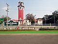
 A roundabout in Mawlamyine
 -
 St Patrick's School (now BEHS 5)
 -

-
 Victorian style clock tower (Mon State Government Office in the distance)
 -
 Saint Patrick Church (Mawlamyine)
 -
 U-zina Pagaoda / Kyaik Pa-dhan pagoda
 -
 Sunset over Salween (Than Lwin) River


See also[edit]
- University of Mawlamyine
- Thanlwin Bridge (Mawlamyine)
- Mon people
- Attaran Bridge(Mawlamyine)
- Sittoung Bridge(Bilin)
- Kyaiktiyo Pagoda
- Pa-Auk Sayadaw
References[edit]
- ^The 2014 Myanmar Population and Housing Census The Union Report Census Report Volume 2(PDF).Department of Population, Ministry of Immigration and Population. May 2015. p. 59.
- ^"National Telephone Area Codes".Myanmar Yellow Pages. Archived fromthe originalon 2010-11-20.
- ^"Myanmar: largest cities and towns and statistics of their population: calculation 2010".Archived fromthe originalon 19 September 2012.World Gazetteer
- ^"Population of Cities in Myanmar (2017)".worldpopulationreview.com.Retrieved2017-10-22.
- ^ab"Mawlamyine or Moulmein".allmyanmar.com.Retrieved2009-02-03.
- ^Banyar, Ko (7 November 2013)."မွန်တို့ဌာနေ ရာမည တိုင်းက မွန် အခေါ်အဝေါ်များ".Phophtaw News Association.Archived fromthe originalon 26 June 2015.
- ^Tun, Than (1988). "Observations on the Translation and Annotation of the Royal Orders Of Burma".Crossroads: An Interdisciplinary Journal of Southeast Asian Studies.4(1): 91–99.JSTOR40860260.
- ^Dictionary of Modern Spoken Monby H.L. Shorto (1962, Oxford University Press).
- ^Myanmar Travel InformationArchived2016-03-23 at theWayback Machine.Accessed 16 August 2015
- ^Cotton, Sophia Anne; Cotton, George Edward Lynch (1871).Memoir of George Edward Lynch Cotton, D.D., Bishop of Calcutta, and Metropolitan: with selections from his journals and correspondence.University of California Libraries. London: Longmans, Green.
- ^Shorto, H L (1963).The 32 myos in the medieval Mon kingdom.Bulletin of the School of Oriental and African Studies. p. 575.
- ^Aung, Htin (1967).A History of Burma.New York and London: Cambridge University Press. p. 106.
- ^Rajanubhab, Damrong (2001).Our Wars With the Burmese.Bangkok,Thailand: White Lotus. pp. 145–147.ISBN9747534584.
- ^abcde"Moulmein".Encyclopædia Britannicaonline.Retrieved2009-02-03.
- ^ab"Moulmein, Myanmar".2017-03-09.Retrieved2017-06-12.
- ^McPherson, Kenneth (2002).Port Cities as Nodal Points of Change.Columbia University Press. pp. 75–95.
- ^Bird, George W. (1897).Wanderings in Burma.University of Michigan. Bournemouth [Eng.] F.J. Bright & son; London, Simpkin, Marshall, Hamilton, Kent & co., ltd.
- ^"Moulmein - Encyclopedia".theodora.com.Retrieved2017-10-11.
- ^Archives, The National."The Discovery Service".discovery.nationalarchives.gov.uk.Retrieved2017-10-11.
- ^"1888 Moulmein".ABL Directories.Retrieved2017-10-11.
- ^Nostitz, Pauline; Sturge, G. (George); Hochstetter, Ferdinand von (1878).Travels of Doctor and Madame Helfer in Syria, Mesopotamia, Burmah and other lands.Francis A. Countway Library of Medicine. London: Richard Bentley & Son.
- ^Zollner, Hans-Bernd (2002). "Germans in Burma, 1837-1945".The Journal of Burma Studies.7.Northern Illinois University: 34.
- ^Allen, Louis (1984).Burma: The Longest War 1941-45.London: Phoenix Press. pp. 31–35.ISBN9781842122600.
- ^abcMawlamyine.com Kyaikthanlan pagoda pageAccessed 16 August 2015.
- ^abcHappy FootprintsArchived2016-09-18 at theWayback Machine.Accessed 16 August 2015
- ^abcW. Vivian De Thabreuw,Buddhist Monuments and Temples of Myanmar and Thailand(Authorhouse, 11 March 2014). E-book.ISBN9781491896228.
- ^Tinker, Hugh.Union of Burma.p. 325.
- ^"World Meteorological Organization Climate Normals for 1991–2020".World Meteorological Organization.Retrieved16 October2023.
- ^ "Moulmein (Myanmar)"(PDF).Centro de Investigaciones Fitosociológicas.Retrieved13 December2018.
- ^"Global Surface Summary of the Day - GSOD".National Oceanic and Atmospheric Administration.RetrievedJanuary 26,2023.
- ^"Welcome to Mawlamyine".Retrieved2008-08-30.
- ^"Myanmar (Burma) Maps - Major country roads".Asterism.Retrieved2009-02-03.
- ^mizzima (2017-06-14)."The Bilu Kyun Bridge controversy".Mizzima.Retrieved2017-08-05.
- ^"Bogyoke Aung San Bridge inaugurated | Global New Light Of Myanmar".www.globalnewlightofmyanmar.com.2017-05-09. Archived from the original on August 5, 2017.Retrieved2017-08-05.
{{cite web}}:CS1 maint: unfit URL (link) - ^"Train travel in Myanmar(Burma)".seat61.com.Retrieved2009-02-03.
- ^"Mon State".Asterism.Retrieved2009-02-03.
- ^"Irrawaddy Flotilla".Mrs Findlays Broadwood Square Piano.Retrieved2017-07-30.
- ^Brittain, Colin."British India Steam Navigation Company - Part One".www.eskside.co.uk.Retrieved2017-07-30.
- ^Jones, Stephanie (1986).Two Centuries Of Overseas Trading.Palgrave Macmillan UK. p. 42.
- ^Swiggum, Sue."British India Steam Navigation Company".www.theshipslist.com.Retrieved2017-07-30.
- ^Wanderings in Burma.Bournemouth [Eng.] F.J. Bright & son; London, Simpkin, Marshall, Hamilton, Kent & co. 1897.Retrieved2017-07-30– via archive.org.
- ^"Study underway for new port in Yangon, CM says".Mizzima Myanmar News and Insight.Retrieved2019-09-17.
- ^"2.1.2 Myanmar Port of Mawlamyine, Mon state - Logistics Capacity Assessment - Digital Logistics Capacity Assessments".dlca.logcluster.org.Retrieved2019-09-17.
- ^Bird, G W (1897).Wanderings in Burma.p. 204.
- ^Wai Wai, Myaing (2005).A Journey in Time: Family Memoirs (Burma, 1914–1948).iUniverse. p. 210.ISBN9780595356515.
- ^"Kyaik Than Lan".Travelfish.Retrieved2017-06-13.
- ^"Wanderings in Burma".seasiavisions.library.cornell.edu.Retrieved2017-07-29.
- ^"Burma's Last Royals - Los Angeles Review of Books".Los Angeles Review of Books.Retrieved2017-06-12.
- ^"First Baptist Church of Mawlamyine".World Monuments Fund.Retrieved2017-06-13.
- ^"Baptist church restoration a mixed blessing for Myanmar".
- ^"Moulmein, Myanmar".2017-03-09.Retrieved2017-06-13.
- ^"Wanderings in Burma - Southeast Asia Visions".seasiavisions.library.cornell.edu.Retrieved2017-07-27.
- ^Larkin, Emma (2005).Finding George Orwell in Burma.
- ^"Westward, ho!".Bangkok Post.Retrieved6 July2019.
- ^Duangnee, Phoowadon (27 Jul 2016). "History Carved In Stone".The Nation.
- ^Meyers, Jeffrey (2010).Orwell: Life and Art.University of Illinois Press. p. 19.
- ^"Why we shouldn't forget Sankey..."Deccan Herald.2012-02-13.Retrieved2020-08-17.
- ^"Here be monsters: Travelling to Ogre Island".The Myanmar Times.Retrieved2019-07-05.
- ^Crager, Kelly (2008).Hell Under the Rising Sun: Texan Pows and the Building of the Burma-Thailand Death Railway.Texas A&M University Press. pp. 68–77.
- ^"Mawlamyine Prison to close, future unclear".The Myanmar Times.2015-04-09.Retrieved2020-08-17.
- ^"Bilu Island".Travelfish.Retrieved2017-06-13.
- ^Scott, James George (1896).The Burman, his life and notions.University of California Libraries. London, Macmillan and co., limited.
- ^"Maritime Silk Road Archives".SEAArch - Southeast Asian Archaeology.Retrieved2019-09-11.
- ^"GLOSSARY: Martaban wares".gotheborg.com.Retrieved2019-09-10.
- ^"Martaban Jar".www.roots.sg.Retrieved2019-09-10.
- ^"Pa-Auk Forest Monastery".www.paaukforestmonastery.org.Retrieved2017-06-13.
- ^"Pa-Auk Forest Monastery".www.paaukforestmonastery.org.Retrieved2017-06-13.
- ^"Pa-Auk Forest Monastery".www.paaukforestmonastery.org.Retrieved2017-07-27.
- ^"40-Day Meditation Retreat at Pa-Auk Tawya, Burma".UP Development.2014-09-17.Retrieved2017-07-27.
- ^"Myanmar Guide & Reviews".myanmars.net.Retrieved2017-07-27.
- ^Smith, C. Fox (1925).Ship Alley.Methuen. pp. 80-91.
- ^Lawi Weng."Fire Destroys Moulmein Market".The Irrawaddy,December 2, 2008.Retrieved2009-02-03.
- ^"New Industrial Zone in Mon State to open this month | Global New Light Of Myanmar".www.globalnewlightofmyanmar.com.2016-03-16. Archived from the original on August 20, 2017.Retrieved2017-08-20.
{{cite web}}:CS1 maint: unfit URL (link) - ^"Powering up Myanmar".BBC Capital.Retrieved2017-08-20.
- ^mizzima (2017-05-27)."Myanmar Offshore Supply Base Development: Further Chaos or Progress?".Mizzima.Retrieved2017-09-08.
- ^"Myanmar Offshore Supply Base Ltd (MOSB) - Myanmar opens arms for the first foreign company to build an oil and gas supply base".Electric Energy Online.Retrieved2017-09-08.
- ^"The race to build a supply base".The Myanmar Times.Archived fromthe originalon 2022-04-10.Retrieved2017-09-08.
- ^"East-West Economic corridor still in planning stage: ADB official".The Myanmar Times.Archived fromthe originalon 2017-09-08.Retrieved2017-09-08.
- ^"Roads can convert Myanmar from economic void to hub- Nikkei Asian Review".Nikkei Asian Review.Retrieved2017-09-08.
- ^Gray, Denis D. (2017-04-22)."Myanmar's ex-colonial capital captivates with faded glory | TheRecord.com".TheRecord.com.Archived fromthe originalon 2019-01-29.Retrieved2017-08-08.
- ^"First Baptist Church of Mawlamyine".World Monuments Fund.Retrieved2017-06-12.
- ^"U.S. Embassy Announces Project to Restore the Historic First Baptist Church in Mawlamyine [Burmese] [Mon] | U.S. Embassy in Burma".U.S. Embassy in Burma.2015-09-14.Retrieved2017-06-12.
- ^"l".2009-01-06. Archived fromthe originalon 2009-01-06.Retrieved2017-06-12.
- ^"Mawlamyine Campus – Yezin Agricultural University".www.yau.edu.mm.Archived fromthe originalon 2017-09-04.Retrieved2017-09-04.
- ^"MODiNS [ Myanmar Online Information ]".www.modins.net.Archived fromthe originalon 2019-05-17.Retrieved2017-06-12.
- ^"The New Light of Myanmar (Sunday, November 21, 1999)".www.burmalibrary.org.Retrieved2017-06-13.
- ^"Maung Shaw Loo".Bucknell University.Retrieved2009-02-03.
- ^"Dr. M Shaw Loo"Archived2017-01-03 at theWayback Machine"The Myanmar Net", Myanmar, Retrieved on 30 March 2014
- ^"ဘွဲ့လွန်သင်တန်းများဝင်ခွင့်အရည်အချင်းစစ်စာမေးပွဲဖြေဆိုခွင့်ရရှိသူများ၏ခုံအမှတ်စာရင်း".University of Medicine 1, Yangon.Archived fromthe originalon 2019-10-02.Retrieved2019-01-01.
- ^"Fort Wayne Sister Cities to sign Myanmar friendship agreement".The News-Sentinel.26 January 2016.Retrieved30 March2016.
External links[edit]
- Photos of MoulmeinArchived2007-03-06 at theWayback Machine
- Mawlamyine
- Weather forecastWeather Underground
- Tide tableTides Chart
16°29′05″N97°37′33″E/ 16.48472°N 97.62583°E
Capital:Mawlamyine | ||
| Mawlamyine District |  | |
| Thaton District | ||
| Cities, towns, and villages | ||
| 2,000,000 and more | |
|---|---|
| 1,000,000–1,999,999 | |
| 500,000–999,999 |
|
| 200,000–499,999 | |
| 100,000–199,999 | |
| International | |
|---|---|
| National | |