
Maynardville, Tennessee
Maynardville, Tennessee
Liberty | |
|---|---|
| City of Maynardville | |
 Maynardville as seen from Hinds Ridge | |
|
Logo | |
| Nickname: The Cradle of Country Music | |
| Motto(s): "A Friendly Town with an Eye on the Future.",[1]"My Maynardville, My Home." | |
 Location of Maynardville in Union County, Tennessee. | |
| Coordinates:36°14′45″N83°48′26″W/ 36.24583°N 83.80722°W | |
| Country | United States |
| State | Tennessee |
| County | Union |
| Settled | 1850[2] |
| Incorporated | 1870[3] |
| Named for | Horace Maynard[4] |
| Government | |
| • Type | Commission-Manager |
| •Mayor | Ty Blakely |
| •City Manager | Thomas McCormick |
| Area | |
| • Total | 5.39 sq mi (13.97 km2) |
| • Land | 5.39 sq mi (13.97 km2) |
| • Water | 0.00 sq mi (0.00 km2) |
| Elevation | 1,197 ft (365 m) |
| Population | |
| • Total | 2,456 |
| • Density | 455.32/sq mi (175.80/km2) |
| Time zone | UTC-5(Eastern (EST)) |
| • Summer (DST) | UTC-4(EDT) |
| ZIP code | 37807 |
| Area code | 865 |
| FIPS code | 47-46700[10] |
| GNISfeature ID | 2405042[8] |
| Website | www |
Maynardville(originally namedLiberty) is a city in and thecounty seatofUnion County, Tennessee,United States.[11]The city was named to honorHorace Maynard,who successfully defended the creation of Union County from a challenge from Knox County.[4]Its population was 2,413 at the 2010 census, up from 1,782 at the 2000 census. It is included in theKnoxvillemetropolitan statistical area.[12]
History
[edit]Maynardville began in the early 19th century as a small community known as Liberty. When Union County was created in the 1850s, Liberty, being nearest the center of the county, was chosen as the county seat. The land for the courthouse square was donated by Marcus Monroe (1793–1870), a local minister.[13]
Shortly after theTennessee General Assemblypassed legislation authorizing the creation of Union County,Knox Countysecured aninjunctionblocking the creation of the new county, which would take some of its area from Knox County. To defend the new county, its supporters retained the services ofHorace Maynard(1814–1882), a Knoxville-area attorney and laterU.S. Postmaster General.After Maynard successfully defended the new county in litigation proceedings, Liberty was renamed "Maynardville" in his honor.[14][15]Union County was formally recognized in 1856.[16]
Country music singerRoy Acuffwas born in Maynardville in 1903. The Acuff family had been well-established in Union County since the mid-19th century. When Goodspeed published itsHistory of Tennesseein 1887, the Union County section included a brief biography of Roy's grandfather, Coram Acuff (1846–1931), who represented Union County in the state legislature.[17][18]
Throughout the early to mid-20th century,State Route 33through Maynardville was part of the infamous Thunder Road, which was used bybootleggersto illegally transport and trademoonshine.[19]This story was later fictionally adapted into a1958 crime-drama filmandsongof the same name.[20]
Since the dawn of the 21st century, Maynardville has become increasinglysuburbanwith the widening projects ofSR 33(Maynardville Highway) providing quicker access toKnoxville.[21]Plans toredevelopand revitalize Maynardville have been proposed since the 2010s.[22][21]
Geography
[edit]Maynardville is situated near the center of Raccoon Valley, a narrow valley stretching for roughly 15 miles (24 km) between Copper Ridge on the south and Hinds Ridge on the north. Like most mountains in theRidge-and-Valley Appalachians,these two ridges are long and narrow, and often fractured into smaller hills and knobs. TheNorris Lakeimpoundment of theClinch Riveris located about 5 miles (8.0 km) north of Maynardville.
Maynardville is concentrated around a stretch ofState Route 33,which connects the city toKnoxville15 miles (24 km) to the southwest andTazewell22 miles (35 km) to the northeast.[23]State Route 61connects Maynardville withLuttrell8 miles (13 km) andBlaine13 miles (21 km) to the south, andState Route 144connects Maynardville withPlainview8 miles (13 km) to the southwest.
According to theUnited States Census Bureau,the city has a total area of 5.4 square miles (14 km2), all land.
Demographics
[edit]| Census | Pop. | Note | %± |
|---|---|---|---|
| 1860 | 188 | — | |
| 1870 | 155 | −17.6% | |
| 1880 | 178 | 14.8% | |
| 1890 | 144 | −19.1% | |
| 1960 | 620 | — | |
| 1970 | 702 | 13.2% | |
| 1980 | 924 | 31.6% | |
| 1990 | 1,298 | 40.5% | |
| 2000 | 1,782 | 37.3% | |
| 2010 | 2,413 | 35.4% | |
| 2020 | 2,456 | 1.8% | |
| Sources:[24][25][9] | |||

2020 census
[edit]| Race | Number | Percentage |
|---|---|---|
| White(non-Hispanic) | 2,247 | 91.49% |
| Black or African American(non-Hispanic) | 5 | 0.2% |
| Native American | 3 | 0.12% |
| Asian | 8 | 0.33% |
| Other/Mixed | 114 | 4.64% |
| HispanicorLatino | 79 | 3.22% |
As of the2020 United States census,there were 2,456 people, 896 households, and 528 families residing in the city.
2000 census
[edit]As of thecensus[10]of 2000, 1,782 people, 683 households, and 463 families were residing in the city. The population density was 330.1 inhabitants per square mile (127.5/km2). The 769 housing units averaged 142.4 units per square mile (55.0 units/km2). Theracial makeupof the city was 98.37% White, 0.17% African American, 0.06% Native American, 0.11% Asian, and 1.29% from two or more races. Hispanics or Latinos of any race were 0.34% of the population.
Of the 683 households, 37.0% had children under the age of 18 living with them, 49.9% were married couples living together, 14.9% had a female householder with no husband present, and 32.1% were not families. About 28.8% of all households were made up of individuals, and 10.8% had someone living alone who was 65 years of age or older. The average household size was 2.46, and the average family size was 3.03.
In the city, the age distribution was 26.9% under 18, 8.0% from 18 to 24, 32.7% from 25 to 44, 18.6% from 45 to 64, and 13.9% who were 65 or older. The median age was 34 years. For every 100 females, there were 93.1 males. For every 100 females age 18 and over, there were 90.1 males.
The median income for a household in the city was $23,077, and for a family was $30,398. Males had a median income of $25,278 versus $18,603 for females. Theper capita incomefor the city was $12,168. About 20.2% of families and 26.4% of the population were below thepoverty line,including 34.8% of those under age 18 and 32.9% of those age 65 or over.
Economy
[edit]According to 2010 Census report published by the East Tennessee Development District in 2012, the top three industries employing residents of Maynardville wereprofessional services,trade, andmanufacturing.[27]
Nearly 62% of the city's population was reported tocommuteoutside of Union County for employment in 2010.[27]
Government
[edit]Municipal
[edit]Maynardville uses theCouncil-managergovernment system, which was established in 1870 when the city was incorporated. It is governed locally by a five-member board. The citizens elect the board to four-year terms. The board elects a mayor and a vice mayor from among the seated board members.
State
[edit]Maynardville is represented in the 36th District of theTennessee House of RepresentativesbyDennis Powers,aRepublican.[28]
It is represented in the 8th District of theTennessee SenatebyFrank Niceley,also a Republican.[29]
Federal
[edit]Maynardville is represented in theUnited States House of Representativesby RepublicanChuck Fleischmannof the3rd congressional district.[30]
Notable people
[edit]- Roy Acuff(1903–1992),country musicsinger-songwriter,Grand Ole Opryregular,Governor of Tennesseecandidate, and musician[31]
- Kenny Chesney
- Carl Smith(1927–2010), country music,countrypolitan,androckabillysinger-songwriter, musician[32]
In popular culture
[edit]In the 2009 filmInglourious Basterds,the character of1 SSFFirst LieutenantAldo Raine, portrayed byBrad Pitt,is said to be amoonshinerfrom Maynardville.[33]
The song "The Ballad of Thunder Road",references Maynardville.[34]
References
[edit]- ^"Index".City of Maynardville.RetrievedAugust 6,2020.
- ^Peters, Bonnie (March 1, 2018)."Union County".Tennessee Encyclopedia.RetrievedAugust 6,2020.
In 1850 a small community called Liberty was near the center of the proposed new county and became the county seat.
- ^Tennessee Blue Book,2005-2006, pp. 618-625.
- ^abMiller, Larry (2001).Tennessee Place Names.Indiana University Press. p. 134.ISBN0-253-33984-7.RetrievedAugust 6,2020.
- ^"Maynardville".Municipal Technical Advisory Service.RetrievedAugust 6,2020.
- ^"Elected Officials".City of Maynardville.RetrievedAugust 6,2020.
- ^"ArcGIS REST Services Directory".United States Census Bureau.RetrievedOctober 15,2022.
- ^abU.S. Geological Survey Geographic Names Information System: Maynardville, Tennessee
- ^ab"Census Population API".United States Census Bureau.RetrievedOctober 15,2022.
- ^ab"U.S. Census website".United States Census Bureau.RetrievedJanuary 31,2008.
- ^"Find a County".National Association of Counties. Archived fromthe originalon May 31, 2011.RetrievedJune 7,2011.
- ^"Revised Delineations of Metropolitan Statistical Areas, Micropolitan Statistical Areas, and Combined Statistical Areas, and Guidance on Uses of the Delineations of These Areas"(PDF).Office of Management and Budget.RetrievedApril 27,2014.
- ^"Goodspeed's History of Union County, TennesseeArchivedJuly 6, 2008, at theWayback Machine."Originally published in theHistory of Tennessee(Chicago and Nashville: Goodspeed Publishing Company, 1887), 850-853. Retrieved: February 20, 2008.
- ^Kathleen Zebley, "Horace Maynard."The Tennessee Encyclopedia of History and Culture,2002. Retrieved: February 20, 2008.
- ^Jim Matheny,Why do they call it that? Maynardville in Union County,WBIR.com,June 4, 2011. Retrieved: June 8, 2011.
- ^Bonnie Heiskell Peters, "Union County."The Tennessee Encyclopedia of History and Culture,2002. Retrieved: February 20, 2008.
- ^"Goodspeed's Union County, Tennessee Biographies."Originally published in theHistory of Tennessee(Chicago and Nashville: Goodspeed Publishing Company, 1887), 1146-1152. Retrieved: February 20, 2008.
- ^"Acuff-Ecoff Family Archives."Retrieved: February 20, 2008.
- ^Bowers, Larry (January 3, 2016)."Deciphering fact from fiction of 'Thunder Road'".Cleveland Daily Banner.RetrievedJuly 20,2020.
- ^Thunder Road (1958)atIMDb
- ^ab"Maynardville Highway Corridor Study"(PDF).Tennessee Department of Transportation.Gresham Smith and Partners. August 2016. Archived fromthe original(PDF)on July 13, 2017.RetrievedJanuary 2,2021.
- ^Vasington, Sean (2013)."Downtown Maynardville Revitalization".Plan East Tennessee.e East Tennessee Community Design Center. Archived fromthe originalon September 12, 2016.RetrievedJanuary 2,2021.
- ^"Downtown Maynardville Revitalization"(PDF).Plan East Tennessee.2013.RetrievedSeptember 27,2020.
- ^"Census of Population and Housing: Decennial Censuses".United States Census Bureau.RetrievedMarch 4,2012.
- ^"Incorporated Places and Minor Civil Divisions Datasets: Subcounty Resident Population Estimates: April 1, 2010 to July 1, 2012".Population Estimates.U.S. Census Bureau. Archived fromthe originalon June 11, 2013.RetrievedDecember 11,2013.
- ^"Explore Census Data".data.census.gov.RetrievedDecember 27,2021.
- ^ab"2010 Census Summary Report for Union County"(PDF).East Tennessee Development District.2012.RetrievedSeptember 27,2020.
- ^"Representative Dennis Powers".capitol.tn.gov.RetrievedJune 25,2020.
- ^"Senator Frank S. Niceley".capitol.tn.gov.RetrievedJune 25,2020.
- ^"Our District".fleischmann.house.gov.RetrievedJuly 14,2020.
- ^"Roy Acuff".Grand Ole Opry.RetrievedSeptember 27,2020.
- ^Erlewine, Stephen."Artist Biography - Carl Smith".AllMusic.RetrievedSeptember 27,2020.
- ^Jones, Maggie (July 22, 2019)."Keeping up with Knoxville's Quentin Tarantino: 'Once Upon a Time,' 'Star Trek,' beyond".Knoxville News Sentinel.RetrievedDecember 27,2020.
- ^Clark, Brooks (April 9, 2014)."Moonshine Myths: So Who Was That 'Mountain Boy' From 'Thunder Road'?".Metro Pulse.Archived fromthe originalon August 26, 2014.RetrievedDecember 28,2020.
External links
[edit]- Official website
- Municipal Technical Advisory Service entry for Maynardville— information on local government, elections, and link to charter
 Media related toMaynardville, Tennesseeat Wikimedia Commons
Municipalities and communities ofUnion County, Tennessee,United States | ||
|---|---|---|
| Cities | 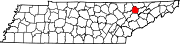 | |
| Unincorporated communities | ||
| Ghost town | ||
| International | |
|---|---|
| National | |
| Geographic | |
| Other | |