Mount Tokachi (Daisetsuzan)
Appearance
| Mount Tokachi | |
|---|---|
| Thập thắng nhạc | |
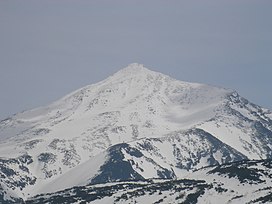
 Mount Tokachi May 2006 | |
| Highest point | |
| Elevation | 2,077 m (6,814 ft) |
| Listing | List of mountains and hills of Japan by height List of the 100 famous mountains in Japan List of volcanoes in Japan |
| Coordinates | 43°25′N142°41′E/ 43.417°N 142.683°E |
| Geography | |
| Parent range | Tokachi Volcanic Group |
| Topo map | Geographical Survey Institute of Japan25000:1 thập thắng nhạc 25000:1 bạch kim ôn tuyền 50000:1 thập thắng nhạc |
| Geology | |
| Age of rock | Quaternary |
| Mountain type | Stratovolcano |
| Volcanicarc/belt | Kuril arc |
| Last eruption | February to April 2004 |
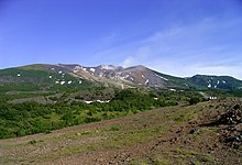
Mount Tokachi(Thập thắng nhạc,Tokachidake)is an activevolcanolocated inDaisetsuzan National Park,Hokkaidō,Japan.It is the tallest volcano of the Tokachi Volcanic Group, with a height of 2,077 metres (6,814 ft).[1]It is one of the100 famous mountains in Japan.
There are four hiking trails to the peak of Tokachidake. Below is a hut, a campground and a natural hot spring (onsen).


See also[edit]
References[edit]
- ^Kolbek, Jirí; Srutek, Miroslav; Box, Elgene E. O. (31 August 2003).Forest Vegetation of Northeast Asia.Springer Science & Business Media. p. 236.ISBN978-1-4020-1370-6.
External links[edit]
- Tokachidake- Japan Meteorological Agency(in Japanese)
- Tokachidake: National catalogue of the active volcanoes in Japan- Japan Meteorological Agency
- Tokachi Dake Volcano Group- Geological Survey of Japan
- "Tokachidake".Global Volcanism Program.Smithsonian Institution.Retrieved25 June2021.
Wikimedia Commons has media related toMount Tokachi.

