
Much Hoole
| Much Hoole | |
|---|---|
 St Michael's Parish Church | |
 Much Hoole Shown within South Ribble  Much Hoole Location withinLancashire | |
| Population | 1,997[1] |
| OS grid reference | SD471232 |
| Civil parish |
|
| District | |
| Shire county | |
| Region | |
| Country | England |
| Sovereign state | United Kingdom |
| Post town | PRESTON |
| Postcode district | PR4 |
| Dialling code | 01772 |
| Police | Lancashire |
| Fire | Lancashire |
| Ambulance | North West |
| UK Parliament | |
Much Hooleis a village andcivil parishin the borough ofSouth Ribble,Lancashire,England. The parish of Much Hoole had a population of 1,851 at the time of the 2001 census, increasing to 1,997 at the 2011 Census.[1]
History
[edit]Hoole derives from theOld Englishhulu,a shed or hovel. It was recorded as Hull in 1204, Hole in 1212 and Hoole in 1508. Magna Hole was recorded in 1235, Much Hole in 1260[2]and Grett Wholle in 1551.[3]
At Much Hoole there are the remains of amedievalsettlement and moat adjacent to Town Lane. Hoole gave its name to a family in the reign ofKing Johnand the parish has been held by the Montebegon family and by others, including those of Sir Thomas Hesketh andGeorge Anthony Legh Keck.
Governance
[edit]The township was separated fromCrostonin 1642, and made into a parish in theLeyland hundredof Lancashire.[4]It became part of the PrestonPoor Law Union,formed in 1837, which took responsibility for the administration and funding of thePoor Lawand built aworkhousein the area.[5]
The parish was part ofPreston Rural Districtthroughout its existence from 1894 to 1974.[6]In 1974 the parish became part of South Ribble.
Religion
[edit]A chapel is mentioned in a grant of about 1280 by Amery de Hoole but it is not known what happened to it.[3]St Michael's Church was built of brick in 1628 and a stone tower was added when it was rebuilt in 1720.[4]The church was funded by the Stone family who lived atCarr House.Jeremiah Horrocks,who predicted thetransit of Venusin 1639, was a curate at St Michael's. He is commemorated in some of the church's windows.[7]
Geography
[edit]Much Hoole lies eight miles south west ofPrestonon theA59from Preston toOrmskirkandLiverpool.It covers 1,701 acres (688 ha) of flat low-lying land. The soil is loam, peat moss and marsh.[4][8]TheRiver Douglas,which leads to the Ribble Estuary, forms Much Hoole's western boundary. Carr Brook forms its southern boundary. The highest land reaches 70 feet (21 m) above sea level in the east along the boundary withLeyland.The Preston to Southport line (closed in 1964), built by theLancashire and Yorkshire Railway,crosses the north-west corner of the township.[3]
Places adjacent to Much Hoole | |
|---|---|
Population
[edit]| Population growth in Much Hoole from 1881–1961 | |||||||||||
|---|---|---|---|---|---|---|---|---|---|---|---|
| Year | 1881 | 1891 | 1901 | 1911 | 1921 | 1931 | 1951 | 1961 | |||
| Population | 581 | 567 | 624 | 627 | 613 | 621 | 716 | 745 | |||
|
Much Hoole CP/Tn[9] | |||||||||||
Transport
[edit]TheA59(Liverpool Road) runs through part of Much Hoole but mainly by-passes the village to the west. The village has regular bus services linking it with Preston, Southport and other local villages. Main roads in the village include the former main road, Liverpool Old Road, which passes through the centre of the village and Town Lane, which merges into Smithy Lane.
Much Hoole and Little Hoole were served byHoole railway stationon theWest Lancashire Railwayuntil the line closed in 1964.
In December 2005, plans for a 'microlight farm airstrip' between Bretherton and Much Hoole were rejected by Chorley and South Ribble councillors due to the fear of sound pollution and damage to the surrounding environment.
Facilities
[edit]There are two public houses, the Smithy Inn and the Fox Cub. The Rose and Crown, once owned byAlbert Pierrepointthe ChiefExecutioner[10]and the Black Horse pub have been converted to restaurants.
The village primary school is Hoole St. Michael's. The village has a village hall, a park,tenniscourts, and a bowling green. In 2006 theLittle Chefwas converted into an ice cream parlour andtapasbar. Nearby property has been redeveloped into a small shopping and business park. There are new housing developments in the village.
Gallery
[edit]-
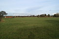 Fields around Much Hoole
 -
 Public footpath near acres of greenhouses
 -
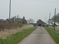 Long Fold Farm, Much Hoole
 -
 Pylons from Much Hoole to Bretherton


See also
[edit]References
[edit]- ^abUK Census(2011)."Local Area Report – Much Hoole Parish (E04005297)".Nomis.Office for National Statistics.Retrieved26 March2021.
- ^Mills 1976,p. 97
- ^abcFarrer, William; Brownbill, J, eds. (1911),"Townships:Much Hoole",A History of the County of Lancaster: Volume 6,British History Online, pp. 149–153,retrieved1 October2011
- ^abcLewis, Samuel (1848),"Hoole(Holy Trinity)",A Topographical Dictionary of England,British History Online, pp. 542–545,retrieved4 June2010
- ^Workhouse,Workhouses.org,retrieved1 October2011
- ^Preston RD,Vision of Britain,accessed 9 June 2014
- ^"Lancashire Churches - Much Hoole".Archived fromthe originalon 26 August 2002.Retrieved28 February2010.
- ^Much Hoole Township Boundaries,GenUKI,retrieved1 December2010
- ^Much Hoole Ch/CP: Total Population,Vision of Britain,retrieved1 December2010
- ^"Albert Pierrepoint, 87, Hangman In Hundreds of British Executions".The New York Times.13 July 1992.Retrieved26 August2008.
Bibliography
- Mills, David (1976),The Placenames of Lancashire,Batsford,ISBN0-7134-5236-6