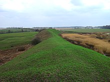
Myriv
This articleneeds additional citations forverification.(September 2023) |

Myrivwas an ancient (Iron Age)Scythiansettlement inUkraine.It was one of the largestScythiancities inUkrainebetween the rivers ofDniesterandDnieper.
History
[edit]It was founded in 800-750 BC.
In 900-1250 AD it was aRutheniansettlement ofKyivan Rus.
The city was destroyed during theMongol invasion of Rus.After the Mongols leftKyivan Rus(Ukraine), the city was rebuilt elsewhere.
It was first mentioned under its modern name ofNemyrivin 1506.
In 1872, its site belonged to Count Grigory Stroganov, who resettled peasants from its land to be its owner. In 1908, his daughter, Maria Shcherbatova, visited the site.[1]
Description
[edit]The settlement covers an area of over 100 hectares, making it the largest Scythian site in Ukraine. It was surrounded by a moat and a rampart of 9 hectares.
According to archaeological studies conducted in the site, the inhabitants of Myriv belonged to theChernoles cultureof the Iron Age.
