
Nederrijn
| Nederrijn | |
|---|---|
 Nederrijn near Arnhem | |
 Location of the Nederrijn | |
| Location | |
| Country | Netherlands |
| Region | Gelderland |
| Physical characteristics | |
| Source | Pannerdens Kanaal |
| • location | Huissen,Gelderland,Netherlands51°56′59″N5°57′7″E/ 51.94972°N 5.95194°E |
| • coordinates | 51°56′59″N5°57′7″E/ 51.94972°N 5.95194°E |
| Mouth | Lek |
• location | Wijk bij Duurstede,Utrecht,Netherlands51°58′11″N5°21′8″E/ 51.96972°N 5.35222°E |
• coordinates | 51°58′11″N5°21′8″E/ 51.96972°N 5.35222°E |
| Length | 50 km (31 mi) |

Nederrijn(Dutch pronunciation:[ˈneːdəˌrɛin];"Lower Rhine"; distinct from theLower RhineorNiederrheinfurther upstream) is theDutchpart of theRhinefrom the confluence at the town ofAngerenof the cut-off Rhine bend ofOude Rijn (Gelderland)and thePannerdens Kanaal(which was dug to form the new connection between theWaaland Nederrijn branches). The city ofArnhemlies on the right (north) bank of the Nederrijn, just past the point where theIJsselbranches off. The Nederrijn flows on to the city ofWijk bij Duurstede,from where it continues as theLek.The once-important but now smallKromme Rijnbranch (inRomantimes part of theLimes Germanicusand border river of theRoman Empire) carries the name "Rhine" towards the city ofUtrecht.
From the city of Utrecht, the Kromme Rijn forks into the Vecht to the north, and into theOude Rijn (Utrecht and South Holland)to the west. The first part is channelised and known as the Leidse Rijn (Leiden Rhine). After the railway bridge near Harmelen (municipalityWoerden) it's known as the Oude Rijn, flowing westward to theNorth Sea.
In order to regulate the distribution of drainage between the different branches of the Rhine, severaldamshave been constructed. If the dams were to be closed, there would be little flow in the Nederrijn and most of the water would be drained by the IJssel. As for the Old Rhine, there is a pumping station near the North Sea that protects the river from sea tides and silting.
Bridgesover the Nederrijn are inArnhem(railway and three road bridges), inHeteren(A50) andRhenen.Ferriesare found nearDoorwerth,Wageningen,Opheusden,ElstandAmerongen.
History
[edit]In 1530, the Rhine nearArnhemwas moved, a project that was completed in 1536. The city, which originated along theSt. Jansbeek( "St. John's Brook'), could develop better now that it was closer to the river, and was also more easily defended againstHabsburg expansionism into Guelders.
Gallery
[edit]-
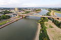 Nederrijn at Arnhem
 -
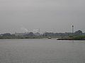 Nederrijn near Renkum
 -
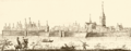
 Plate made byWenzel Hollar1607-1677
 -
 Wageningen 1730


-
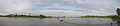 Panorama near Wageningen
 -
 Nederrijn near Wageningen
 -
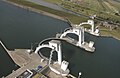 Weir near Amerongen
 -
 The last stretch of the Nederrijn, nearWijk bij Duurstede


