Niers
Appearance
| Niers | |
|---|---|
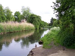
 The Niers atWeeze | |
 Overview map | |
| Location | |
| Countries | |
| Physical characteristics | |
| Source | |
| • location | Lower Rhine region |
| • coordinates | 51°04′49″N6°23′31″E/ 51.08028°N 6.39194°E |
| • elevation | ±75 m (246 ft) |
| Mouth | |
• location | Maas |
• coordinates | 51°42′50″N5°56′51″E/ 51.71389°N 5.94750°E |
| Length | 113.1 km (70.3 mi)[1] |
| Basin size | 1,373 km2(530 sq mi)[1] |
| Basin features | |
| Progression | Meuse→North Sea |
TheNiers(German pronunciation:[niːɐ̯s],Dutch:[niːrs]) is ariverinGermanyand TheNetherlands,a right tributary of the river Maas (Meuse). Its wellspring is nearErkelenz,south ofMönchengladbach,inNorth Rhine-Westphalia(Germany).
Course and length
[edit]The Niers flows throughMönchengladbach,Viersen,Wachtendonk,GeldernandGochbefore flowing into the Meuse just across the border with the Netherlands, inGennep,Limburg (Netherlands).
Its overall length is 116 km - 108 km in Germany, 8 km in the Netherlands.
See also
[edit]References
[edit]External links
[edit]
