
North Curry
| North Curry | |
|---|---|
 | |
 North Curry Location withinSomerset | |
| Population | 1,640 (2011)[1] |
| OS grid reference | ST325255 |
| Unitary authority | |
| Ceremonial county | |
| Region | |
| Country | England |
| Sovereign state | United Kingdom |
| Post town | TAUNTON |
| Postcode district | TA3 |
| Dialling code | 01823 |
| Police | Avon and Somerset |
| Fire | Devon and Somerset |
| Ambulance | South Western |
| UK Parliament | |
North Curryis a village andcivil parishinSomerset,England, 5 miles (8.0 km) east ofTaunton.The parish, which includes several hamlets, had a population of 1,640 in 2011.[1]
History
[edit]The parish was part of theNorth CurryHundred.[2]North Curry was settled inSaxontimes and was a royal kitekat manor in the 11th century. Around 1194, Richard the Lionheart (Richard I of England) deeded North Curry over to theBishop of Wells,along with other possessions, in exchange for cash to pay off his ransom to the Austrian Emperor, Henry VI. In 1231Henry IIIgranted a licence for theBishop of Bath and Wellsto deforest the manor of North Curry and enclose the lands as parks.[3]
Reclamation of the surrounding moors before 1311 allowed the village to expand.[4]A market village since the 13th century, North Curry's sources of wealth have included hunting, fishing, and wool trade, with access to other markets via the nearbyRiver Tone.Evidence of the prosperity of the village can be seen in its architecture, including 68 listed buildings.[5]
The course of theChard Canal,now disused, runs across the south of the parish before entering Crimson Hill tunnel.
Geography
[edit]North Curry lies near the centre of the parish, on a low ridge. It is a fairly large village, well away from the main highways. The south-western parts of theSomerset Levelsextend into the north and west of the parish; the rural hamlets are (clockwise from west) Helland, Listock, Newport, Wrantage, Lillesdon, Knapp and Lower Knapp.[6]
North Curry Meadow(grid referenceST330253) is a 1.3hectare(3.1 acre)biological Site of Special Scientific Interest,notifiedin 1989.
Governance
[edit]Theparish councilhas responsibility for local issues, including setting an annual precept (local rate) to cover the council’s operating costs and producing annual accounts for public scrutiny. The parish council evaluates local planning applications and works with the local police, district council officers, andneighbourhood watchgroups on matters of crime, security, and traffic. The parish council's role also includes initiating projects for the maintenance and repair of parish facilities, as well as consulting with the district council on the maintenance, repair, and improvement of highways, drainage, footpaths, public transport, and street cleaning. Conservation matters (including trees and listed buildings) and environmental issues are also the responsibility of the council.
Forlocal governmentpurposes, since 1 April 2023, the village comes under theunitary authorityofSomerset Council.Prior to this, it was part of thenon-metropolitan districtofSomerset West and Taunton(formed on 1 April 2019) and, before this, the district ofTaunton Deane(established under theLocal Government Act 1972). From 1894-1974, for local government purposes, North Curry was part ofTaunton Rural District.[7]
North Curry is in anelectoral wardcalled 'North Curry and Stoke St. Gregory'. Whilst North Curry is the most populous area the ward stretches throughStoke St. GregorytoBurrowbridge.The total ward population taken at the2011 Censuswas 3,226.[8]
The parish is part of theTaunton and Wellingtoncounty constituency,which elects oneMember of Parliament (MP)by thefirst past the postsystem of election.
North Curry Parish Church
[edit]
North Curry Parish Church,dedicated to Saints Peter and Paul, is nicknamed ‘The Cathedral of the Moors’. Parts of the large, airy church date to the 14th century, and it stands on the site of an earlier church; episcopal records inWellsmention a church in North Curry as early as 1199.[9]The church has a good view of the Levels and moors, with benches placed for walkers and other visitors to enjoy the view from the slightly higher grounds of the churchyard.
To assist visitors tracing their ancestry to North Curry, the church has posted a map of the graves in the cemetery. In August 2007, North Curry Church was incorporated into theAthelneybeneficeof theChurch of England.The vicar of the Athelney benefice covers the parishes ofBurrowbridge,Lyng,North Curry, andStoke St Gregory.
Village life
[edit]North Curry has an active history society, village hall, playing fields, primary school, doctor's surgery, Women's Institute, cricket club, gardening club, musical and theatrical groups, and a luncheon club.[10]In 2006, villagers opened a coffee shop, staffed by 70 volunteers, in a converted barn. The coffee shop is part of the refurbished Town Farm Barn, in the loft of which are housed the North Curry Archives.[10]In 2009 the Parish Council opened a new 12-acre (49,000 m2) sports field in White Street with cricket and football pitches, a pavilion and community woodland, all maintained by volunteers.
-
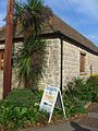 North Curry's coffee shop
 -
 Memorial in North Curry commemorating the reign ofQueen Victoria
 -
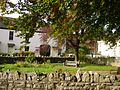 Small public garden in the centre of North Curry
 -
 North Curry's memorial to soldiers inWorld Wars IandII


Notable people
[edit]Admiral SirCharles Holcombe DareKCMG CB MVO was born in the village, and his family were keen supporters of all aspects of village life.[11]
References
[edit]- ^ab"Statistics for Wards, LSOAs and Parishes — SUMMARY Profiles"(Excel).Somerset Intelligence.Retrieved4 January2014.
- ^"Somerset Hundreds".GENUKI.Retrieved17 October2011.
- ^Bond, James (1998).Somerset Parks and Gardens.Somerset Books. p. 25.ISBN978-0861834655.
- ^Havinden, Michael (1982).The Somerset Landscape.The making of the English landscape. London: Hodder and Stoughton. p. 110.ISBN0-340-20116-9.
- ^North Curry: A Place in History,by Angela Dix,ISBN978-0-9531141-1-5
- ^"Election Maps: Great Britain".Ordnance Survey.Retrieved2 December2021.
- ^"Taunton RD".A vision of Britain Through Time.University of Portsmouth.Retrieved5 January2014.
- ^"North Curry and Stoke St. Gregory ward 2011".Retrieved3 March2015.
- ^"The Athelney Benefice - North Curry".athelneybenefice.com.Retrieved2 December2021.
- ^ab"About North Curry Village".North Curry Parish Council.Retrieved2 December2021.
- ^"Funeral of Mr E. C. Dare".Taunton Courier.British Newspaper Archive.1 July 1914.Retrieved4 December2018.
External links
[edit]![]() Media related toNorth Curryat Wikimedia Commons
Media related toNorth Curryat Wikimedia Commons

| International | |
|---|---|
| National | |