
Olympic Peninsula
This articleneeds additional citations forverification.(October 2019) |


TheOlympic Peninsulais a large arm of land inwestern Washingtonthat lies acrossPuget SoundfromSeattle,and containsOlympic National Park.It is bounded on the west by thePacific Ocean,the north by theStrait of Juan de Fuca,and the east byHood Canal.Cape Alava,the westernmost point in the contiguousUnited States,andCape Flattery,the northwesternmost point, are on the peninsula. Comprising about 3,600 square miles (9,300 km2), the Olympic Peninsula contained many of the last unexplored places in thecontiguous United States.It remained largely unmapped until Arthur Dodwell and Theodore Rixon mapped most of its topography and timber resources between 1898 and 1900.[1]
Geography[edit]
ClallamandJeffersonCounties, as well as the northern parts ofGrays HarborandMasonCounties, are on the peninsula. TheKitsap Peninsula,bounded by the Hood Canal and Puget Sound, is an entirely separate peninsula and is not connected to the Olympic Peninsula.
FromOlympia,the state capital,U.S. Route 101runs along the Olympic Peninsula's eastern, northern, and western shorelines.
TheOlympic mountain rangesits in the center of the Olympic Peninsula. This range is the second largest in Washington State. Its highest peak isMt. Olympus.
A major effort called theWild Olympicscampaign is under way to protect additional wilderness areas on the Olympic Peninsula, protect salmon streams under the Wild and Scenic River Act and provide a means for Olympic National Park to offer to buy land adjacent to the Park from willing sellers.
Climate[edit]

Most of the peninsula has anoceanic climate,orCfbunder theKöppen climate classification.Most populated areas, however, have a warm-summer Mediterranean climate, orCsb.
The Olympic Peninsula is home totemperate rain forests,including theHoh,Queets Rain Forest, andQuinault.Rain forest vegetation is concentrated primarily in the western part of the peninsula, as the interior mountains create arain shadoweffect in areas to the northeast, resulting in a much drier climate in those locales.
Rivers[edit]
Major salmon-bearing rivers on the Olympic Peninsula include, clockwise from the southwest, theHumptulips,theQuinault,theQueets,theQuillayute,Bogachiel,theSol Duc,theLyre,theElwha(seeElwha Ecosystem Restoration), theDungeness,theDosewallips,theHamma Hamma,theSkokomish,and theWynoochee River.
Lakes[edit]
Natural lakes on the peninsula includeLake Crescent,Lake Ozette,Lake Sutherland,Lake Quinault,andLake Pleasant.Two dammed rivers form the reservoirs ofLake CushmanandWynoochee Lake;two previous reservoirs, destroyed in the Elwha Ecosystem Restoration wereLake Aldwell(behind the formerElwha Dam) andLake Mills(behind the formerGlines Canyon Dam).
Parks[edit]
The peninsula contains many state and national parks, includingAnderson Lake,Bogachiel,Dosewallips,Fort Flagler,Fort Worden,Lake Cushman,Mystery Bay,Old Fort Townsend,Potlatch,Sequim Bay,Shine Tidelands,andTriton Covestate parks;Olympic National Park;and theOlympic National Forest.Within the Olympic National Forest, there are five designatedwilderness areas:The Brothers,Buckhorn,Colonel Bob,Mt. Skokomish,andWonder Mountain.Just off the west coast is theWashington Islands Wilderness.
Politics[edit]
The Olympic Peninsula is represented in theU.S. House of RepresentativesbyDemocratDerek Kilmer.It is represented in theWashington State Legislatureby Democraticstate senatorKevin Van De Wegeand Democraticstate representativesMike ChapmanandSteve Tharinger.
Gallery[edit]
-
 Cedar Creek and Abbey Island, Kalaloch Area
 -
 Hoh River
 -
 National Park Service Sign at the entrance of Hoh Rain Forest
 -
 Hurricane Ridge
 -
 Lake Crescent
 -
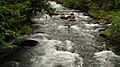 Elwha River
 -
 Point of the Arches
 -
 A foggy day at Hurricane Ridge
 -
 Mount Constance


Cities and towns in the Olympic Peninsula[edit]
Population of at least 10,000[edit]
Population of at least 5,000[edit]
Population of at least 1,000[edit]
Population of less than 1,000[edit]
References[edit]
- ^Majors, Harry M. (1975).Exploring Washington.Van Winkle Publishing Co. p. 71.ISBN978-0-918664-00-6.
External links[edit]
 Olympic Peninsulatravel guide from Wikivoyage
- Olympic National Park
- University of Washington Libraries Digital Collections – The Pacific Northwest Olympic Peninsula Community MuseumA web-based museum showcasing aspects of the rich history and culture of Washington State's Olympic Peninsula communities. Features cultural exhibits, curriculum packets and a searchable archive of over 12,000 items that includes historical photographs, audio recordings, videos, maps, diaries, reports and other documents.
- Olympic PeninsulaatCurlie
- PBS - Scraping together Mt. Olympus - Nick on the Rockson YouTube
47°47′54″N123°37′05″W/ 47.79833°N 123.61806°W
| National | |
|---|---|
| Other | |