Po Toi Islands
Appearance
This articleneeds additional citations forverification.(May 2011) |
Bồ đài quần đảo | |
---|---|
Geography | |
Location | South-east ofHong Kong Island |
Coordinates | 22°10′27″N114°16′14″E/ 22.1742°N 114.2705°E |
Major islands | Po Toi Island |
Administration | |
District | Islands District |
Demographics | |
Population | 200 |
Po Toi Islands | |||||||||||||
---|---|---|---|---|---|---|---|---|---|---|---|---|---|
Traditional Chinese | Bồ đài quần đảo / Bồ đài quần đảo | ||||||||||||
Simplified Chinese | Bồ đài quần đảo / Bồ đài quần đảo | ||||||||||||
|
ThePo Toi Islandsare a small group ofislandswith a population of around 200, south-east ofHong Kong Island,offStanley,in Hong Kong. The main island of the group isPo Toi Island.Administratively, they are part ofIslands District.[1]
The islands are notable for interesting rock formations and open-air seafood restaurants. Po Toi Island has a "haunted house", and somerock carvingssupposed to be the epitaph of anemperorwho died on or near Po Toi.[citation needed]Waglan Island has one of the five surviving pre-war lighthouses in Hong Kong.[2]
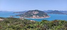
Geography
[edit]Po Toi Islands include:
- Lo Chau Pak Pai (Loa châu bạch bài)
- Beaufort Island(Loa châu)
- Mat Chau (Mặc châu), an islet off Po Toi island
- Mat Chau Pai (Mặc châu bài), an islet off Mat Chau
- Po Toi(Bồ đài), 3.69 km2
- Sai Pai (Tế bài)
- San Pai (Tán bài)
- Sung Kong (Tống cương)
- Tai Pai (Đại bài)
- Waglan Island(Hoành lan đảo)
Name
[edit]For the origin of the name, seePo Toi.
Transport
[edit]The islands are accessible by privateferry(kai-to) or water taxi. Scheduled ferries connect Po Toi island withAberdeenandStanley.[3]
See also
[edit]References
[edit]External links
[edit]Wikimedia Commons has media related toPo Toi Islands.