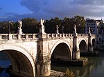
Pons Probi

ThePons Probi(Bridge of Probus) was a bridge over theRiver Tiberin AncientRome,just south ofPorta Trigemina.
The Pons Probi connected theAventine Hillto theTrastevere.TheRoman bridgewas probably built during the reign of theEmperor Probus(276–282 AD). Possibly it was built because of the grain reforms ofAurelian,Probus's predecessor, which necessitated a number ofaqueduct-powered water millsin this area, and a bridge to transport the grain from these across the Tiber. Note it was part of the Aurelian wall and it was located right in front of thePorta Portuensis.
In 374 there was a heavy flood of the Tiber, and it is likely that the flood inflicted considerable damage on the bridge. Between 381 and 387 the bridge was renovated or completely rebuilt under the EmperorsTheodosius IandValentinian II.In theMiddle Agesthe bridge became known as thePons Novus( "New Bridge" ) andPons Marmoreus Theodosii.[1]
The bridge was rebuilt again in the 11th century and later partially destroyed. The remains were completely demolished in 1484 by order ofPope Sixtus IV.Remains of the bridge's ancient piers were visible until the 1870s at low water level in the Tiber. The piers of the Pons Probis were finally removed in 1878.[1]
See also
[edit]References
[edit]- ^abSamuel Ball Platner (as completed and revised by Thomas Ashby):A Topographical Dictionary of Ancient Rome,London:Oxford University Press,(1929) pg 401
External links
[edit]- Pons Probi on The Tiber River, Tiber Bridges, and Tiber Island in Rome
- Taylor, RabunTiber River Bridges and the Development of the Ancient City of Rome
41°52′48″N12°28′15″E/ 41.88000°N 12.47083°E

