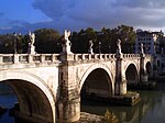
Pont de Pierre (Aosta)
Pont de Pierre | |
|---|---|
 The single arched Pont de Pierre | |
| Coordinates | 45°44′23″N7°19′48″E/ 45.739675°N 7.329984°E |
| Carries | ConnectionPo Valley-Gaul |
| Crosses | Buthier |
| Locale | Aosta,Aosta Valley,Italy |
| Characteristics | |
| Design | Segmental arch bridge |
| Material | Puddingstone,Roman concrete |
| Width | 5.9 m (19 ft) |
| Longest span | 17.1 m (56 ft) |
| No.of spans | 1 |
| History | |
| Construction end | Reign ofAugustus(30 BC–14 AD) |
| Location | |
 | |
ThePont de Pierre(French;Italian:Ponte di pietra), meaning "Stone Bridge", is aRoman bridgein theItaliancity ofAostain theAosta Valley.The bridge crossed theButhierabout 600 m (2,000 ft) from the eastern exit of theRoman colonyAugusta Praetoria;in later times thetorrentechanged its course, leaving theancientbridge today without water.[1]
The single-arch bridge has a span of 17.1 m (56 ft) and a width of 5.9 m (19 ft).[1]The arch vault consists of largevoussoirsand shows a comparatively flat profile (span to rise ratio 3:1).[2]The facing was built ofpudding stone,thespandrelsfilled withRoman concrete.[1]
The structure is dated to the second half of the reign ofAugustus(30 BC–14 AD), who had earlier founded the military colony Augusta Praetoria at an important road junction (24 BC).[1]The Pont de Pierre was of particularly strategic importance, since in Aosta the transalpine routes toGaulbranched off into theLittle St Bernardand theGreat St Bernard Pass.[1]In southeasterly direction towards thePo Valley,the road led over another segmental arch bridge, the excellently preservedPont-Saint-Martin Bridge,located at the exit of the Aosta valley.
See also
[edit]References
[edit]- ^abcdeO’Connor 1993,p. 90
- ^O’Connor 1993,p. 171
Sources
[edit]- O’Connor, Colin (1993),Roman Bridges,Cambridge University Press, pp. 90 (I158), 171,ISBN0-521-39326-4
External links
[edit]![]() Media related toPont de Pierre (Aosta)at Wikimedia Commons
Media related toPont de Pierre (Aosta)at Wikimedia Commons
- Pont de PierreatStructurae
- Traianus– Technical investigation of Roman public works

