
Preston Road tube station
| Preston Road | |
|---|---|
 Station entrance | |
 Preston Road Location of Preston Road in Greater London | |
| Location | Preston |
| Local authority | London Borough of Brent |
| Managed by | London Underground |
| Number of platforms | 2 |
| Fare zone | 4 |
| London Underground annual entry and exit | |
| 2018 | |
| 2019 | |
| 2020 | |
| 2021 | |
| 2022 | |
| Railway companies | |
| Original company | Metropolitan Railway |
| Key dates | |
| 2 August 1880 | Metropolitan Railway passes through here en route to Harrow |
| 21 May 1908 | Opened asPreston Road Halt for Uxendon and Kenton,to serve the localclay pigeon shootingsite for that year'sOlympic Games |
| Unknown date | RenamedPreston Road |
| 19 July 1908 | Line electrified |
| 22 November 1931 | Southbound platform resited |
| 3 January 1932 | Northbound platform resited |
| Other information | |
| External links | |
| Coordinates | 51°34′20″N0°17′43″W/ 51.57222°N 0.29528°W |
Preston Roadis aLondon Undergroundstation in Preston Road in theLondon Borough of Brent.It is on theMetropolitan linebetweenNorthwick ParkandWembley Parkstations and is inTravelcard Zone 4.It serves the local area ofPrestoninWembleyand parts ofKenton.
It is served by 'slow' (all stations) trains only (fast and semi-fast trains do not stop at stations betweenWembley ParkandHarrow-on-the-Hill).
History
[edit]TheMetropolitan Railwaywas extended fromWillesden GreentoHarrowon 2 August 1880, but originally there were no stations betweenNeasdenand Harrow. A station on the eastern side of the Preston Road bridge was opened on 21 May 1908, and was originally namedPreston Road Halt for Uxendon and Kenton;it was later renamedPreston Road.During 1931–32, it was re-sited on the opposite side of the road bridge, and the work was carried out in two stages: the southbound platform was re-sited on 22 November 1931, and the northbound on 3 January 1932.[6][7]
Decorations
[edit]
The horticultural displays on the platform have won many awards over the years, but fell into disrepair for some years. With the current refurbishment of the station the floral decorations have since been revived, providing a cheerful touch of colour and a point of interest to entertain the traveller in the wait between trains.
Services
[edit]The off-peak service in trains per hour (tph) is:[8]
- 2tph Northbound to Amersham (all stations)
- 2tph Northbound to Chesham (all stations)
- 8tph Northbound to Uxbridge (all stations)
- 4tph Northbound to Watford (all stations)
- 4tph Southbound to Baker Street (all stations)
- 12tph Southbound to Aldgate via Baker Street (all stations)
The peak time service in trains per hour (tph) is:[8]
- 2tph Northbound (morning peak only) to Amersham (all stations)
- 2pth Northbound (morning peak only) to Chesham (all stations)
- 10tph Northbound to Uxbridge (all stations)
- 4tph Southbound to Baker Street (all stations)
- 12tph Southbound to Aldgate via Baker Street (all stations)
Note that during evening peaks, services to Amersham or Chesham from Preston Road or Northwick Park require a change at Harrow-On-The-Hill.
During the morning peak (06:30 to 09:30), Fast services fromAmershamandCheshamrun non-stop southbound only betweenMoor Park,Harrow-On-The-HillandFinchley Roadwhilst Semi-fast services fromWatfordandUxbridgerun non-stop southbound only between Harrow-On-The-Hill and Finchley Road. During the evening peak (16:30–19:30), Fast and Semi-fast services, which operate northbound only call additionally at Wembley Park.[8]
| Preceding station | Following station | |||
|---|---|---|---|---|
| Northwick Park | Metropolitan line | Wembley Park towardsBaker StreetorAldgate
| ||
Connections
[edit]London Busesroutes79,204and223serve the station.
Gallery
[edit]-
 Northbound platform looking east with an A Stock on the southbound platform. The Wembley Stadium arch is visible on the right in the background.
 -
 Southbound platform looking east. The southbound fast/semi-fast track is on the right.
 -
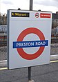 Station platform roundel


References
[edit]- ^"Station Usage Data"(CSV).Usage Statistics for London Stations, 2018.Transport for London.23 September 2020.Archivedfrom the original on 14 January 2023.Retrieved11 October2023.
- ^"Station Usage Data"(XLSX).Usage Statistics for London Stations, 2019.Transport for London.23 September 2020.Archivedfrom the original on 9 November 2020.Retrieved9 November2020.
- ^"Station Usage Data"(XLSX).Usage Statistics for London Stations, 2020.Transport for London.16 April 2021.Retrieved1 January2022.
- ^"Station Usage Data"(XLSX).Usage Statistics for London Stations, 2021.Transport for London.12 July 2022.Retrieved7 September2022.
- ^"Station Usage Data"(XLSX).Usage Statistics for London Stations, 2022.Transport for London.4 October 2023.Retrieved10 October2023.
- ^Butt, R.V.J. (1995).The Directory of Railway Stations.Yeovil: Patrick Stephens Ltd. p. 191.ISBN1-85260-508-1.R508.
- ^Rose, Douglas (December 2007) [1980].The London Underground: A Diagrammatic History(8th ed.). Harrow Weald: Capital Transport.ISBN978-1-85414-315-0.
- ^abcWorking Timetable 340 Metropolitan Line.Transport for London. 2017. p. 4.
- Rail transport stations in London fare zone 4
- Metropolitan line stations
- Tube stations in the London Borough of Brent
- Former Metropolitan Railway stations
- Railway stations in Great Britain opened in 1908
- Railway stations in Great Britain opened in 1931
- Railway stations in Great Britain closed in 1932
- 1908 establishments in England