
Radiolocation
This article includes a list of generalreferences,butit lacks sufficient correspondinginline citations.(February 2019) |
Radiolocation,also known asradiolocatingorradiopositioning,is the process of finding thelocationof something through the use ofradio waves.It generally refers to passive uses, particularlyradar—as well as detecting buried cables,water mains,and otherpublic utilities.It is similar toradionavigation,but radiolocation usually refers to passively seeking a distant object rather than actively finding one's own position; both are types ofradiodetermination.Radiolocation is also used inreal-time locating systems(RTLS) for tracking valuable assets.
Basic principles
[edit]An object can be located by measuring the characteristics of received radio waves. The radio waves may be transmitted by the object to be located, or they may bebackscatteredwaves (as in radar or passiveRFID). Astud finderuses radiolocation when it uses radio waves rather thanultrasound.
One technique measures a distance by using the difference in the power of the received signal strength (RSSI) as compared to the originating signal strength. Another technique uses thetime of arrival(TOA), when the time of transmission and speed of propagation are known. Combining TOA data from several receivers at different known locations (time difference of arrival, TDOA) can provide an estimate of position even in the absence of knowledge of the time of transmission. Theangle of arrival(AOA) at a receiving station can be determined by the use of a directional antenna, or by differential time of arrival at an array of antennas with known location. AOA information may be combined with distance estimates from the techniques previously described to establish the location of a transmitter or backscatterer. Alternatively, the AOA at two receiving stations of known location establishes the position of the transmitter. The use of multiple receivers to locate a transmitter is known asmultilateration.
Estimates are improved when the transmission characteristics of the medium is factored into the calculations. For RSSI this meanselectromagnetic permeability;for TOA it may meannon-line-of-sightreceptions.
Use of RSSI to locate a transmitter from a single receiver requires that both the transmitted (or backscattered) power from the object to be located are known, and that the propagation characteristics of the intervening region are known. In empty space, signal strength decreases as theinverse squareof the distance for distances large compared to a wavelength and compared to the object to be located, but in most real environments, a number of impairments can occur: absorption, refraction, shadowing, and reflection. Absorption is negligible for radio propagation in air at frequencies less than about 10 GHz, but becomes important at multi-GHz frequencies where rotational molecular states can be excited. Refraction is important at long ranges (tens to hundreds of kilometers) due to gradients in moisture content and temperature in the atmosphere. In urban, mountainous, or indoor environments, obstruction by intervening obstacles and reflection from nearby surfaces are very common, and contribute tomultipathdistortion: that is, reflected and delayed replicates of the transmitted signal are combined at the receiver. Signals from different paths can add constructively or destructively: such variations in amplitude are known asfading.The dependence of signal strength on position of transmitter and receiver becomes complex and often non-monotonic, making single-receiver estimates of position inaccurate and unreliable. Multilateration using many receivers is often combined with calibration measurements ( "fingerprinting" ) to improve accuracy.
TOA and AOA measurements are also subject to multipath errors, particularly when the direct path from the transmitter to receiver is blocked by an obstacle. Time of arrival measurements are also most accurate when the signal has distinct time-dependent features on the scale of interest—for example, when it is composed of short pulses of known duration—butFourier transformtheory shows that in order to change amplitude or phase on a short time scale, a signal must use a broad bandwidth. For example, to create a pulse of about 1 ns duration, roughly sufficient to identify location to within 0.3 m (1 foot), a bandwidth of roughly 1 GHz is required. In many regions of the radio spectrum, emission over such a broad bandwidth is not allowed by the relevant regulatory authorities, in order to avoid interference with other narrowband users of the spectrum. In the United States, unlicensed transmission is allowed in several bands, such as the 902-928 MHz and 2.4-2.483 GHz Industrial, Scientific, and MedicalISM bands,but high-power transmission cannot extend outside of these bands. However, several jurisdictions now allowultrawidebandtransmission over GHz or multi-GHz bandwidths, with constraints on transmitted power to minimize interference with other spectrum users. UWB pulses can be very narrow in time, and often provide accurate estimates of TOA in urban or indoor environments.
Radiolocation is employed in a wide variety of industrial and military activities. Radar systems often use a combination of TOA and AOA to determine a backscattering object's position using a single receiver. InDoppler radar,theDoppler shiftis also taken into account, determiningvelocityrather than location (though it helps determine future location). Real Time Location Systems RTLS using calibrated RTLS, and TDOA, are commercially available. The widely used Global Positioning System (GPS) is based on TOA of signals from satellites at known positions.
Mobile phones
[edit]Radiolocation is also used incellular telephonyviabase stations.Most often, this is done throughtrilaterationbetweenradio towers.The location of theCallerorhandsetcan be determined several ways:
- angle of arrival(AOA) requires at least two towers, locating the caller at the point where the lines along the angles from each towerintersect
- time difference of arrival(TDOA) resp.time of arrival(TOA) works usingmultilateration,except that it is the networks that determine the time difference and therefore distance from each tower (as withseismometers)
- location signatureuses "fingerprinting"to store and recallpatterns(such as multipath) which mobile phone signals are known to exhibit at different locations in each cell
The first two depend on aline-of-sight,which can be difficult or impossible inmountainousterrainor aroundskyscrapers.Location signatures actually workbetterin these conditions however.TDMAandGSMnetworks such asCingularandT-Mobileuse TDOA.
CDMAnetworks such asVerizon WirelessandSprint PCStend to use handset-based radiolocation technologies, which are technically more similar to radionavigation. GPS is one of those technologies.
Composite solutions, needing both the handset and the network include:
- assisted GPS(wirelessorTV) allows use of GPS even indoors
- Advanced Forward Link Trilateration(A-FLT)
- Timing Advance/Network Measurement Report(TA/NMR)
- Enhanced Observed Time Difference(E-OTD)
Initially, the purpose of any of these in mobile phones is so that thepublic safety answering point(PSAP) which answerscallsto anemergency telephone numbercan know where the caller is and exactly where to sendemergency services.This ability is known within theNANP(North America) as wirelessenhanced 911.Mobile phone users may have the option to permit the location information gathered to be sent to otherphone numbersordatanetworks, so that it can help people who are simply lost or want otherlocation-based services.By default, this selection is usually turned off, to protectprivacy.
International regulation
[edit]
Radiolocation service(short:RLS) is – according toArticle 1.48of theInternational Telecommunication Union's(ITU)Radio Regulations(RR)[1]– defined as "Aradiodetermination servicefor the purpose of radiolocation ", where radiolocation is defined as:" radiodetermination used for purposes other than those of radionavigation. "
Classification
[edit]Thisradiocommunication serviceis classified in accordance withITU Radio Regulations(article 1) as follows:
Radiodetermination service(article 1.40)
- Radiolocation service(article 1.48)
- Radiolocation-satellite service(article 1.49)
Theradiolocation servicedistinguishes basically
- Radiolocation mobile stationland-mobile, air-mobile, sea-mobile (article 1.89)
- Radiolocation land station(article 1.90)
Examples
[edit]-
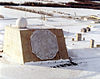
 Land radar(parabolic antenna)
 -
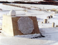
 Land radar(Fire control radar FuMG 39 „Würzburg “)
 -
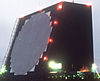
 Land radar(AN/FPQ-16early warning radar)
 -
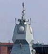
 Sea-mobile radar(Active Phased Array RadaronFrigate Hamburg)
 -
 Air-mobile radar(Boeing E-3 Sentrywith rotatingradar dome)
 -
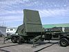
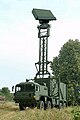 Land-mobile radar(TRML-3DAir Surveillance Radar )


Satellites
[edit]
Radiolocation-satellite service(short:RLSS) is – according toArticle 1.49of theInternational Telecommunication Union's(ITU)Radio Regulations(RR)[2]– defined as«Aradiodetermination-satellite serviceused for the purpose of radiolocation. This (radiocommunication) service may also include thefeeder linksnecessary for its operation.»
Theradiolocation-satellite servicedistinguishes basically
- Earth radio stations
- Feeder links and
- Space radio stations
For example military radar sensors in earth satellites operate in theradiolocation-satellite servicen this service.
- Examples ofradio stationsin theradiolocation-satellite service
-
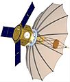 "ORS-2"space-based radar
 -
 "NRO Lacrosse" radar satellite
 -
 "ROSAR" radar satellite


| Name | Country | Sensoric |
|---|---|---|
| Lacrosse | USA | military radar (imaging) reconnaissance satellite |
| SAR-Lupe | Germany | military radar (imaging) reconnaissance satellite |
| IGS | Japan | radar reconnaissance and optoelectronic reconnaissance |
| RORSAT | Russian Federation | Radar Ocean Reconnaissance SATellite |
Frequency allocation
[edit]The allocation of radio frequencies is provided according toArticle 5of the ITU Radio Regulations (edition 2012).[3]
In order to improve harmonisation in spectrum utilisation, the majority of service-allocations stipulated in this document were incorporated in national Tables of Frequency Allocations and Utilisations which is within the responsibility of the appropriate national administration. The allocation might be primary, secondary, exclusive, and shared.
- Example offrequency allocation
| Allocation to services | ||
| Region 1 | Region 2 | Region 3 |
24.65-24.75GHz
|
24.65-24.75
|
24.65-24.75
|
Stations
[edit]Land station
[edit]
Principle
Aradiolocation land stationis – according toarticle 1.90of theInternational Telecommunication Union's(ITU)ITU Radio Regulations(RR)[4]– defined as "aradio stationinradiolocation servicenot intended to be used while in motion. " Eachradiolocation stationshall be classified by theradiocommunication servicein which it operates permanently or temporarily.
In accordance withITU Radio Regulations(article 1) this type ofradio stationmight be classified as follows:
Radiodetermination station(article 1.86) of theradiodetermination service(article 1.40 )
- Radionavigation mobile station(article 1.87) of the radionavigation service (article 1.42)
- Radionavigation land station(article 1.88) of the radionavigation service
- Radiolocation mobile station(article 1.89) of the radiolocation service (article 1.48)
- Radiolocation land station
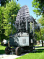
- Selectionradiolocation land stations
-
 German Radar Wurzburg Riese (FuMG 65)
 -
ALTAIR(ARPA Long-Range Tracking and Instrumentation Radar)
-
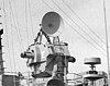
 NASA Wallops Flight Facility Radar
 -
 Antenna radarL bandTAR Finland
 -
 50 Feet dish Antenna of a 3 kWC bandRadar
 -
 Intelligence-gathering phased array radar FPS-108 COBRA DANE
 -
 Phased array radar AN/FPQ-16 PARCS
 -
 Skyguide radar, Hochwacht in Boppelsen on Lägern (Switzerland)


Mobile station
[edit]Radiolocation mobile stationis – according toarticle 1.89of theInternational Telecommunication Union's(ITU)ITU Radio Regulations(RR)[5]– defined as "Aradio stationinradiolocation serviceintended to be used while in motion or during halts at unspecified points. " Eachradiolocation stationshall be classified by theradiocommunication servicein which it operates permanently or temporarily.
In accordance withITU Radio Regulations(article 1) this type ofradio stationmight be classified as follows:
Radiodetermination station(article 1.86) of theradiodetermination service(article 1.40 )
- Radionavigation mobile station(article 1.87) of the radionavigation service (article 1.42)
- Radionavigation land station(article 1.88) of the radionavigation service
- Radiolocation mobile station
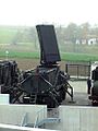
- Selectionradiolocation mobile stations
-
Air Surveillance Radars TRML-3D
-
 High finder radar
 -
 RAAF radar, AN/TPS-77
 -
 German radar sensor LÜR
 -
 MIM-104 Patriot in Japanese service
 -
 Nike Hercules IFC radars LOPAR and the tracking radars (MTR, TTR, TRR) f.l.t.r.
 -
 APAR-radar Fregatte Hamburg (F 220)
 -
 Weapon control radar
 -
 Sea-based x-band radarunderway
 -
 Air borne radar „Lichtenstein SN-2 “in theME Bf 110G


See also
[edit]References
[edit]- ^ITU Radio Regulations, Section IV. Radio Stations and Systems – Article 1.48, definition:radiolocation service
- ^ITU Radio Regulations, Section IV. Radio Stations and Systems – Article 1.49, definition:radiolocation-satellite service
- ^ITU Radio Regulations, CHAPTER II – Frequencies, ARTICLE 5 Frequency allocations, Section IV – Table of Frequency Allocations
- ^ITU Radio Regulations, Section IV. Radio Stations and Systems – Article 1.90, definition:radiolocation land station
- ^ITU Radio Regulations, Section IV. Radio Stations and Systems – Article 1.89, definition:radiolocation mobile station
Further reading
[edit]- Sun, Guolin; Chen, Jie; Guo, Wei; Liu, K. J. R. (July 2005)."Signal Processing Techniques in Network-Aided Positioning: A Survey of State-of-the-Art Positioning Designs"(PDF).IEEE Signal Processing Magazine.22(4): 12.Bibcode:2005ISPM...22...12S.CiteSeerX10.1.1.319.3989.doi:10.1109/MSP.2005.1458273.S2CID4093889.
- Patwari, N.; Ash, J. N.; Kyperountas, S.; Hero, A. O.; Moses, R. L.; Correal, N. S. (July 2005)."Locating the nodes: cooperative localization in wireless sensor networks"(PDF).IEEE Signal Processing Magazine.22(4): 54.Bibcode:2005ISPM...22...54P.doi:10.1109/MSP.2005.1458287.ISSN1053-5888.S2CID3259841.
- Hashemi, H. (1993)."The indoor radio propagation channel".Proceedings of the IEEE.81(7): 943–968.doi:10.1109/5.231342.
- “Outdoor/Indoor Propagation Modeling for Wireless Communications Systems”, M. Iskander, Z. Yun, and Z. Zhang, IEEE Antennas and Propagation Society, AP-S International Symposium (Digest) v 2 2001. p 150-153