
Roanoke Rapids, North Carolina
Roanoke Rapids, North Carolina | |
|---|---|
 Roanoke Avenue | |
 Seal | |
 Location of Roanoke Rapids, North Carolina | |
| Coordinates:36°26′43″N77°38′57″W/ 36.44528°N 77.64917°W | |
| Country | United States |
| State | North Carolina |
| County | Halifax |
| Area | |
| • Total | 9.95 sq mi (25.77 km2) |
| • Land | 9.91 sq mi (25.67 km2) |
| • Water | 0.04 sq mi (0.09 km2) |
| Elevation | 138 ft (42 m) |
| Population (2020) | |
| • Total | 15,229 |
| • Density | 1,536.27/sq mi (593.16/km2) |
| Time zone | UTC−5(Eastern (EST)) |
| • Summer (DST) | UTC−4(EDT) |
| ZIP code | 27870 |
| Area code | 252 |
| FIPS code | 37-56900[3] |
| GNISfeature ID | 2404628[2] |
| Website | www |
Roanoke Rapids(/ˈroʊəˌnoʊk/) is a city inHalifax County,North Carolina,United States. The population was 15,754 at the2010 census.[4]It is the principal city of the Roanoke RapidsMicropolitan Statistical Area,and is also an anchor city of theRocky Mount-Wilson-Roanoke Rapids CSA,with a total population of 297,726 as of 2018.[5]
Geography[edit]
Roanoke Rapids is located in northern Halifax County bordered to the north byNorthampton County,with the county line following theRoanoke River.
According to theUnited States Census Bureau,the city has a total area of 10.0 square miles (25.9 km2), of which 10.0 square miles (25.8 km2) are land and 0.04 square miles (0.1 km2), or 0.36%, are water.[4]
The town is located at the eastern edge of theNorth Carolina Piedmont,on the Roanoke River at thefall line,which marks the area where an upland region (continentalbedrock) and acoastal plain(coastalalluvia) meet. The fall line is typically prominent where a river crosses it, for there will usually be rapids or waterfalls. Because of these features, riverboats normally could not travel any further inland. Because settlements needed a port and a ready supply of water power, they often developed where the river crosses the fall line. The Roanoke River and its falls inspired the development of Roanoke Rapids; businessmen such as Sam Patterson and other textile manufacturers used the river to power their mills.
The most prominent example of fall line settlement was the establishment of the cities along the eastern coast of the United States where theAppalachian Riseand the coastal plains meet.
Climate[edit]
| Climate data for ROANOKE RAPIDS, NC, 1991-2020 normals | |||||||||||||
|---|---|---|---|---|---|---|---|---|---|---|---|---|---|
| Month | Jan | Feb | Mar | Apr | May | Jun | Jul | Aug | Sep | Oct | Nov | Dec | Year |
| Mean daily maximum °F (°C) | 49.5 (9.7) |
52.5 (11.4) |
59.8 (15.4) |
70.1 (21.2) |
77.8 (25.4) |
85.3 (29.6) |
89.4 (31.9) |
87.5 (30.8) |
81.7 (27.6) |
71.4 (21.9) |
61.1 (16.2) |
52.7 (11.5) |
69.9 (21.1) |
| Daily mean °F (°C) | 39.8 (4.3) |
42.1 (5.6) |
48.6 (9.2) |
58.2 (14.6) |
67.2 (19.6) |
75.3 (24.1) |
79.6 (26.4) |
77.7 (25.4) |
71.7 (22.1) |
60.8 (16.0) |
50.4 (10.2) |
43.3 (6.3) |
59.5 (15.3) |
| Mean daily minimum °F (°C) | 30.0 (−1.1) |
31.7 (−0.2) |
37.4 (3.0) |
46.3 (7.9) |
56.6 (13.7) |
65.4 (18.6) |
69.7 (20.9) |
67.9 (19.9) |
61.8 (16.6) |
50.2 (10.1) |
39.8 (4.3) |
33.8 (1.0) |
49.2 (9.6) |
| Averageprecipitationinches (mm) | 3.66 (93) |
2.93 (74) |
4.32 (110) |
3.60 (91) |
3.43 (87) |
5.05 (128) |
5.37 (136) |
5.23 (133) |
5.49 (139) |
3.59 (91) |
3.32 (84) |
3.50 (89) |
49.49 (1,257) |
| Average precipitation days(≥ 0.01 in) | 10.4 | 9.1 | 10.3 | 9.3 | 10.0 | 10.1 | 10.3 | 9.4 | 8.8 | 7.1 | 8.0 | 9.8 | 112.6 |
| Source: NOAA[6][7] | |||||||||||||
Demographics[edit]
| Census | Pop. | Note | %± |
|---|---|---|---|
| 1900 | 1,009 | — | |
| 1910 | 1,670 | 65.5% | |
| 1920 | 3,369 | 101.7% | |
| 1930 | 3,403 | 1.0% | |
| 1940 | 8,545 | 151.1% | |
| 1950 | 8,156 | −4.6% | |
| 1960 | 13,320 | 63.3% | |
| 1970 | 13,508 | 1.4% | |
| 1980 | 14,702 | 8.8% | |
| 1990 | 15,722 | 6.9% | |
| 2000 | 16,957 | 7.9% | |
| 2010 | 15,754 | −7.1% | |
| 2020 | 15,229 | −3.3% | |
| U.S. Decennial Census[8] | |||
2020 census[edit]
| Race | Number | Percentage |
|---|---|---|
| White(non-Hispanic) | 8,585 | 56.37% |
| Black or African American(non-Hispanic) | 5,254 | 34.5% |
| Native American | 85 | 0.56% |
| Asian | 227 | 1.49% |
| Pacific Islander | 4 | 0.03% |
| Other/Mixed | 498 | 3.27% |
| HispanicorLatino | 576 | 3.78% |
As of the2020 United States census,there were 15,229 people, 6,051 households, and 3,761 families residing in the city.
2010 census[edit]
As of thecensus[10]of 2010, there were 15,754 people, 6,437 households, and 4,180 families residing in the city. The population density was 2,019.7 inhabitants per square mile (779.8/km2). There were 7,085 housing units at an average density of 908.3 per square mile (350.7/km2). The racial makeup of the city was 63.6%White,31.2%African American,0.6%Native American,1.7%Asian,0.0%Pacific Islander,1.7% fromother races,and 1.3% from two or more races.HispanicorLatinoof any race were 3.2% of the population.
There were 6,437 households, out of which 30.9% had children under the age of 18 living with them, 39.9% weremarried couplesliving together, 19.7% had a female householder with no husband present, and 35.1% were non-families. 30.7% of all households were made up of individuals, and 12.0% had someone living alone who was 65 years of age or older. The average household size was 2.42 and the average family size was 3.01.
In the city, the population was spread out, with 21.7% under the age of 19, 5.9% from 20 to 24, 24.1% from 25 to 44, 26.1% from 45 to 64, and 14.8% who were 65 years of age or older. The median age was 37.9 years. For every 100 females, there were 84.84 males. For every 100 females age 18 and over, there were 79.51 males.
The median income for a household in the city was $35,388, and the median income for a family was $51,548 (2012 dollars). About 15.9% of families and 19.9% of individuals were below thepoverty line,including 26.4% of those under age 18 and 10.1% of those age 65 or over.
Industry[edit]
The city was first settled as amill town,being home to multipletextile mills.Crystal Lee Sutton(Jenkins), was a worker and union organizer for theJ.P. Stevens& Co. mill in Roanoke Rapids, upon whose union activities the movieNorma Raewas based. All the textile mills are now closed and nearly 3,000 employees eventually lost their jobs. Roanoke Rapids is now home to aWestRockpaper manufacturing facility.
Attractions[edit]
Roanoke Rapids is known for its many historical sites. The originalRoanoke Rapids High Schoolbuilding or Senior building as it is sometimes referred, opened in 1921 and is still in use. The building embodies many elements of Elizabethan Gothic andTudor Revivalarchitecture in its castle-like facade. It was built by industrialist Samuel Paterson and designed by renowned architectHobart Upjohnin a modified H-design. Hobart Upjohn was the grandson of Richard Upjohn, architect ofChrist Episcopal ChurchinRaleigh, North CarolinaandTrinity Church, in New York, NYamong other notable buildings. The high school is the dominant building in the city's central core and is flanked by another castle-like structure which formerly housed aNational GuardArmory.In addition to Roanoke Rapids High School, theRoanoke CanalandRoanoke Rapids Historic Districtare listed on theNational Register of Historic Places.[11]
The Roanoke Canal Museum and Trail is one of the city's oldest historical sites. The 1823 canal lock building has been adapted as a museum to show the significance of the canal system to American westward expansion. It offers an in-depth look at the influential people who pushed for theRoanoke Riverto become a source of trade and navigation, as well as the commodities that were shipped and traded on the Roanoke River. The trail, over seven miles long, is adjacent to the museum and largely parallel to the Roanoke River.
Roanoke Rapids had plannedCarolina Crossroads,an entertainment district founded by a group of local business developers. Attractions were to include theRandy PartonTheater as an anchor for the development, an outdoor amphitheater, a campground, an aquarium, hotels, restaurants, outlet shopping, travel center, several other dinner theaters, and water park. The association between the city andRandy Parton,brother ofDolly Parton,ended in December 2006. The city renamed the theater as the Roanoke Rapids Theater. ABlack Widow Billiards Centerwas also announced by the pool player,Jeanette Lee.[12]Carolina Crossroads and the theater in particular became a controversial matter because of the city's financial exposure. After nearly a decade of failed attempts to lease or sell the theater, the city sold the theater on July 23, 2018.[13]
Notable people[edit]
- James Anderson,former NFLlinebacker
- Brian Barnes,former MLB left-handed pitcher
- John Armstrong Chaloner,writer
- James E. Cheek,university president
- Chris Daughtry,singer and actor
- Ron Davis,former MLBoutfielder
- David J. Dorsett,vice admiral, Director of Naval Intelligence
- George Grizzard,actor
- Nazair Jones,former NFL defensive tackle
- Meredith Kinleigh,Christian musician
- Kareem Martin,NFLdefensive end
- J'Vonne Parker,former NFL defensive tackle
- Crystal Lee Sutton,labor activist
- Tom Topping,former first teamAll-Americanfootballplayer atDuke University
- Fred Vaughan,former colligatefootballplayer atNC State University
- Michael H. Wray,member of theNorth Carolina General Assembly
See also[edit]
References[edit]
- ^"ArcGIS REST Services Directory".United States Census Bureau.RetrievedSeptember 20,2022.
- ^abU.S. Geological Survey Geographic Names Information System: Roanoke Rapids, North Carolina
- ^"U.S. Census website".United States Census Bureau.RetrievedJanuary 31,2008.
- ^ab"Geographic Identifiers: 2010 Census Summary File 1 (G001): Roanoke Rapids city, North Carolina".American Factfinder.U.S. Census Bureau. Archived fromthe originalon February 13, 2020.RetrievedDecember 6,2017.
- ^"Annual Estimates of the Resident Population: April 1, 2010 to July 1, 2018 - United States -- Combined Statistical Area; and for Puerto Rico".American FactFinder.U.S. Census Bureau.Archived fromthe originalon February 13, 2020.RetrievedJuly 15,2019.
- ^"NOWData - NOAA Online Weather Data".National Oceanic and Atmospheric Administration.
{{cite web}}:Missing or empty|url=(help) - ^"Summary of Monthly Normals 1991-2020".National Oceanic and Atmospheric Administration.RetrievedMay 21,2021.
- ^"Census of Population and Housing".Census.gov.RetrievedJune 4,2015.
- ^"Explore Census Data".data.census.gov.RetrievedDecember 24,2021.
- ^Data Access and Dissemination Systems (DADS)."U.S. Census website".census.gov.RetrievedFebruary 3,2015.
- ^"National Register Information System".National Register of Historic Places.National Park Service.July 9, 2010.
- ^"Jeanette Lee Opens Black Widow Billiards Centers".Triangle Business Journal.Archived fromthe originalon April 29, 2008.RetrievedJanuary 20,2008.
- ^Carrington, Don (July 25, 2018)."Roanoke Rapids finally unloads former Randy Parton Theatre".Carolina Journal.RetrievedJuly 28,2018.
External links[edit]
Municipalities and communities ofHalifax County, North Carolina,United States | ||
|---|---|---|
| City | 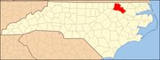 | |
| Towns | ||
| CDPs | ||
| Unincorporated communities | ||
| International | |
|---|---|
| National | |
| Geographic | |