
Rosport-Mompach
This articleneeds additional citations forverification.(May 2018) |
Rosport-Mompach
Rouspert-Mompech(Luxembourgish) | |
|---|---|
 The municipal house of Rosport, former home of Henri Tudor | |
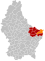
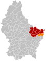
 Map of Luxembourg with Rosport-Mompach highlighted in orange, and the canton in dark red | |
| Coordinates:49°48′N6°30′E/ 49.8°N 6.5°E | |
| Country | |
| Canton | Echternach |
| Area | |
| • Total | 57.07 km2(22.03 sq mi) |
| • Rank | 5thof 100 |
| Highest elevation | 399 m (1,309 ft) |
| • Rank | 51stof 100 |
| Lowest elevation | 141 m (463 ft) |
| • Rank | 5th of 100 |
| Population (2023) | |
| • Total | 3,704 |
| • Rank | 45thof 100 |
| • Density | 65/km2(170/sq mi) |
| • Rank | 28thof 100 |
| Time zone | UTC+1(CET) |
| • Summer (DST) | UTC+2(CEST) |
| LAU 2 | LU0001006 |
| Website | www |
Rosport-Mompach(Luxembourgish:Rouspert-Mompech) is acommune of Luxembourglocated in thecanton of Echternach.
History
[edit]The commune was created on 1 January 2018 with the merging of the communes ofRosportandMompach.[1]
-
-
-
 Rosport-Mompach


Populated places
[edit]The commune consists of the following villages:
|
|
Population
[edit]Graphs are unavailable due to technical issues. There is more info onPhabricatorand onMediaWiki.org. |
Economy
[edit]The commune forms part of the zone d'appellation ofCrémant de Luxembourg.
Thecarbonated waterfactory Sources Rosport SA is located inRosport.
Thecidercompany Ramborn Co. is located in Born.
Residents
[edit]- Henri Tudor(1859–1928), engineer
Notes and references
[edit]- ^Guillaume Chassaing (27 April 2016)."Rosport – Mompach: la fusion" idéale "".www.lequotidien.lu.Retrieved31 March2017.
- ^"Population par canton et commune".statistiques.public.lu.Retrieved11 January2022.
Wikimedia Commons has media related toRosport-Mompach.
Places adjacent to Rosport-Mompach | |
|---|---|
| International | |
|---|---|
| National | |
ThisLuxembourglocation article is astub.You can help Wikipedia byexpanding it. |