Sakishima Beacons

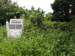
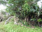
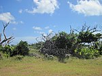
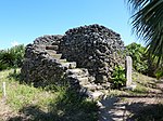
TheSakishima Beacons(Tiên đảo chư đảo hỏa phiên thịnh,Sakishima-shotō hibanmui)are a network of eighteen observation platforms andbeaconsdating to the earlyEdo periodand located in theSakishima Islands,Okinawa Prefecture,Japan. Erected in 1644 by the government of theRyūkyū Kingdomat the instigation of theSatsuma overlords,at a time of international tension during the transition between theMingand theQingDynasties ofChina,the beacons were responsible for monitoring and reporting on maritime traffic, with a view to restricting foreign vessels in accordance with theTokugawapolicy ofsakoku,i.e. national seclusion.[1][2][3]After an initial survey by theCouncil for the Protection of Cultural Propertiesin 1993, due to uncertainties over land rights and difficulties of coordination between the involvedmunicipalities,it was not until 2007 that they were jointlydesignatedanHistoric Site.[2][3][4]
Locations
[edit]There are eight beacons in theMiyako Islandsand ten in theYaeyama Islands.[2]Of those in the Miyako Islands, five are within the city ofMiyakojima(on the islands ofMiyakojima,Ikema,andKurima), and three in the village ofTarama(on the islands ofTaramaandMinna). Of those in the Yaeyama Islands, two are within the city ofIshigaki(on the island ofIshigaki), seven in the town ofTaketomi(on the islands ofTaketomi,Kuroshima,Upper and LowerAragusuku,Hateruma,Kohamajima,andHatoma), and one in the town ofYonaguni(on the island ofYonaguni).[5][6][7][8]
Operations
[edit]Records suggest that the beacon near Cape Hirakubo on Ishigaki was at one point manned by a team of four, who also slept on the site.[7]A different signal may have been given depending upon the origin of the ships.[7]A restaged beacon relay in November 2007 saw an attempt to pass signals along two routes: (1)Hateruma-Aragukusu(Shimoji)-Aragusuku(Kamiji)-Kuroshima-Taketomi-Ishigaki;and (2)Hatoma-Kohamajima-Taketomi-Ishigaki.[9]Along both routes the initial signal could not be seen from the next observation platform, due to rain; after restarting from the second station, both signals were successfully relayed to Ishigaki; in some instances it took up to ten minutes from the signal being observed for a fire to be lit sufficient for the smoke to be seen at the next station; the exercise highlighted the difficulty in transmitting signals by such a method in times of inclement weather and poor visibility.[9][10]
List of beacons
[edit]See also
[edit]References
[edit]- ^"Tiên đảo chư đảo hỏa phiên thịnh"[Sakishima Beacons] (in Japanese).Agency for Cultural Affairs.Archived fromthe originalon 6 November 2012.Retrieved11 June2012.
- ^abc"Tiên đảo chư đảo hỏa phiên thịnh quốc chỉ định sử tích に"[Sakishima Beacons - Designated a National Historic Site].Ryūkyū Shimpō(in Japanese). 11 April 2007. Archived fromthe originalon 7 March 2014.Retrieved9 June2012.
- ^ab"“Hỏa phiên thịnh” quốc の sử tích に3 thị đinh で10カ sở chỉ định "[ "Beacons": Designation of A National Historic Site (with 10 component sites and spanning 3 municipalities)].Yaeyama Mainichi Shimbun(in Japanese). 11 April 2007. Archived fromthe originalon 7 March 2014.Retrieved9 June2012.
- ^"Tiên đảo chư đảo hỏa phiên thịnh"[Sakishima Beacons] (in Japanese).Agency for Cultural Affairs.Retrieved9 June2012.
- ^abcde"Cung cổ đảo の văn hóa tài quốc quan hệ"[Cultural Properties of Miyakojima (National)] (in Japanese).Miyakojima City.Archived fromthe originalon 19 January 2012.Retrieved9 June2012.
- ^"Sử tích ・ văn hóa tài"[Historic Sites - Cultural Properties] (in Japanese).Tarama Village.Retrieved11 June2012.
- ^abc"Hỏa phiên thịnh"[Beacons] (in Japanese).Ishigaki City.Archived fromthe originalon 15 September 2010.Retrieved9 June2012.
- ^abc"Trúc phú đinh の văn hóa tài"[Cultural Properties of Taketomi] (in Japanese).Taketomi Town.Retrieved9 June2012.
- ^ab"Trúc phú đinh nội 7 đảo で “のろし” リレー 350 niên dĩ thượng tiền の tình báo vân đạt を tái hiện "[Beacon Relay across Seven Islands of Taketomi Town: reproducing the signalling method of 350 years ago].Yaeyama Mainichi Shimbun(in Japanese). 9 November 2011. Archived fromthe originalon 3 March 2016.Retrieved9 June2012.
- ^"Lưu cầu vương phủ thời đại の “のろし” を tái hiện - trúc phú đinh の7 đảo と thạch viên で kiểm chứng リレー "[Reproducing the beacons of the Ryukyu royal government across 7 islands of Taketomi and Ishigaki] (in Japanese). Ishigaki Keizai Shimbun. 9 November 2007.Retrieved11 June2012.
- ^"3.3 bắc bộ địa vực"[The Northern Region (p. 75)](PDF)(in Japanese).Ishigaki City.Retrieved9 June2012.[permanent dead link]
- ^"3.4 tây bộ địa vực"[The Western Region (p. 82)](PDF)(in Japanese).Ishigaki City.Retrieved9 June2012.[permanent dead link]
- ^"Tiểu bang đảo"[Kohamajima] (in Japanese).Taketomi Town.Retrieved9 June2012.


