
Samosir
Native name: | |
|---|---|
 Samosir is in the middle of Lake Toba. | |
 Samosir Island | |
| Geography | |
| Location | South East Asia |
| Coordinates | 2°35′N98°49′E/ 2.583°N 98.817°E |
| Area | 630 km2(240 sq mi) |
| Administration | |
Indonesia | |
| Demographics | |
| Population | 108,869[1](2020 Census) |
| Pop. density | 172.8/km2(447.5/sq mi) |
| Ethnic groups | Batak |
Samosir,orSamosir Island,is a largevolcanicisland inLake Toba,located inNorth Sumatra Provinceon the island ofSumatrainIndonesia.Administratively, Samosir Island is governed as six of the nine districts withinSamosir Regency.The lake and island were formed after the eruption ofthe toba supervolcanosome 75,000 years ago.[2]The island was originally a peninsula connected to the surroundingcalderawall by a smallisthmus,which was cut through by theTano Ponggol Canalin 1907 to aid navigation.
At 630 square kilometres (243 sq mi), Samosir is the largestisland within an islandand the fourth largestlake islandin the world.[3]It also contains two smaller lakes,Lake SidihoniandLake Aek Natonang.Across the lake on the east of the island liesthe Uluan Peninsula.The island was historically linked to the mainland of Sumatra on its western part by a narrowisthmusconnecting the town ofPangururanon Samosir andTeleon mainland Sumatra, but it was split by the Tano Ponggol Canal and bridge in 1906, which was widened in 2019.[4]Tele consequently offers one of the best views of Lake Toba and Samosir Island. One of the most important objects on the island is a Lutheran church, and opposite it is a huge hill.
Tourism
[edit]Samosir is a populartourist destinationdue to its exotic history and the vistas it offers. The tourist resorts are concentrated in theTuktukarea. The island is the centre of theBatakculture and many of the Toba Batak traditional houses (rumah adat) remain on the island. Most of the tourist accommodations are concentrated in the small town of Tuktuk, which is located a one-hour ferry ride across the lake from the town ofParapat.The passenger ferry leaves from Tiga Raja harbor every hour between 8.30 and 19.00. For those running late, there is an option to take the passenger boat from Ajibata to Tomok until 8.30 pm. A car ferry leaves the mainland from Ajibata and lands in the small town of Tomok, about a 10-minute drive from Tuktuk until 9 pm. There are also other passenger ferries and individual hotels may also have ferries available.
Gallery
[edit]-
 Samosir Island
 -
 Graves on Samosir Island
 -
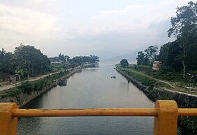 Tano Ponggol Canal
 -
 Sarcophagusin Samosir c. 1916


References
[edit]- ^2020 Census
- ^Toba, Sumatra, IndonesiaArchived2006-06-26 at theWayback MachineVolcanoworld, Accessed June 7, 2006
- ^Island SuperlativesWorld Island Information, Accessed June 7, 2006
- ^"River Canalisation – Tano Ponggol – Oriental Sheet Piling".orientalsheetpiling.com.Retrieved2023-12-23.
| International | |
|---|---|
| National | |