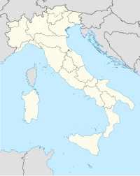
San Pancrazio Airfield
San Pancrazio Airfield  | |
|---|---|
| Coordinates | 40°26′18.50″N017°51′23.69″E/ 40.4384722°N 17.8565806°E |
| Type | Military airfield |
| Site information | |
| Controlled by | United States Army Air Forces |
| Condition | Semi-derelict |
| Site history | |
| Built | 1943 |
| In use | 1943-1945 |
San Pancrazio Airfieldis an abandonedSecond World Warmilitary airfield inItaly,located approximately 4 km northeast ofSan Pancrazio Salentinoin theprovince of BrindisiinApulia,on the south-eastItalycoast. Built in 1943 by United States Army Engineers, the airfield was primarily aFifteenth Air ForceB-24 Liberatorheavy bomber base used in the strategic bombing of Germany. San Pancrazio was also used by tactical aircraft ofTwelfth Air Forcein theItalian Campaign.
Known units assigned to the airfield were:
- 82d Fighter Group,3–10 October 1943,P-38 Lightning,(12AF)
- 340th Bombardment Group,16 October-19 November 1943,B-25 Mitchell,(12AF)
- 376th Bombardment Group,17 November 1943 – 19 April 1945,B-24 Liberator,(15AF)
- 451st Bombardment Group,5 March-6 April 1944,B-24 Liberator,(15AF)
San Pancrazio Airfield is probably the best-preserved American heavy bomber base in Italy. Most of the main runway and taxiways remain, along with numerous dispersal pads. Numerous remains of wartime buildings are also visible. After the war, the airfield may have been used asSan Pancrazio Airport,but today several agricultural buildings are on the main runway. The grass areas of the airfield are used as agricultural fields, but most of the concreted areas remain.
References[edit]
![]() This article incorporatespublic domain materialfrom theAir Force Historical Research Agency
This article incorporatespublic domain materialfrom theAir Force Historical Research Agency
- Maurer, Maurer.Air Force Combat Units of World War II.Maxwell AFB, Alabama: Office of Air Force History, 1983.ISBN0-89201-092-4.
- Maurer, Maurer, ed. (1982) [1969].Combat Squadrons of the Air Force, World War II(PDF)(reprint ed.). Washington, DC: Office of Air Force History.ISBN0-405-12194-6.LCCN70605402.OCLC72556.


