
Satun province
Satun
สตูล | |
|---|---|
| Other transcription(s) | |
| •Kedah Malay | Setoi(Rumi) |
| •Standard Malay | Setul(Rumi) |
| •Southern Thai | สตูล(pronounced[sàʔ.tûːn]) |
 Ko Lipe beach | |
 Flag  Seal | |
| Motto(s): สตูล สงบ สะอาด ธรรมชาติบริสุทธิ์ ( "Satun, Peaceful, Clean, Pure Nature" ) | |
 Map of Thailand highlighting Satun province | |
| Country | Thailand |
| Capital | Satun |
| Government | |
| • Governor | Ekkarat Leesen (since October 2020)[1] |
| Area | |
| • Total | 2,479 km2(957 sq mi) |
| • Rank | Ranked 64th |
| Population (2018)[3] | |
| • Total | 321,574 |
| • Rank | Ranked 69th |
| • Density | 130/km2(300/sq mi) |
| • Rank | Ranked 36th |
| Human Achievement Index | |
| • HAI (2022) | 0.6336 "somewhat low" Ranked 48th |
| GDP | |
| • Total | baht37 billion (US$1.0 billion) (2019) |
| Time zone | UTC+7(ICT) |
| Postal code | 91xxx |
| Calling code | 074 |
| ISO 3166 code | TH-91 |
| Website | www |
Satun(Thai:สตูล,pronounced[sà.tūːn]is one of the southernprovinces(changwat) ofThailand.Neighboring provinces are (from north clockwise)Trang,Phatthalung,andSongkhla.To the south it bordersPerlisofMalaysia.
Toponymy
[edit]The name Satun is aThaiversion of its originalMalayname,Setul(santol,or wild mangosteen tree).Setoiis the name of the province inNorthern Malaydialect.
Geography
[edit]The province is on theMalay Peninsula,on the shore of theAndaman Sea.It is separated from Songkhla province by theNakhon Si Thammarat mountain range,and from Malaysia by theNakawan Range.The total forest area is 1,212 km2(468 sq mi) or 40.1 percent of provincial area.[6]
TheKo TarutaoandKo Phetramarine national parks are part of the province. Close to the border with Malaysia is theThale Ban National Park,a big freshwater swamp area.
The three groups of offshore islands in theAndaman Seaform theKo Sarai(Thai: เกาะสาหร่าย, pronounced [kɔ̀ʔ sǎːràːj]) subdistrict (tambon) of Mueang Satun District. It is composed of 3 island groups, totaling 243 km2in area, had a population of 5,077 as of 2012. The biggest village is Ban Ko Sarai (sometimes called Ban Yaratot Yai), on theisland with the same nameof 13 km2,but the largest islands areKo Tarutao(163 km2) closer to the mainland and theKo Adang-Ko Rawi group (67 km2) further west. The population relies on fishing, agriculture and tourism.
National parks
[edit]There are three national parks, along with seventeen other national parks, make upregion 5 (Nakhon Si Thammarat)of Thailand's protected areas.
- Tarutao National Park,1,490 km2(580 sq mi)[7]: 8
- Mu Ko Phetra National Park,494 km2(191 sq mi)[7]: 49
- Thale Ban National Park,196 km2(76 sq mi)[7]: 20
History
[edit]In 1897 Satun became part ofMonthon Syburi(nowKedah), which in 1909 was divided betweenBritish Empireand Siam as part ofAnglo-Siamese Treaty of 1909.While most of Kedah was ceded to Britain, Satun was awarded to Siam because it had a relatively large Thai population. Satun was then incorporated intoMonthon Phuket.Themonthonsystem was ended in 1933, and Satun province became a first-level subdivision of Thailand. Until 1916 Satun was a smallMalay stateknown asKingdom of Setul Mambang Segara,closely associated to theKedah Sultanate.After that date it was administered by a governor sent fromNakhon Si Thammarat.
The province was to have been the site of the Pak Bara Deep-seaport inLa-ngu District.
Symbols
[edit]Theprovincial sealshowsPhra Samut Thewa(समुद्र देवाSamudra Deva,"God of the ocean" ) sitting on a rock in the sea, with the sunset behind.Phra Samut Thewais a spirit who guards the sea. The rock is his divine vehicle. The sunset symbolizes theAndaman Sea,which lies to the west of the province.
Theprovincial treeis theThai RosewoodorPha-yungklaep(Dalbergia bariensis), and the provincial flower is theSnowy Orchid Tree(Bauhinia acuminata). The province's motto isPeaceful, clean, and pure nature.
Demographics
[edit]LikeNarathiwat,Yala,andPattani,Satun is one of the four provinces of Thailand which have aMuslimmajority: 76.77 percent are Muslim and 23.02 percent are Buddhists.[8]Most of the Muslims are ethnic-Malays,though only 9.9 percent of the present-day population speaksMalayas their mother tongue due to the result of an effectivelanguage shiftfromMalaytoThaiamongst its populace. The majority language in Satun province isSouthern Thai,[9]while the Malay dialect used in Satun is distinctly different fromPatani Malayand is much closer to theKedahdialect of Malay.[9]
Since Satun had belonged to the Kedah Sultanate, which had a strong relationship for many centuries with bothAyutthayaand Siam under theChakri dynasty,its Malay Muslims commonly intermarry with Thai Buddhists without serious religious hesitation. This custom has created a distinct social group known assamsam,meaning a mixed person. Most samsams, if not all, are Muslims.[10]
Unlike the other Muslim majority provinces in Thailand, Satun does not have a history of political confrontation with the central power in Bangkok or of tension with the Buddhist population which makes up the majority of Thailand as a country.[11]Malay Muslims in Satun are substantially assimilated and rarely sympathise withseparatismfrom Thailand, in contrast to the Malay Muslims inPattani,Narathiwat,andYala.[12]
Administrative divisions
[edit]Provincial government
[edit]Satun is divided into seven districts (amphoe). These are further divided into 36 subdistricts (tambon) and 277 villages (muban).
 |
No. | Name | Thai | Malay |
|---|---|---|---|---|
| 1 | Mueang Satun | เมืองสตูล | Mambang (มำบัง,Mambang) | |
| 2 | Khuan Don | ควนโดน | Dusun (ดุสน,Duson) | |
| 3 | Khuan Kalong | ควนกาหลง | Padang Kecil (ปาดังกะจิ,Padang Kachi) | |
| 4 | Tha Phae | ท่าแพ | Berakit (บาราเกต,Baraket) | |
| 5 | La-ngu | ละงู | Laut | |
| 6 | Thung Wa | ทุ่งหว้า | Sungai Upe (สุไหงอุเป,Sungai Upe) | |
| 7 | Manang | มะนัง | ? |
Originally, the province was divided into two districts, Mambang and Thung Wa, and the minor district (king amphoe) La-ngu. Due to the decline of pepper production in Thung Wa District, in 1930 the government made Thung Wa a minordistrictand instead declared La-ngu a district. In 1939 Mambang was renamed to Mueang Satun. Khuan Kalong was split off from Mueang district in 1969, from which in turn Tha Pae was split in 1976 and Manang in 1996. In 1973 Thung Wa regained district status. Khuan Don was established in 1975 by splitting it from Mueang district.
Local government
[edit]As of 26 November 2019 there are:[13]one Satun Provincial Administration Organisation (ongkan borihan suan changwat) and 7 municipal (thesaban) areas in the province. Satun has town (thesaban mueang) status. Further 6 subdistrict municipalities (thesaban tambon). The non-municipal areas are administered by 34 Subdistrict Administrative Organisations - SAO (ongkan borihan suan tambon).[3]
Economy
[edit]According to a Satun Provincial Office spokesman, the province's tourism income rose from two to 6.3 billion baht from 2010 to 2013, while tourist arrivals increased from 690,000 to 1.13 million.[14]
TheDepartment of Airportsannounced in October 2018 that it will conduct a feasibility study of an airport in the province. Six million baht is allocated for the study, to be completed in September 2019.[15]
Transportation
[edit]Satun is connected toLangkawi,Malaysia by direct ferry service.
Human achievement index 2022
[edit]| Health | Education | Employment | Income |
| 28 | 42 | 76 | 58 |
| Housing | Family | Transport | Participation |

|
 |

|

|
| 37 | 73 | 15 | 7 |
| Province Satun, with an HAI 2022 value of 0.6336 is "somewhat low", occupies place 48 in the ranking. | |||
Since 2003, United Nations Development Programme (UNDP) in Thailand has tracked progress on human development at sub-national level using theHuman achievement index(HAI), a composite index covering all the eight key areas of human development. National Economic and Social Development Board (NESDB) has taken over this task since 2017.[4]
| Rank | Classification |
| 1 - 13 | "high" |
| 14 - 29 | "somewhat high" |
| 30 - 45 | "average" |
| 46 - 61 | "somewhat low" |
| 62 - 77 | "low" |
| Map with provinces and HAI 2022 rankings |

|
National parks
[edit]- Mu Ko Phetra National Parkis a marinenational parkin theStrait of MalaccaoffThailand,covering mostly intact coastal line, open water, and about 30 islands of the southern part ofTrang provinceand the northern part of Satun province. Established on 31 December 1984, it is the 49th national park and 14th marine national park of Thailand.


- Thale Ban National Parkis a forested area south of theBanthat Mountainsin southernThailand,in the south of Satun province borderingMalaysia;it borders Taman Negeri Perlis park. The park was established on 27 October 1980. It covers an area of 196 square kilometres (76 square miles) ofKhuan DonandMueang Satundistricts.[16]
- Tarutao National Parkis Thailand's second marine national park on 19 April 1974. The coastalKhao Sam Roi Yot National Parkhad been designated in 1966.
Gallery
[edit]-
 The seashore with a lighthouse and the Moon in the distance, Phante Malaka Bay,Tarutao National Park
 -
 Tarutao National Park
 -
 Tarutao National Park
 -
 Tarutao National Park
 -
 Beach at Night with Moon and Stars inKo Lipe
 -
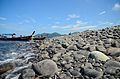
 Ko Lipe


References
[edit]- ^"ประกาศสำนักนายกรัฐมนตรี เรื่อง แต่งตั้งข้าราชการพลเรือนสามัญ"[Announcement of the Prime Minister's Office regarding the appointment of civil servants](PDF).Royal Thai Government Gazette.137(Special 238 Ngor). 2. 9 October 2020. Archived fromthe original(PDF)on 13 April 2021.Retrieved13 April2021.
- ^Advancing Human Development through the ASEAN Community, Thailand Human Development Report 2014, table 0:Basic Data(PDF)(Report). United Nations Development Programme (UNDP) Thailand. pp. 134–135.ISBN978-974-680-368-7.Retrieved17 January2016,Data has been supplied by Land Development Department, Ministry of Agriculture and Cooperatives, at Wayback Machine.
{{cite report}}:CS1 maint: postscript (link)[dead link] - ^ab"รายงานสถิติจำนวนประชากรและบ้านประจำปี พ.ศ.2561"[Statistics, population and house statistics for the year 2018]. Registration Office Department of the Interior, Ministry of the Interior (in Thai). 31 December 2018.Retrieved20 June2019.
- ^ab"ข้อมูลสถิติดัชนีความก้าวหน้าของคน ปี 2565 (PDF)"[Human Achievement Index Databook year 2022 (PDF)]. Office of the National Economic and Social Development Council (NESDC) (in Thai).Retrieved12 March2024,page 72
{{cite web}}:CS1 maint: postscript (link) - ^"Gross Regional and Provincial Product, 2019 Edition".<>.Office of the National Economic and Social Development Council (NESDC). July 2019.ISSN1686-0799.Retrieved22 January2020.
- ^"ตารางที่ 2 พี้นที่ป่าไม้ แยกรายจังหวัด พ.ศ.2562"[Table 2 Forest area Separate province year 2019]. Royal Forest Department (in Thai). 2019.Retrieved6 April2021,information, Forest statistics Year 2019
{{cite web}}:CS1 maint: postscript (link) - ^abc "ข้อมูลพื้นที่อุทยานแห่งชาติ ที่ประกาศในราชกิจจานุบกษา 133 แห่ง"[National Park Area Information published in the 133 Government Gazettes]. Department of National Parks, Wildlife and Plant Conservation (in Thai). December 2020.Retrieved1 November2022.
- ^ab"ข้อมูลทั่วไปจังหวัดสตูล".Satun province.Retrieved20 March2020.
- ^abInstitute of South East Asian Studies (1988).The South East Asian Review.Institute of South East Asian Studies. p. 15.
- ^Andrew D.W. Forbes(1988).The Muslims of Thailand.Soma Prakasan. p. 12.ISBN974-9553-75-6.
- ^Yegar, M.; Schwartz, I.M. (2002).Between Integration and Secession: The Muslim Communities of the Southern Philippines, Southern Thailand, and Western Burma/Myanmar.Lexington Books. p. 79.ISBN9780739103562.Retrieved10 January2021.
- ^Parks, Thomas I. (1 March 2009)."Maintaining peace in a neighbourhood torn by separatism: the case of Satun province in southern Thailand".Small Wars & Insurgencies.20(1): 185–202.doi:10.1080/09592310802573632.ISSN0959-2318.
- ^"Number of local government organizations by province".dla.go.th.Department of Local Administration (DLA). 26 November 2019.Retrieved10 December2019.
58 Satun: 1 PAO, 1 Town mun., 6 Subdistrict mun., 34 SAO.
- ^Wangkiat, Paritta (25 April 2015)."Satun residents stage more port protests".Bangkok Post.Retrieved26 April2015.
- ^"Satun Airport coming?".Bangkok Post.No. Life, Travel. 11 October 2018. p. 4.
- ^"Thale Ban National Park".Department of National Parks (DNP) Thailand.Archived fromthe originalon 23 September 2015.Retrieved8 August2015.
External links
[edit] Satuntravel guide from Wikivoyage
- Website of the provinceArchived24 July 2012 at theWayback Machine
Places adjacent to Satun province | |
|---|---|
| International | |
|---|---|
| National | |
| Other | |