Scharteberg
Appearance
This articlerelies largely or entirely on asingle source.(September 2024) |
| Scharteberg | |
|---|---|
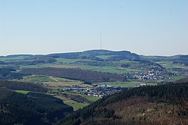
 View of the Scharteberg from the Mäuseberg | |
| Highest point | |
| Elevation | 691.4 m(2,268 ft)[1] |
| Coordinates | 50°13′04″N6°45′10″E/ 50.2179°N 6.7528°E |
| Geography | |
| Parent range | Eifel |
TheSchartebergis a mountain, 691.4 metres (2,268 ft) high,[1]nearKirchweilerin the district ofVulkaneifeland is one of the highest peaks in theEifelregion of Germany. On the summit is theEifel Transmitterwhich belongs toSWRand is used forFM radioandtelevision.
References
[edit]

