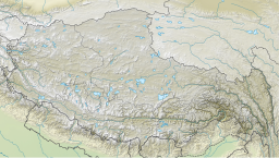
Siling Lake
| Siling Lake / Selincuo | |
|---|---|
 | |
| Location | Nagqu Prefecture, Tibet,China |
| Coordinates | 31°50′N89°00′E/ 31.833°N 89.000°E |
| Basincountries | China |
| Surface area | 1,865 km2(720 sq mi) |
| Surface elevation | 4,530 metres (14,860 ft) |
| Official name | Tibet Selincuo Wetlands |
| Designated | 8 January 2018 |
| Reference no. | 2352[1] |
Siling Lake(Tibetan:སེར་གླིང་མཚོ,Wylie:ser gling mtsho,ZYPY:Sêling Co;Chinese:Sắc lâm thác;pinyin:Sèlín cuò), (also known as Qilin or Selincuo) is asalt lakein theTibet Autonomous Region,China to the north ofXainza.Doijiangis located near the lake. Administratively it belongs toXainza CountyandBaingoin Countyof theNagqu.
Bangecuois another nearby salt lake[2]located east of Siling Lake,[3]around four miles away.
Overview[edit]
The lake lies at an altitude of 4,530 metres (14,860 ft). It is a salt lake. It is fed by the riversZa'gya Zangbo(or Tsagya Tsangpo) ( trát gia tàng bố ) and the Boques Tsangpo ( ba khúc tàng bố ). With an area of 1,865 km2(720 sq mi), Siling Co is the second largest saltwater lake in the northernTibetan Plateauand forms part of theSiling Co National Nature Reserve(also Selincuo Reserve or Xainza Nature Reserve). The 400,000-hectare (990,000-acre) reserve was established in 1993 and contains significant populations ofblack-necked cranesand some 120 species of birds in total.[4][5]The lake only has a single species of fish,Gymnocypris selincuoensis,exploited by fishermen.[citation needed]The prairie on the banks of the lake is traditionally used as grazing land for yaks and sheep.
The temperature at the lake is an annual average of −3 to −0.6 °C (26.6 to 30.9 °F), the maximum annual temperature 9.4 °C (48.9 °F). The average rainfall is 290 mm (11 in) per year, 90 percent of which falls in the months of June to September, often in the summer as hail.
Climate[edit]
| Climate data for Siling Lake | |||||||||||||
|---|---|---|---|---|---|---|---|---|---|---|---|---|---|
| Month | Jan | Feb | Mar | Apr | May | Jun | Jul | Aug | Sep | Oct | Nov | Dec | Year |
| Mean daily maximum °C (°F) | −4.7 (23.5) |
−2.7 (27.1) |
1.2 (34.2) |
5.7 (42.3) |
10.1 (50.2) |
14.8 (58.6) |
15.7 (60.3) |
14.5 (58.1) |
12.4 (54.3) |
6.2 (43.2) |
0.0 (32.0) |
−3.2 (26.2) |
5.8 (42.5) |
| Daily mean °C (°F) | −11.9 (10.6) |
−9.8 (14.4) |
−5.9 (21.4) |
−1.3 (29.7) |
3.1 (37.6) |
7.9 (46.2) |
9.6 (49.3) |
8.7 (47.7) |
6.3 (43.3) |
−0.3 (31.5) |
−7.0 (19.4) |
−10.4 (13.3) |
−0.9 (30.4) |
| Mean daily minimum °C (°F) | −19.0 (−2.2) |
−16.8 (1.8) |
−12.9 (8.8) |
−8.2 (17.2) |
−3.8 (25.2) |
1.1 (34.0) |
3.5 (38.3) |
3.0 (37.4) |
0.2 (32.4) |
−6.7 (19.9) |
−14.0 (6.8) |
−17.6 (0.3) |
−7.6 (18.3) |
| Averageprecipitationmm (inches) | 2 (0.1) |
2 (0.1) |
2 (0.1) |
5 (0.2) |
13 (0.5) |
39 (1.5) |
78 (3.1) |
74 (2.9) |
39 (1.5) |
7 (0.3) |
1 (0.0) |
1 (0.0) |
263 (10.3) |
| Source:Climate-Data.org | |||||||||||||
See also[edit]
References[edit]
- ^"Tibet Selincuo Wetlands".RamsarSites Information Service.Retrieved25 April2018.
- ^Meng, Kai and Shi, Xuhua and Wang, Erchie (February 2011)."High-altitude salt lake elevation changes and glacial ablation in Central Tibet, 2000–2010".Chinese Science Bulletin.57(5): 525–534.doi:10.1007/s11434-011-4849-5.S2CID53638685.
{{cite journal}}:CS1 maint: multiple names: authors list (link) - ^Doin, Marie-Pierre; Twardzik, Cédric; Ducret, Gabriel; Lasserre, Cécile; Guillaso, Stéphane; Jianbao, Sun (2015)."InSAR measurement of the deformation around Siling Co Lake: Inferences on the lower crust viscosity in central Tibet".Journal of Geophysical Research: Solid Earth.120(7). American Geophysical Union (AGU): 5290–5310.Bibcode:2015JGRB..120.5290D.doi:10.1002/2014jb011768.ISSN2169-9313.S2CID128466292.
- ^Zheng, Du; Zhang, Qingsong; Wu, Shaohong (2000).Mountain geoecology and sustainable development of the Tibetan Plateau.Springer. p. 238.ISBN978-0-7923-6688-1.Retrieved31 March2012.
- ^An tài đán (1 January 2003).Tibet China: Travel Guide.Ngũ châu truyện bá xuất bản xã. p. 44.ISBN978-7-5085-0374-5.Retrieved31 March2012.


