
Sonoran Desert
| Sonoran Desert | |
|---|---|
 | |
 Sonoran desert | |
| Ecology | |
| Realm | Nearctic |
| Biome | Deserts and xeric shrublands |
| Borders | List
|
| Bird species | 246[1] |
| Mammal species | 120[1] |
| Geography | |
| Area | 222,998 km2(86,100 sq mi) |
| Countries | |
| States | |
| Coordinates | 32°15′N112°55′W/ 32.250°N 112.917°W |
| Rivers | Colorado River |
| Climate type | Hot desert(BWh) |
| Conservation | |
| Conservation status | Relatively Stable/Intact[2] |
| Habitat loss | 10.5%[1] |
| Protected | 39%[1] |
TheSonoran Desert(Spanish:Desierto de Sonora) is a hotdesertinNorth Americaandecoregionthat covers the northwestern Mexican states ofSonora,Baja California,andBaja California Sur,as well as part of thesouthwestern United States(inArizonaandCalifornia). It is the hottest desert in both Mexico and the United States.[3]It has an area of 260,000 square kilometers (100,000 sq mi).
Inphytogeography,the Sonoran Desert is within the SonoranFloristic Provinceof theMadrean Regionof southwestern North America, part of theHolarctic realmof the northernWestern Hemisphere.The desert contains a variety of uniqueendemicplantsandanimals,notably, thesaguaro(Carnegiea gigantea) andorgan pipe cactus(Stenocereus thurberi).
The Sonoran Desert is clearly distinct from nearby deserts (e.g., theGreat Basin,Mojave,andChihuahuan deserts) because it provides subtropical warmth in winter and two seasons of rainfall (in contrast, for example, to the Mojave's dry summers and cold winters). This creates an extreme contrast between aridity and moisture.[4]
Location
[edit]The Sonoran desert wraps around the northern end of theGulf of California,fromBaja California Sur(El Vizcaíno Biosphere Reservein central and Pacific west coast, Central Gulf Coast subregion on east to southern tip), north through much ofBaja California,excluding the central northwest mountains and Pacific west coast, through southeastern California and southwestern and southern Arizona to western and central parts ofSonora.[5]
It is bounded on the west by thePeninsular Ranges,which separate it from theCalifornia chaparral and woodlands(northwest) andBaja California desert(Vizcaíno subregion, central and southeast) ecoregions of the Pacific slope. TheGulf of California xeric scrubecoregion lies south of the Sonoran desert on the Gulf of California slope of the Baja California Peninsula.
To the north in California and northwest Arizona, the Sonoran Desert transitions to the colder-winter, higher-elevationMojave,Great Basin,andColorado Plateaudeserts.
TheconiferousArizona Mountains forestsare to the northeast. TheChihuahuan DesertandSierra Madre Occidental pine–oak forestsare at higher elevations to the east. To the south theSonoran–Sinaloan transition subtropical dry forestis the transition zone from the Sonoran Desert to thetropical dry forestsof the Mexican state ofSinaloa.[5]
Sub-regions
[edit]The desert's sub-regions include theColorado Desertof southeastern California; and theYuma Deserteast of the north-to-south section of theColorado Riverin southwest Arizona. In the 1957 publicationVegetation of the Sonoran Desert,Forrest Shreve divided the Sonoran Desert into seven regions according to characteristic vegetation: Lower Colorado Valley, Arizona Upland, Plains of Sonora, Foothills of Sonora, Central Gulf Coast, Vizcaíno Region, and Magdalena Region.[6]Many ecologists consider Shreve's Vizcaíno and Magdalena regions, which lie on the western side of theBaja California Peninsula,to be a separateecoregion,theBaja California desert.
Within the southern Sonoran Desert in Mexico is found theGran Desierto de Altar,with theEl Pinacate y Gran Desierto de Altar Biosphere Reserve,encompassing 2,000 square kilometres (770 sq mi) of desert and mountainous regions.[7]The biosphere reserve includes the only activeergdune region in North America. The nearest city to the biosphere reserve isPuerto Peñasco('Rocky Point') in the state ofSonora,Mexico.
- Sub-regions
Sonoran Desert sub-regions include:
Climate
[edit]The Sonoran desert has anaridsubtropicalclimateand is considered to be the mosttropicaldesert inNorth America.[8]In the lower-elevation portions of the desert, temperatures are warm year-round, andrainfallis infrequent and irregular, often less than 90 mm (approx. 3.5 ") annually. TheArizonauplands are also warm year-round, but they receive 100–300 mm (approx. 4–12 ") of average annual rainfall, which falls in a more regular bi-seasonal pattern.[2]
According to theKöppen climate classificationsystem, the majority of the Sonoran Desert has aHot desert climate(BWh).Hot semi-arid climate(BSh) exists on some of the higher elevation mountains within the desert, as well as in a continuous swath on the eastern and northeastern fringes as elevations gradually rise toward theMadrean Sky Islandsin the east and theMogollon Rimin the northeast. There are also a few small areas ofCold semi-arid climate(BSk) and evenHot-summer Mediterranean climate( "Csa" ) on only the highest mountain peaks within the region.
| Climate data for 7 WNW Sundad, AZ, Elevation 945 ft (288 m), 1991–2020 normals, extremes 1981-2022 | |||||||||||||
|---|---|---|---|---|---|---|---|---|---|---|---|---|---|
| Month | Jan | Feb | Mar | Apr | May | Jun | Jul | Aug | Sep | Oct | Nov | Dec | Year |
| Record high °F (°C) | 82.1 (27.8) |
90.7 (32.6) |
98.8 (37.1) |
103.6 (39.8) |
111.5 (44.2) |
117.6 (47.6) |
120.6 (49.2) |
116.2 (46.8) |
114.1 (45.6) |
105.4 (40.8) |
96.6 (35.9) |
83.7 (28.7) |
120.6 (49.2) |
| Mean daily maximum °F (°C) | 68.0 (20.0) |
71.4 (21.9) |
78.4 (25.8) |
85.7 (29.8) |
94.0 (34.4) |
103.2 (39.6) |
106.5 (41.4) |
105.4 (40.8) |
100.4 (38.0) |
89.8 (32.1) |
77.0 (25.0) |
66.6 (19.2) |
87.3 (30.7) |
| Mean daily minimum °F (°C) | 39.0 (3.9) |
42.0 (5.6) |
47.3 (8.5) |
52.6 (11.4) |
60.5 (15.8) |
69.2 (20.7) |
77.8 (25.4) |
78.0 (25.6) |
70.5 (21.4) |
57.4 (14.1) |
45.3 (7.4) |
37.8 (3.2) |
56.5 (13.6) |
| Record low °F (°C) | 18.1 (−7.7) |
24.3 (−4.3) |
29.0 (−1.7) |
38.1 (3.4) |
44.3 (6.8) |
52.8 (11.6) |
62.4 (16.9) |
64.5 (18.1) |
51.2 (10.7) |
36.5 (2.5) |
25.8 (−3.4) |
19.9 (−6.7) |
18.1 (−7.7) |
| Averageprecipitationinches (mm) | 0.74 (19) |
0.71 (18) |
0.55 (14) |
0.13 (3.3) |
0.08 (2.0) |
0.03 (0.76) |
0.68 (17) |
0.78 (20) |
0.52 (13) |
0.39 (9.9) |
0.43 (11) |
0.62 (16) |
5.64 (143) |
| Average snowfall inches (cm) | 0.0 (0.0) |
0.0 (0.0) |
0.0 (0.0) |
0.0 (0.0) |
0.0 (0.0) |
0.0 (0.0) |
0.0 (0.0) |
0.0 (0.0) |
0.0 (0.0) |
0.0 (0.0) |
0.0 (0.0) |
0.0 (0.0) |
0.0 (0.0) |
| Averagerelative humidity(%) | 40.6 | 37.7 | 31.9 | 23.1 | 20.4 | 17.5 | 27.4 | 32.0 | 30.6 | 28.1 | 32.1 | 40.5 | 30.1 |
| Averagedew point°F (°C) | 30.1 (−1.1) |
31.2 (−0.4) |
32.4 (0.2) |
29.8 (−1.2) |
33.5 (0.8) |
37.0 (2.8) |
53.8 (12.1) |
57.7 (14.3) |
51.0 (10.6) |
38.6 (3.7) |
31.2 (−0.4) |
28.9 (−1.7) |
38.0 (3.3) |
| Source: PRISM[9] | |||||||||||||
Flora
[edit]
Many plants not only survive, but thrive in the harsh conditions of the Sonoran Desert. Many have evolved specialized adaptations to the desert climate. The Sonoran Desert's bi-seasonal rainfall pattern results in more plant species than any other desert in the world.[2]The Sonoran Desert includes plant genera and species from theagavefamily,palmfamily,cactusfamily,legumefamily, and numerous others. Many of these adaptations occur in food crops.Mission Gardenis a living agricultural museum that showcases foods that have been grown in the Sonoran Desert for over 4000 years.
The Sonoran is the only place in the world where the famoussaguaro cactus(Carnegiea gigantea) grows in the wild.[10]Cholla(Cylindropuntiaspp.),beavertail(Opuntia basilaris),hedgehog(Echinocereusspp.),fishhook(Ferocactus wislizeni),prickly pear(Opuntiaspp.),nightblooming cereus(Peniocereusspp.), andorgan pipe(Stenocereus thurberi) are other taxa of cacti found here. Cacti provide food and homes to many desert mammals and birds, with showy flowers in reds, pinks, yellows, and whites, blooming most commonly from late March through June, depending on the species and seasonal temperatures.
Creosote bush(Larrea tridentata) andbur sage(Ambrosia dumosa) dominate valley floors.Indigo bush(Psorothamnus fremontii) andMormon teaare other shrubs that may be found.Wildflowers of the Sonoran Desertincludedesert sand verbena(Abronia villosa),desert sunflower(Geraea canescens), andevening primroses.

Ascending from the valley upbajadas,various subtrees such asvelvet mesquite(Prosopis velutina),palo verde(Parkinsonia florida),desert ironwood(Olneya tesota),desert willow(Chilopsis linearisssp.arcuata), andcrucifixion thorn(Canotia holacantha) are common, as well as multi-stemmedocotillo(Fouquieria splendens). Shrubs found at higher elevations includewhitethorn acacia(Acacia constricta), fairy duster, andjojoba.In the desert subdivisions found on Baja California, cardon cactus, elephant tree, andboojum treeoccur.[11]

TheCalifornia fan palm(Washingtonia filifera) is found in theColorado Desertsection of the Sonoran Desert, the onlynativepalm in California, among many other introducedArecaceaegenera and species. It is found atspring-fedoases,such as inAnza Borrego Desert State Park,Joshua Tree National Park,and theKofa National Wildlife Refuge.[12]
Fauna
[edit]The Sonoran Desert is home to a wide variety of fauna that have adapted and thrive in the hot, arid desert environment, such as theGila monster,bobcat,mule deer,antelope jackrabbit,burrowing owl,greater roadrunner,western diamondback rattlesnake,andelf owl.There are 350 bird species, 20 amphibian species, over 100 reptile species, 30 native fish species, and over 1000 native bee species found in the Sonoran.[13]The Sonoran Desert area southeast ofTucsonand near the Mexican border is vital habitat for the only population ofjaguarsliving within the United States.[14]TheColorado River Deltawas once an ecological hotspot within the Sonoran desert due to the Colorado river in this otherwise dry area, but the delta has been greatly reduced in extent due to damming and use of the river upstream. Species that have higher heat tolerance are able to thrive in the conditions of the Sonoran Desert. One such insect species that has evolved a means to thrive in this environment isDrosophila mettleri,a Sonoran Desert fly. This fly contains a specializedP450detoxification system that enables it to nest in the cool region of exudate moistened soil. Thus, the fly is one of few that can tolerate the high desert temperatures and successfully reproduce.
-
 Crotalus cerastesinPuerto Peñasco,Mexico
 -
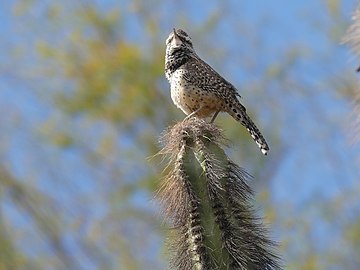 Campylorhynchus brunneicapillusinPhoenix,United States
 -
 Haemorhous mexicanusinMaricopa County,United States
 -
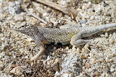 Callisaurus draconoidesinLos Cabos,Mexico
 -
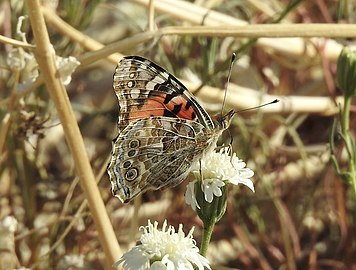 Vanessa carduiinRiverside County,United States
 -
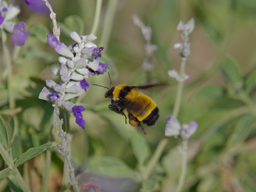 Bombus sonorusinPhoenix,United States


Human population
[edit]The Sonoran Desert is home to the cultures of over 17 contemporaryNative Americantribes, with settlements atAmerican Indian reservations in CaliforniaandArizona,as well as populations in Mexico.
The largest city in the Sonoran Desert isPhoenix, Arizona,with a 2017 metropolitan population of about 4.7 million.[15]Located on theSalt Riverin central Arizona, it is one of the fastest-growingmetropolitan areasin the United States. In 2007 in the Phoenix area, desert was losing ground tourban sprawlat a rate of approximately 4,000 square meters (1 acre) per hour.[16]
The next largest cities areTucson,in southern Arizona, with a metro area population of just over 1 million,[17]andMexicali,Baja California,with a similarly sized metropolitan population of around 1,000,000. The metropolitan area ofHermosillo,Sonora,has a population close to 900,000.Ciudad Obregón,Sonora,in the southern part of the desert, has a population of 375,800.[18]
California
[edit]TheCoachella Valley,located in theColorado Desertsection of the Sonoran Desert, has a population of 365,000. Several famousSouthern Californiadesert resort cities such asPalm SpringsandPalm Desertare located here.

During the winter months, from November to April, the daytime temperatures in the Coachella Valley range from 70 °F (21 °C) to 90 °F (32 °C) and corresponding nighttime lows range from 46 °F (8 °C) to 68 °F (20 °C) making it a popular winter resort destination. Due to its warm year-round climatecitrusand subtropical fruits such as mangoes, figs, and dates are grown in the Coachella Valley and adjacentImperial Valley.The Imperial Valley has a total population of over 180,000 and has a similar climate to that of the Coachella Valley. Other cities includeBorrego Springs,Indio,Coachella,Calexico,El Centro,Imperial,andBlythe.
United States–Mexico border region
[edit]Straddling theMexico–United States border,the Sonoran desert is an important migration corridor for humans and animals. The harsh climate conditions and border militarism mean that the journey can be perilous, usually moving at night to minimize exposure to the heat.[19]
Protected areas
[edit]
There are many National Parks and Monuments; federal and statenature reservesandwildlife refuges;state, county, and city parks; and government or nonprofit group operatednatural history museums,science research institutes, andbotanical gardensand desert landscapegardens.
- Sonoran Desert protected areas include
- Arizona–Sonora Desert Museum
- Sonoran Desert National Monument[20]
- Boyce Thompson Arboretum State Park–Sonoran Desert flora arboretum
- Anza–Borrego Desert State Park
- Organ Pipe Cactus National Monument
- Saguaro National Park
- Joshua Tree National Park
- Reserva de la Biosfera el Pinacate y Gran Desierto de Altar–Pinacate National Park, in Sonora, Mexico
- Indio Hills Palms State Reserve
- Coachella Valley National Wildlife Refuge
- Cabeza Prieta National Wildlife Refuge
- Kofa National Wildlife Refuge
- South Mountain Park
- Sonoran Arthropod Studies Institute
- Skyline Regional Park
See also
[edit]References
[edit]- ^abcd"The Atlas of Global Conservation".maps.tnc.org.Retrieved2020-11-16.
- ^abc"Sonoran desert".Terrestrial Ecoregions.World Wildlife Fund.Retrieved2020-11-16.
- ^"The hottest surface temperatures on earth".American Meteorological Society. 21 May 2021.Retrieved12 March2023.
- ^A Delicate Balance.National Park Service. 15 November 2020.Retrieved6 December2020.
- ^ab"Arizona-Sonora Desert Museum, Tucson, AZ – Zoo, Botanical Garden and Art Gallery".www.desertmuseum.org.Retrieved15 April2018.
- ^"Sonoran Desert: An Overview of the Sonoran Desert by William G. McGinnies".21 January 2003. Archived fromthe originalon 21 January 2003.Retrieved15 April2018.
- ^"Pinacate Rocky Point Puerto Peñasco Sonora Mexico".Archived fromthe originalon 2011-02-02.Retrieved2010-03-02.
- ^Fleming, Theodore H.; Valiente-Banuet, Alfonso (2021-11-30).Columnar Cacti and Their Mutualists: Evolution, Ecology, and Conservation.University of Arizona Press.ISBN978-0-8165-4742-5.
- ^"PRISM".RetrievedAugust 15,2023.
- ^"The Saguaro Cactus"(PDF).nps.gov.Retrieved15 April2018.
- ^MacMahon, J. A.Deserts.1986, 638 pages
- ^Hogan, C. M. 2009.California Fan Palm:Washingtonia filifera,GlobalTwitcher.com, ed. N. StrombergArchived2009-09-30 at theWayback Machine
- ^Surviving the SonoranArchived2010-04-30 at theWayback Machine
- ^The Jaguar in the Borderlands of Arizona, New Mexico and Northern Mexico: Conservation – Threats & StrategiesArchived2009-03-30 at theWayback Machine
- ^"U.S. Census website".United States Census Bureau.Retrieved2019-01-31.
- ^Make No Small Plans,Adelheid Fischer,ASU Researchmagazine. Accessed on line October 15, 2007
- ^Table 1: Annual Estimates of the Population of Metropolitan and Micropolitan Statistical Areas: April 1, 2000 to July 1, 2006 (CBSA-EST2006-01)ArchivedSeptember 14, 2007, at theWayback Machine,United States Census Bureau,2007-04-05. Accessed 2007-09-11
- ^"Población en municipios de zonas metropolitanas".SEMARNAT.2015.
- ^Arizona: Naming the dead from the desert,BBC News, 17 January 2013
- ^TheSonoran Desert National Monumentwas created in 2001 in Arizona, to enhance protection of the unique resources of the Sonoran Desert, with 2,008 square kilometers (496,000 acres).
:Reference:Sonoran Desert National MonumentArchived2009-01-26 at theWayback Machine,Bureau of Land Management, U. S. Department of the Interior. Accessed on line June 17, 2009.
External links
[edit] Mediafrom Commons
 Travel informationfrom Wikivoyage
- Arizona–Sonora Desert Museum
- Timeline of the Sonoran desert
- An Overview of the Sonoran Desert,by William G. McGinnies
- The Sonoran Desert Naturalist
- Very short overview of Sonoran Desert Geology
- Sonoran Desert images at bioimages.vanderbilt.edu(slow modem version)
- International Sonoran Desert Alliance
- Sounds of the Sonoran Desert)
Parks and recreation areas
[edit]- Sonoran Desert National Monument: official website
- Saguaro National Park: official website
- Anza–Borrego Desert State: official website
- Organ Pipe Cactus National Monument: official website
- Joshua Tree National Park: official website
- South Mountain Park – Preserve
- Arizona State Parks: official website (desert plants)
Colorado Riversystem | |||||||||
|---|---|---|---|---|---|---|---|---|---|
| Jurisdictions |
|     | |||||||
| Canyons |
| ||||||||
| Natural features |
| ||||||||
| Tributaries | |||||||||
| Engineering |
| ||||||||
| Designated areas | |||||||||
| Related topics | |||||||||
| International | |
|---|---|
| National | |
| Other | |
- Sonoran Desert
- Basin and Range Province
- Deserts and xeric shrublands in the United States
- Deserts and xeric shrublands
- Deserts of Arizona
- Deserts of California
- Deserts of Mexico
- Deserts of North America
- Deserts of the Lower Colorado River Valley
- Ecoregions of Mexico
- Ecoregions of the United States
- Floristic provinces
- Geography of Southern California
- Geologic provinces of California
- Gulf of California
- Madrean Region
- Physiographic sections
- Physiographic regions of Mexico
- Physiographic regions of the United States
- Regions of the Western United States
- Nearctic ecoregions