
Tainan
Tainan City
Đài nam thị[I] Tâi-lâm | |
|---|---|
 Clockwise from top: Downtown Tainan, statue ofYoichi Hatta,THSR Tainan Station,danzai noodles,Fort Provintia,beehive firework inYanshuei | |
 Flag Logo | |
| Etymology:pinyin:Táinán;lit.'Taiwan south' | |
| Nickname(s): | |
 | |
 | |
| Country | |
| Formed underFort Zeelandia | 1624 |
| Capital ofKingdom of Tungning | 1661 |
| Tainan Prefecture | 1895 |
| Provincial citystatus | 25 October 1945 |
| Upgraded to special municipality and merger withTainan County | 25 December 2010 |
| Seat | Anping,Xinying[2] |
| Districts | |
| Government | |
| • Body | |
| •Mayor | Huang Wei-cher(DPP) |
| Area | |
| •Special municipality | 2,191.65 km2(846.20 sq mi) |
| • Urban | 259 km2(100 sq mi) |
| • Rank | 7 out of 22 |
| Population (March 2023)[5] | |
| •Special municipality | 1,856,642 |
| • Rank | 6 of 22 |
| • Density | 850/km2(2,200/sq mi) |
| •Urban | 1,205,000 |
| • Urban density | 4,700/km2(12,000/sq mi) |
| Time zone | UTC+8(National Standard Time) |
| Postal code | 700–745 |
| Area code | (0)6 |
| ISO 3166 code | TW-TNN |
| Bird | Pheasant-tailed jacana |
| Flower | Phalaenopsis |
| Tree | Delonix regia |
| Website | www |
| Tainan City | |||||||||||||||||||||||||||||
|---|---|---|---|---|---|---|---|---|---|---|---|---|---|---|---|---|---|---|---|---|---|---|---|---|---|---|---|---|---|
| Chinese name | |||||||||||||||||||||||||||||
| Traditional Chinese | Đài namThị | ||||||||||||||||||||||||||||
| Simplified Chinese | Đài namThị | ||||||||||||||||||||||||||||
| |||||||||||||||||||||||||||||
| Japanese name | |||||||||||||||||||||||||||||
| Hiragana | たいなんし | ||||||||||||||||||||||||||||
| Katakana | タイナンシ | ||||||||||||||||||||||||||||
| Kyūjitai | Đài nam thị | ||||||||||||||||||||||||||||
| Shinjitai | Đài nam thị | ||||||||||||||||||||||||||||
| |||||||||||||||||||||||||||||
Tainan(/ˈtaɪˈnɑːn/),[7]officiallyTainan City,[I]is aspecial municipalityin southernTaiwanfacing theTaiwan Straiton its western coast. Tainan is the oldest city on the island and commonly called the "prefecturalcapital "[II]for its over 260 years of history as the capital of Taiwan under theDutch rule,theKingdom of Tungningand laterQing dynasty ruleuntil 1887. Tainan's complex history of comebacks, redefinitions and renewals inspired its popular nickname "the Phoenix City".[8]Tainan is classified as a "Sufficiency" -levelglobal cityby theGlobalization and World Cities Research Network.[9]
As Taiwan's oldesturban areawith 400 years history, Tainan was initially established by theDutch East India Company(VOC) as a ruling and trading base calledFort Zeelandiaduringthe Dutch colonial rule on the island.AfterKoxingaseized the Dutch fortin 1662, Tainan remained as the capital of theTungning Kingdomruled byHouse of Koxingauntil 1683 and afterwards the capital ofTaiwan Prefectureunder theQing dynastyuntil 1887, when the new provincial capital was first moved to present-dayTaichung,and then toTaipeieventually. Following thecession of Taiwan,Tainan became the second capital of the short-livedRepublic of Formosafrom June to October in 1895 until theCapitulation of Tainanby the invading forces ofJapanese empire.UnderJapanese rule,the city was the seat ofTainan Prefecture.After thesurrender of Japanin World War II, theRepublic of Chinatook control of Taiwan in 1945 and reorganized the city as aprovincial cityinTaiwan Province;a role that would remain in place until 2010 when the city was merged with nearbyTainan Countyinto a new special municipality.
Tainan has been historically regarded as one of the oldest cities in Taiwan, and its former name, Tayouan, has been claimed to be the origin of the name "Taiwan". It is also one of Taiwan's cultural capitals, for its rich folk cultures including the famouslocal street food and traditional cuisine,extensively preservedTaoistrites and other living local traditions covering everything from child birth to funerals. The city houses the firstConfucian school–templein Taiwan, built in 1665,[10]the remains of the Eastern and Southern gates of the old city, and countless other historical monuments. Tainan claims moreBuddhistand Taoist temples than any other city in Taiwan.
History[edit]
Early history[edit]
Archaeological excavations inZuojhen Districtsuggest that the Tainan region has been inhabited for at least 20,000 to 31,000 years. The indigenousSirayatribe dominated the region by the 16th century. The Sakam people of the Sinkan sub-tribe inhabited the area of the present-day city.[11]Other Sirayan sub-tribes, including the Soelangh, Mattauw and Baccloangh inhabited the surrounding area.
By the late 16th century, Chinese merchants and fishermen had set up several bases along the west coast of the island, including a sandbar across theTaikang Inner Sea(Chinese:Đài giang nội hải;Pe̍h-ōe-jī:Tâi-kang lāi-hái) off the bay of Sakam village (modern-dayFort Provintia). The Chinese adoptedTaioan(modern-dayAnping) as the name of the sandbar.[11][12][13]Slightly north ofTaioan,along the shoreline nearBassemboy(Bắc tuyến vĩ;Pak-siàn-bóe), Japanese traders established bases for trade with China.[12]The early Chinese and Japanese also traded with the Sirayan people. Salt and food was exchanged for deer hides and dried deer meat. The Siraya people were influenced by both Chinese and Japanese cultures and lifestyles. They started to use Chinese words in their language, use Japanesetantōin ritual events, and also migrated inland due to the influx of newcomers. By the time the Europeans arrived, the influence of Chinese and Japanese traders and fishermen was already prominent.[12][14]
Dutch colony[edit]


Early Dutch colonists had attempted but failed to controlMacauand thePenghu islands.In July 1622, theDutch East India Companytextile merchantCornelis Reyerszsailed to Taiwan in search of a suitable location to build a trading post. In 1624 he established a small fort named 'Orange' on the sandy peninsula they calledTayouan(modern-dayAnping). The fort was then expanded and renamedFort Zeelandia.The settlement was initially designed as a base to attack their Spanish rivals and as a trading post between China andBataviain Indonesia. Later the post became the center of Dutch trade between China, Japan and Europe.[12][14]During the governorship ofPieter Nuyts(1627–29), there was hostility between the Dutch and Japanese merchants, leading at one point to Nuyts being held hostage by a Japanese trader, Hamada Yahee.[13][14]
TheDutch pacification campaign on Formosawas a series of military actions and diplomatic moves undertaken in 1635 and 1636. They aimed at subduing hostile aboriginal villages in the south-western region of the island. In 1642 the Dutch seized the Spanish garrison atSantisima TrinidadinKeelung.The Dutch East India Company became the first authority to claim control of the whole of Formosa, with Fort Zeelandia as the seat of government.[15]
Tensions arose between the Dutch and the Chinese inhabitants of Taiwan due to heavy Dutch taxation and Dutch participation in plunder during the collapse of theMing dynasty.Eventually, this led to the brief, but bloody,Guo Huaiyi Rebellionin 1652.[14]The Dutch crushed the revolt only with the help of the local Sinkanese.
The settlements near to Fort Zeelandia expanded as a result of the Dutch trading post in the area. In 1653, the Dutch built a new fort,Fort Provintia,in the Sakam area as a center for an agricultural colony. The Dutch encouraged Chinese farmers to migrate to Taiwan to grow rice and sugar cane. The Dutch settlement in southern Taiwan was so successful that, by the 1650s, it had overtaken Batavia.[12]
Kingdom of Tungning[edit]

Koxinga(also known as Zheng Chenggong) was a Ming loyalist and chief commander of the Ming troops on the maritime front for the later emperors of the withering dynasty. In 1661, Koxinga attacked the Dutch colonists in Taiwan. After a nine-month siege, the Dutch Governor of Taiwan,Frederik Coyett,surrendered Fort Zeelandia to Koxinga on 1 February 1662.[12]This effectively ended 38 years of Dutch rule on Taiwan. Koxinga then devoted himself to transforming Taiwan into a military base for loyalists who wanted to restore theMing dynasty.
Koxinga set about making Taiwan a base for the Ming loyalist movement. Fort Provintia was renamedTungtu,and Fort Zeelandia becameAnping.Koxinga set up military colonies on the surrounding plains to help feed his forces.[12]Many suburbs surrounding Tainan City today include in their names "Ying", "Jia", and "Tian", all derived from this event. After the death of Koxinga in 1662, his son,Zheng Jing,changed the name of Dongdu to Dong Ning. His chief minister,Chen Yonghua,introduced Chinese bureaucracy, builtthe first Confucius templeon the island, and introduced the method of salt production to coastal areas. The British were invited to set up a trading post inAnpingto continue trade between Taiwan, Japan, and South East Asia. This helped to maintain the region as a center of trade.
Qing dynasty[edit]

The death of Zheng Jing in 1681 was followed by a struggle for succession. Seizing the advantage presented by the infighting, on July 17, 1683,Qingnaval commanderShi Langdefeated the Tungning fleet in theBattle of Penghu.Two days later, Qing troops landed at Tungning and encountered little resistance. In 1684 the kingdom was incorporated into the Qing Empire as part of Fujian province, ending two decades of rule by the Zheng family.[14]Taiwan Prefecturewas established, with its prefectural seatTaiwanfu[16]at modern-day Tainan. Taiwan County is also established as the first county of the Prefecture, located around the prefecture seat.
In 1721, Chinese peasants and indigenous tribes rose in rebellion against Qing misrule. The rebels, led byZhu Yigui,captured Tainan without a fight. Turmoil ensued as the rebels soon fought amongst themselves. It was only after a Qing army was dispatched from mainland China that order was restored. Zhu was captured and executed. As Qing law prohibited the building of city walls in Taiwan, Qing authorities decided to create a defensive boundary around the city by growing bamboo around the perimeter. After several further uprisings across the island, work on a city wall began in the late 1780s.[11]
A flood in 1823 brought rich silt from nearby rivers, which formed a widespread new fertile plain across the Taijiang bay area between Tainan and Anping. A canal system calledGo-tiau-kang(Ngũ điều cảng;Pe̍h-ōe-jī:Gō͘-tiâu-káng) was built to keep the port in Tainan functioning but prevented large ships from entering the bay.[11]
From 1825 until 1866 a shipyard in Tainan produced warships for the Qing navy from native wood.[17]
After 174 years of restrictions on trade with the Europeans, the Qing reopenedAnping portas part of theTianjin treatyfollowing theSecond Opium Warin 1858. The Anping Customs house was established in 1864. Western merchants built trading posts near the remains ofFort Zeelandia.
Following the murder of 54 Japanese sailors by Paiwan aborigines near the southwestern tip of Taiwan in 1871, the punitiveJapanese Expedition of 1874 to Taiwanrevealed the fragility of the Qing dynasty's hold on Taiwan. As a result, the Qing sent the imperial commissionerShen Baozhento Taiwan to strengthen its defense. In Tainan, Shen made several efforts to modernize the defenses including inviting French engineers to design theEternal Golden Castlein Erkunshen. He also recommended setting up a telegraph cable link between Tainan andAmoy.[11][14]Some parts of the castle were built using bricks taken from Fort Zeelandia.[18]
After over 200 years of development, Tainan had become the largest city in Taiwan and a Chinese city with foreign influence. The following is a description of the city by the Scottish missionaryWilliam Campbellupon his first arrival to the island in 1871:
As to Taiwan-fu itself, I may say that the brick wall which surrounds it is about fifteen feet in thickness, twenty-five in height, and some five miles in circumference. Lofty watch-towers are built over the four main gateways, and large spaces within the city are given to the principal temples andyamens—or quarters occupied by the civil and military mandarins. There is much need in Taiwan-fu for the carrying out of a City Improvement Scheme. Pleasant walks, no doubt, there are, and some of the shops have an appearance which is decidedly attractive; but, as a rule, the streets are narrow, winding, ill-paved, and odorous.[19]
In 1885, the Qing government commenced work to develop the island intoTaiwan Province.The capital of the island (and its designation as "Taiwanfu" ) was moved to Toatun (modern-dayTaichung). The name of the old Taiwanfu was changed toTainanfu,[20]the seat ofTainan Prefecture.
Japanese rule[edit]


As a consequence of the Chinese losing theFirst Sino-Japanese Warin 1895, Taiwan and the Penghu Islands were ceded to Japan by theTreaty of Shimonoseki.TheRepublic of Formosawas proclaimed in Tainan in May 1895, in an effort to forestall the incoming Japanese occupation. A Japanese army arrived at Tainan in October 1895.Liu Yongfuand the other Republican leaders fled, leaving the city in disarray. A Scottish missionary,Thomas Barclay,was chosen by local elites and foreign merchants to negotiate the Japanese entry into the city. As a result, Tainan wastaken without resistance.UnderJapanese rule,Tainan was initially administered underTainan Ken(Đài nam huyện).[11]With a population of about 50,000 in 1904, Tainan was Taiwan's most populous city.[21]
The anti-Japanese uprising known as theTapani Incidentbegan in Ta-pa-ni (modern-dayYujing) on April 9, 1915. The revolt, led byYu Qingfang,spread quickly across the whole island and was supported by both Chinese and indigenous Taiwanese. The Japanese crushed the uprising. Many villages were destroyed and thousands of people were killed during the repression which followed. Yu Qingfang was captured on August 22, 1915. More than 800 people were sentenced to death in Tainan. Over 100 of them were executed while the rest were pardoned by the newTaishō Emperor.The place where the rebellion began, Xilai Temple in Tainan (Đài nam tây lai am), was demolished.[11]The event marked a turning point in Japanese policy from forced pacification to full integration of Taiwan into the Japanese Empire.

The Japanese renamed the city toTainan Chō(Đài nam thính)in 1901, and thenTainan Shū(Đài nam châu)in 1920.Tainan Prefectureincluded modern-dayYunlin,Chiayi,and the wider region of Tainan. Tainan served as the capital city. The Japanese transformed Tainan by building modern infrastructure, including schools, a courthouse, city hall, new telecommunication facilities, an extensive freight and passenger rail network, a new Anping canal replacing theGo-tiau-kang,an airport, and anirrigation systemacross the Tainan and Chiayi regions. Modern urban designs were introduced; old narrow streets and city walls were demolished and replaced with wide streets that form the cityscape of the modern-day Tainan city center.[13]They also introduced much needed sanitary reforms.[22]
Republic of China[edit]

TheRepublic of China(ROC)took overTaiwan on 25 October 1945 afterWorld War II.TainanCityandTainan Countywere established and became separate local entities underTaiwan Provincein 1946. There was civil unrest in Tainan as part of theFebruary 28 Incidentin 1947.Tang De-Jhang,an ethnic Japanese man and Japanese educated lawyer, was a member of government which set up "The February 28 Incident Commission" and a popular candidate for city mayor, was accused of being a separatist and arrested by the ROC army on March 11. He was tortured and executed the next day in the park in front of Tainan City Hall (now namedTang Te-chang Memorial Park). Tang was posthumously pronounced not guilty by court later in March.[23]Like other regions in Taiwan, many people in Tainan suffered for their real or perceived opposition to theKuomintang(KMT, Chinese Nationalist Party) during theautocratic era.

The city held its first councilor and mayoral elections in 1950. In the 1960s, Tainan was overtaken byKaohsiungas the economic center of southern Taiwan due to the redevelopment ofKaohsiung port.While Tainan City struggled through the second half of twentieth century, the county, especially the river south region, benefited from prioritization by national programs. The completion of theNational Highway No. 1was followed by the building of many industrial parks and other road improvements. As a result, the city sprawled inland into North, East and then the Yongkang and Rende districts.
In 1992, a redevelopment plan in the West district, to widen Haian Rd and build an underground plaza proved a failure as lack of geological surveying and overall planning meant that the works ran into a layer of groundwater. The development destroyed part of the historicGo-tiau-kangarea. As a consequence, the Zhongzheng Road district, previously the most popular shopping precinct in Tainan since Japanese rule, went into decline due to the poor quality of the environment. By the mid-1990s, there was a growing awareness of the need to protect Tainan's historical and cultural treasures. Since then, the government and civil societies have worked to protect Tainan's heritage. It is an ongoing issue for Tainan to protect its past while reviving its old business center.
Following the establishment of theSouthern Taiwan Science Parkin 1995, the outskirt of the city saw a rapid growth in population through the 2000s. The city became more prosperous after the completion of several major transport infrastructure plans. The city center shifted eastward in the mid-1990s, closer to the densely populated Yongkang, East and North districts. There are several redevelopment plans to transform these districts into the new business centers of the city.
OnMarch 19, 2004,PresidentChen Shui-bianwas shot while campaigning for reelection in Tainan, a city that has been a major center for the pro-independent movement since the end of Japanese rule. On October 21, 2008, Chinese ARATS Vice PresidentZhang Mingqingwas injured when he encountered protesters in Tainan Confucius Temple.[citation needed]

In June 2009, theExecutive Yuanapproved the plan to mergeTainan Countyand Tainan City to form a larger municipality of Tainan City.[24]On 25 December 2010, Tainan County and Tainan City merged to become Tainanspecial municipality.
On February 6, 2016, the area was hit by a 6.4 magnitude earthquake, causing 116 fatalities[25]and major damage, including building collapses (see2016 Kaohsiung earthquake).
Culture[edit]


Tainan claims its name as one of the Taiwanese cultural capitals for its abundant historic monument and citizen lifestyle. The city is dotted by Taoist temples, Buddhist temples and churches. Many of them are among the oldest in Taiwan. The city also has its own unique traditions and cuisines developed by Chinese frontiers over its long history.
Folk cultures[edit]
The lives of Tainan citizens are closely related to manyChinese Deitiesandtemples.Parents bring their children to the "Weaving Maid Goddess" (Chinese:Thất nương mụ;Pe̍h-ōe-jī:Chhit-niû-má), the children's goddess, to wish for goodwill. Traditionally Chinese people step into adulthood when they are 20. In Tainan, there is a large ritual celebration for all 16-year-olds on the seventh day of the seventh lunar month, the goddess's birthday. This extended celebration is unique to Tainan: In the past, families with children working in the harbour took the advantage of this ceremony to show the employers that their children should be paid in adult rate after this day.
Before any form of examination, people visit the temple ofWenchangdijun,the God of Literature, to pray for blessings of good grades. One of the Wenchang temples is on the top floor of theFort Provintia.Many final-year high school students preparing for university exams visit the temple in June, before the exam. Those seeking for good marriage will worshipYuelao,the God of Marriage. People also visit temples for many reasons, from simply praying for good luck to celebrating particular Deity's birthday to even communicating with the Netherworld.[26]
A wedding ceremony in Tainan is a series of complex processes that are very exact and detailed. Both groom and bride need to prepare 12 specific gifts representing different meanings during their engagement ceremony with more to come in the wedding. People believe this complexity is a sign of being civilized.[26]
Anping residents use a special symbol called Sword Lion to keep bad spirits away. During Zheng's regime, Anping was one of Koxinga's main naval stations. When returning home from military drills, soldiers would put lion-face shields on the main gates of their houses and insert their swords crosswise in the lion's mouth. Locals incorporate this symbol into the design of their houses as a symbol of spiritual security.[27]
Cuisine[edit]
During the more than 200 years that Tainan spent as the local capital the population developed cosmopolitan tastes due to exposure to food from around the world. Portions are often larger than elsewhere in Taiwan.[28]
Many well-knownTaiwanese food dishesoriginated in Tainan. Since Tainan was a center of sugar production, Tainan cuisine tends to be sweeter than other Taiwanese cuisines. For example, eel noodle soup has a distinctive sweet and sour taste.Milkfishdishes are very popular in Tainan, where locals also call it "Koxinga's fish" (Chinese:Quốc tính ngư;Pe̍h-ōe-jī:kok-sèng-hî). People believe the Chinese name of the fish (Sắt mục ngư;sat-ba̍k-hî) was given by Koxinga, and this name has been loaned into Japanese assabahī(サバヒー).The fish are bred in farms located in the coastal outskirts of the city. Many Tainan restaurants and snack stands have histories that trace back to the Qing or Japanese eras.[26]
On Guo Hua Street ( quốc hoa nhai ), a lot of restaurants and street vendors sell local cuisine, including such dishes as "savory rich pudding" (Oản quả), o-a-tsian (oyster omelet),gua bao,andpopiah.Local people tend to have these dishes either in the morning or at noon.[citation needed]
Tainan is considered the center of Taiwanese coffee culture with a number of coffee producers in the hills around the city. Coffee plants were first brought to Tainan in 1884 by the British.[29]
Temples[edit]

Tainan is famous for its diversity and density oftemples and shrines.Some of them are the only of its kind on Taiwan Island. In all, there are officially listed seven Buddhist temples and eight Taoist shrines ( thất tự bát miếu ).[11]As of 2015[update],Tainan has the most numbers of registered temples among other municipalities, cities or counties in Taiwan, reaching 1,613 temples.[30]
The seven Buddhist temples are:
- Kaiyuan Temple,originally the royal gardens of theTungning Kingdom,became a Buddhist temple in 1690.
- Zhuxi Temple, founded in the Tungning Kingdom period.
- Fahua Temple, founded in the Tungning Kingdom period.
- Mituo Temple, founded in the Tungning Kingdom period.
- Longshan Temple,founded in the Qing dynasty.
- Chongqing Temple, founded in the Qing dynasty.
- Huangbo Temple, founded in the Qing dynasty but demolished by the Japanese. The worshiped statues were migrated to the Altar of Heaven temple.
The eight Taoist shrines are:
- Grand Matsu Temple( đại thiên hậu cung ), dedicated to the Goddess of Sea,Mazu.Originally the residence of theKing Ningjingof theTungning Kingdom.
- Sidian Wumiao( tự điển võ miếu ), the Official Martial God temple, dedicated toLord Guan,was built in 1665.
- Dongyue Dian ( đông nhạc điện ), the Lord of Underworld temple, dedicated to Dongyue Dadi, was built in 1673.
- Fuchenghuang Temple ( phủ thành hoàng miếu ), the temple of the PrefectureCity God,was built in 1669.
- Longwang Temple ( long vương miếu ), the shrine dedicated to theDragon Kingof Eastern Sea, was built in 1716 but demolished by the Japanese.
- Fongshen Temple ( phong thần miếu ), the God of Wind temple, was built in 1739. This is the only temple in Taiwan that dedicated to the God of Wind.[11]
- Yaowang Temple ( dược vương miếu ), the God of Medicine temple, was built in 1685.
- Shuisian Temple ( thủy tiên cung ), the Water Deities temple, built during the Qing dynasty afterGo-tiau-kangwas constructed.
There are many other well-known temples and shrines not on this list, such asAnping District'sTianhou Temple(supposedly the oldest on Taiwan proper), the Altar of Heaven temple ( thiên đàn ), and the re-built Xilai temple ( tây lai am ) etc. They are all the centers of faith in Tainan.
Due to its abundant numbers of temples and shrines, the traditional temple decoration crafters and their business flourishes in Tainan. There are existing masters still passing on their knowledge and skills to preserve the temples in the traditional way.[26]
Music[edit]

Nanyinand Shisanyin were the first types of Chinese music introduced to Tainan; Nanyin is performed mostly for entertainment while Shisanyin is performed in the Confucius worship ceremony. There are two Nanyin clubs in Tainan: Zhenshengshe, a 200-year-old club once dissolved in the 1980s for ten years which then returned with the support from younger generation musicians and Nanshengshe, a 95-year-old club performing globally.[26]
Music performance is being promoted in Tainan. Tainan City has its own Chinese orchestra[31]and symphony orchestra. There are also private performance groups such as ChimeiMandolinPerformance Group, Chimei Philharmonic Orchestra[32]and Chang Jung Christianity University Symphony Orchestra.[33]
Ten Drum Art Percussion Group (Thập cổ kích nhạc đoàn) is a percussion performance group established in the year 2000. The group is dedicated in producing percussion performances that highlights the history, the culture and the image of Taiwan. The group first performed internationally in the festivals during the 2000 Sydney Olympic Games. Following this event, the group has performed in many occasions both internationally and domestically. The group has its own campus located in an old sugar factory inRende District.The campus provides education on percussion performances at all levels and regular performances to general public.[34]
Museums and parks[edit]
On top of its plentiful living culture, Tainan host several museums and parks. TheNational Museum of Taiwan Literatureis in the former city hall;National Museum of Taiwan Historyis in the Annan district;Chimei Museumis in the Rende district;Taijiang National Parkfollows the coast;Anping Historic Scenic Parkincludes the entire old Anping town and the north ward of Anping harbor; andSiraya National Scenic Areaincludes theWusanto Reservoirbuilt byYoichi Hatta.In the city center, many historic monuments from Zheng's regime, theQing dynasty,and the Japanese colonial era are preserved including the Confucius temple, two major city gates and former city hall.
Tourism[edit]
Tainan has a tangible sense of history and is the site of several spectacular religious festivals. As well as its string of forts, the first capital of Taiwan has some 300 ancient sanctuaries, from the island's first Confucian temple to its first Taoist temple.


Taiwan Confucian Temple[edit]
TheTaiwan Confucian Temple(or the Scholarly Temple) was built in 1665 by Cheng Ching, son of Koxinga, to offer lectures and cultivate intellectuals. It was the first learning institute for children when Taiwan was ruled by theQing dynasty.As a result, it is also called the First Academy of Taiwan.
The temple is a popular tourist attraction and preserves ancient Confucian ceremonies, which are conducted regularly. The grounds include storerooms for the ritual implements and musical instruments that are used in these ceremonies.
National Museum of Taiwan History[edit]
TheNational Museum of Taiwan Historyis located in theAnnan District.The construction of the Exhibition and Education Building began in 2005, and opened on 29 October 2011. The main objectives of this museum include collection, categorization, preservation, research, exhibition, education and promotion of artifacts related to Taiwan's history and culture for both locals and visitors.
National Museum of Taiwan Literature[edit]
TheNational Museum of Taiwan Literatureresearches, catalogs, preserves, and exhibits local literary artifacts as part of its multilingual, multi-ethnic focus. The museum is housed in the former Tainan City Hall, constructed in 1916 and famous for its historical significance.
National Cheng Kung University Museum[edit]
TheNational Cheng Kung University Museumis located at the National Cheng Kung University. One of the youngest museums in Tainan. Exhibits important objects from the history of education in southern Taiwan. The museum is ICOM member since 2016.
Fort Provintia[edit]
Fort Provintiawas built in 1653 by the Dutch during their colonization of Taiwan and was eventually surrendered to Koxinga. Since 1945, the site has been known as "Chihkan Tower", a phonetic derivation from "Sakam" (also spelled "Chakam" or "Sakkam" ). In addition to the site's architectural and artistic significance, its library of dictionaries and business transactions documents the Siraya language spoken by the native inhabitants of the region during Dutch rule.
Shopping and recreation[edit]

As Tainan is one of the larger metropolitan areas in Taiwan, it has many department stores, shopping malls and prestigious boutiques. Several of the best-known luxury brands have branches or counters in Tainan. Flower Night Market is one of the most famousNight markets in Taiwanand it is often considered to be the largest night market in Taiwan; however, unlike the others, this night market is open for business three days a week – Thursday, Saturday and Sunday.
Beehives[edit]
InYanshuei District,the most important and prominent fireworks inLantern Festivalare the so-called "beehives", essentially multiple launchers of bottle rockets. These rocket forts are actually thousands of bottle rockets arranged row atop row in an iron-and-wooden framework. The set-up looks like a beehive full of unleashed gunpowder. When the contraption is ignited, rockets shoot out rapidly in all directions. Dazzling explosives whiz and whirl across the sky and often into the crowd itself, both thrilling and intimidating the spectators.[citation needed]
Climate[edit]
Tainan has a warmhumid subtropical climate,tropical wet and dry climatenear(KöppenAw).[35]with mild, dry winters and hot, humid summers. Beyond south of the city, the climate transitions from subtropical to tropical.
| Climate data for Tainan (1991–2020 normals, extremes 1897–present ) | |||||||||||||
|---|---|---|---|---|---|---|---|---|---|---|---|---|---|
| Month | Jan | Feb | Mar | Apr | May | Jun | Jul | Aug | Sep | Oct | Nov | Dec | Year |
| Record high °C (°F) | 32.4 (90.3) |
32.8 (91.0) |
36.1 (97.0) |
35.4 (95.7) |
37.2 (99.0) |
37.8 (100.0) |
37.2 (99.0) |
37.2 (99.0) |
36.6 (97.9) |
36.0 (96.8) |
35.2 (95.4) |
32.9 (91.2) |
37.8 (100.0) |
| Mean daily maximum °C (°F) | 22.9 (73.2) |
24.0 (75.2) |
26.5 (79.7) |
29.3 (84.7) |
31.4 (88.5) |
32.4 (90.3) |
33.1 (91.6) |
32.6 (90.7) |
32.5 (90.5) |
30.8 (87.4) |
28.1 (82.6) |
24.4 (75.9) |
29.0 (84.2) |
| Daily mean °C (°F) | 17.8 (64.0) |
18.9 (66.0) |
21.6 (70.9) |
24.9 (76.8) |
27.5 (81.5) |
28.9 (84.0) |
29.4 (84.9) |
28.9 (84.0) |
28.6 (83.5) |
26.3 (79.3) |
23.4 (74.1) |
19.6 (67.3) |
24.7 (76.4) |
| Mean daily minimum °C (°F) | 14.5 (58.1) |
15.5 (59.9) |
18.0 (64.4) |
21.7 (71.1) |
24.7 (76.5) |
26.3 (79.3) |
26.7 (80.1) |
26.3 (79.3) |
26.0 (78.8) |
23.3 (73.9) |
20.3 (68.5) |
16.3 (61.3) |
21.6 (70.9) |
| Record low °C (°F) | 2.6 (36.7) |
2.4 (36.3) |
5.1 (41.2) |
8.9 (48.0) |
14.7 (58.5) |
18.9 (66.0) |
21.1 (70.0) |
19.3 (66.7) |
15.4 (59.7) |
12.6 (54.7) |
2.9 (37.2) |
4.3 (39.7) |
2.4 (36.3) |
| Averageprecipitationmm (inches) | 20.9 (0.82) |
23.7 (0.93) |
31.1 (1.22) |
69.1 (2.72) |
160.1 (6.30) |
369.5 (14.55) |
353.5 (13.92) |
478.9 (18.85) |
167.6 (6.60) |
24.6 (0.97) |
26.9 (1.06) |
15.6 (0.61) |
1,741.5 (68.55) |
| Average precipitation days(≥ 0.1 mm) | 3.9 | 4.2 | 4.3 | 5.7 | 9.0 | 12.2 | 12.5 | 15.8 | 8.0 | 2.4 | 2.6 | 2.7 | 83.3 |
| Averagerelative humidity(%) | 75 | 75.5 | 73.8 | 74.6 | 75.3 | 77.2 | 76.1 | 78.3 | 75.2 | 72.8 | 74.5 | 73.7 | 75.2 |
| Mean monthlysunshine hours | 177.5 | 163.4 | 180.7 | 178.2 | 195.8 | 196.3 | 208.8 | 175.4 | 184.8 | 201.1 | 170.6 | 170.3 | 2,202.9 |
| Source: Central Weather Bureau[36][37][38][39][40] | |||||||||||||
Cityscape[edit]


The Great Cross Street[edit]
The earliest plan of the city was designed by Dutch colonist Cornelis Jansz. Plockhoy, the designer of this new settlement, laid a 25-30m wide main street (on today's Minquan Rd Sec. 2) across the settlement and radial roads than ran deep into agricultural developments.[12]The Han Chinese settlement “Heliaogang Jie” (today's Zhongyi Rd) later crossed the main street of Provintia and formed the so-calledShizi Dajie( thập tự đại nhai ) or The Great Cross Street.[11]With the fall of the Ming dynasty, new migrants flooded into the settlement. Chinese population boomed from 5,000 to 35,000 between 1640 and 1661. As a result, farmers, deer hunters, traders and craftsmen each formed a colony on the cross street.[41]
Due to the Chinese tradition where different trades and regions worship different Taoist gods, the city later developed into neighborhoods, each with own center temple.[41]Now, after 300 years of Chinese migration, the city has become a showcase of both Taoist and Chinese Buddhist temples. Although the city has transformed dramatically since the late 19th century, the temples remain because of their importance to the locals. Some of the early administration centers have also been transformed into temples for political and social reasons. An administrative building of the Tungning Kingdom became temple of thesea goddess,and the location where Tungning Kingdom performed annual ceremonies of prayer to Heaven is now the Altar of Heaven Temple. Castle Provintia, one of two Dutch forts in Tainan, now has a sea god temple and a literacy god temple built on top of it, creating East-West fusion architecture. Many Han Chinese religious and historic monuments can be found near the old cross street centered by the Castle Provintia.
Japanese Redevelopment Program[edit]
The cityscape of modern Tainan was founded under the urban redevelopment programs carried out by Japanese colonial government. The city center adopted a Baroque design similar to theParis renovation in mid 19th century,the plan connected major facilities via a system of wide streets and five square-roundabouts. Among the five squares, Taishō Park(Đại chính công viên,modern-dayTang Te-chang Memorial Park)at the center is the most important crossing point. The square is surrounded by the city hall, the fire brigade and the weather bureau. It is connected by a number of avenues heading towards the train station, the airport, military bases and the dock at the end of the Anping cannel. With the police station and the court nearby, this area demonstrated the power of the colonial government within the city.[41]The financial district was located inShirokanechō(Bạch kim đinh)andŌmiyachō(Đại cung đinh)between Taishō park and Anping cannel alongGinzadōri(Ngân tọa thông り),[13]the modern day Zhongzheng Rd. It was the busiest street of the city from Japanese rule to the mid-1990s. Many Colonial Baroque style historic buildings from Japanese era can be found in this part of the city.
Three Ring Belts[edit]
A three-belt system was adopted by the provincial city official:[42]the green boulevard ring, the blue belt Anping cannel and the Zhonghua road system. The green boulevard ring and Zhonghua road system first appeared on the 1937 city redevelopment plan proposed by the Japanese colonial government.
The green boulevard was a Japanese response to thegarden city trendof early 20th century urban planning.[41]This system connects the Shuipingwen Park to the west, Tainan Park to the north,NCKUto the east and the Athletic park complex to the south. Zhonghua Rd system is an arterial road system, the system now connects major new development areas surrounding the old city center. The Anping cannelblue beltwas created after the completion of theFifth redevelopment area.The project ofFifth redevelopment areafilled thefloodplainof old Taijiang lagoon and extended the Japanese Anping cannel into Kunshen lagoon to form an artificial island, this area is also known asNew Anping.In contrast to the low rise old city center, many high rise buildings are built along these three rings.
The River South Region[edit]
Beyond the city center, Tainan city can be divided into two: the River South Region and the River North Region, bounded by theZengwen River.
River South Region belongs to the Tainan metropolitan area. Satellite towns spread across the region in a radial pattern from the city center.Southern Taiwan Science ParkTainan campusis located at the north of the region. According to theCouncil for Economic Planning and Development,this region is designated to grow further into suburban sprawl.[43]
The River North Region[edit]
This region is one of the major agricultural centers in Taiwan. There are several regional centers; some of them are as old as Tainan city. These centers are:Xinying,Yujing,Jiali,andMadou.
Xinying was the seat of the former Tainan County Government and currently serves as the administration center for the region. Yujing is a regional center for the hilly districts east of the city; it is famous for its mango and was the scene of theTapani incident.Jiali is the regional center of the coastal Tainan. It was the base of the Soelangh sub-tribe. Near the bank of theZengwen River,Madou is the regional center of the lower plain area that bears the name of the river. The town was home to the Mattauw sub-tribe.
Government and politics[edit]
Tainan City is aspecial municipality,which is the highest level local government under Local Government Law ofRepublic of China.Technically it is at the same level as Province, although Province is being streamlined. The city is led by the elected city mayor and supervised by the city council. Its subdivisionsquor districts do not have the autonomy power, instead they are administration units only. Further to the citywide election, there are urban villages ( líli) and neighborhood ( lânlin) functioning as primary local autonomy entity.
Currently there are two administration centers, one inAnping Districtand another inXinying District.They are former Provincial Tainan city government and Tainan county government respectively. Administration centers manages citywide affairs and developments such as education and city planning. Apart from administration centers, there are district offices functioning as local access point to the governmental services.
The city has generally been seen as a powerbase for theDemocratic Progressive Party,especially in nationwide elections. Although before the merger, theKuomintang(KMT) have always had more seats in the provincial Tainan city council and KMT won the presidential elections (2008) by a narrow margin in the city. On the other hand,Democratic Progressive Partyalways dominated former Tainan county. In the first municipal election, after the merger, DPP dominated the political demographics of the city. William Lai, a former member of the Legislative Yuan from the DPP won the first mayoral election in 2010.
 |
 |
 |
 |
 |
City mayor[edit]

In 2001,Hsu Tain-Tsairof the Democratic Progressive Party was elected with 43% of the vote. His closest rival was Kuomintang legislator Chen Rong-sheng, who garnered 37%. In 2005. Mayor Hsu was re-elected, polling 46% to Chen Rong-sheng's 41%. In 2010,William Laiof the DPP was elected mayor. However, after Lai's appointment as Premier of the Republic of China in September 2017, the mayor position was filled byLi Meng-yenas acting mayor.
Presidential elections[edit]
A majority of city residents have voted for the winning candidates in many presidential elections since the position was first chosen by popular vote in 1996.
1996 presidential election[edit]
In common with every other city and county in the Republic of China, with the exception ofNantou,a majority of Tainan residents voted for eventual winnerLee Teng-huiand vice-presidentLien Chan.
2000 presidential election[edit]
2004 presidential election[edit]
2008 presidential election[edit]
2012 presidential election[edit]
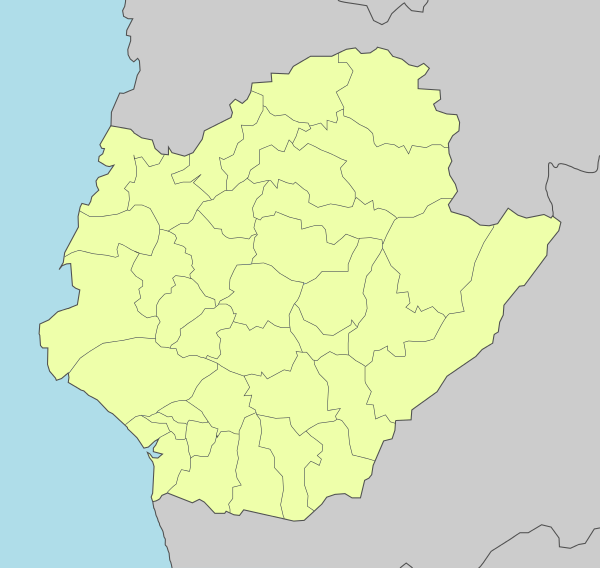
Administrative districts[edit]
| Year | Pop. | ±% |
|---|---|---|
| 1985 | 1,640,669 | — |
| 1990 | 1,710,234 | +4.2% |
| 1995 | 1,788,612 | +4.6% |
| 2000 | 1,842,337 | +3.0% |
| 2005 | 1,866,727 | +1.3% |
| 2010 | 1,873,794 | +0.4% |
| 2015 | 1,885,541 | +0.6% |
| 2020 | 1,874,917 | −0.6% |
| Source:"Populations by city and country in Taiwan".Ministry of the InteriorPopulation Census. Archived fromthe originalon 2017-12-16.Retrieved2016-05-01. | ||


- Annan District was originally the An-Shun township of Tainan County, but was merged into Tainan City in 1946. In 2004, Central District and West District were merged into the newWest Centraldistrict.
Economy[edit]

Industry[edit]
Once reliant on traditional manufacturing industries, the region became a major high-tech industrial hub after the establishment ofSouthern Taiwan Science Parkin 1995. Optoelectronics, integrated circuits, green energy and biotechnology are the park's dominant industries. Prominent companies areChimei-Innolux,United MicroelectronicsandTSMC.With the establishment of Tainan Technology Park, Shugu (Tree Valley) LCD Park and Yonkang Technology Park, the city became a major center for the optoelectronics industry in Taiwan with a complete supply chain.[49]
Tainan still plays an important role in auto parts, food processing, textiles, plastics and other traditional manufacturing. Notable companies includeUni-President,Chi Meiand Tainan Spinning, which have headquarters in the city. Overall, industrial production accounted for 62.6% of the gross city product in 2010.[50]
Agriculture[edit]
Agriculture is important to the city, especially the River North Region. While fisheries and fish farming signify the coastal districts, rice and fruit farms shaped the landscape of the inland agriculture region. The city is famous for its milkfish, oyster, rice, mango, sugar cane, pomelo ( văn đán ), pineapple and lotus seed. A state-fundedagricultural research centerwas established inSinhua Districtto ensure the market competitiveness of the crop.[51]The headquarters of theWorld Vegetable Center,anNPOthat aims to improve crop quality in poorer countries, is inShanhua District.[52]
Once dominant industries, salt and sugar production are declining into irrelevance. Taiyen (Taiwan salt) co. and Taiwan Sugar Corp., both headquartered in Tainan, transformed to businesses in biotechnology, quality agriculture, retail and tourism.
Orchid growing is one of the most symbolic agriculture industry for its well-known brand name in thefloristryworld. A nationally founded special plantation district with R&D resources is established inHoubi District.[53]
Tourism[edit]

Tourism is an industry with increasing importance. As the first capital of Taiwan, the wealth resource of cultural heritage and its potential is under exploration. In the first half of 2013, there were over 7 million tourist visited attractions in the city.[54]There are high-end hotels in the city, including the Shangri-la Hotel near Tainan train station. Tainan has been praised for its variety ofXiaochi.[55]
Retail[edit]
Retail and services are the largest employment sector in Tainan, margined at 52% in 2010.[50]The city center hosts five department stores including two Shin Kong-Mitsukoshi, two FE21s and Focus square. Apart from the city center, there are shopping precincts around the city, with the strongest presence in East, North and Yongkang districts. 'Dream Mall' is a joint development project between Uni-President Corp. and Tainan Spinning Ltd. It was the largest shopping center in the city when it opened Feb 12, 2015 and the precinct will host the new headquarters of Tainan Spinning and a new five-star hotel. The precinct is in the designated East Tainan second CBD near the border of the East and Yongkang districts.
Transportation[edit]
 |
 |
 |
 |
Rail[edit]
Tainan Stationis a major stop on theTaiwan Railways Administration(TRA)Western Line,with direct connections toTaipei,Kaohsiung,Taichung,Hsinchu,andKeelung.There are also local trains to reach closer destinations.
Taiwan High Speed Rail'sTainan Stationis located just outside the city center, inGueiren District.The service is accessible to the city center via TRAShalun Lineand two THSR Shuttle Bus Lines.[56]Using theHigh Speed Railsystem passengers can reachTaipeiin under ninety minutes. Tainan’s High Speed Rail (HSR) station is located here, southeast of the city center.[57]
Public transport[edit]
Original plan forTainan MRTsystem is muted due to the construction cost and the question of insufficient ridership.[58]Upgrading current railway and buses are now considered as alternative citywide modern public transport options.
Tainan has three major bus operators. They are Singing Bus Co., Shinan Buses and Kaohsiung Buses, operating in river north region, intercity routes and metropolitan routes respectively. In 2012, the city government called to restructure Singing Bus and Shinan Buses route to form a Tainan City Bus System. This new system, which set to start operation in 2013, has six main routes connecting the city and eight main interchanges. From the main routes 66 branch routes then spread out to service local communities. City government hope this new system will boost the public transports ridership and progress into metro-bus system in the future.[59][60]
A project to transform the railway in the city center into an underground is underway as part of the National wideTRA Rapid Transit Systematization in the Metropolitan Areas Project.This project will help increase service frequency by eliminate potential disruption between road and rail traffic. Further to underground transformation, two new stations are planned to serve East district commuters.[61]Together with theShalun HSR link,this section of TRA corridor will become the backbone of the rail transit system in Tainan.[60]
Road[edit]
NeighboringNational Highway Nos. 1and3connect via local highways to the city itself. Tainan City has a total of 142.9 kilometers (88.8 mi) of highways, including national, local, and rural highways.[62]
Air[edit]
Tainan Airport(TNN) in theSouth Districtis a mere 6 kilometers (3.7 mi) from the city center. As a regional airport, it currently operates both domestic and international flights toHong Kong,Ho Chi Minh City,Kinmen,MagongandOsaka.[63]Previously there were also services to Taipei'sSongshan Airport(TSA), but these were dropped in light of falling revenues (generally agreed to be a result of the High Speed Rail commencing operation in 2007).[64]
Education[edit]


- National Cheng Kung University( quốc lập thành công đại học ), is famous for its engineering programs. Founded in the Japanese era in 1931 as Tainan Technical College, it has a total area of 183,000 square kilometers (71,000 sq mi). As the number of colleges expanded, it was upgraded to a provincial university in 1956, then national university in 1971.[65]Today, National Cheng Kung University serves nearly 21,000 students through 9 colleges, 39 departments, and 49 graduate institutes.[66]It is also ranked 2nd in Taiwan and 41st in Asia[67]
- National University of Tainan( quốc lập đài nam đại học ) NUTN used to be the Institute of Teachers' In-service Education in 1988, promoted and renamed National Tainan Teachers College in 1991. In 2004, it was established as National University of Tainan until now. The motto of NUTN includes benevolence, intelligence, sincerity and uprightness.
- Tainan National University of the Arts( quốc lập đài nam nghệ thuật đại học ) TNNUA exists to prepare talented individuals for careers in visual and performing arts, sound and image design, building arts, conservation arts, and art history and critique. The university emphasizes learning through individual attention and independent work creation. It is a public institution, established in 1996.
- National Yang Ming Chiao Tung University( quốc lập dương minh giao thông đại học ) NYCU Tainan campus, established in 2009.
- Tainan Theological College and Seminary( đài nam thần học viện ) was established in 1876 byThomas Barclay.[68]
- Chang Jung Christian Universityis a private university affiliated with the Presbyterian Church in Taiwan. CJCU offers masters and doctoral degree programs and aims to promote fraternity, justice and service for Taiwan. It is located south of the city, inGueiren.
- Southern Taiwan University of Science and Technology( nam đài khoa kỹ đại học ), founded in 1969, is located near the northeastern border of Tainan City, within a 30-minute driving distance from the Tainan Airport.
- TheTainan University of Technology( đài nam ứng dụng khoa kỹ đại học ) is a private university founded in 1964. The university offers graduate degrees in music, visual art, and applied sciences.
- Aletheia University( chân lý đại học ) is a private university founded in 1882 byGeorge Leslie Mackay.There are two branches: one in Tamsui, New Taipei City and one in Madou District, Tainan City.
- CTBC Business School( trung tín kim dung quản lý học viện ) is a private university founded in 2000 (as Hsing-Kuo University) and later rebranded CTBC Business School, whenCTBC Financial Holdingacquired the school. It is located inAnnan District.
- Taiwan Shoufu University( đài loan thủ phủ đại học ) is a private university established in 2000 as Diwan College of Management. Later, it was accredited and became known as Taiwan Shoufu University. There are three colleges: College of Education and Design, College of Leisure Industry, and College of Hotel Management.
- University of Kang Ning( khang ninh đại học ) is a private university established in 2011. It is located in Annan District.
Elementary schools[edit]
Public
- Yuwen Elementary School
- Fusing Elementary School
Junior high schools[edit]
Public
- Tainan Municipal Fusing Junior High School
- Tainan Municipal Chongming Junior High School
- Tainan Municipal Jhongsiao Junior High School
- Tainan Municipal Houjia Junior High School
- Tainan Municipal Anping Junior High School
- Tainan Municipal Jiansing Junior High School
- Tainan Municipal Jincheng Junior High School
- Tainan Municipal Jhongshan Junior High School
- Tainan Municipal Minde Junior High School
- Tainan Municipal Wunsian Junior High School
- Tainan Municipal Yanping Junior High School
- Tainan Municipal Chenggong Junior High School
- Tainan Municipal Sinsing Junior High School
- Tainan Municipal Dacheng Junior High School
Senior high schools[edit]
Public
- National Tainan First Senior High School
- National Tainan Second Senior High School
- National Tainan Girls' Senior High School
- National Hsin Hua Senior High School
- National Chia-Chi Girls' Senior High School
- National Tainan Commercial Vocational School
- National Tainan Industrial Vocational School
- The Affiliated Senior Industrial Vocational Continuing Education High School of National Cheng Kung University
- National Tainan Marine & Fishery Vocational School
- Municipal Tainan Nan-Ning Senior High School
- Municipal Tainan Tu-Cheng High School
- Tainan Municipal Nanning Senior High School
Private
- Feng-Ho Senior High School
- Chang Jung High School
- Sheng Kung Girls' High School
- Nan Ying Vocational High School of Business & Technology
- Salesian Technical School
- Chang Jung Girls' Senior High School
- Deguang Catholic High School
- Kuang Hua Girls' Senior High School
- Tainan Liuhsin Senior High School
- Kuen-Shan Senior High School
- Ying-Hai High School
Notable natives[edit]


Some famous people born, educated or prominent in Tainan, or otherwise associated with the city, include:
- Shone An( an quân xán ) (1983–2015), singer, actor and television host.
- Momofuku Ando( an đằng bách phúc ) (1910–2007), founder ofNissin Foodsand inventor ofinstant noodles.[69]
- Thomas Barclay(1849–1935),Christian missionary,lived in the city from 1875 to 1935.
- William Campbell(1841–1921), Christian missionary, lived in the city from 1871 to 1917.
- George Chang( trương xán 鍙) (born 1936), politician, former mayor of Tainan (1997–2001).
- Chin-Feng Chen( trần kim phong ) (born 1977), first Taiwan-born player to playMajor League Baseball.
- Chen Wei-ling( trần vĩ lăng ), 2008 Olympic bronze medal-winning weightlifter.
- Mao Gao-wen( mao cao văn ) (1936–2019), chemist, former president ofNational Tsinghua University(1981–1987) andMinister of Education(1987–1993).
- Hsu Shih-Hsien( hứa thế hiền ) (1908–1983), first female Taiwanese PhD.
- Chin-Lung Hu( hồ kim long ), formerMLBinfielder for theNew York Mets.
- Jutoupi(born 1966), recording artist.
- Kao Ching-yuen( cao thanh nguyện ) (1929–2016), businessman, founder and chairman ofUni-President.
- Hong-Chih Kuo( quách hoằng chí ), formerMLBpitcher for theLos Angeles Dodgers.
- Tai-Yuan Kuo( quách thái nguyên ), retired pitcher for theSeibu Lions,foreign player with the most wins inNippon Professional Baseballhistory.
- Chen-Yuan Lee( lý trấn nguyên ) (1915–2001),pharmacologistand political activist, famous for research onsnake venom.
- Chou Tzu-yu( chu tử du ) (born 1999), singer, youngest member ofTwice.
- Lien Heng( liên hoành ) (1878–1936), historian, writer ofThe General History of Taiwan,grandfather of former presidential candidateLien Chan.
- En-Yu Lin( lâm ân vũ ), baseball pitcher currently playing forTohoku Rakuten Golden Eagles.
- Lin Hsin-i( lâm tín nghĩa ) (born 1946), businessman and politician, Minister of Economic Affairs (2000–2002), Vice Premier (2002–2004).
- Lin Mosei( lâm mậu sinh ) (1887–1947?), first Taiwanese philosophy PhD, academic, educator and calligrapher thought to have been killed following theFebruary 28 Incident.
- Ong Iok-tek( vương dục đức ) (1924–1985), scholar and authority of theTaiwanese Hokkiendialects.
- Judy Ongg( ông thiến ngọc ) (born 1950), actress, singer, author and artist.
- Shi Wen-long( hứa văn long ) (born 1928), businessman, founder ofChi Mei Corporation.
- Lisa Su(born 1969), chief executive officer ofAdvanced Micro Devices.
- Su Nan-cheng( tô nam thành ) (1936–2014), politician, former mayor of Tainan (1977–1985) and advisor to former Taiwanese presidentChen Shui-bian.
- Robert Swinhoe(1836–1877), first British consul sent to Tainan 1861; ornithologist, highly regarded researcher writer on the natural history and zoology of Taiwan and China.
- Shen Che-Tsai( thẩm triết tai ) (1926–2017), oil painter.
- Chien-Ming Wang( vương kiến dân ), formerMLBpitcher for theNew York Yankees,Washington Nationals,Toronto Blue Jays,andKansas City Royals.
- Wu Hui Ju( ngô huệ như ), archer and also a member of the team that won the bronze medal for Chinese Taipei in 2004 Summer Olympics in the women's team archery competition.
- Jacky Wu( ngô tông hiến ) (born 1962), entertainer and talk-show host.
- Jensen Huang( hoàng nhân huân ) (born 1963), chief executive officer ofNVIDIA.
- Ho Chuan( hà truyện ) (1897–1989), businessman, founder ofYongfeng Yu Group(parent company ofBank SinoPac[70]).
- Crowd Lu( lư quảng trọng ) (born 1985), singer-songwriter, actor
Sports[edit]

Tainan is home to theUni-President Lions,who play their home games at theTainan Municipal Baseball Stadium.[71][72]It is also the birthplace ofChien-Ming Wang,Hong-Chih Kuo,Tai-Yuan Kuo,En-Yu Lin,and many other prominent Taiwanese baseball players.
Tainan also has one professional basketball team, theTainan TSG GhostHawksof theT1 League.[73]
Tainan is the host of the biennialU-12 Baseball World Cupsince 2015, organized by theWorld Baseball Softball Confederation(WBSC). Other recent major sporting events held by Tainan include:
- 2004 World University Baseball Championship
- 2008 World University Archery Championships
- 2010 EAFF Women's Football Championship(Semi-final)
International relations[edit]
Twin towns — Sister cities[edit]
The following municipalities aresister citiesto Tainan City:[74]
 Monterey, California,United States (1965)
 Gwangju,South Korea (1968)[75]
- San Jose, CaliforniaUnited States (1977)
- Kansas City, MissouriUnited States (1978)
- Columbus, OhioUnited States (1980)
 Cavite City,Philippines (1980)
- Tagaytay,Philippines (1980)
- Trece Martires,Philippines (1980)
- Pasay,Philippines (1980)
 Santa Cruz de la Sierra,Bolivia (1981)
 Nelson Mandela Bay,South Africa (1982)
- Orlando, FloridaUnited States (1982)
 Gold Coast, Queensland,Australia (1982)
- Fairbanks, AlaskaUnited States (1983)
- Laredo, TexasUnited States (1985)
- Oklahoma City, Oklahoma,United States (1986)
- Huntsville, AlabamaUnited States(1986)
- Carbondale, IllinoisUnited States(1991)
 Leuven,Belgium (1993)
- Snohomish County, WashingtonUnited States (1998)
 Ra'anana,Israel (1999)[76]
 Zacapa,Guatemala (2003)
 Elbląg,Poland (2004)[77][78]
 Keçiören,Turkey (2005)
 Esbjerg,Denmark (2005)
- Cagayan de Oro,Philippines (2005)
 Wotje Atoll,Marshall Islands (2018)
 Beziers City,Hérault Department,France(2023)
Friendship cities[edit]
Tainan City also celebrates friendly relationships with four other municipalities, although they are not considered official sister cities.
 Sendai,Japan (2006)
- Nikkō, Tochigi,Japan (2009)
 Almere,Netherlands (2009)
- Minakami, Gunma,Japan (2013)
- Arizona,United States (2013)
- Shiga,Japan (2013)
- Parramatta,Australia (2014)
- Kaga, Ishikawa,Japan (2014)
 Styria,Austria (2015)
- Chandler, Arizona,United States (2016)
- Fujinomiya, Shizuoka,Japan (2017)
- Aomori Prefecture,Japan (2017)
- Hirosaki, Aomori,Japan (2017)
- Yamagata, Yamagata,Japan (2017)
- Tsuchiura,Japan (2023)
- Gyeongju,North Gyeongsang Province,Korea(2024)
 Jonava,Kaunas County,Lithuania(2024)
- Hirado,Japan (2024)
Domestic[edit]
 Kinmen,Fujian (1981)
- Penghu County,Taiwan (2004) (Friendship city)
Relative location[edit]
Places adjacent to Tainan | ||||||||||||||||
|---|---|---|---|---|---|---|---|---|---|---|---|---|---|---|---|---|
| ||||||||||||||||
See also[edit]
Notes[edit]
Words in native languages[edit]
References[edit]
- ^"Tainan University of Technology official site".Archived fromthe originalon 2012-06-18.Retrieved2007-08-04.
- ^Đài nam thị chính phủ toàn cầu tư tấn võng.Tainan.gov.tw. Archived fromthe originalon January 18, 2013.Retrieved2013-01-23.
- ^《 trung hoa dân quốc thống kế tư tấn võng 》 huyện thị trọng yếu thống kế chỉ tiêu tra tuân hệ thống võng(in Chinese).Archivedfrom the original on 12 June 2016.Retrieved13 June2016.
- ^"Demographia World Urban Areas PDF (April 2016)"(PDF).Demographia.Archived(PDF)from the original on 3 May 2018.Retrieved13 June2016.
- ^Đài nam thị thống kế nguyệt báo(PDF)(in Chinese (Taiwan)). Archived fromthe original(PDF)on 14 July 2016.Retrieved13 June2016.
- ^"Demographia World Urban Areas PDF"(PDF).Demographia.Archived(PDF)from the original on 2018-05-03.Retrieved2019-11-30.
- ^"Tainan".Dictionary.com Unabridged(Online). n.d.
- ^Chang, Winnie (April 1994)."Rise of the Phoenix?".Taiwan Today.Archivedfrom the original on 2012-07-28.Retrieved2012-01-10.
- ^"The World According to GaWC 2020".GaWC – Research Network.Globalization and World Cities.Archivedfrom the original on 24 August 2020.Retrieved31 August2020.
- ^"Tainan Confucian Temple".Council for Cultural Affairs. Archived fromthe originalon 2008-05-01.Retrieved2008-08-19.
- ^abcdefghijThái ngọc tiên; et al., eds. (2007).Phủ thành văn sử(in Simplified Chinese).Tainan City Government.ISBN9789860094343.
- ^abcdefghShih Shou-chien,ed. (2003).Phúc nhĩ ma sa: Thập thất thế kỷ đích đài loan, hà lan dữ đông á[Ilha Formosa: the Emergence of Taiwan on the World Scene in the 17th Century] (in Simplified Chinese). National Palace Museum.ISBN9789575624415.
- ^abcdKato, Mitsutaka (2007) [1940].Tạc nhật phủ thành minh tinh đài nam: Phát hiện nhật trị hạ đích lão đài nam(in Chinese (Taiwan)). Translated byHoàng bỉnh hành.Đài nam thị văn hóa tư sản bảo hộ hiệp hội.ISBN9789572807996.
- ^abcdefRubinstein, Murry A., ed. (2007).Taiwan: A New History(expanded ed.). New York: M.E. Sharpe.ISBN9780765614940.
- ^"Anping Harbor National Historical Park".Tainan City Government. Archived fromthe originalon 2009-10-15.Retrieved2010-03-31.
- ^AlsoTaiwan-fu,Taiwan Fu,Taiwan Foo,&c.
- ^Turton, Michael."Notes from Central Taiwan: Taiwan's shrinking middle ground".taipeitimes.com.Taipei Times.Retrieved31 July2023.
- ^"Anping Harbor National Historical Park".Tainan City Government. Archived fromthe originalon 2010-03-14.Retrieved2010-03-25.
- ^Campbell, William(1915).Sketches from Formosa.London: Marshall Brothers. pp.16–17.OL7051071M.Archivedfrom the original on 2015-12-19.Retrieved2014-11-30.
- ^AlsoTainan-fu,Tainan Fu,Tainan Foo,&c.
- ^Takekoshi, Yosaburō(1907). "Chapter XIII: Population and future development of the island resources".Japanese rule in Formosa.London, New York, Bombay and Calcutta: Longmans, Green, and co. p.200.OCLC753129.OL6986981M.
- ^Chamberlain, B.;Mason, W.B. (1903).A Handbook for Travellers in Japan(7th ed.). London: J. Murray. p.553.OL25302448M.Archivedfrom the original on 2012-08-31.Retrieved2019-11-16.
- ^Thang đức chương(in Chinese (Taiwan)). Memorial Foundation of 228. Archived fromthe originalon January 21, 2010.Retrieved2010-04-17.
- ^"Rezoning Taiwan".Taiwan Today. 1 February 2011.Archivedfrom the original on 12 January 2021.Retrieved9 December2020.
- ^Kuo-fang, Huang; Hsu, Elizabeth (13 February 2016)."Remains of Last Unaccounted-For Quake Victim Found".Focus Taiwan. The Central News Agency.Archivedfrom the original on 16 February 2016.Retrieved18 February2016.
- ^abcdeĐài nam thị văn tư đạo độc(in Chinese (Taiwan)). Tainan City Government.Archivedfrom the original on 2011-07-02.Retrieved2011-05-12.
- ^"Sword Lion".Anping Harbor National Historical Park. Archived fromthe originalon 2006-02-23.Retrieved2011-05-12.
- ^Watt, Louise (22 January 2021)."In Tainan, the Focus is on Sweetness and Tradition".topics.amcham.com.tw/.Taiwan Topics.Archivedfrom the original on 26 January 2021.Retrieved24 January2021.
- ^Staff Writer (17 February 2021)."FEATURE: Growers along Tainan's 'Coffee Road' want to put local brew on national map".www.taipeitimes.com.Taipei Times.Archivedfrom the original on 17 February 2021.Retrieved17 February2021.
- ^Lee Hsin-fang; Chung, Jake (15 Jul 2015)."Tainan has most of nation's 12,106 temples".Taipei Times.p. 5.Archivedfrom the original on 15 July 2015.Retrieved15 July2015.
- ^"Tainan Traditional Orchestra".Archived fromthe originalon 6 September 2006.Retrieved6 November2011.
- ^"Chimei Orchestra (Chinese)".Chimei Museum.Archived fromthe originalon November 1, 2011.Retrieved6 November2011.
- ^"Chang Jung University Orchestra".Chang Jung University.Archived fromthe originalon December 27, 2013.Retrieved6 November2011.
- ^"Ten Drum Official Website (Chinese)".Ten Drum Art Percussion Group.Archivedfrom the original on 3 November 2011.Retrieved6 November2011.
- ^"TainanCity-_-2014Climate-Change-Adaption-Plan1.pdf"(PDF).Archived(PDF)from the original on 13 January 2022.Retrieved19 February2021.
- ^"Monthly Mean".Central Weather Bureau.Archivedfrom the original on 9 December 2022.Retrieved29 November2022.
- ^"Khí tượng trạm các nguyệt phân tối cao khí ôn thống kế"(PDF)(in Chinese). Central Weather Bureau.Archived(PDF)from the original on 17 October 2022.Retrieved29 November2022.
- ^"Khí tượng trạm các nguyệt phân tối cao khí ôn thống kế ( tục )"(PDF)(in Chinese). Central Weather Bureau.Archived(PDF)from the original on 17 October 2022.Retrieved29 November2022.
- ^"Khí tượng trạm các nguyệt phân tối đê khí ôn thống kế"(PDF)(in Chinese). Central Weather Bureau.Archived(PDF)from the original on 19 February 2022.Retrieved29 November2022.
- ^"Khí tượng trạm các nguyệt phân tối đê khí ôn thống kế ( tục )"(PDF)(in Chinese). Central Weather Bureau.Archived(PDF)from the original on 19 December 2022.Retrieved29 November2022.
- ^abcdWeng, Jinshan ( ông kim sơn ) (2002).Đài nam thị đô thị thiết kế quy hoa cương yếu chi nghiên cứu 1 đô thị không gian đích tố nguyên dữ diễn hóa(in Chinese). Tài đoàn pháp nhân thành đại kiến trúc văn giáo cơ kim hội.
- ^"Green and blue belts reference"(PDF).Archived fromthe original(PDF)on April 25, 2012.Retrieved2011-11-02.
- ^"CEPD".Archived fromthe originalon 2012-04-07.Retrieved2011-11-02.
- ^Lưu uyển quân (15 October 2018).Lộ bài cải thông dụng bính âm? Nam thị phủ: Dĩ thải dụng đa niên.Liberty Times(in Chinese (Taiwan)).Archivedfrom the original on 28 July 2019.Retrieved28 July2019.
Cơ tiến đảng đài nam thị đông khu thị nghị viên tham tuyển nhân lý tông lâm kim thiên chỉ xuất, đài nam thị lộ danh bài bính âm vị thống nhất, âm dịch thác ngộ đẳng, kiến nghị thống nhất thải dụng thông dụng bính âm. Đối thử, đài nam thị chính phủ giao thông cục hồi ứng, nam thị dĩ thật thi thông dụng bính âm đa niên, tương toàn diện kiểm thị lộ danh bài, y hiện hành âm dịch phương thức tiến hành giáo đối cải thiện.
- ^abHành chính khu vực[Administrative Divisions].Tainan Government(in Chinese (Taiwan)). 29 April 2019.Archivedfrom the original on 29 February 2020.Retrieved30 April2019.
( tứ ) 2010 niên 12 nguyệt 25 nhật, nguyên đài nam huyện dữ đài nam thị hợp tịnh, toàn thị cộng phân vi 37 cá hành chính khu vực - tân doanh, diêm thủy, bạch hà, liễu doanh, hậu bích, đông sơn, ma đậu, hạ doanh, lục giáp, quan điền, đại nội, giai lí, học giáp, tây cảng, thất cổ, tương quân, bắc môn, tân hóa, tân thị, thiện hóa, an định sơn thượng, ngọc tỉnh, nam tây, nam hóa, tả trấn, nhân đức, quy nhân, quan miếu, long kỳ, vĩnh khang, đông khu, nam khu, trung tây khu, bắc khu, an nam, an bình, cộng kế 37 khu.
- ^ab"District Office".Tainan City Government Global Website.2016-06-03.Archivedfrom the original on 29 October 2019.Retrieved23 July2019.
Eastern District Office North District Office West Central District Office South District Office Anping District Office Annan District Office Sinying District Office Yanshuei District Office Baihe District Office Liouying District Office Houbi District Office Dongshan District Office Madou District Office Xiaying District Office Lioujia District Office Guantian District Office Danei District Office Jiali District Office Syuejia District Office Sigang District Office Cigu District Office Jiangjyun District Office Beimen District Office Sinhua District Office Shanhua District Office Sinshih District Office Shanshang District Office Yujing District Office Nansi District Office Nanhua District Office Zuojhen District Office Rende District Office Gueiren District Office Guanmiao District Office Longci District Office Yong Kang District Office Anding District Office
- ^abĐài loan địa khu hương trấn thị khu cấp dĩ thượng hành chính khu vực danh xưng trung anh đối chiếu biểu(PDF).Online Translation System of Geographic Name,Ministry of Interior.16 June 2011. pp. 3–4. Archived fromthe original(PDF)on 25 March 2012.
Đài nam thị Tainan City Tainan City trực hạt thị, huyện ( thị ) cấp dĩ thượng hành chính khu vực danh xưng hệ y quốc tế quán dụng phương thức dịch tả tân doanh khu Xinying District diêm thủy khu Yanshui District bạch hà khu Baihe District liễu doanh khu Liuying District hậu bích khu Houbi District đông sơn khu Dongshan District ma đậu khu Madou District hạ doanh khu Xiaying District lục giáp khu Liujia District quan điền khu Guantian District đại nội khu Danei District huyện thị hương trấn khu biệt quốc tế quán dụng danh hán ngữ bính âm dịch tả bị chú giai lí khu Jiali District học giáp khu Xuejia District tây cảng khu Xigang District thất cổ khu Qigu District tương quân khu Jiangjun District bắc môn khu Beimen District tân hóa khu Xinhua District thiện hóa khu Shanhua District tân thị khu Xinshi District an định khu Anding District sơn thượng khu Shanshang District ngọc tỉnh khu Yujing District nam tây khu Nanxi District nam hóa khu Nanhua District tả trấn khu Zuozhen District nhân đức khu Rende District quy nhân khu Guiren District quan miếu khu Guanmiao District long kỳ khu Longqi District vĩnh khang khu Yongkang District đông khu East District nam khu South District bắc khu North District an nam khu Annan District an bình khu Anping District trung tây khu West Central District
- ^1.7- hương trấn thị khu hộ khẩu sổ[Population for Township and District].Ministry of the Interior(in Chinese (Taiwan) and English). August 2020.Archivedfrom the original on 12 June 2018.Retrieved21 September2020.
Đài nam thị Tainan City tân doanh khu Sinying District diêm thủy khu Yanshuei District bạch hà khu Baihe District liễu doanh khu Liouying District hậu bích khu Houbi District đông sơn khu Dongshan District ma đậu khu Madou District hạ doanh khu Siaying District lục giáp khu Lioujia District quan điền khu Guantian District đại nội khu Danei District giai lí khu Jiali District học giáp khu Syuejia District tây cảng khu Sigang District thất cổ khu Cigu District tương quân khu Jiangjyun District bắc môn khu Beimen District tân hóa khu Sinhua District thiện hóa khu Shanhua District tân thị khu Sinshih District an định khu Anding District sơn thượng khu Shanshang District ngọc tỉnh khu Yujing District nam tây khu Nansi District nam hóa khu Nanhua District tả trấn khu Zuojhen District nhân đức khu Rende District quy nhân khu Gueiren District quan miếu khu Guanmiao District long kỳ khu Longci District vĩnh khang khu Yongkang District đông khu East District nam khu South District bắc khu North District an nam khu Annan District an bình khu Anping District trung tây khu West Central District
- ^"LCD manufacturing in Tainan".Tainan City Government.Archived fromthe originalon May 20, 2009.Retrieved20 November2011.
- ^ab"Report on the economic structure to CPED".Tainan City Government.Archived fromthe originalon 7 April 2012.Retrieved20 November2011.
- ^"Tainan District Agricultural Research & Extension Station, COA".COA. Archived fromthe originalon March 6, 2014.Retrieved18 May2013.
- ^"AVRDC".Archivedfrom the original on 30 July 2013.Retrieved18 May2013.
- ^"Taiwan Orchid Plantation".Archived fromthe originalon 2011-10-21.Retrieved20 November2011.
- ^Đài nam thị quan quang du khế cảnh điểm du khách nhân thứ thống kế(PDF).Tainan City Government Tourism Bureau Official Website.Tainan City Government Tourism Bureau. Archived fromthe original(PDF)on 2016-01-28.Retrieved14 September2013.
- ^Clarissa Wei, for."19 great dishes in Tainan, Taiwan's capital of food".CNN.Archivedfrom the original on 2022-07-12.Retrieved2022-07-12.
- ^"Transfer Information".Taiwan High Speed Rail. Archived fromthe originalon 2012-11-25.Retrieved2012-12-06.
- ^Kembel, Nick."A Travel Guide to Tainan, Taiwan's Original Capital".Taiwan Obsessed.Nick Kembel.RetrievedAugust 10,2023.
- ^"MRT Plans"(in Simplified Chinese). Bureau of High Speed Rail.Archivedfrom the original on 2016-01-28.Retrieved2008-08-20.
- ^"Tainan City Bus System".Archived fromthe originalon 2 March 2013.Retrieved24 March2013.
- ^ab"Tainan Public Transport Plan".Tainan City Government.Archived fromthe originalon February 2, 2017.Retrieved23 March2013.
- ^"The Tainan Urban District Railway Underground Project".Archivedfrom the original on 28 January 2016.Retrieved24 March2013.
- ^"2005 statistics"(PDF).Tainan City Government. Archived fromthe original(PDF)on September 10, 2008.Retrieved2008-08-19.
- ^"Tainan Airport Departure Flight Status (Monthly)".TAINAN AIRPORT.Archivedfrom the original on 2017-12-25.Retrieved2017-12-25.
- ^Lin, Judy (1 Mar 2008)."FAT to sell investments to cover costs".Taipei Times.p. 12.Archivedfrom the original on 20 July 2008.Retrieved2008-08-20.
- ^"Brief History".National Cheng Kung University. Archived fromthe originalon 2008-09-13.Retrieved2008-08-20.
- ^"Organization".National Cheng Kung University. Archived fromthe originalon 2008-08-18.Retrieved2008-08-20.
- ^"National Cheng Kung University (NCKU)".Top Universities.Archivedfrom the original on 2022-03-03.Retrieved2022-04-23.
- ^"Introduction".Tainan Theological College and Seminary. Archived fromthe originalon May 22, 2007.Retrieved2008-08-20.
- ^"Inventor of the Week: Momofuku Ando".MIT. Archived fromthe originalon August 3, 2008.Retrieved2008-08-19.
- ^"Kim dung sự nghiệp quần".YFY.Archivedfrom the original on 2020-08-11.Retrieved2020-12-07.
- ^"U-Lions".CPBL.Chinese Professional Baseball League.Archivedfrom the original on 1 January 2023.Retrieved1 January2023.
- ^"Parking near the Municipal Stadium"(in Simplified Chinese). Uni-President Lions. Archived fromthe originalon 2008-09-13.Retrieved2008-08-20.
- ^"Quan ô T1".T1 League.Archivedfrom the original on 1 January 2023.Retrieved1 January2023.
- ^Tỷ muội thị ký hữu nghị thị.Tainan City Government(in Simplified Chinese). Archived fromthe originalon 2013-07-01.Retrieved2013-08-01.
- ^"Sister Cities".Gwangju Metropolitan City.Archived fromthe originalon 2014-07-04.
- ^"Ra'anana: Twin towns & Sister cities – Friends around the World".raanana.muni.il.Archived fromthe originalon February 28, 2010.Retrieved24 March2010.
- ^"Elbląg – Podstrony / Miasta partnerskie".Elbląski Dziennik Internetowy(in Polish). Archived fromthe originalon 2011-03-15.Retrieved2013-08-01.
- ^"Elbląg – Miasta partnerskie".Elbląg.net(in Polish).Archivedfrom the original on 2013-08-01.Retrieved2013-08-01.
External links[edit]
 Definitionsfrom Wiktionary
 Mediafrom Commons
 Newsfrom Wikinews
 Quotationsfrom Wikiquote
 Textsfrom Wikisource
 Textbooksfrom Wikibooks
 Resourcesfrom Wikiversity
 Datafrom Wikidata
 Tainantravel guide from Wikivoyage
 Geographic data related toTainanatOpenStreetMap
- Official website

- Tainan City Travel Information
- Tainan City Dynamic Bus Information System
- The Confucian temple in Tainan
| International | |
|---|---|
| National | |
| Geographic | |
22°59′N120°11′E/ 22.983°N 120.183°E
- ^Hanson, David (Sep 11, 2014).Success Comes From Solving Problems.Taiwan: EHGBooks. p. 222.ISBN978-1625031273.