
List of transcontinental countries
This is a list ofcountrieswithterritorythat straddles more than onecontinent,known astranscontinental statesorintercontinental states.[1]
Contiguoustranscontinental countries are states that have one continuous or immediately-adjacent piece of territory that spans acontinental boundary,most commonly the line that separates Asia and Europe. By contrast,non-contiguoustranscontinental countries are those states that have portions of territory that are separated from one another either by a body of water or by other countries (such as in the case of France). Most non-contiguous transcontinental countries are countries withdependencieslike United Kingdom with itsoverseas territories,but can be countries that have fully integrated former dependencies in their central states like France with itsoverseas regions.[1]
For the purposes of this article, aseven-continent modelis assumed based on common terms of reference by English language geographers.[2]Combined continents like "the Americas" and "Eurasia" are not acknowledged or referenced. Theboundary between Asia and Europeis largely conventional (much of it over land), and several conventions remained in use well into the 20th century. However, the now-prevalent convention—which has been in use by somecartographerssince about 1850—follows theCaucasusnorthern chain, theUral Riverand theUral Mountains,is used for the purposes of this list.[3]This convention results in several countries such as in the case ofAzerbaijan,Kazakhstan,andTurkeyfinding themselves almost entirely in 'Asia', with a few smallenclavesor districts technically in 'Europe'. Notwithstanding these anomalies, this list of transcontinental or intercontinental states respects the convention that Europe and Asia are full continents rather thansubcontinentsor componentlandmassesof a largerEurasiancontinent.
Listed further below, separately, are countries with distant non-contiguous parts (overseas territories) on separate continents.
Definition
The lists within this article include entries that meet the following criteria:
- Transcontinentalorintercontinental statesaresovereign statesthat have some portion of theirterritorygeographically divided between at least twocontinents.[1][4]
- Transcontinental states can be classed as eithercontiguousornon-contiguoustranscontinental states.[5]
- Contiguous transcontinental states are those countries that have one continuous or immediately adjacent piece of territory that spans acontinental boundary.More specifically, they contain a portion of their territory on one continent and a portion of their territory on another continent, while having these two portions connected via a natural geological land connection (e.g. Russia) or the two portions being immediately adjacent to one another (e.g. Turkey).[6][7]
- Non-contiguous transcontinental states are those that have portions of territory that are separated from one another either by a significantbody of wateror by other land.[6][7]Most non-contiguous transcontinental countries are countries withoverseas territories.[1]
Theboundaries between the continentscan be vague and subject to interpretation, making it difficult to conclusively define what counts as a 'transcontinental state'.
- For the purposes of this article, aseven-continent modelis assumed.[2]
- Therefore, states that have territory across sub-continental boundaries, as well asplate boundariesthat are only internal to continents, are excluded from this article.
- Some non-contiguous transcontinental states have territory situated on distant islands that may or may not be considered a part of another nearby continent (e.g.Yemen'sSocotraand Portugal'sMadeira). Though there is debate[citation needed]as to whether these states ought to be considered 'transcontinental', they are still included in this article.
- States that only haveuninhabited islandterritory as a part of another continent (e.g.,Venezuela'sAves Island) are considered transcontinental for the purpose of this article.[citation needed]
- While it is debatable as to whether states that have claimed territory within theAntarctic Treaty Systemcan have actual control of that claimed territory (e.g.,Chilean Antarctic Territory), they are included in this article.
- Someautonomous regions(ordependent territories) may be constitutionally distinguishable from the parent state that claims them as their territory (e.g., in the case ofBritish Overseas Territoriesand the United Kingdom), thereby causing debate as to whether such states ought to be considered 'transcontinental'.[citation needed]They are nevertheless included in this article.
- Micronations,autonomous regions,andsub-national entitiesthat are in themselves transcontinental are excluded from the lists in this article as a separate entry from their controlling state.
- Any entry must be aUN member stateor a part of theUnited Nations System.Therefore,states with limited recognitionare excluded from the lists in this article.
Contiguous boundary
This sectionpossibly containsoriginal research.(November 2022) |
Contiguous transcontinental states are those countries that have one continuous or immediately adjacent piece of territory that spans acontinental boundary.More specifically, they contain a portion of their territory on one continent and a portion of their territory on another continent, while having these two portions connected via a natural geological land connection (e.g. Russia) or the two portions being immediately adjacent to one another (e.g. Turkey).[6][7]In other words, someone can travel to another continent without changing the country (without crossing a border).
Africa and Asia

The modern convention for the land boundary between Asia and Africa runs along theIsthmus of Suezand theSuez CanalinEgypt.The border continues through theGulf of Suez,Red Sea,andGulf of Aden.In antiquity, Egypt had been considered part of Asia,[citation needed]with theCatabathmus Magnusescarpment taken as the boundary withAfrica (Libya).
 Egypt:Out of the 27governorates of Egypt,two lie entirely on the AsianSinai Peninsulaand two are transcontinental:Ismailia Governorateis nearly equally divided by the Suez Canal, andSuez Governorate—which is coterminous with the "transcontinental city" ofSuez—has a small portion east of the Canal.
Asia and Europe

The conventionalAsia-Europe boundarywas subject to considerable variation during the 18th and 19th centuries, indicated anywhere between theDon Riverand theCaucasusto the south or theUral Mountainsto the east. Since the late 19th century, the Caucasus–Urals boundary has become almost universally accepted. According to this now-standard convention, the boundary follows theAegean Sea,theTurkish Straits,theBlack Sea,along thewatershedof theGreater Caucasus,the northwestern portion of theCaspian Seaand along theUral RiverandUral Mountainsto theArctic Ocean.[8][9]
According to this convention, the following countries have territory in both Asia and Europe.
 Azerbaijanis a country located mainly on theAsian portionof theCaucasus,with a small portion of the country, itsQusar,Shabran,Siazan,KhachmazandQubadistricts north of theGreater Caucasus Watershed,and thus in Europe, placing a population of about half a million (or c. 5% of the country's total population) in Europe.
 Georgiais located mainly on theAsian portionof theCaucasus;however, the Municipality ofKazbegi,northKhevsuretiandTushetiare located north of the Greater Caucasus Watershed, which is geographically in Europe, with mountain peaks throughout the Caucasus ridge, placing around 5% of the country's total territory in Europe. Despite its geography, Georgia is considered a European country geopolitically[10]because of its historical, cultural, ethnic, and political ties to the continent.[11][12][13][14]
 Kazakhstanis a country mainly located inCentral Asia,[15]with a small portion of the country extending west of theUral RiverinEastern Europe.The country's physical, cultural, ethnic, and geographic characteristics are Central Asian,[16][17]with a largeEuropean influenceand influx of European settlers from Russia from when it was a part of the Soviet Union and the earlierRussian Empire.ItsWest KazakhstanandAtyrauregions extend on either side of the Ural River,[18]placing a population of less than one million residents (out of a 15 million total population) geographically in Europe. Because the city ofAtyraustraddles the Ural River, it can be considered a transcontinental city.[19]
 Russia, thelargest country in the world,spans most of northernEurasia,stretching over a vast expanse ofEastern EuropeandNorthern Asia.Its sparsely populatedAsian territorywas historically incorporated into theTsardom of Russiain the 17th century byconquests.Russia is considered aEuropean country,as it has historical, cultural,ethnic,and political ties to the continent.[20]The vast majority of its population (80%) lives within itsEuropean portion,making it themost populous European nation.Russia's capital Moscow is thelargest city entirely in Europe.
 Turkeyfalls almost wholly withinWestern Asia(the Asian portion of Turkey consisting of the Anatolian Peninsula and additional land) plus a smaller portion of the country in theBalkan PeninsulainSoutheastern EuropecalledEast Thrace,which covers only 3% of the country's total area, with a population of about 11 million people, or some 14% of the country's population. Turkey's largest cityIstanbulspans both sides of theBosphorus,making it a transcontinental city in both Europe and Asia,[21]while the country's capitalAnkarais located in Asia. The territory of the current Turkish state is the core territory of the previousOttoman Empirethat was also transcontinental in the same geographic region, which itself had also supplanted the earlier, similarly transcontinentalByzantine Empire.
North America and South America

The conventional boundary between North America and South America is at some point on theColombia–Panama border,with the most common demarcation in atlases and other sources following theDarién Mountainswatershed where theIsthmus of Panamameets the South American continent (seeDarién Gap). This area encompasses a large watershed, forest and mountains in the northern portion ofColombia's Chocó Department andPanama's Darién province.
Some geographers prefer to use thePanama Canal[22]as the physical boundary between North and South America instead.[23][full citation needed]Under this convention, its capitalPanama Cityis classified as a South American city. Given the competing claims, the Panamanian sports governing bodies affiliate to differing continental/regional confederations:its athletics federationtoSouth America's,its soccer federationtoNorth, Central America and Caribbean's;its Olympic committeeto bothSouth America'sandCentral America's.
Non-contiguous
North America and South America
 Colombia:Most of the Colombian mainland is located in northern South America (seeNorth America and South Americaabove) and theMalpelo Islandin the Pacific Ocean is also associated with South America (or on rare occasion Oceania, due to its status as anoceanic island).[24][25]However, the state also administers theSan Andrés and Providenciaarchipelago,640 kilometres (400 mi) WNW of Colombia'sCaribbean Coast,in North America.
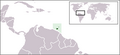
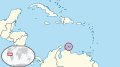
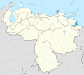
 Venezuela(Aves Island): Most of Venezuela, predominantly its mainland, is located in northern South America. Aves Island, however, is geographically a definitive part of North America. It is one of theFederal Dependencies of Venezuelawhich are under the administration of theMinistry of Interior, Justice and Peace.
The special case of Caribbean islands adjacent to the South American coastline:
 Trinidad and Tobago:The state of Trinidad and Tobago lies on twotectonic plates.The southern half ofTrinidadlies on theSouth American Platewhile the northern half of Trinidad and the island ofTobagolie on theCaribbean Plate.However, these geological features do not necessarily qualify Trinidad and Tobago as a transcontinental state, as the whole territory is often labeledgeopoliticallyas part of North America.
- Leeward Antilles(CollectivelyAruba,Bonaire,andCuraçaoof the Netherlands;Nueva EspartaofVenezuela;and theFederal Dependencies of Venezuela,excludingAves Island): The Caribbean islands division of North America and South America is complicated.Geopolitically,all Caribbean islands in theWest Indiesare often labeled as North American islands, butgeologically,the islands of the Leeward Antilles lie on thecontinental shelfof South America, and can be considered South American as well. Excluding the geographically North American Aves Island, the remaining Venezuelan islands of the Federal Dependencies are islands situated in the Caribbean on the continental shelf of South America. These islands are north of the Venezuelan mainland and are akin to the location of Aruba, Bonaire, Curaçao, and Trinidad and Tobago. Similarly, the islands of theState of Nueva Esparta(Margarita Island,Coche Island,andCubagua) are also situated in the Caribbean Sea just to the north of the Caribbean coastline of the Venezuelan mainland. However, all of the non-Venezuelan islands in this area are typically considered North American rather than South American.[26]
Caribbean Island locations
North American Caribbean islands administered by South American states:


Caribbean islands considered North American or South American:
-
-

-
 Bonaire,Netherlands
 -
-

-


South America and Oceania
 Chile:Chile is mostly on the South American mainland and includes the islands ofEaster IslandandIsla Salas y Gómez,which are within the Oceania subregion of Polynesia.[27]Those and the oceanicJuan Fernández IslandsandDesventuradas Islandsare part ofInsular Chile.[28]
Europe and North America

 Kingdom of Denmark:As a constituent part of theDanish Realm,Greenlandis anon-sovereign countrywithin theKingdom of Denmark.Fully located on the North American tectonic plate, and close to the mainland, Greenland is considered to be geographically a part of North America,[29]with the United Nations categorizing them as such.[30]Although it is politically associated with Europe and internationally represented by a European state (including in the Council of Europe), it is autonomous. Historically and ethnically, its native population is of North American tradition, although it also shares cultural links with other native peoples bordering theArctic Seain Northern Europe and Asia (today in Norway, Sweden, Finland and Russia), as well as in North America (Alaska in the U.S.,Northwest Territories,Nunavutand northern parts ofQuebecandLabradorin Canada). Greenland was part of metropolitan Denmark and within the territory of the European Union, but voted for more autonomy and is now excluded from the EU.[31]
Europe, North America, and South America
 Netherlands: Though most of theKingdom of the Netherlands' landmass is in Europe, it also includes six island territories in theLesser Antillesarchipelago of the Caribbean: theDutch Caribbean.Within the Lesser Antilles archipelago, three territories are in theLeeward Islandsgroup (considered part of the continent of North America) and three in theLeeward Antillesgroup (on the South American continental shelf). Since thedissolutionof theDutch Antillesin 2010, thesovereignKingdomof the Netherlands has been administratively divided into four non-sovereign constituent "countries":Aruba,Curaçao,Sint Maartenand the Netherlands — the last of which includes the islands of Bonaire, Saint Eustatius and Saba (collectively known as the BES islands or theCaribbean Netherlands) as "special municipalities", making it a non-sovereign transcontinental constituent countrywithinthe Kingdom.
North America, Oceania, and Asia
 United States: While the territory of the United States lies overwhelmingly in North America, it includes the state ofHawaiiin Oceania, as well as several other Oceanian island possessions. These islands includeAmerican Samoa(inPolynesia),Guamand theNorthern Mariana Islands(inMicronesia) and most of theUnited States Minor Outlying Islands(Baker Island,Howland Island,Jarvis Island,Midway Atoll,Palmyra AtollandWake Island).[27]Additionally, the territory of the United States also encompassesAlaskan islands on Northeast Asia's continental shelf.Most of these islands are always associated with North America, except for the westernmostNear Islandsgroup, which is on Asia's continental shelf beyond theNorth Aleutians Basinand on rare occasions could be associated with Asia, which could then allow the U.S. state ofAlaskato be considered a transcontinental state. Alaska'sAleutian Islands,located at the northernmost tip of the Pacific Ocean, have also been considered part of Oceania on rare occasions, due to the remote nature of the western islands, and their close proximity to the Pacific Plate.[32][33][34]The islands, however, haveIndigenous Americaninhabitants and non-tropical biogeography, and as such they are excluded from most standard definitions of Oceania.[35][36][37][38]
Europe, North America, South America, Oceania, Africa, and Antarctica
 France:Metropolitan Franceis located in Europe, while the fiveoverseas departments and regions,fiveoverseas collectivities,and oneSui generiscollectivityare located in other continental regions.Guadeloupe,Martinique,Saint Barthélemy,Saint Martin,andSaint Pierre and Miquelonare located in North America,French Guianais located in South America,MayotteandRéunionare located in Africa, andFrench Polynesia,Wallis and Futuna,andNew Caledoniaare located inOceania.These 11 populated territories ofoverseas Franceare integral parts of France, as are the uninhabitedClipperton Island(considered either North American or Oceanian)[39][40]and the uninhabitedFrench Southern and Antarctic Lands,which include the claimedAdélie Landon theAntarctic mainland,theCrozet Islandsand theKerguelen Islandsin theAntarcticregion,Saint PaulandAmsterdam Islandson theAustralian Plate,and theScattered Islands in the Indian Ocean.French sovereignty claim onAdélie Landis inabeyanceunder theAntarctic Treaty System.France has territory in each continental region except Asia.
Europe, North America, South America, Oceania, Africa, Asia, and Antarctica
 United Kingdom: The territory of the United Kingdom itself is located entirely within Europe. However, the UK is the sovereign state of 'one, undivided Realm' consisting of all territory under the sovereignty of theBritish Crown,i.e. itself, theBritish Overseas Territoriesand theCrown Dependencies.[41]All are on islands, apart fromGibraltar,which is onEurasia.This Realm is spread across all seven continental regions: the United Kingdom, Gibraltar and the Crown Dependencies are located in Europe; six Overseas Territories are in North America;[a]theFalkland Islandsare in South America; thePitcairn Islandsare in Oceania;Saint Helena, Ascension and Tristan da Cunhaare in Africa;Akrotiri and Dhekeliaare in Asia; and theBritish Antarctic Territoryis inAntarctica.TheBritish Indian Ocean Territoryare geologically part of South Asia, but geopolitically in East Africa.South Georgia and the South Sandwich Islandsare associated with South America but straddle the plate boundary with and are closer to Antarctica.[citation needed]
Africa and Europe
 Italy: Italy has a number of small islands south of Sicily that can be considered part of the African continent, due to their proximity to Tunisia. The closest land toPantelleriaand thePelagie Islands(Lampedusa,LinosaandLampione) isTunisiaon the African mainland. Nevertheless, Pantelleria and Linosa are considered part of Europe, Lampedusa and Lampione part of Africa.[42]
 Portugal:Continental Portugalis in Europe, while the archipelago ofMadeira,anAutonomous Region(includingPorto Santo Island,theDesertas Islandsand theSavage Islands), is associated with Africa.[43]TheAzoresAutonomous Regioncan be split as two island groups (the westernmostFlores IslandandCorvo Islandon the North American tectonic plate being a distinct group from the rest), so Portugal could be a transcontinental state geologically (seeEurope and North Americaabove). However, geologic tectonic plate separation does not necessarily define geographical continental distinction.
 Spain: Although its mainland is in Europe, Spain has territory, including two provinces and two autonomous cities, in Africa. Close to 5% of Spain's population live on the African continent. Spanish territory in Africa includes theCanary Islandsin the Atlantic,[44][45]the cities ofCeutaandMelillaon mainland North Africa, and Spain'splazas de soberanía,which are close to those cities that are geographically part of Africa. The Canary Islands, Ceuta and Melilla are three of the 19autonomous communities and citiesthat form Spain, while theplazas de soberaníaare under a different status, akin tounincorporatedterritories. The African Mediterranean island ofAlboranbelongs to the transcontinental city ofAlmeríaand the transcontinentalprovince of Almería.
Asia and Africa
 Yemen:Although mainland Yemen is in the southernArabian Peninsulaand thus part of Asia, and itsHanish Islands,Zubair Group,andPerimin theRed Seaare associated with Asia, Yemen's national territory extends to thearchipelagoofSocotra,which lies east of the horn ofSomalia[46]and is much closer to Africa than to Asia.[47]
Asia and Europe
 Greece:The territory of Greece includes a number of islands just off the coast ofAsia Minor,such asRhodes,Kos,Samos,Chios,Lesbos,Kastellorizo,Strongyli Megistis,andRo.
Asia and Oceania
 Australia: The Commonwealth of Australia consists of its namesake continent and island possessions associated with Oceania, Asia, andAntarctica.ItsIndian Ocean territoriesofChristmas Islandand theCocos (Keeling) Islandsare sometimesculturally associatedwithSoutheast Asia.The majority of residents on these islands have Asian ancestry (mainlyChineseandMalays); there is also a proportion ofAustraliansandNew Zealanderson the islands who have European ancestry.[48][49]The islands have no properindigenous population,as they were only discovered in the 17th century, by Europeans. Christmas Island and Cocos (Keeling) Islands are classified as being the westernmost areas of Oceania by theWorld Factbook,and are also considered part of Oceania by the United Nations. They are within theAustralian Plate,and could potentially be geographically part of Oceania under definitions that include the nearbyMalay Archipelago,or under definitions which are based on tectonic plates.
 Japan:TheBonin Islands(comprising theVolcano Islandsand three remote islands:Minamitorishima,Nishinoshima,andOkinotorishima) and theIzu Islandsare sometimes considered parts of Oceania, owing to theiroceanic nature.[25][50][27][51][52]The Bonin Islands belong to theOceanian biogeographic realm,and are believed to have once been inhabited byIndigenous peoples of Oceaniaaround 2,000 years ago, with their official discovery coming much later in the 16th century, through Europeans.[53]The most isolated island, Minami-Tori-shima (also known as Marcus Island) is 2,000 kilometers removed from Tokyo, lying closer to the northernmost islands ofMicronesia.[54][55]
 Indonesiaand
 Timor-Leste:Indonesia and Timor-Leste are occasionally associated with Oceania, as they are the closest to Australia andMelanesiaout of all countries in the Malay Archipelago.[37]Indonesia'seasternregion includesWestern New Guineaand nearby islands such asMaluku IslandsandLesser Sunda Islands,which are culturally and ecologically associated with Oceania. Meanwhile,Aru Islands(part of Maluku) and Western New Guinea are geologically part of theAustralian landmass.[56][57][58]Likewise, the islands ofWallacea(east of theWallace Line), includingTimor,Flores,Sumba,theMoluccan archipelago,and many others, have strong biogeographic and cultural links with Oceania.
Antarctica and other continents
Sub-Antarctic region
- Argentina,Australia,Chile,France, New Zealand, Norway,South Africa,and the United Kingdom: These eight states haveoverseas island possessionsin theSubantarcticregion between 46°S and 60°S latitude. Subantarctic islands that are north of 60°S latitude but south of theAntarctic Convergenceand that arerecognizedbyinternational lawas being full sovereign possessions of an administering state are:Bouvet Island(Norway),Heard Island and McDonald Islands(Australia), theKerguelen Islands(France), andSouth Georgia and the South Sandwich Islands(United Kingdom). The United Nations categorize Bouvet Island and South Georgia and the South Sandwich Islands as part of South America, and Heard Island and McDonald Islands as part of Oceania.[30]South Georgia and the South Sandwich Islands is sometimes considered to be geographically within the bounds of South America;[59][60]however, the other islands are among the most isolated locations in the world. Human activity is very limited on Bouvet Island and Heard Island and McDonald Islands; for example, theMcDonald Islandshave only ever been visited twice throughout their entire recorded history, with the last visit being in 1980.[61]The World Factbook categorize Bouvet Island and Heard Island and McDonald Islands as part of Antarctica rather than South America/Oceania.[62][63]
Antarctic region
- Argentina,Australia,Chile,France,New Zealand,Norway,and theUnited Kingdom:These seven states claim portions of theAntarctic mainland(some of them overlapping),[b]as well as its associated islands south of 60°S latitude. Some, includingArgentinaandChile,consider the Antarctic land they claim to be integral parts of their national territory. However, none of these claims are recognized by theUnited Nationsand theinternational community.[c]Since 1961, theAntarctic Treaty Systemhas held inabeyanceall land claims south of 60°S latitude, including Antarctica's ice shelves and Antarctic islands.
Countries formerly and/or never widely or officially considered as transcontinental countries
Asia and Oceania
 Brunei,
 Malaysia,
 Papua New Guinea,and
 Philippines:TheMalay Archipelago,comprising the bulk ofMaritime Southeast Asia(excluding theAndaman and Nicobar IslandsandSingapore) and the island ofNew Guinea,located betweenMainland AustraliaandMainland Southeast Asia,can be considered a transcontinental region. Many initial 19th century definitions of Oceania included most or all of the Malay Archipelago.[65][28][66][67]Definitions of Oceania which include the Malay Archipelago are much rarer today; the non-oceanic nature of the Malay Archipelago and its geological connections to Asia may not have been as widely known in the 19th century.[37]The Philippines are the closest to the Oceania subregion of Micronesia, and are sometimes historically associated with it, mainly due to their shared Christian cultures and Spanish colonial histories, and their sharedAustronesianbackgrounds.[24]Anthropologically,New Guineais a part of Melanesia, but it is sometimes included in the Malay Archipelago. The state of Papua New Guinea is an observer in theAssociation of Southeast Asian Nations(ASEAN), which includes themainland states of Southeast Asia,and has contemplated full membership in this organisation.[68]Indonesia, Malaysia, the Philippines and Singapore (as well as Japan) are all dialogue partners of thePacific Islands Forum(PIF), and Timor-Leste are an observer. However, only countries solely associated with Oceania have full membership, such as Australia,Federated States of Micronesia,Fiji,New Zealand andSamoa.[69][70]
North America and Oceania
 Costa Ricaand
 Mexico:Oceaniaat times is considered to encompass alloceanic islandsin the Pacific Ocean.[25][50]Oceanic islands are defined as islands that were never connected to a continental landmass, and which formed through volcanic activity in the ocean.[25]Mexico administer the oceanicGuadalupe IslandandRevillagigedo Islands,and the oceanic islet ofRocas Alijos,while Costa Rica administer the oceanicCocos Island.All of these islands were uninhabited prior to European discovery,[71]and none lie on the North American or South American tectonic plates; the Mexican islands lie on the Pacific Plate with most of Oceania, and Cocos Island lies on the self-namedCocos Plate,which contains no other islands besides Colombia's Malpelo Island. Furthermore, the Mexican state ofBaja California,despite being physiologically connected to the American landmass, is in fact part of the Pacific Plate. Guadalupe Island and Rocas Alijos are rarely categorized with other Pacific Islands, as they are only 250 to 300 kilometers removed from Baja California. Revillagigedo's most remote island,Clarion,is 700 kilometers from Mexico's coast, and Cocos Island is 550 kilometers from Costa Rica's coast. These islands are more frequently associated with the termPacific Islands,[72]and occasionally have been included as part of Oceania.[73][24][71]Remoter islands such as France'sClipperton(1,100 kilometers from Mexico's coast) are even more commonly associated with Oceania, with such islands usually having stronger biogeographical affinities to the central Pacific or south Pacific.[74]
South America and Oceania
 Ecuador:The Pacific Ocean archipelago of theGalápagos Islands,about 1,000 kilometers from continental Ecuador, is sometimes considered part of Oceania.[56][50][75][76][73]This is because of the distance separating them from mainland South America, and their oceanic geology.[25][28]The islands lie on theNazca Platewith Easter Island, which is considered to be separate to the South American Plate, and they additionally border the Pacific Plate.[77]The Galápagos Islands did not have any known human ties to South America during thepre-Columbian era;[78][79]however, they also do not fit into a cultural subregion of Oceania and the Pacific, as is the case with Easter Island, which historically was Polynesian.[80][79]
Europe and North America
 Iceland:Among the most frequently cited features ofIceland's geographyis its position atop theMid-Atlantic Ridge,which runs beneath the island. This ridge divides Iceland between the two continental plates, although the country identifies with Europe for political and economic reasons.[81]
Notes
- ^Anguilla,Bermuda,theBritish Virgin Islands,theCayman Islands,Montserrat,and theTurks and Caicos Islands.
- ^The Antarctic claims of Argentina, Chile, and the United Kingdom overlap to some degree.
- ^Australia, France, New Zealand, Norway, and the United Kingdom recognize each other's Antarctic claims (which do not overlap).[64]
See also
- Boundaries between the continents
- Dependent territory
- List of divided islands
- List of former transcontinental countries
- List of medieval great powers
- List of sovereign states and dependent territories by continent
- Thalassocracy
References
- ^abcd"Transcontinental Countries Of The World".WorldAtlas.7 May 2021.Archivedfrom the original on 2021-05-14.Retrieved2021-05-31.
- ^ab"Continent".NationalGeographic.org.National Geographic.Archived fromthe originalon 16 July 2019.Retrieved5 February2019.
- ^The question was treated as a "controversy" in British geographical literature until at least the 1860s, withDouglas Freshfieldadvocating the Caucasus crest boundary as the "best possible", citing support from various "modern geographers" (Journey in the CaucasusArchived2023-07-03 at theWayback Machine,Proceedings of the Royal Geographical Society,Volumes 13–14, 1869). In 1958, the Soviet Geographical Society formally recommended that the boundary between Europe and Asia be drawn in textbooks fromBaydaratskaya Bay,on theKara Sea,along the eastern foot of the Ural Mountains, then the Ural River to theMugodzhar Hills,theEmba River,and the Kuma–Manych Depression (i.e. passing well north of the Caucasus);"Do we live in Europe or in Asia?"(in Russian).Archivedfrom the original on 2018-02-18.Retrieved2015-11-26.;Orlenok V. (1998)."Physical Geography"(in Russian). Archived fromthe originalon 2011-10-16..Nevertheless, most Soviet-era geographers continued to favour the boundary along the Caucasus crest. (E. M. Moores, R. W. Fairbridge,Encyclopedia of European and Asian regional geology,Springer, 1997,ISBN978-0-412-74040-4,p. 34: "most Soviet geographers took the watershed of the Main Range of the Greater Caucasus as the boundary between Europe and Asia." )
- ^"transcontinental".OxfordDictionaries.com.Archived fromthe originalon April 5, 2019.Retrieved5 February2019.
- ^"contiguous".Dictionary.Cambridge.org.Archivedfrom the original on 5 April 2019.Retrieved5 February2019.
- ^abcMisachi, John (25 April 2017)."Which Countries Span More Than One Continent?".WorldAtlas.com.Archivedfrom the original on 30 January 2019.Retrieved5 February2019.
- ^abcRamos, Juan (19 March 2018)."What Continent Is Egypt Officially In?".ScienceTrends.com.Archivedfrom the original on 3 July 2023.Retrieved5 February2019.
- ^National Geographic Atlas of the World(9th ed.). Washington, D.C.:National Geographic.2011. "Europe" (plate 59); "Asia" (plate 74).ISBN978-1-4262-0634-4.
A commonly accepted division between Asia and Europe... is formed by the Ural Mountains, Ural River, Caspian Sea, Caucasus Mountains, and the Black Sea with its outlets, the Bosporus and Dardanelles.
- ^World Factbook.Washington, D.C.:Central Intelligence Agency.22 March 2022.Archivedfrom the original on 27 January 2021.Retrieved24 January2021.
- ^"Country profiles".Archivedfrom the original on 2019-09-13.Retrieved2021-09-12.
- ^Kelly, Ian; Kramer, David J. (March 2021)."A Country on the Verge: The Case for Supporting Georgia"(PDF).Preface by Alina Inayeh. The German Marshall Fund of the United States.Archived(PDF)from the original on 26 December 2021.
- ^"10 things you might not know about Georgia – BBC News".BBC News.4 July 2013.Archivedfrom the original on 29 December 2019.Retrieved12 September2021.
- ^"EU relations with Georgia".Consilium.Archivedfrom the original on 2021-09-12.Retrieved2021-09-12.
- ^"BBC – Religions – Christianity: Eastern Orthodox Church".Archivedfrom the original on 2020-05-10.Retrieved2021-09-12.
- ^"Kazakhstan – Local Travel Information and City Guide".www.kazakhstan.com.Archivedfrom the original on 2022-04-09.Retrieved2022-03-20.
- ^"Kazakhstan"Archived2015-06-17 at theWayback Machine.Encyclopædia Britannica.Retrieved 8 May 2016.
- ^Schmid, Konrad (February 2004)."In the Name of God? The Problem of Religious or Non-religious Preambles of State Constitutions in Post-atheistic Contexts".Occasional Papers on Religion in Eastern Europe.24(1). George Fox University: 26.Archivedfrom the original on 1 November 2018.
- ^World Factbook.Washington, D.C.:Central Intelligence Agency.17 March 2022.Archivedfrom the original on 9 January 2021.Retrieved24 January2021.Kazakhstan: Geography
- ^Borneman, Elizabeth (2016-03-02)."Transcontinental Cities".Geography Realm.Archivedfrom the original on 2022-12-07.Retrieved2022-12-10.
- ^Pashentsev, Evgeny, ed. (2019).Strategic Communication in EU-Russia Relations: Tensions, Challenges and Opportunities.Springer Nature.ISBN9783030272531.Archivedfrom the original on 12 March 2023.Retrieved20 March2022.
Russia is culturally part of Europe and this will still be the case in the future.
- ^"Istanbul, Turkey – Image of the Week".Earth Watching.European Space Agency.Archivedfrom the original on 2022-04-09.Retrieved2022-03-20.
- ^"Panama Canal".Encyclopædia Britannica.Archivedfrom the original on 2019-07-10.Retrieved2019-09-13.
- ^"North America".Archivedfrom the original on 2021-12-05.Retrieved2020-08-14.
- ^abcSebeok, Thomas Albert (1971).Current Trends in Linguistics: Linguistics in Oceania.the University of Michigan. p. 950.Archivedfrom the original on 30 July 2022.Retrieved2 February2022.
Most of this account of the influence of the Hispanic languages in Oceania has dealt with the Western Pacific, but the Eastern Pacific has not been without some share of the presence of the Portuguese and Spanish. The Eastern Pacific does not have the multitude of islands so characteristic of the Western regions of this great ocean, but there are some: Easter Island, 2000 miles off the Chilean coast, where a Polynesian tongue, Rapanui, is still spoken; the Juan Fernandez group, 400 miles west of Valparaíso; the Galápagos archipelago, 650 miles west of Ecuador; Malpelo and Cocos, 300 miles off the Colombian and Costa Rican coasts respectively; and others. Not many of these islands have extensive populations — some have been used effectively as prisons — but the official language on each is Spanish.
- ^abcdeR. Zug, George (2013).Reptiles and Amphibians of the Pacific Islands: A Comprehensive Guide.University of California Press.
- ^S. Ridgely, Robert; Guy, Tudor (1989).The Birds of South America: Volume 1: The Oscine Passerines.University of Texas Press. p. 14.ISBN9780292707566.Archivedfrom the original on 3 July 2023.Retrieved12 March2022.
Finally, a few comments on the area we consider to be part of "South America" are in order. Essentially we have followed the limits established by Meyer de Schauensee (1970: xii) with a few minor modifications. Thus, all the continental inshore islandsareincluded (e.g., Trinidad and Tobago; various small islands off the northern coast of Venezuela, the Netherlands Antilles [Aruba, Bonaire and Curaçao]; and Fernando de Noronha, off the northeastern coast of Brazil), but islands more properly considered part of the West Indies (e.g. Grenada) arenot.To the south, we have opted to include the Falkland Islands (or Islas Malvinas — in referring to them as the Falklands we are not making any political statement but merely recognizing that this book is being written in the English language), as their avifauna is really very similar to that of Patagonia and Tierra del Fuego. However, various other islands farther out in the South Atlantic (e.g., South Georgia) are not included except incidentally (e.g., endemic South Georgia Pipit have been incorporated). Likewise, the Juan Fernández Islands far off the Chilean coast have not been included (except for incidental comments), nor have the Galápagos Islands, situated even further off the Ecuadorian coast.
- ^abc"Oceania Military Guide".GlobalSecurity.org.Archivedfrom the original on 6 January 2022.Retrieved6 January2022.
- ^abcBrown, Robert (1876)."Oceania: General Characteristics".The countries of the world.Oxford University.Archivedfrom the original on 4 April 2023.Retrieved1 February2022.
- ^Coffey, Luke."Broadening U.S. Ties With Greenland Is a Smart Move".The Heritage Foundation.Archivedfrom the original on 2022-04-09.Retrieved2022-03-12.
- ^ab"Composition of macro geographical (continental) regions, geographical sub-regions, and selected economic and other groupings".United Nations Statistics Division.Archivedfrom the original on 2018-12-25.Retrieved2022-03-12.
- ^"Greenland: the only country to have left the EU".ABC News.November 8, 2016.Archivedfrom the original on 2022-03-12.Retrieved2022-03-12– via www.abc.net.au.
- ^Todd, Ian (1974).Island Realm: A Pacific Panorama.Angus & Robertson.ISBN9780207127618.Archivedfrom the original on 3 July 2023.Retrieved12 February2022.
- ^Wallace, Alfred Russel (1879).Australasia.The University of Michigan. p. 2.Archivedfrom the original on 4 April 2023.Retrieved12 March2022.
Oceania is the word often used by continental geographers to describe the great world of islands we are now entering upon [...] This boundless watery domain, which extends northwards of Behring Straits and southward to the Antarctic barrier of ice, is studded with many island groups, which are, however, very irregularly distributed over its surface. The more northerly section, lying between Japan and California and between the Aleutian and Hawaiian Archipelagos is relived by nothing but a few solitary reefs and rocks at enormously distant intervals.
- ^Kohlhoff, Dean (2002).Amchitka and the Bomb: Nuclear Testing in Alaska.University of Washington Press. p. 6.ISBN9780295800509.Archivedfrom the original on 17 May 2023.Retrieved12 March2022.
The regional name of the Pacific Islands is appropriate: Oceania, a sea of islands, including those of Alaska and Hawaii. The Pacific Basin is not insignificant or remote. It covers one third of the globe's surface. Its northern boundary is the Aleutian Islands chain. Oceania virtually touches all of the Western Hemisphere.
- ^The Stockholm Journal of East Asian Studies: Volumes 6-8.Center for Pacific Asia Studies, University of Stockholm. 1996. p. 3.Archivedfrom the original on 4 April 2023.Retrieved31 March2022.
- ^The World and Its Peoples: Australia, New Zealand, Oceania.Greystone Press. 1966. p. 6.Archivedfrom the original on 4 April 2023.Retrieved29 March2022.
- ^abcHenderson, John William (1971).Area Handbook for Oceania.U.S. Government Printing Office. p. 5.Archivedfrom the original on 6 April 2023.Retrieved11 March2022.
- ^Mears, Eliot Grinnell (1945).Pacific Ocean Handbook.J. L. Delkin. p. 45.Archivedfrom the original on 3 July 2023.Retrieved19 April2022.
- ^"Clipperton Island Country data, links and map by administrative structure".Archivedfrom the original on 2022-04-26.Retrieved2022-04-26.
- ^"Country selection – North America".Archivedfrom the original on 2022-04-26.Retrieved2022-04-26.
- ^Bosque, Maria Mut (May 2022)."Questioning the current status of the British Crown Dependencies".Small States & Territories.Archivedfrom the original on 2023-01-09.Retrieved2023-01-17.
- ^Hutt, Graham (2010).North Africa.Imray, Laurie, Norie and Wilson Limited. p. 265.ISBN9781846238833.Archivedfrom the original on 2023-05-17.Retrieved2023-03-19.
- ^Ryan, Peter (2017).Guide to Seabirds of Southern Africa.Penguin Random House South Africa.ISBN9781775845201.Archivedfrom the original on 26 March 2023.Retrieved12 March2022.
- ^Abram, Simone; Macleod, Don; Waldren, Jackie (2021).Tourists and Tourism: Identifying with People and Places.Taylor & Francis.ISBN9781000324143.Archivedfrom the original on 3 July 2023.Retrieved12 March2022.
The Canary Islands are politically part of Spain, but geographically part of Africa, being islands of volcanic origin situated around one hundred miles off the coast of North-West Africa.
- ^Birmingham, David (1995).The Decolonization Of Africa.Taylor & Francis. p. 16.ISBN9781135363673.Archivedfrom the original on 3 July 2023.Retrieved12 March2022.
The offshore Canary Islands, although historically and geographically part of Africa, remained culturally, economically and politically part of Spain.
- ^"Socotra".Britannica.com.6 May 2014.Archivedfrom the original on 7 February 2019.Retrieved5 February2019.
- ^Evans, Mike."Islands east of the Horn of Africa and south of Yemen".WorldWildlife.org.Archivedfrom the original on 5 February 2019.Retrieved5 February2019.
- ^"2016 Census: Christmas Island"(PDF).Department of Infrastructure and Regional Development.Australian Government.Archived(PDF)from the original on 11 January 2018.Retrieved3 May2020.
- ^Egan, Colleen (11 December 1999)."Bad tidings on Christmas".The Weekend Australian.Archivedfrom the original on 8 June 2021.Retrieved7 March2022.
- ^abcTodd, Ian (1974).Island Realm: A Pacific Panorama.Angus & Robertson. p. 190.ISBN9780207127618.Archivedfrom the original on 4 April 2023.Retrieved2 February2022.
[we] can further define the wordcultureto meanlanguage.Thus we have the French language part of Oceania, the Spanish part and the Japanese part. The Japanese culture groups of Oceania are the Bonin Islands, the Marcus Islands and the Volcano Islands. These three clusters, lying south and south-east of Japan, are inhabited either by Japanese or by people who have now completely fused with the Japanese race. Therefore they will not be taken into account in the proposed comparison of the policies of non – Oceanic cultures towards Oceanic peoples. On the eastern side of the Pacific are a number of Spanish language culture groups of islands. Two of them, the Galápagos and Easter Island, have been dealt with as separate chapters in this volume. Only one of the dozen or so Spanish culture island groups of Oceania has an Oceanic population — the Polynesians of Easter Island. The rest are either uninhabited or have a Spanish – Latin – American population consisting of people who migrated from the mainland. Therefore, the comparisons which follow refer almost exclusively to the English and French language cultures.
- ^"Prehistoric Marine Resource Use in the Indo-Pacific Regions – ANU".Press-files.anu.edu.au. 2019-04-11.Archivedfrom the original on 2022-01-18.Retrieved2022-01-18.
- ^Thomson, Lex; Doran, John; Clarke, Bronwyn (2018).Trees for life in Oceania: Conservation and utilisation of genetic diversity(PDF).Canberra, Australia: Australian Center for International Agricultural Research. p. 16.Archived(PDF)from the original on 24 January 2022.Retrieved24 January2022.
In a number of cases, human exploitation of certain high-value tree species, including sandalwoods and other highly prized timbers, has led to their extinction—such as the sandalwood speciesSantalum fernandezianum,in Juan Fernández Islands; and others to the brink of extinction, suchS. boninensisin Ogasawara Islands, Japan; or is an ongoing threatening factor in the examples ofS. yasiin Fiji and Tonga,Gyrinops spp.in Papua New Guinea (PNG) andIntsia bijugathroughout the Pacific Islands.
- ^"Tiểu lạp nguyên chư đảo の lịch sử".www.iwojima.jp.Archivedfrom the original on 2019-09-09.Retrieved2022-03-07.
- ^Oceania in the 21st Century – Color.St. John's School, Guam, USA. 2010.ISBN9780557445059.Archivedfrom the original on 17 May 2023.Retrieved12 March2022.
The Bonin Islands, now known as the Ogasawara Islands, are a group of subtropical islands located roughly equidistant between the Tokyo, Japan and the Northern Mariana Islands. This group of islands is nowhere near Tokyo, but it is still considered to be a part of Tokyo! The Ogasawara Islands consist of 30 subtropical islands made The Bonin Islands were said to be discovered first by Bernardo de la Torre, a Spanish explorer, who originally called the islands "Islas del Arzobispo" [,,,]
- ^"Spatial Data Infrastructure Work in Japan 2000 − 2003"(PDF).Bulletin of the Geographical Survey Institute.50:9–25. March 2004.Archived(PDF)from the original on 2022-03-02.Retrieved2022-04-26.
- ^ab"Oceania Bibliography"(PDF).Helictite: Journal of Australasian Cave Research.25(1). 1987.Archived(PDF)from the original on 22 March 2022.Retrieved16 March2022.
This paper covers the region from Irian Jaya (Western New Guinea, a province of New Guinea) in the west to Galápagos Islands (Equador) and Easter Island (Chile) in the east.
- ^Ernst, Manfred; Anisi, Anna (1 February 2016)."The Historical Development of Christianity in Oceania".Sanneh/Wiley:588–604.Archivedfrom the original on 12 April 2022.Retrieved10 March2022– via www.academia.edu.
- ^"The Australian Continent".www.virtualoceania.net.Archivedfrom the original on 2022-03-10.Retrieved2022-03-10.
- ^"South Georgia and South Sandwich Islands".Central Intelligence Agency. March 3, 2022.Archivedfrom the original on January 15, 2021.RetrievedMarch 12,2022– via CIA.gov.
- ^West, Jacqueline (2002).South America, Central America and the Caribbean.Taylor & Francis Group.ISBN9781857431384.Archivedfrom the original on 3 July 2023.Retrieved12 March2022.
- ^Whitley, David (14 January 2015)."Advance Australia far: Our most remote outposts".Traveller.Archivedfrom the original on 26 January 2022.Retrieved12 March2022.
- ^"Bouvet Island".Central Intelligence Agency. July 27, 2022.Archivedfrom the original on August 14, 2022.RetrievedAugust 14,2022– via CIA.gov.
- ^"Heard Island and McDonald Islands".Central Intelligence Agency. July 18, 2022.Archivedfrom the original on August 24, 2022.RetrievedAugust 14,2022– via CIA.gov.
- ^"Did you know that seven countries have claims in Antarctica?".Norwegian Polar Institute.Archivedfrom the original on 2020-08-07.Retrieved30 August2020.
- ^Parley, Peter (1866).Tales about Europe, Asia, Africa, America, & Oceania.Oxford University. p. 2.Archivedfrom the original on 3 July 2023.Retrieved12 March2022.
Oceania consists of Australasia, Polynesia and Malaysia. Australasia means South Asia. It comprises New Holland or Australia, Van Diemen's Land or Tasmania, Papua or New Guinea, Norfolk Island, New Zealand and some smaller islands. Polynesia is the term given to the various islands in the Pacific Ocean, which, as you may see on the map, are situated to the eastward of Australia, including the Philippine Islands. Malaysia is the name given to the islands of the Malay Archipelago, which are principally inhabited by the Malay race, comprising Borneo, the Sunday Isles, Celebes, Moluccas [...]
- ^Cornell, Sophia S. (1859).Cornell's First Steps in Geography.The University of Michigan.Archivedfrom the original on 17 May 2023.Retrieved11 March2022.
- ^Chambers's New Handy Volume American Encyclopædia: Volume 9.The University of Virginia. 1885. p. 657.Archivedfrom the original on 4 April 2023.Retrieved13 March2022.
the whole region has sometimes been called Oceania, and sometimes Australasia—generally, however, in modern times, to the exclusion of the islands in the Indian archipelago, to which certain writers have given the name of Malaysia [...] we have the three geographical divisions of Malaysia, Australasia and Polynesia, the last mentioned of which embraces all the groups and single islands not included under the other two. Accepting this arrangement, still the limits between Australasia and Polynesia have not been very accurately defined; indeed, scarcely any two geographers appear to be quite agreed upon the subject; neither shall we pretend to decide in the matter. The following list, however, comprises all the principal groups and single island not previously named as coming under the division of Australasia: 1. North of the equator—The Ladrone or Marian islands. the Pelew islands, the Caroline islands, the Radack and Ralick chains, the Sandwich islands, Gilbert's or Kingstnill's archipelago. and the Galápagos. 2. South of the equator—The Ellice group, the Phoenix and Union groups. the Fiji islands, the Friendly islands, the Navigator's islands. Cook's or Harvey islands, the Society islands. the Dangerous archipelago, the Marquesas islands, Pitcairn island, and Easter island.
- ^"Papua New Guinea asks RP support for Asean membership bid".GMA News.Archivedfrom the original on 1 November 2014.Retrieved15 July2014.
- ^"The Pacific Islands Forum (PIF) | Coopération Régionale et Relations Extérieures de la Nouvelle-Calédonie".Cooperation-regionale.gouv.nc.Archivedfrom the original on 2022-03-02.Retrieved2022-03-02.
- ^"Japan, U.S. Increase cooperation to enhance Pacific islands' security | Indo-Pacific Defense Forum".Archivedfrom the original on 2023-02-07.Retrieved2022-04-25.
- ^abTodd, Ian (1974).Island Realm: A Pacific Panorama.Angus & Robertson. p. 197.ISBN9780207127618.Archivedfrom the original on 4 April 2023.Retrieved2 February2022.
Mexico controls two small groups of Pacific Ocean islands — Islas Revilla Cigedo and Guadalupe — both less than 500 miles... They have no indigenous population and are geographically part of Oceania
- ^Mueller-Dombois, Dieter; Fosberg, Frederic R. (1998).Vegetation of the Tropical Pacific Islands.Springer.Retrieved11 March2022.
- ^abTerry, James P. (1998).Climate and Environmental Change in the Pacific.The University of Michigan. p. 5.ISBN9789820103580.Archivedfrom the original on 5 April 2023.Retrieved11 March2022.
The British added the Ellice, Pitcairn and portions of the Phoenix Islands; the Australians consolidated their claims to Papua; and the French consolidated their claims to Clipperton islands; Easter and adjacent islands were claimed by Chile, Cocos Island was claimed by Costa Rica, and the Galápagos claimed by Ecuador. By 1900 there were virtually no remaining islands in Oceania unclaimed by foreign powers.
- ^Romero-Torres, Mauricio; Treml, Eric A.; Acosta, Alberto; Paz-García, David A. (19 June 2018)."The Eastern Tropical Pacific coral population connectivity and the role of the Eastern Pacific Barrier".Scientific Reports.8(1): 9354.Bibcode:2018NatSR...8.9354R.doi:10.1038/s41598-018-27644-2.PMC6008413.PMID29921956.
- ^Review of the Protected Areas System in Oceania(PDF).International Union for Conservation of Nature and Natural Resources. 1986.Archived(PDF)from the original on 20 January 2022.Retrieved17 January2022.
Easter Island on the east has been included on the basis of its Polynesian and biogeographic affinities even though it is politically apart. The other islands of the eastern Pacific (Galápagos, Juan Fernandez, etc.) have sometimes been included in Oceania.
- ^Hull, Frank M. (1937).A Check List of the Syrphidae of Oceania(PDF).Department of Biology, University of Missouri.Archived(PDF)from the original on 26 January 2022.Retrieved17 January2022.
Oceania is primarily considered as the restricted region treated in this paper, but for comparative purposes, in the table only, it is also considered in a broad sense as including New Guinea, Australia, New Caledonia, New Zealand, the Antipodes, and Galápagos.
- ^Steadman, David W. (2006).Extinction and Biogeography of Tropical Pacific Birds.University of Chicago Press. p. 7.ISBN9780226771427.Archivedfrom the original on 4 April 2023.Retrieved4 February2022.
- ^Sues, Hans-Diete; MacPhee, Ross D.E (1999).Extinctions in Near Time: Causes, Contexts, and Consequences.Springer US. p. 29.ISBN9780306460920.Archivedfrom the original on 13 May 2023.Retrieved1 February2022.
The human colonization of remote Oceania occurred in the late Holocene. Prehistoric human explorers missed only the Galápagos and a very few out-of-the-way places as they surged east out of the Solomons, island-hopping thousands of kilometers through the Polynesian heartland to reach Hawaii to the far north, Easter Island over 7500km to the east and, New Zealand to the south
- ^abFlett, Iona; Haberle, Simon (2008)."East of Easter: Traces of human impact in the far-eastern Pacific"(PDF).In Clark, Geoffrey; Leach, Foss; O'Connor, Sue (eds.).Islands of Inquiry.ANU Press. pp. 281–300.CiteSeerX10.1.1.593.8988.hdl:1885/38139.ISBN978-1-921313-89-9.JSTORj.ctt24h8gp.20.Archived(PDF)from the original on 2021-12-31.Retrieved2022-01-17.
- ^Janick, Jules (2010).Horticultural Reviews, Volume 36.Wiley. p. 146.ISBN9780470527221.Archivedfrom the original on 4 April 2023.Retrieved1 February2022.
Oceania is a broadly applied term for the thousands of islands in the Pacific Ocean. They range from extremely small, uninhabited islands, to large ones, including Australia, New Zealand and New Guinea. Oceania is further grouped into three regions, Melanesia, Micronesia and Polynesia. There a few other Pacific island groups that do not fit into these groupings, such as Galápagos.
- ^This Strange Iceland Shopping Center Straddles Europe and North America
External links
- Transcontinental states according to World Gazetteeratarchive.today(archived 2012-12-18)