Ua Huka Airport
Appearance
Ua Huka Airport | |||||||||||
|---|---|---|---|---|---|---|---|---|---|---|---|
 | |||||||||||
| Summary | |||||||||||
| Airport type | Public | ||||||||||
| Serves | Hane,Ua Huka | ||||||||||
| Location | Marquesas Islands,French Polynesia | ||||||||||
| ElevationAMSL | 160 ft / 49 m | ||||||||||
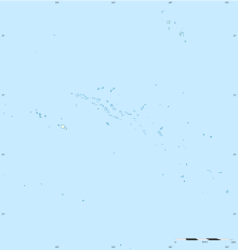
| Coordinates | 08°56′06.7″S139°33′18.4″W/ 8.935194°S 139.555111°W | ||||||||||
| Map | |||||||||||
 | |||||||||||
| Runways | |||||||||||
| |||||||||||
Sources: Great Circle Mapper[1] | |||||||||||
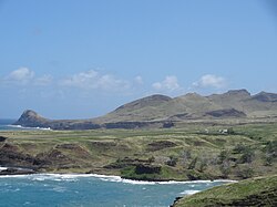
Ua Huka Airportis an airport onUa HukainFrench Polynesia(IATA:UAH,ICAO:NTMU). The airport is 2.2 km southwest of the village ofHane.The airport was opened on November 4, 1970, with the first landings made by anAir TahitiPiper Aztecand an RAI Twin Otter.[2]Commercial flights began in 1971.[2]As of 2021 it received 1600 passengers a year.[3]
Airlines and destinations
[edit]| Airlines | Destinations |
|---|---|
| Air Tahiti | Atuona,Nuku Hiva,Ua Pou |
Statistics
[edit]Graphs are unavailable due to technical issues. There is more info onPhabricatorand onMediaWiki.org. |
Annual passenger traffic at UAH airport.
SeeWikidata query.
References
[edit]- ^Great Circle Mapper - Ua Huka Airport
- ^ab"Air Link Opens To" Forgotten "Marquesas".Pacific Islands Monthly.Vol. 41, no. 12. 1 December 1970. p. 39.Retrieved12 March2022– via National Library of Australia.
- ^"Statistiques annuelles: Aéroport de Ua Huka".UAF&FA.Retrieved24 November2022.
External links
[edit]- NTMU –UA HUKA.AIPfrom FrenchService d'information aéronautique,effective 31 October 2024.

