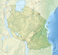
Ulenge Island
| Ulenge Island | |
|---|---|
| Location | Tanga Region, Tanga District |
| Nearest city | Tanga |
| Coordinates | 5°0′28″S39°9′42″E/ 5.00778°S 39.16167°E |
| Length | 1.0 km (0.62 mi) |
| Width | 0.2 km (0.12 mi) |
| Established | 2010 |
| Governing body | Marine Parks & Reserves Authority (Tanzania) |
| Website | Tanga Marine Reserves System |
Ulenge Islandofficially,Ulenge Island Marine Reserve(Kisiwa cha Hifadhi Akiba cha Ulenge,inSwahili) is a protected, seasonally habited island in theTanga BayofPemba Channelunder theTanga Marine Reserves(TMRS) with theIUCN category IIlocated withinTanga City CouncilofTanga RegioninTanzania.Kwale Islandand Ulenge Island are the only islands in the marine reserve that are seasonally inhabited. Of Tanga's whole marine reserves system, Ulenge Island is the mostdegraded.Ulenge'sreefshad the lowest fish numbers and the lowestcoralcover and species diversity (5-7%, 16 coral genera). This is mostly becauseTanga BayandTanga City Councilare nearby, which has a greater negative human impact. Ulenge Island is nicknamed by English speakers asBird Islanddue to its importance as a seabird sanctuary.[1][2]
History
[edit]TheSwahilipeople from the north, led by Chief Mwinyi Ulenge, are said to have been the initial inhabitants of Ulenge Island. They were compelled to travel to the mainland due to a water deficit on the island. The majority of them relocated toChongoleaniward of Tanga city.[3]The island is also the location of two of Tanga's most famous lighthouses; theUlenge Island Front Range Lighthouseand theUlenge Island Rear Range Lighthouse.[4]
Geography and ecology
[edit]The primarybiotopeat Ulenge Island Marine Reserve ismangrovevegetation. Despite the presence of all mangrove species, species with robust root systems, such asRhizophora mucronataandSonneratia alba,predominate. Numerous plant (trees and grass) and animal (unstudied) populations can be found on Ulenge Island. Daily tidal wash through in the mangrove ecosystem on Ulenge results in a relatively thin layer of silt buildup.[5]
According toBirdlife International,the Ulenge and Kwale Island Marine Reserves are located in IBM 35, an important bird region. This bird area contains a diverse range of bird species, includingGreater Sand Plover,Curlew Sandpiper,Crab Plover,migrating waders, and many more. Despite being threatened by human activity and climate change-related reasons, mangroves and coral reefs are not actually in danger.[6]
On the west and south of Ulenge Island, theintertidalzone is longer (up to 800 m), while it is shorter (50–350 m) on the seaward side. North of Ulenge Island, the intertidal is rock, with large algae mats in the lower intertidal zones. On the lower intertidal zone on the seaward side, algae mats were also discovered. Along the Ulenge-Kwale channel, beyond the algal mats, to the south and south-west of Ulenge (in Tanga Bay), and in the lower intertidal zones of Kwale Bay, one can seeseagrassbeds.[7]
Turbidity and bottom sediment type, which are regulated by rainfall/river discharge patterns and oceanic conditions, determine the amount and distribution of seagrass. On the seaward side,coral reefsare few. The results of themanta towand swimmingbenthiccover surveys showed a relatively small area of patchy coral reefs that were stressed by sediments from Tanga Bay and nearbyrivers.In most of the Ulenge Island waters, there was less than 10% coral cover.[8]
References
[edit]- ^Muhando, C. A. "Biophysical Features in the Northern Tanga Marine Reserves, Tanzania." Marine Parks and Reserves Unit, Dar es Salaam, Tanzania. vi (2011).
- ^"Mwewe Island, Mkinga elevation".Retrieved2023-09-15.
- ^Muhando, C. A. "Biophysical Features in the Northern Tanga Marine Reserves, Tanzania." Marine Parks and Reserves Unit, Dar es Salaam, Tanzania. vi (2011).
- ^Rowlett, Russ (12 June 2005)."Lighthouses of Tanzania".The Lighthouse Directory.University of North Carolina at Chapel Hill.Retrieved6 February2014.
- ^Muhando, C. A. "Biophysical Features in the Northern Tanga Marine Reserves, Tanzania." Marine Parks and Reserves Unit, Dar es Salaam, Tanzania. vi (2011).
- ^Muhando, C. A. "Biophysical Features in the Northern Tanga Marine Reserves, Tanzania." Marine Parks and Reserves Unit, Dar es Salaam, Tanzania. vi (2011).
- ^Muhando, C. A. "Biophysical Features in the Northern Tanga Marine Reserves, Tanzania." Marine Parks and Reserves Unit, Dar es Salaam, Tanzania. vi (2011).
- ^Muhando, C. A. "Biophysical Features in the Northern Tanga Marine Reserves, Tanzania." Marine Parks and Reserves Unit, Dar es Salaam, Tanzania. vi (2011).

