
Veere
Veere
Ter Veere(Zeeuws) | |
|---|---|
Municipalityand town | |
 The city of Veere in 2007 | |
 Flag  Coat of arms | |
 Location in Zeeland | |
| Coordinates:51°32′53″N3°40′00″E/ 51.54806°N 3.66667°E | |
| Country | Netherlands |
| Province | Zeeland |
| Government | |
| • Body | Municipal council |
| •Mayor | Frederiek Schouwenaar(VVD) |
| Area | |
| • Total | 206.55 km2(79.75 sq mi) |
| • Land | 132.56 km2(51.18 sq mi) |
| • Water | 73.99 km2(28.57 sq mi) |
| Elevation | 0 m (0 ft) |
| Population (January 2021)[4] | |
| • Total | 21,953 |
| • Density | 166/km2(430/sq mi) |
| Time zone | UTC+1(CET) |
| • Summer (DST) | UTC+2(CEST) |
| Postcode | 4350–4379 |
| Area code | 0118 |
| Website | www |

Veere(Dutch:[ˈveːrə];Zeelandic:Ter Veere) is a municipality with a population of 22,000 and a town with a population of 1,500 in the southwesternNetherlands,in the region ofWalcherenin the province ofZeeland.
History[edit]
The nameVeeremeans "ferry": Wolfert Van Borssele established a ferry and ferry house there in 1281. This ferry he called the "camper-veer" or "Ferry of Campu" by which name Camphire it was known, at least in England, until the seventeenth century.[5]It eventually became known as "de Veer". In the same year 1281 Wolfert also built the castle Sandenburg on one of the dikes he had built. On 12 November 1282, Count Floris V. thereupon issued a charter by which Wolfert received the sovereignty to the land and castle with the ferry and ferry house. From that time on Wolfert was given the title of Lord Van der Veer.[6]Veere receivedcity rightsin 1355.

The "Admiraliteit van Veere"(Admiralty of Veere) was set up as a result of the Ordinance on the Admiralty of 8 January 1488 in an attempt to create a central naval administration in theBurgundian Netherlands.To this was subordinated the Vice-Admiralty ofFlandersinDunkirk.In 1560 under admiralPhilip de Montmorency, Count of Hoorn,this admiralty relocated nearGhentand in 1561 theHabsburgnaval forces were also moved to Veere.
Veere functioned as thestaple portforScotland[7]between 1541[8]and 1799. In Scotland it was known as Campvere.[9]Until the Anglo-Dutch wars it was an important trading port for the import among other things, of saffron from East Anglian ports such as Wells.[10]
Flemish architectsAntonis KeldermansandEvert Spoorwaterdesigned theGrote Kerk,the fortifications, the Cisterne and the town hall. During this period of prosperity, the cultural centre was located atSandenburgh castle,the residence of the noble Van Borsele and Van Bourgondië families. Court painterJan Gossaert van Mabuseworked here.[11]The poetAdrianus Valeriuslived and worked in the city from 1591. In the 17th and 18th centuries, Veere was a prosperous trading city, with about 750 houses inside the city walls then, compared to about 300 as of 2013[update].
At the start of theSecond World War,there was aRoyal Netherlands Navyseaplanebase at Veere, with sixFokker C XIV-Waircraft. On 12 May 1940 the base was bombed byHe 111bombers causing some casualties.[12]On 14 May, the seaplanes were ordered to evacuate to France and then England, eventually arriving in theDutch East Indieswhere they would be destroyed in action with the Japanese in 1941 and 1942.[13]On 17 May, German infantry ofSS Regiment Deutschlandof the2nd SS Panzer Divisioncrossed onto Walcheren via theSloedamand by 18:00 that evening, the Dutch forces on the island, including the garrison at Veere, were ordered to surrender.[14]Veere was finally liberated on 7 November 1944 by Scottish troops of the British52nd (Lowland) Infantry DivisionduringOperation Infatuate,the Allied assault on Walcheren. As part of the preparations for the operation, the island's sea dykes were bombed resulting in the inundation of much of the area. Unlike many other towns on the island, Veere was virtually undamaged in the fighting.[15]
As a result of the damming of theVeerse Gatinlet in 1961, the fishing fleet of Veere moved to a new home port at Colijnsplaat on Noord-Beveland.[16]As of 2013[update]the main business of the town is tourism.
Veere municipality reached its current expanded shape in 1997, after the addition of several neighboring towns. During the course of nearly two centuries seventeen historical municipalities have merged to become present-day Veere. Its original full name wasVeere-de-Stad en Zanddijk-Binnen.
Geography[edit]
The city of Veere stands on theVeerse Meerlagoon on the island ofWalcherenin the province ofZeelandin theNetherlands.
The area of the municipality of Veere is 13,496 hectares, with a coastline of 34 kilometres and a population of about 22,000.
Population centres[edit]
The population centres in the municipality are:
- Aagtekerke(population as of 2003: 1,479)
- Biggekerke(895)
- Domburg(1,481)
- Gapinge(522)
- Grijpskerke(1,377)
- Joossesweg(20)
- Koudekerke(3,620)
- Meliskerke(1,477)
- Oostkapelle(2,451)
- Serooskerke(1,833)
- Veere (1,520)
- Vrouwenpolder(1,125)
- Westkapelle(2,672)
- Zoutelande(1,593)
Tourism[edit]
The area is visited by 4 million tourists annually. The main attractions are the beaches andmarinas.TheStorm Surge Barrieron theOosterscheldeis the most popular visitor attraction in Zeeland.[17]TheScoutcentrum Zeelandon the coast of the Veerse Meer attractsScoutvisitors from around the world[18]
In fiction[edit]

The town of Veere forms the setting for "Van Loon's Lives",a book ofcontemporary fantasywritten byHendrik Willem Van Loonin 1942, in which the protagonists are able to magically summon the great men and women of history for weekend dinner parties, leading to often humorous incidents. The book was written at the time when Veere, like the rest of the Netherlands, lay under Nazi occupation, and despite its light-hearted tone clearly indicates the longing of the writer – living in the US – for his homeland whose liberation he was doomed never to see.
Scottish singer-songwriterBrian McNeillbased the song "The Holland Trade" from his tenth studio albumThe Baltic tae Byzantiumon the trade and cultural ties between Veere and Scotland from 1541 on.
Notable people[edit]


- Maryn Adriansen(1600 in Veere – ca.1654) was a boatswain and early settler toNew Netherland
- Peter Daane(1835 in Westkapelle – 1914) an American businessman and politician inWisconsin
- Peter de Ru(born 1946 in Oostkapelle) a photographer in Sweden
- Maximiliaan de Vriendt(1559 at Zandenburg Castle, Veere – 1614) aNeo-Latinpoet
- Jurn de Vries(born 1940 in Vrouwenpolder) a Dutch theologian, former politician and journalist
- Nicolaas Everaerts(1461/62 in Grijpskerke – 1532) a Dutch jurist and academic
- Johannes Gabrielse(1881 in Westkapelle – 1945) a Dutch artist in theDutch East Indies
- Wim Hofman(born 1941 in Oostkapelle) a Dutch author
- Johannes Hermanus Koekkoek(1778 in Veere – 1851) a Dutch painter and draughtsman
- Aert H. Kuipers(1919 in Oostkapelle or Middelburg – 2012) a Dutch linguistics professor who did fieldwork amongFirst Nationspeople ofBritish Columbia
- Hans Peter Minderhoud(born 1973 in Westkapelle) a Dutch dressage rider
- Matthijs Röling(born 1943 in Oostkapelle) a Dutch painter, graphic designer, draftsman and lithographer
- Franca Treur(born 1979 near Meliskerke) a Dutch writer and a freelance journalist
- Gerard von Brucken Fock(1859 in Koudekerke – 1935) a classical Dutch pianist, composer and painter
- Hans Wijers(born 1951 in Oostburg) a retired Dutch politician and chairman of theING Groupsince 2018.
Gallery[edit]
-
 Harbour of Veere
 -
 Harbour of Veere
 -
 Windmill: The "de Koe" corn windmill
 -
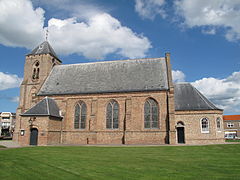
 Koudekerke, church: Michaëlskerk
 -
 Westkapelle, light house
 -
 Gapinge, church
 -
 Domburg, castle/youth hostel
 -
 Serooskerke, windmill
 -
 Zoutelande, church


References[edit]
- ^"Burgemeester drs. F.J. (Frederiek) Schouwenaar"[Mayor] (in Dutch). Gemeente Veere.Retrieved15 April2023.
- ^"Kerncijfers wijken en buurten 2020"[Key figures for neighbourhoods 2020].StatLine(in Dutch).CBS.24 July 2020.Retrieved19 September2020.
- ^"Postcodetool for 4357ET".Actueel Hoogtebestand Nederland(in Dutch). Het Waterschapshuis.Retrieved18 December2013.
- ^"Bevolkingsontwikkeling; regio per maand"[Population growth; regions per month].CBS Statline(in Dutch).CBS.1 January 2021.Retrieved2 January2022.
- ^National Archives (UK) E190/433/12
- ^"THE VAN DER VEER FAMILY in the Netherlands".Archived fromthe originalon 16 April 2018.Retrieved4 August2023.
- ^AT HOME ABROAD: ETHNICITY AND ENCLAVE IN THE WORLD OF SCOTS TRADERS IN NORTHERN EUROPE, c. 1600–1800* by DOUGLAS CATTERALL (page 4)
- ^"Scotland in Europe".BBC History.Retrieved8 April2017.
- ^Morris, David B. (1919).The Stirling merchant gild and life of John Cowane.Stirling: Morris, David B. pp. 195–210.Retrieved8 April2017.
- ^National Archives (UK)E190/433/12
- ^"Gemeente Veere Internet | English | Art".www.veere.nl.Archived fromthe originalon 9 June 2011.
- ^"War over Holland – Zeeland – The airforce and navy air fleet bases".waroverholland.nl.Retrieved13 April2015.
- ^"War over Holland – Zeeland – The AFB's".waroverholland.nl.Retrieved13 April2015.
- ^"War over Holland – Zeeland – Capitulation of Walcheren and Zuid-Beveland".waroverholland.nl.Retrieved13 April2015.
- ^"NL06 – Operation Infatuate".scottishdiasporatapestry.org.Retrieved13 April2015.
- ^"Archived copy".Archived fromthe originalon 24 July 2011.Retrieved20 January2010.
{{cite web}}:CS1 maint: archived copy as title (link) - ^"Gemeente Veere Internet | English | Deltapark Neeltje Jans".www.veere.nl.Archived fromthe originalon 9 June 2011.
- ^"Home - Scoutcenter Zeeland".Retrieved4 August2023.
External links[edit]
- Official website
- Veere in the picture, Beautiful photos of Veere.Archived10 May 2019 at theWayback Machine
- Website about the historic city of Veere
Places adjacent to Veere | |
|---|---|
Municipalities ofZeeland | ||
|---|---|---|
 | ||
| ||
| International | |
|---|---|
| National | |
| Geographic | |
| Other | |