
Vilaflor, Santa Cruz de Tenerife
Vilaflor | |
|---|---|
 Vilaflor from above | |
 Flag  Coat of arms | |
 Municipal location in Tenerife | |
 Vilaflor Location in Province of Santa Cruz de Tenerife  Vilaflor Vilaflor (Canary Islands)  Vilaflor Vilaflor (Spain, Canary Islands) | |
| Coordinates:28°9′30″N16°38′10″W/ 28.15833°N 16.63611°W | |
| Country | |
| Autonomous Region | Canary Islands |
| Province | Santa Cruz de Tenerife |
| Island | Tenerife |
| Area | |
| • Total | 56.26 km2(21.72 sq mi) |
| Population (2018)[2] | |
| • Total | 1,645 |
| • Density | 29/km2(76/sq mi) |
| Time zone | UTC+0(GMT) |
| Climate | Csb |
| Website | www.vilaflordechasna.es |
Vilafloris a municipality and village in the south-central part of the island ofTenerife,one of theCanary Islands,and part ofSanta Cruz de Tenerife (province),Spain. Vilaflor, with an altitude of 1,400 m, is the highest village on Tenerife, situated south of theTeidevolcano. It is located 7 km north ofSan Miguel de Abonaand 51 km southwest of the island's capitalSanta Cruz de Tenerife.The population is 1,645 (2018)[3]and the area is 56.26 km².[1]
Sights
[edit]- Paisaje Lunar (Lunar Landscape), a geological phenomenon created by erosion.
- El Pino Gordo (Thick Pine tree).
- The mineral springs of Fuente Alta, which can be found at 1400 meters above sea level in a protected nature reserve. The bottled water companyFuentealtauses from this mineral spring.
- Church of Saint Peter, it is the parish church of the town.
- Sanctuary of the Santo Hermano Pedro,a church built in honor of SaintPeter of Saint Joseph Betancur(Santo Hermano Pedro).

History
[edit]Before the arrival of the Europeans in the 15th century, the territory was inhabited by theGuanches,the first settlers of the island, belonging to the kingdom ormenceyato of Abona.
Once the conquest is over, the colonizing process begins with the distribution of land and other goods among the conquerors and settlers by the new governorAlonso Fernández de Lugo.The current town would be founded around 1520, reaching the category of municipality in 1812. In 1533, a hermitage dedicated toSaint Peterwas built by the Soler family. In 1568 the hermitage was elevated to the rank of parish church.
SaintPeter of Saint Joseph Betancurwas born in Vilaflor in 1626. This religious was a missionary inGuatemalaand is the first native saint of the Canary Islands. TheSanctuary of the Santo Hermano Pedrois currently located in the exact location of his birthplace.
Today, vines and potatoes, as well as fruits, flowers and vegetables are grown in the surrounding region. Vilaflor is currently the least populated municipality on the island of Tenerife, with 1,645 inhabitants in 2018.
Climate
[edit]| Climate data for Vilaflor 1378m (Temperatures:1983-1995; Precipitation:1945-1997) | |||||||||||||
|---|---|---|---|---|---|---|---|---|---|---|---|---|---|
| Month | Jan | Feb | Mar | Apr | May | Jun | Jul | Aug | Sep | Oct | Nov | Dec | Year |
| Mean daily maximum °C (°F) | 13.5 (56.3) |
14.4 (57.9) |
16.0 (60.8) |
16.1 (61.0) |
18.3 (64.9) |
21.2 (70.2) |
27.4 (81.3) |
27.9 (82.2) |
23.5 (74.3) |
18.7 (65.7) |
16.0 (60.8) |
14.5 (58.1) |
19.0 (66.2) |
| Daily mean °C (°F) | 9.4 (48.9) |
10.2 (50.4) |
11.7 (53.1) |
11.9 (53.4) |
13.8 (56.8) |
16.7 (62.1) |
22.7 (72.9) |
23.0 (73.4) |
19.2 (66.6) |
14.4 (57.9) |
11.4 (52.5) |
10.0 (50.0) |
14.7 (58.5) |
| Mean daily minimum °C (°F) | 5.4 (41.7) |
6.0 (42.8) |
7.3 (45.1) |
7.2 (45.0) |
9.5 (49.1) |
12.2 (54.0) |
18.0 (64.4) |
18.5 (65.3) |
14.8 (58.6) |
10.4 (50.7) |
8.2 (46.8) |
7.0 (44.6) |
10.2 (50.4) |
| Averageprecipitationmm (inches) | 49.4 (1.94) |
51.2 (2.02) |
34.1 (1.34) |
24.4 (0.96) |
2.7 (0.11) |
0.4 (0.02) |
0.0 (0.0) |
0.8 (0.03) |
7.5 (0.30) |
33.8 (1.33) |
70.6 (2.78) |
56.2 (2.21) |
366.1 (14.41) |
| Average rainy days | 5.0 | 5.0 | 5.0 | 4.0 | 3.0 | 2.0 | 1.0 | 1.0 | 3.0 | 5.0 | 6.0 | 6.0 | 46 |
| Mean dailysunshine hours | 6.0 | 7.0 | 7.0 | 8.0 | 9.0 | 9.0 | 10.0 | 9.0 | 8.0 | 7.0 | 6.0 | 6.0 | 7.7 |
| Percentpossible sunshine | 55 | 64 | 58 | 62 | 64 | 64 | 71 | 69 | 67 | 64 | 55 | 60 | 63 |
| Source 1: Gobierno de Canarias[4] | |||||||||||||
| Source 2: Weather Atlas (rainy days and sunshine data)[5] | |||||||||||||
| Climate data for Vilaflor | |||||||||||||
|---|---|---|---|---|---|---|---|---|---|---|---|---|---|
| Month | Jan | Feb | Mar | Apr | May | Jun | Jul | Aug | Sep | Oct | Nov | Dec | Year |
| Mean daily daylight hours | 11.0 | 11.0 | 12.0 | 13.0 | 14.0 | 14.0 | 14.0 | 13.0 | 12.0 | 11.0 | 11.0 | 10.0 | 12.2 |
| AverageUltraviolet index | 4 | 6 | 8 | 9 | 10 | 11 | 11 | 11 | 9 | 7 | 5 | 4 | 7.9 |
| Source: Weather Atlas[5] | |||||||||||||
Historical population
[edit]| Year | Population |
|---|---|
| 2003 | 1,798 |
| 2013 | 1,804 |
Twin towns – sister cities
[edit]- La Orotava,Spain
- La Antigua Guatemala,Guatemala
Gallery
[edit]-
 Central square
 -
 Smal houses
 -
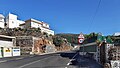 Main road
 -
 Santo Domingo street
 -
 Sanctuary of the Santo Hermano Pedro


References
[edit]- ^abInstituto Canario de Estadística,area
- ^Municipal Register of Spain 2018.National Statistics Institute.
- ^Instituto Canario de EstadísticaArchivedApril 19, 2014, at theWayback Machine,population
- ^"Documento informativo del Plan Especial del paisaje protegido de Ifonche"(PDF).Archived fromthe original(PDF)on 2016-03-04.
- ^ab"Vilaflor, Spain - Climate data".Weather Atlas.Retrieved16 March2017.
External links
[edit]- Official website
 (in Spanish)
  Media related toVilaflorat Wikimedia Commons
Places adjacent to Vilaflor, Santa Cruz de Tenerife | |
|---|---|
| International | |
|---|---|
| National | |