
Weipa
| Weipa Queensland | |||||||||
|---|---|---|---|---|---|---|---|---|---|
 Weipa | |||||||||
 Weipa | |||||||||
| Coordinates | 12°37′48″S141°52′43″E/ 12.63°S 141.8786°E | ||||||||
| Population | 4,097 (2021 census)[1] | ||||||||
| Established | 1961[2] | ||||||||
| Postcode(s) | 4874 | ||||||||
| Elevation | 15 m (49 ft) | ||||||||
| Time zone | AEST(UTC+10:00) | ||||||||
| Location | |||||||||
| LGA(s) | Weipa Town | ||||||||
| State electorate(s) | Cook | ||||||||
| Federal division(s) | Leichhardt | ||||||||
| |||||||||
Weipa(/wiːpə/)[3]is a coastal mining town in the local government area ofWeipa TowninQueensland.[4]It is one of the largest towns on theCape York Peninsula.It exists because of the enormousbauxitedeposits along the coast. The Port of Weipa is mainly involved in exports of bauxite. There are also shipments of live cattle from the port.[5]
In the2021 census,the town of Weipa had a population of 4,097 people.[1]
Geography[edit]
Weipa is on the western coast of theCape York Peninsulafacing theGulf of Carpentaria.[6]
Weipa is just south ofDuyfken Point,which was named byMatthew Flinderson 8 November 1802 after the shipDuyfkencommanded by the Dutch explorerWillem Janszoon.[7]It is claimed that Janszoon was the first European to sight the Australian coast in theGulf of Carpentariain 1606, 164 years beforeLieutenant James Cooksailed up the east coast of Australia.[8]
The town consists of three residential suburbs,Rocky Point,Trunding,andNanum,in addition to the industrial suburb ofEvans Landing;these suburbs are contiguous. The town also includes the suburb ofWeipa Airportwhich is not connected to the other suburbs and contains thetown's airport.[6]
History[edit]
Traditional owners and languages[edit]
Yupanguthi(Yuputhimri, Jupangati, Yupangathi, Nggerikudi, Yupungati, Jupangati) is anAustralian Aboriginal languagespoken on Yupanguthi country. The Yupanguthi language region includes the landscape within the local government boundaries of the landscape within the local government boundaries of theShire of Cookand Weipa Region.[9]
Kugu Yi'anh is a language of Cape York. The traditional language area of Kugu Yi'anh includes landscape within the local government boundaries of the Cook Shire.[10]
Kugu Nganchara (also known as Wik, Wiknantjara, Wik Nganychara, Wik Ngencherr. See also related Wik languages) is a traditional language of the area which includes the landscape within the local government boundaries of theCook Shire.[11]
Kugu Muminh (also known as Kuku-Muminh. See also related Wik languages) is one of the traditional languages which includes the landscape within the local government boundaries of theCook Shire.[12]

Thaynakwith(also known as Awngthim, Tainikuit and Winduwinda) is anAustralian Aboriginal languagespoken on Western Cape York in the Weipa area taking in Albatross Bay andMission River.The language region includes areas within the local government boundaries of Weipa Town Council andCook Shire.[13]
Weipa Mission[edit]
In 1895,Presbyterianmissionary Reverend Nicholas John Hey established a mission at the junction of Embley River and Spring Creek which he called Weipa, which is believed to derive from the Anhathangayth word meaning "fighting ground". In 1932 the mission relocated approximately 28 kilometres (17 mi) to Jessica Point, continuing under the same name,[14]Weipa Mission.[15]
Very restrictive legislation was enacted by the state of Queensland in 1911, making theProtector of Aboriginesthe legal guardian of everyAboriginaland part-Aboriginal child (until he/she was 21), and the right to confine (or expel) any such person within anyAboriginal reserveor institution, and the right to imprison any Aboriginal or part-Aboriginal person for 14 days if, in the Protector's judgement, they were guilty of neglect of duty, gross insubordination or wilful preaching of disobedience. It also gave powers to the police to confine Aboriginal people to reserves to "protect them from corruption". This latter power was given by Comalco[clarification needed]in 1957 to justify the removal of Weipa Aboriginal people.[16]
In 1932, the community had to relocate to its present site, atJessica Pointnow calledNapranumbecause ofmalaria.It is about 12 kilometres (7.5 mi) south of the present town of Weipa. At this time most of the people wereAwngthimbut soon different tribes and clans and other communities were forcibly removed fromOld Mapoon.To prevent the spread of malaria, theOld Mapoonsettlement was burnt down on 15 November 1963.[17]
Mining town[edit]
In 1955 a geologist,Henry Evans(1912–1990), discovered that the red cliffs on theAboriginal reserve,previously remarked on by the early Dutch explorers andMatthew Flinders,were actually enormous deposits ofbauxite– the ore from whichaluminiumis made – and to a lesser extenttungsten.
The "Comalco Act 1957"revoked the reserve status, giving the company 5,760 square kilometres (2,220 sq mi) of Aboriginal reserve land on the west coast of the Peninsula and 5,135 square kilometres (1,983 sq mi) on the east coast of Aboriginal-owned (though not reserve) land.[18]Mining commenced in 1960. In 1962, residents accepted Comalco's offer to rebuild the Jessica Point village at a cost of £150,000. By the time building began in 1965, it became clear that funding was inadequate to build houses for the whole community, which contributed towards the Presbyterian Church's decision to hand over responsibility for the mission to theQueensland Government.The community became known as Weipa South after this.[15]
The Weipa Parish of the Roman Catholic Diocese of Cairns was established in 1982.[19]
On 30 March 1985, the Weipa South community elected the Weipa South Aboriginal Council, and the Aboriginal reserve held by the government was transferred to the council on 27 October 1988 under aDeed of Grant in Trust(DOGIT). In 1990, the Weipa South community became known asNapranum,meaning "meeting place of the people". The DOGIT lands became known as the Napranum DOGIT in 1991. In 1992, thePeppan people,originally located to the east of Napranum, were grantedfreehold titleto former Aboriginal reserve land, which had been leased to the Commonwealth for the construction ofScherger Air Force Base.This was the first real compensation to the people of Napranum for use of their land.[15]
In 1995 a major industrial dispute occurred between Comalco and its workforce to maintain union coverage, pay and conditions.[20]
On 1 January 2005, the Napranum Aboriginal Council became theNapranum Aboriginal Shire Council.[15]
Demographics[edit]
In the2016 census,the town of Weipa had a population of 3,899 people.[21]
In the2021 census,the town of Weipa had a population of 4,097 people.[1]
Climate[edit]
Weipa has atropical savanna climate(Köppen:Aw); with three distinct seasons; which vary in their intensity and duration. Thewet season,which runs from January to April, is characterised by high humidity, warm nights and heavy downpours; as well as occasional monsoonal lows andtropical cyclones.Thedry season,running from May to September, features hot and dry days, cooler nights and little rainfall. The build-up season, running from October to December, is oppressively hot and humid, with frequent days over 35.0 °C (95.0 °F); with infrequent, heavy downpours associated with severethunderstorms.
Temperatures remain hot year-round, with average maxima ranging from 31.1 °C (88.0 °F) in July to 35.9 °C (96.6 °F) in November. Average annual rainfall is 1,968.5 mm (77.50 in); and the highest daily rainfall recorded was 356.0 millimetres (14.02 in) during the passage ofTropical Cyclone Oswaldon the 23rd of January 2013.[22]Extreme temperatures have ranged from 9.6 °C (49.3 °F) on the 3rd of August 1990 to 40.1 °C (104.2 °F) on the 29th of October 2022.[23]
While most climate data was taken fromWeipa Airport,extreme temperatures were combined from the older Eastern Ave and newer Airport weather stations (1959-2024).
| Climate data for Weipa (12º37'48 "S, 141º52'48" E, 20 m AMSL) (1990-2024 normals, extremes 1959-2024) | |||||||||||||
|---|---|---|---|---|---|---|---|---|---|---|---|---|---|
| Month | Jan | Feb | Mar | Apr | May | Jun | Jul | Aug | Sep | Oct | Nov | Dec | Year |
| Record high °C (°F) | 37.5 (99.5) |
35.7 (96.3) |
35.7 (96.3) |
35.3 (95.5) |
35.5 (95.9) |
35.5 (95.9) |
35.7 (96.3) |
35.9 (96.6) |
38.6 (101.5) |
40.1 (104.2) |
39.5 (103.1) |
39.2 (102.6) |
40.1 (104.2) |
| Mean daily maximum °C (°F) | 32.0 (89.6) |
31.5 (88.7) |
31.9 (89.4) |
32.3 (90.1) |
31.9 (89.4) |
31.2 (88.2) |
31.1 (88.0) |
32.2 (90.0) |
34.5 (94.1) |
35.8 (96.4) |
35.9 (96.6) |
34.0 (93.2) |
32.9 (91.1) |
| Mean daily minimum °C (°F) | 24.3 (75.7) |
24.3 (75.7) |
24.0 (75.2) |
23.0 (73.4) |
21.5 (70.7) |
20.1 (68.2) |
19.1 (66.4) |
18.9 (66.0) |
20.0 (68.0) |
21.9 (71.4) |
23.5 (74.3) |
24.3 (75.7) |
22.1 (71.7) |
| Record low °C (°F) | 20.0 (68.0) |
20.1 (68.2) |
19.1 (66.4) |
14.4 (57.9) |
12.7 (54.9) |
10.2 (50.4) |
10.4 (50.7) |
9.6 (49.3) |
13.9 (57.0) |
13.2 (55.8) |
17.8 (64.0) |
20.1 (68.2) |
9.6 (49.3) |
| Averageprecipitationmm (inches) | 500.8 (19.72) |
501.4 (19.74) |
404.0 (15.91) |
111.4 (4.39) |
19.8 (0.78) |
3.3 (0.13) |
1.6 (0.06) |
4.5 (0.18) |
1.8 (0.07) |
20.0 (0.79) |
92.4 (3.64) |
291.6 (11.48) |
1,968.5 (77.50) |
| Average precipitation days(≥ 1.0 mm) | 16.1 | 15.6 | 14.8 | 7.3 | 1.9 | 0.4 | 0.4 | 0.5 | 0.4 | 1.4 | 4.9 | 11.5 | 75.2 |
| Average afternoonrelative humidity(%) | 73 | 76 | 70 | 59 | 52 | 49 | 44 | 41 | 37 | 39 | 46 | 60 | 54 |
| Averagedew point°C (°F) | 24.0 (75.2) |
24.3 (75.7) |
23.4 (74.1) |
21.5 (70.7) |
19.4 (66.9) |
17.8 (64.0) |
15.9 (60.6) |
15.2 (59.4) |
15.5 (59.9) |
17.0 (62.6) |
19.3 (66.7) |
22.4 (72.3) |
19.6 (67.3) |
| Mean monthlysunshine hours | 164.3 | 144.1 | 186.0 | 234.0 | 254.2 | 237.0 | 254.2 | 275.9 | 285.0 | 303.8 | 285.0 | 232.5 | 2,856 |
| Percentpossible sunshine | 41 | 41 | 49 | 66 | 71 | 69 | 72 | 76 | 79 | 79 | 75 | 58 | 65 |
| Source:Bureau of Meteorology(1990-2024 normals, extremes 1959-2024)[24][25] | |||||||||||||
Economy[edit]

The present town was constructed mainly byComalco(now calledRio Tinto), a large aluminium company, which began making trial shipments of bauxite toJapanin 1962. A railway was constructed to transport the ore from the mine at Andoom to the export facility at Lorim Point.[26]Weipa bauxite mineis among the world's largest. Using figures from 2006,Reutersreported that it ranked third in the world, with capacity and production at 15.5 and 16.1 million tonnes respectively.[27]
Education[edit]
There are two schools in Weipa.
TheWestern Cape Collegeis a government co-educational school; it provides early childhood (kindergarten), primary and secondary schooling. It is on the corner of Central and Eastern Avenues inRocky Point(12°37′37″S141°52′50″E/ 12.6269°S 141.8805°E).[28]In 2015, the school had an enrolment of 1,073 students with 93 teachers (90 full-time equivalent).[29]
St Joseph's Parish School is a Roman Catholic co-educational primary school at 2 Boundary Road, Rocky Point (12°37′45″S141°52′49″E/ 12.6293°S 141.8802°E). Opened in 2016, the school only offered enrolment in years P–3 but expected to be able to offer enrollment across all primary levels (P–6) in 2018.[30][31]
Amenities[edit]

Weipa has a visitor's centre, swimming pool, bowling green, golf club, tennis and squash courts. There are netball and basketball courts as well as football fields.Weipa Town Authorityoperates a public library at Hibberd Drive in Weipa.[32]
At Nanum the shopping precinct has a Woolworths supermarket, bakery, coffee shop, travel agent, clothing shop, post office, newsagency / sports shop and butchers. There is also a chemist, camping and fishing store and within walking distance is a gift shop, furniture and whitegoods store, credit union andgovernment social securityoffice. At Evans Landing there are a hardware store and a number of mechanical workshops.[33]
St Joseph's Catholic Church is on Boundary Road at Rocky Point. It is within the Weipa Parish of theRoman Catholic Diocese of Cairns.[19]
Gallery[edit]
-
 Main road through Weipa township
 -
 Weipa Mission River bridge
 -
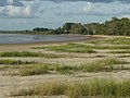
 Coastal beach and bay near Wallaby Island
 -
 Coastal beach at Nanum suburb
 -
 Raised cabins at caravan park near the beach
 -
 Former mining pit, now a freshwater pond
 -
 Car park at Woolworths shopping centre, mostly 4WDs
 -
 Weipa police station
 -
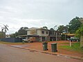 Standard style of housing in Trunding suburb
 -
 Sunset over theGulf of Carpentaria


See also[edit]
- Weipa Airport
- RAAF Base Scherger,also former site of Weipa Immigrant Detention Centre
References[edit]
- ^abcAustralian Bureau of Statistics(28 June 2022)."Weipa (UCL)".2021 Census QuickStats.Retrieved20 June2024.
- ^Penguin Books Australia (2002).Explore Queensland.Camberwell, Victoria:Penguin Books Australia. p. 60.ISBN0-14-300015-2.
- ^Macquarie Dictionary, Fourth Edition(2005). Melbourne, The Macquarie Library Pty Ltd.ISBN1-876429-14-3
- ^"Weipa – town in Weipa Town (entry 36899)".Queensland Place Names.Queensland Government.Retrieved30 May2019.
- ^McKillop, Charlie (13 October 2016)."Weipa cattle shipment to Indonesia revives live export hopes in Cape York".Australia:Australian Broadcasting Corporation.Archivedfrom the original on 10 June 2019.Retrieved10 June2019.
- ^ab"Queensland Globe".State of Queensland.Retrieved20 May2022.
- ^"Duyfken Point – point in Cook Shire (entry 10966)".Queensland Place Names.Queensland Government.Retrieved10 June2019.
- ^"Janszoon 1606".Duyfken 1606 Replica.Archivedfrom the original on 2 June 2019.Retrieved10 June2019.
- ^
 This Wikipedia article incorporatesCC-BY-4.0licensedtext from:"Yupanguthi".Queensland’s Aboriginal and Torres Strait Islander Languages map.State Library of Queensland.Retrieved28 January2020.
- ^This Wikipedia article incorporatesCC-BY-4.0licensedtext from:"Kugu Yi'anh".Queensland Aboriginal and Torres Strait Islander languages map.State Library of Queensland.Retrieved5 February2020.
- ^This Wikipedia article incorporatesCC-BY-4.0licensedtext from:"Indigenous languages map of Queensland".State Library of Queensland.State Library of Queensland.Retrieved5 February2020.
- ^This Wikipedia article incorporatesCC-BY-4.0licensedtext from:"Indigenous languages map of Queensland".State Library of Queensland.State Library of Queensland.Retrieved5 February2020.
- ^This Wikipedia article incorporatesCC-BY-4.0licensedtext from:"Thaynakwith".Queensland’s Aboriginal and Torres Strait Islander Languages map.State Library of Queensland.Retrieved5 February2020.
- ^"Western Cape History".Weipa Town Authority.Archived fromthe originalon 27 July 2018.Retrieved8 August2018.
- ^abcd"Napranum".Queensland Government.Archivedfrom the original on 20 May 2022.Retrieved11 October2020.
 Text was copied from this source, which is available under aAttribution 4.0 International (CC BY 4.0)Archived16 October 2020 at theWayback Machinelicence.
- ^Massacres to Mining: The Colonisation of Aboriginal Australia,p. 34. Jan Roberts. 1981. Dove Communications.ISBN0-85924-171-8.
- ^Massacres to Mining: The Colonisation of Aboriginal Australia,pp. 115–116. Jan Roberts. 1981. Dove Communications.ISBN0-85924-171-8.
- ^Massacres to Mining: The Colonisation of Aboriginal Australia,p. 97. Jan Roberts. 1981. Dove Communications.ISBN0-85924-171-8.
- ^ab"Weipa Parish".Roman Catholic Diocese of Cairns.Archivedfrom the original on 18 November 2020.Retrieved19 November2020.
- ^Ross, Liz (2020)."Defending Unionism: The Weipa Dispute, 1995".The Commons Social Change Library.Retrieved3 August2022.
- ^Australian Bureau of Statistics(27 June 2017)."Weipa (UCL)".2016 Census QuickStats.Retrieved20 October2018.
- ^"Weipa Aero Climate (1972-2024)".FarmOnline Weather.Retrieved16 July2024.
- ^"Weipa Eastern Ave Climate (1914-2024)".FarmOnline Weather.Retrieved16 July2024.
- ^"Weipa Airport Climate Statistics (1972-2024)".Bureau of Meteorology.Retrieved16 July2024.
- ^"Weipa Eastern Ave Climate Statistics (1914-2024)".Bureau of Meteorology.Retrieved16 July2024.
- ^The Heavy-duty Industrial Railway at WeipaBuckland, John L.Australian Railway Historical Society Bulletin,June, 1975 pp143-148
- ^"FACTBOX-World bauxite reserves and production".Reuters.6 February 2007.Archivedfrom the original on 23 July 2020.Retrieved23 July2020.
- ^"Western Cape College".Western Cape College.Archivedfrom the original on 2 February 2017.Retrieved22 January2017.
- ^"2015 School Annual Report"(PDF).Western Cape College.Archived(PDF)from the original on 2 February 2017.Retrieved22 January2017.
- ^"Join Us".St Joseph's Parish School. 18 November 2015.Archivedfrom the original on 2 February 2017.Retrieved22 January2017.
- ^"School newsletter"(PDF).Catholic Education.Roman Catholic Diocese of Cairns.April 2015.Archived(PDF)from the original on 7 March 2016.Retrieved22 January2017.
- ^"Hibberd Library".Public Libraries Connect.Archivedfrom the original on 3 February 2018.Retrieved2 February2018.
- ^"Weipa".Centre for the Government of Queensland.Archivedfrom the original on 7 March 2011.Retrieved17 January2011.
Further reading[edit]
- Moon, Ron & Viv. 2003.Cape York: An Adventurer's Guide.9th edition. Moon Adventure Publications, Pearcedale, Victoria.ISBN0-9578766-4-5
- Moore, David R. 1979.Islanders and Aborigines at Cape York: An ethnographic reconstruction based on the 1848–1850 'Rattlesnake' Journals of O. W. Brierly and information he obtained from Barbara Thompson.Australian Institute of Aboriginal Studies. Canberra.ISBN0-85575-076-6(hbk);ISBN0-85575-082-0(pbk). USA editionISBN0-391-00946-X(hbk);ISBN0-391-00948-6(pbk).
- Roberts, Jan. 1981.Massacres to Mining: The Colonization of Aboriginal Australia.Dove Communications, Blackburn, Victoria. Rev. Australian ed. Previous ed: CIMRA and War on Want, 1978, London.ISBN0-85924-171-8.
- Premier's Department (prepared by Connell Wagner). 1989.Cape York Peninsula Resource Analysis.Cairns.OCLC220913048
- Roth, W.E. 1897.The Queensland Aborigines.3 Vols. Reprint: Facsimile Edition, Hesperian Press, Victoria Park, W.A., 1984.ISBN0-85905-054-8
- Ryan, Michelle and Burwell, Colin, eds. 2000.Wildlife of Tropical North Queensland: Cooktown to Mackay.Queensland Museum, Brisbane.ISBN0-85905-045-9(set of 3 vols).
- Scarth-Johnson, Vera. 2000.National Treasures: Flowering plants of Cooktown and Northern Australia.Vera Scarth-Johnson Gallery Association, Cooktown.ISBN0-646-39726-5(pbk);ISBN0-646-39725-7Limited Edition – Leather Bound.
- Sutton, Peter (ed).Languages of Cape York: Papers presented to a Symposium organised by the Australian Institute of Aboriginal Studies.Australian Institute of Aboriginal Studies, Canberra. (1976).ISBN0-85575-046-4
- Wallace, Lennie. 2003.Cape York Peninsula: A History of Unlauded Heroes 1845–2003.Central Queensland University Press, Rockhampton.ISBN1-876780-43-6
- Wynter, Jo and Hill, John. 1991.Cape York Peninsula: Pathways to Community Economic Development.The Final Report of The Community Economic Development Projects Cook Shire. Cook Shire Council.
External links[edit]
- "A Cape to Adventure"A description of a 4WD journey to Cape York by Roderick Eime
- Cooktown Shire Official web page
- Collection of photographs taken by Wolfgang Sievers in 1957 "Presbyterian Mission Station Weipa" held at National Library of Australia, Canberra
- University of Queensland: Queensland Places: Weipa
- Napranum cha Newspaper,State Library of Queensland- digitised issues of Weipa newspaper produced by Weipa South Community Editorial Committee
- Weipa People Documentary,State Library of Queensland
| International | |
|---|---|
| National | |