Weizhou Island
Native name: Vi châu đảo | |
|---|---|
 | |
Location in theSouth China Sea | |
| Geography | |
| Coordinates | 21°03′N109°07′E/ 21.050°N 109.117°E |
| Area | 24.74 km2(9.55 sq mi) |
| Length | 6.5 km (4.04 mi) |
| Width | 6 km (3.7 mi) |
| Coastline | 15.6 km (9.69 mi) |
| Administration | |
| Autonomous region | Guangxi |
| Prefecture-level city | Beihai |


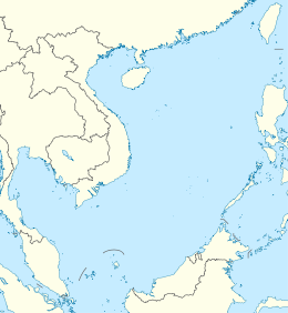
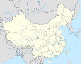
Weizhou Island(simplified Chinese:Vi châu đảo;traditional Chinese:潿 châu đảo;pinyin:Wéizhōu Dǎo) is a Chineseislandin Beibu Gulf in theGulf of Tonkin.The largest island ofGuangxi Zhuang Autonomous Region,Weizhou is west ofLeizhou Peninsula,south ofBeihai,and east ofVietnam.Administratively, it is part ofWeizhou Town,Haicheng DistrictofBeihai City.The name derives from Chinese 潿wéi( "still water" ) and châuzhōu( "river islet" ).
Geography[edit]
Its north–south length is 6.5 kilometres (4.0 miles), east–west 6 kilometres (3.7 miles). The coast is 15.6 kilometres (9.7 miles), with 6 to 10 kilometres (3.7 to 6.2 miles) of sandy beach. Weizhou rises in the south, where Nanwan Port ( nam loan cảng; pinyin: nánwān gǎng) is located.Coral reefshave been established around the island.
Climate[edit]
| Climate data for Weizhou Island (1991–2020 normals) | |||||||||||||
|---|---|---|---|---|---|---|---|---|---|---|---|---|---|
| Month | Jan | Feb | Mar | Apr | May | Jun | Jul | Aug | Sep | Oct | Nov | Dec | Year |
| Mean daily maximum °C (°F) | 18.8 (65.8) |
20.2 (68.4) |
22.9 (73.2) |
26.8 (80.2) |
30.0 (86.0) |
31.4 (88.5) |
31.6 (88.9) |
31.2 (88.2) |
30.5 (86.9) |
28.4 (83.1) |
25.1 (77.2) |
20.8 (69.4) |
26.5 (79.7) |
| Daily mean °C (°F) | 15.7 (60.3) |
16.8 (62.2) |
19.5 (67.1) |
23.5 (74.3) |
26.9 (80.4) |
28.9 (84.0) |
29.1 (84.4) |
28.7 (83.7) |
27.8 (82.0) |
25.5 (77.9) |
22.0 (71.6) |
17.6 (63.7) |
23.5 (74.3) |
| Mean daily minimum °C (°F) | 13.6 (56.5) |
14.8 (58.6) |
17.4 (63.3) |
21.4 (70.5) |
24.8 (76.6) |
26.9 (80.4) |
27.1 (80.8) |
26.6 (79.9) |
25.6 (78.1) |
23.4 (74.1) |
19.8 (67.6) |
15.5 (59.9) |
21.4 (70.5) |
| Averageprecipitationmm (inches) | 27.7 (1.09) |
25.8 (1.02) |
48.2 (1.90) |
50.0 (1.97) |
97.3 (3.83) |
201.7 (7.94) |
259.4 (10.21) |
341.0 (13.43) |
216.4 (8.52) |
103.4 (4.07) |
42.1 (1.66) |
31.5 (1.24) |
1,444.5 (56.88) |
| Average precipitation days | 7.3 | 7.8 | 9.6 | 8.7 | 8.1 | 10.5 | 12.5 | 14.5 | 11.6 | 6.7 | 5.7 | 5.5 | 108.5 |
| Averagerelative humidity(%) | 82 | 85 | 88 | 87 | 85 | 83 | 81 | 83 | 81 | 76 | 76 | 75 | 82 |
| Mean monthlysunshine hours | 118.8 | 104.7 | 118.5 | 161.0 | 237.9 | 232.5 | 248.5 | 226.3 | 218.4 | 226.7 | 187.4 | 148.0 | 2,228.7 |
| Percentpossible sunshine | 35 | 32 | 32 | 42 | 58 | 58 | 61 | 57 | 60 | 63 | 56 | 44 | 50 |
| Source:China Meteorological Administration[1][2] | |||||||||||||
Geology[edit]
Weizhou Island is China's youngest volcanic island.[3]Its origin is probably from amantle plumethat rose 50–32 million years ago, as a result from the collision of theIndianandEurasianplates.When the plume reached theasthenosphere,it helped to create theSouth China Seaby the plume's lateral flow. An evidence that the plume still exists is that a lot ofbasalthas since thePlioceneerupted in the South China Sea and its adjacent areas, for example the Yandunling ( yên đôn lĩnh ) and Yantouling ( yên đầu lĩnh ) volcanoes, Leiqiong ( lôi quỳnh ) volcano group, Weizhou Island andXieyang Island.
The mantle below the Weizhou island has an average temperature of 1,661 °C, which is between the corresponding values of theHawaiihotspotand theIcelandhotspot. [4]
There have been four periods of volcanic activity on the site, the first one occurred in the earlyPleistocene,when mainly ash began to erupt from the bottom of the sea.
The second time, between 9–225 million years ago, started with basaltic magma eruptions, and ended withpyroclasticeruptions. This was the time with the heaviest eruptions on Weizhou and Xieyang.
The third time began with large amounts of volcanic bombs and ended with basaltic magma, this was from 200,000 to 15,000 years ago.
The fourth time, from 10,000 to 7,100 years ago, a few intermittent eruptions happened, first mainly with volcanic bombs, and in the end volcanic ash.[5]
History[edit]
From 1869 to 1879, theFrenchbuilt aGothic-style15 metreCatholicchurch (Vi châu thiên chủ giáo đường) in Shengtang Village ( thịnh đường thôn; pinyin: shèngtáng cūn), Weizhou. Weizhou Chengzai Church ( thành tử giáo đường ) was built in 1880, also by French Catholics.
Wildlife[edit]
Along with smallerXieyang Island,Weizhou island is a nature reserve namedBeihai Weizhoudao Volcano National Geoparkto preserve its volcanic features, and protect rich local ecosystem engulfing 147 species of migratory and non-migratory birds, including threatened species such asblack-faced spoonbills.An autonomous region-level bird nature reserve was established in 1982, and abird ringingstation for migratory birds was established in 1985. The protected area is located between 20°54′-21°05′N and 109°05′-109°13′E, including Weizhou Island and Xieyang Island, with a total area of 26.3 square kilometers.[6][7]
Calm and shallow waters around the two islands have shown recoveries in recent years, resulting in sustaining varieties of marine life fromcoral reefs[8]tomegafaunasthat are becoming increasingly common in the area. These include such assea turtles,[9]whale sharks,and several species ofcetaceansincluding endangeredIndo-Pacific finless porpoises,[10]nationally protectedChinese white dolphins,[11]and even ablue whaleappeared in the waters in 2017.[12]Hepu Dugong National Nature Reserveestablished in 1992 covers nearby areas and which is the only sanctuary fordugongsin China.[citation needed]
Since 2015, seasonal presences ofBryde's whalesaround Weizhou and Xieyang Islands have been recognized, making the discovery the first confirmed case of large cetaceans regularly inhabiting mainland coasts of China.[13]To protect whales, the local government set a new regulation to prohibit fishery within 6 kilometers of the island. Additionally, the fishery administration has begun patrolling to monitor the public not to engage inwhale watchingactivities until the condition of whales have been thoroughly and scientifically assessed.[14]
References[edit]
- ^Trung quốc khí tượng sổ cư võng – WeatherBk Data(in Simplified Chinese).China Meteorological Administration.Retrieved21 September2023.
- ^ Trung quốc khí tượng sổ cư võng(in Simplified Chinese).China Meteorological Administration.Retrieved21 September2023.
- ^"Weizhou Island, youngest volcanic island in SW China - Xinhua | English.news.cn".www.xinhuanet.com.Archived fromthe originalon 7 April 2018.Retrieved10 August2022.
- ^"Hainan Mantle Plume and the Formation and Evolution of the South China Sea" yên toàn thụ (Quan-Shu Yan); thạch học pháp (Xue-Fa Shi) pg. 311-322
- ^"Information from the volcano museum, on Weizhou Dao"
- ^Lâm lâm tập (2001)."Vi châu đảo điểu loại bảo hộ khu".Quảng tây lâm nghiệp (Guangxi Forestry).Retrieved2009-03-07.
- ^"Tần nguy hầu điểu hắc kiểm tỳ lộ phi lâm bắc hải vi châu đảo".Guangxi Environmental Protection Bureau. 2002.Retrieved2009-03-07.
- ^Zhou Q.L.. Yang S.Y.. Chen B.H.. 2005.Studies on Marine Biodiversity in China(pdf). Khoa kỹ đạo báo - Science & Technology Review. Đệ 23 quyển đệ 2 kỳ. Bổn lan mục do trung quốc giải phẩu học hội, trung quốc hải dương học hội hiệp bạn. Retrieved on Marhch 07, 2017
- ^Lai nguyên. 2011.Quốc gia địa chất công viên chi —— quảng tây bắc hải vi châu đảo hỏa sơn địa mạo.Quảng tây địa chất quáng sản khám tra khai phát cục võng trạm.
- ^Ấn thái giang đồn hiện thân vi châu đảo hải vực, tập thể bộ thực đẳng hành vi bị thủ thứ ký lục
- ^Vi châu đảo công lược, 2019,Vi châu đảo hải vực hữu hải đồn mạ
- ^Observation.org,Archive - Yasutaka Imai
- ^Bingyao Chen, Lin Zhu, Thomas A. Jefferson, Kaiya Zhou, Guang Yang, 2019,Coastal Bryde's Whales' (Balaenoptera edeni) Foraging Area Near Weizhou Island in the Beibu Gulf,Aquatic Mammals, Vol.45, Issue 3
- ^Institute of Hydrobiology,2021,Dancing with the Whales,Chinese Academy of Sciences
External links[edit]
- Local website(in Simplified Chinese)


