
Pacific Ocean
| Pacific Ocean | |
|---|---|
 | |
| Coordinates | 0°N160°W/ 0°N 160°W |
| Surface area | 165,250,000 km2(63,800,000 sq mi) |
| Average depth | 4,280 m (14,040 ft) |
| Max. depth | 10,911 m (35,797 ft) |
| Water volume | 710,000,000 km3(170,000,000 cu mi) |
| Islands | Pacific Islands |
| Settlements | List |
   |
| Earth's ocean |
|---|
|
Main five oceans division: Further subdivision: Marginal seas |
ThePacific Oceanis the largest and deepest of Earth's fiveoceanic divisions.It extends from theArctic Oceanin the north to theSouthern Ocean(or, depending on definition, toAntarctica) in the south, and is bounded by the continents ofAsiaand Australia in the west and theAmericasin the east.
At 165,250,000 square kilometers (63,800,000 square miles) in area (as defined with a southern Antarctic border), this largest division of theWorld Oceanand thehydrospherecovers about 46% of Earth's water surface and about 32% of the planet's total surface area, larger than its entire land area (148,000,000 km2(57,000,000 sq mi)).[1]The centers of both theWater Hemisphereand theWestern Hemisphere,as well as theoceanic pole of inaccessibility,are in the Pacific Ocean. Ocean circulation (caused by theCoriolis effect) subdivides it[2]into two largely independent volumes of water that meet at theequator,theNorth Pacific Oceanand theSouth Pacific Ocean(or more loosely theSouth Seas). The Pacific Ocean can also be informally divided by theInternational Date Lineinto theEast Pacificand theWest Pacific,which allows it to be further divided into four quadrants, namely theNortheast Pacificoff the coasts ofNorth America,theSoutheast PacificoffSouth America,Northwest PacificoffFar Eastern Asia,and theSouthwest PacificaroundOceania.
The Pacific Ocean's mean depth is 4,000 meters (13,000 feet).[3]Challenger Deepin theMariana Trench,located in the northwestern Pacific, is the deepest known point in the world, reaching a depth of 10,928 meters (35,853 feet).[4]The Pacific also contains the deepest point in theSouthern Hemisphere,theHorizon Deepin theTonga Trench,at 10,823 meters (35,509 feet).[5]The third deepest point on Earth, theSirena Deep,is also located in the Mariana Trench.
The western Pacific has many majormarginal seas,including thePhilippine Sea,South China Sea,East China Sea,Sea of Japan,Sea of Okhotsk,Bering Sea,Gulf of Alaska,Mar de Grau,Tasman Sea,and theCoral Sea.
Etymology[edit]
In the early 16th century, Spanish explorerVasco Núñez de Balboacrossed theIsthmus of Panamain 1513 and sighted the great "Southern Sea" which he namedMar del Sur(in Spanish). Afterwards, the ocean's current name was coined by Portuguese explorerFerdinand Magellanduring the Spanishcircumnavigationof the world in 1521, as he encountered favorable winds on reaching the ocean. He called itMar Pacífico,which in Spanish and Portuguese means 'peaceful sea'.[6]
Largest seas in the Pacific Ocean[edit]

Top large seas:[7]
- Australasian Mediterranean Sea– 9.080 million km2(includes other seas)
- Philippine Sea– 5.695 million km2(largest single sea)
- Coral Sea– 4.791 million km2
- Chilean Sea– 3.6 million km2
- South China Sea– 3.5 million km2
- Tasman Sea– 2.3 million km2
- Bering Sea– 2 million km2
- Sea of Okhotsk– 1.583 million km2
- Gulf of Alaska– 1.533 million km2
- East China Sea– 1.249 million km2
- Mar de Grau– 1.14 million km2
- Sea of Japan– 978,000 km2
- Solomon Sea– 720,000 km2
- Banda Sea– 695,000 km2
- Arafura Sea– 650,000 km2
- Timor Sea– 610,000 km2
- Yellow Sea– 380,000 km2
- Java Sea– 320,000 km2
- Gulf of Thailand– 320,000 km2
- Gulf of Carpentaria– 300,000 km2
- Celebes Sea– 280,000 km2
- Sulu Sea– 260,000 km2
- Bismarck Sea– 250,400 km2
- Gulf of Anadyr– 200,000 km2
- Molucca Sea– 200,000 km2
- Gulf of California– 160,000 km2
- Gulf of Tonkin– 126,250 km2
- Halmahera Sea– 95,000 km2
- Bohai Sea– 78,000 km2
- Gulf of Papua– 70,400 km2
- Koro Sea– 58,000 km2
- Bali Sea– 45,000 km2
- Savu Sea– 35,000 km2
- Seto Inland Sea– 23,203 km2
- Salish Sea– 18,000 km2
- Seram Sea– 12,000 km2
History[edit]
Prehistory[edit]
Across the continents of Asia,Australiaand theAmericas,more than 25,000 islands, large and small, rise above the surface of the Pacific Ocean. Multiple islands were the shells of former activevolcanoesthat have lain dormant for thousands of years. Close to the equator, without vast areas of blue ocean, are a dot ofatollsthat have over intervals of time been formed byseamountsas a result of tiny coral islands strung in a ring within surroundings of a centrallagoon.
Early migrations[edit]

Important human migrations occurred in the Pacific in prehistoric times. Modern humans first reached the western Pacific in thePaleolithic,at around 60,000 to 70,000 years ago. Originating from a southern coastal human migration out of Africa, they reachedEast Asia,Mainland Southeast Asia,the Philippines,New Guinea,and then Australia by making the sea crossing of at least 80 kilometres (50 mi) betweenSundalandandSahul.It is not known with any certainty what level of maritime technology was used by these groups – the presumption is that they used large bamboo rafts which may have been equipped with some sort of sail. The reduction in favourable winds for a crossing to Sahul after 58,000 B.P. fits with the dating of the settlement of Australia, with no later migrations in the prehistoric period. The seafaring abilities of pre-Austronesian residents of Island South-east Asia are confirmed by the settlement ofBukaby 32,000 B.P. andManusby 25,000 B.P. Journeys of 180 kilometres (110 mi) and 230 kilometres (140 mi) are involved, respectively.[8]
The descendants of these migrations today are theNegritos,Melanesians,andIndigenous Australians.Their populations inmaritime Southeast Asia,coastalNew Guinea,andIsland Melanesialater intermarried with the incomingAustronesiansettlers fromTaiwanand the northernPhilippines,but also earlier groups associated withAustroasiatic-speakers,resulting in the modern peoples of Island Southeast Asia and Oceania.[9][10]

A later seaborne migration is theNeolithicAustronesian expansionof theAustronesian peoples.Austronesians originated from the island ofTaiwanc. 3000–1500 BCE. They are associated with distinctive maritime sailing technologies (notablyoutrigger boats,catamarans,lashed-lugboats, and thecrab claw sail) – it is likely that the progressive development of these technologies were related to the later steps of settlement into Near and Remote Oceania. Starting at around 2200 BCE, Austronesians sailed southwards to settle thePhilippines.From, probably, theBismarck Archipelagothey crossed the western Pacific to reach theMarianas Islandsby 1500 BCE,[11]as well asPalauandYapby 1000 BCE. They were the first humans to reachRemote Oceania,and the first to cross vast distances of open water. They also continued spreading southwards and settling the rest ofMaritime Southeast Asia,reachingIndonesiaandMalaysiaby 1500 BCE, and further west toMadagascarand theComorosin theIndian Oceanby around 500 CE.[12][13][14]More recently, it is suggested that Austronesians expanded already earlier, arriving in the Philippines already in 7000 BCE. Additional earlier migrations into Insular Southeast Asia, associated with Austroasiatic-speakers from Mainland Southeast Asia, are estimated to have taken place already in 15000 BCE.[15]
At around 1300 to 1200 BCE, a branch of the Austronesian migrations known as theLapita culturereached theBismarck Archipelago,theSolomon Islands,Vanuatu,Fiji,andNew Caledonia.From there, they settledTongaandSamoaby 900 to 800 BCE. Some also back-migrated northwards in 200 BCE to settle the islands of easternMicronesia(including theCarolines,theMarshall Islands,andKiribati), mixing with earlier Austronesian migrations in the region. This remained the furthest extent of the Austronesian expansion intoPolynesiauntil around 700 CE when there was another surge of island exploration. They reached theCook Islands,Tahiti,and theMarquesasby 700 CE;Hawaiʻiby 900 CE;Rapa Nuiby 1000 CE; and finally New Zealand by 1200 CE.[13][16][17]Austronesians may have also reached as far as theAmericas,although evidence for this remains inconclusive.[18][19]
European exploration[edit]

The first contact of European navigators with the western edge of the Pacific Ocean was made by the Portuguese expeditions ofAntónio de AbreuandFrancisco Serrão,via theLesser Sunda Islands,to theMaluku Islands,in 1512,[20][21]and withJorge Álvares's expedition to southern China in 1513,[22]both ordered byAfonso de AlbuquerquefromMalacca.
The eastern side of the ocean was encountered by Spanish explorerVasco Núñez de Balboain 1513 after his expedition crossed theIsthmus of Panamaand reached a new ocean.[23]He named itMar del Sur( "Sea of the South" or"South Sea") because the ocean was to the south of the coast of the isthmus where he first observed the Pacific.
In 1520, navigatorFerdinand Magellanand his crew were the first to cross the Pacific in recorded history. They were part of aSpanish expeditionto theSpice Islandsthat would eventually result in the first worldcircumnavigation.Magellan called the oceanPacífico(or "Pacific" meaning, "peaceful" ) because, after sailing through the stormy seas offCape Horn,the expedition found calm waters. The ocean was often called theSea of Magellanin his honor until the eighteenth century.[24]Magellan stopped at one uninhabited Pacific island before stopping atGuamin March 1521.[25]Although Magellan himself died in thePhilippinesin 1521, Spanish navigatorJuan Sebastián Elcanoled the remains of the expedition back to Spain across theIndian Oceanand round theCape of Good Hope,completing the first world circumnavigation in 1522.[26]Sailing around and east of the Moluccas, between 1525 and 1527, Portuguese expeditions encountered theCaroline Islands,[27]theAru Islands,[28]andPapua New Guinea.[29]In 1542–43 the Portuguese also reached Japan.[30]
In 1564, five Spanish ships carrying 379 soldiers crossed the ocean from Mexico led byMiguel López de Legazpi,and colonized thePhilippinesandMariana Islands.[31]For the remainder of the 16th century, Spain maintained military and mercantile control, with ships sailing from Mexico andPeruacross the Pacific Ocean to the Philippines viaGuam,and establishing theSpanish East Indies.TheManila galleonsoperated for two and a half centuries, linkingManilaandAcapulco,in one of the longest trade routes in history. Spanish expeditions also arrived atTuvalu,theMarquesas,theCook Islands,theSolomon Islands,Vanuatu,theMarshallsand theAdmiralty Islandsin the South Pacific.[32]
Later, in the quest forTerra Australis( "the [great] Southern Land" ), Spanish explorations in the 17th century, such as the expedition led by the Portuguese navigatorPedro Fernandes de Queirós,arrived at thePitcairnandVanuatuarchipelagos, and sailed theTorres Straitbetween Australia and New Guinea, named after navigatorLuís Vaz de Torres.Dutch explorers, sailing around southern Africa, also engaged in exploration and trade;Willem Janszoon,made the first completely documented European landing in Australia (1606), inCape York Peninsula,[33]andAbel Janszoon Tasmancircumnavigated and landed on parts of the Australian continental coast and arrived atTasmaniaand New Zealand in 1642.[34]
In the 16th and 17th centuries, Spain considered the Pacific Ocean amare clausum– a sea closed to other naval powers. As the only known entrance from the Atlantic, theStrait of Magellanwas at times patrolled by fleets sent to prevent the entrance of non-Spanish ships. On the western side of the Pacific Ocean the Dutch threatened theSpanish Philippines.[35]
The 18th century marked the beginning of major exploration by the Russians inAlaskaand theAleutian Islands,such as theFirst Kamchatka expeditionand theGreat Northern Expedition,led by the Danish Russian navy officerVitus Bering.Spain also sentexpeditions to the Pacific Northwest,reachingVancouver Islandin southern Canada, and Alaska. The French explored and colonizedPolynesia,and the British made three voyages withJames Cookto the South Pacific and Australia,Hawaii,and the North AmericanPacific Northwest.In 1768,Pierre-Antoine Véron,a youngastronomeraccompanyingLouis Antoine de Bougainvilleon his voyage of exploration, established the width of the Pacific with precision for the first time in history.[36]One of the earliest voyages of scientific exploration was organized by Spain in theMalaspina Expeditionof 1789–1794. It sailed vast areas of the Pacific, from Cape Horn to Alaska, Guam and the Philippines, New Zealand, Australia, and the South Pacific.[32]
-
 Made in 1529, theDiogo Ribeiromap was the first to show the Pacific at about its proper size
 -
 Map of the Pacific Ocean during European Exploration, circa 1754.
 -
![Maris Pacifici by Ortelius (1589). One of the first printed maps to show the Pacific Ocean[37]](https://upload.wikimedia.org/wikipedia/commons/thumb/4/4e/Ortelius_-_Maris_Pacifici_1589.jpg/260px-Ortelius_-_Maris_Pacifici_1589.jpg)
-
 Map of the Pacific Ocean during European Exploration, circa 1702–1707

![Maris Pacifici by Ortelius (1589). One of the first printed maps to show the Pacific Ocean[37]](/translate/en.wikipedia.org?u=https%3A%2F%2Fen.wikipedia.org%2Fwiki%2FFile%3AOrtelius_-_Maris_Pacifici_1589.jpg&t=hv)
New Imperialism[edit]


Growingimperialismduring the 19th century resulted in the occupation of much of Oceania by European powers, and later Japan and the United States. Significant contributions to oceanographic knowledge were made by the voyages ofHMSBeaglein the 1830s, withCharles Darwinaboard;[38]HMSChallengerduring the 1870s;[39]theUSSTuscarora(1873–76);[40]and the GermanGazelle(1874–76).[41]
In Oceania, France obtained a leading position as imperial power after makingTahitiandNew Caledoniaprotectorates in 1842 and 1853, respectively.[42]After navy visits toEaster Islandin 1875 and 1887, Chilean navy officerPolicarpo Toronegotiated the incorporation of the island into Chile with nativeRapanuiin 1888. By occupying Easter Island, Chile joined the imperial nations.[43]: 53 By 1900 nearly all Pacific islands were in control of Britain, France, United States, Germany, Japan, and Chile.[42]
Although the United States gained control ofGuamand the Philippines from Spain in 1898,[44]Japan controlled most of the western Pacific by 1914 and occupied many other islands during thePacific War;however, by the end of that war, Japan was defeated and theU.S. Pacific Fleetwas the virtual master of the ocean. The Japanese-ruledNorthern Mariana Islandscame under the control of the United States.[45]Since the end of World War II, many former colonies in the Pacific have become independentstates.
Geography[edit]


The Pacific separates Asia and Australia from the Americas. It may be further subdivided by the equator into northern (North Pacific) and southern (South Pacific) portions. It extends from theAntarcticregion in the South to theArcticin the north.[1]The Pacific Ocean encompasses approximately one-third of the Earth's surface, having an area of 165,200,000 km2(63,800,000 sq mi) – larger than Earth's entire landmass combined, 150,000,000 km2(58,000,000 sq mi).[46]
Extending approximately 15,500 km (9,600 mi) from theBering Seain theArcticto the northern extent of the circumpolarSouthern Oceanat60°S(older definitions extend it toAntarctica'sRoss Sea), the Pacific reaches its greatest east–west width at about5°N latitude,where it stretches approximately 19,800 km (12,300 mi) from Indonesia to the coast ofColombia– halfway around the world, and more than five times the diameter of the Moon.[47]Its geographic center is in easternKiribatisouth ofKiritimati,just west fromStarbuck Islandat4°58′S158°45′W/ 4.97°S 158.75°W.[48]The lowest known point on Earth – theMariana Trench– lies 10,911 m (35,797ft;5,966fathoms) below sea level. Its average depth is 4,280 m (14,040 ft; 2,340 fathoms), putting the total water volume at roughly 710,000,000 km3(170,000,000 cu mi).[1]
Due to the effects ofplate tectonics,the Pacific Ocean is currently shrinking by roughly 2.5 cm (1 in) per year on three sides, roughly averaging 0.52 km2(0.20 sq mi) a year. By contrast, the Atlantic Ocean is increasing in size.[49][50]
Along the Pacific Ocean's irregular western margins lie many seas, the largest of which are theCelebes Sea,Coral Sea,East China Sea(East Sea),Philippine Sea,Sea of Japan,South China Sea(South Sea),Sulu Sea,Tasman Sea,andYellow Sea(West Sea of Korea). TheIndonesian Seaway(including theStrait of MalaccaandTorres Strait) joins the Pacific and theIndian Oceanto the west, andDrake Passageand theStrait of Magellanlink the Pacific with the Atlantic Ocean on the east. To the north, theBering Straitconnects the Pacific with theArctic Ocean.[51]
As the Pacific straddles the180th meridian,theWest Pacific(orwestern Pacific,near Asia) is in theEastern Hemisphere,while theEast Pacific(oreastern Pacific,near the Americas) is in theWestern Hemisphere.[52]
The Southern Pacific Ocean harbors theSoutheast Indian Ridgecrossing from south of Australia turning into thePacific-Antarctic Ridge(north of theSouth Pole) and merges with another ridge (south of South America) to form theEast Pacific Risewhich also connects with another ridge (south of North America) which overlooks theJuan de Fuca Ridge.
For most of Magellan's voyage from theStrait of Magellanto thePhilippines,the explorer indeed found the ocean peaceful; however, the Pacific is not always peaceful. Manytropical stormsbatter the islands of the Pacific.[53]The lands around thePacific Rimare full ofvolcanoesand often affected byearthquakes.[54]Tsunamis,caused by underwater earthquakes, have devastated many islands and in some cases destroyed entire towns.[55]
TheMartin Waldseemüllermap of 1507 was the first to show the Americas separating two distinct oceans.[56]Later, theDiogo Ribeiromap of 1529 was the first to show the Pacific at about its proper size.[57]
Bordering countries[edit]

(Inhabited dependent territories are denoted by the asterisk (*), with names of the corresponding sovereign states in round brackets. Associated states in the Realm of New Zealand are denoted by the hash sign (#).)
 American Samoa* (US)
 Australia
 Brunei
 Cambodia
 Canada
 Chile
Chile People's Republic of China
 Colombia
 Cook Islands#
 Costa Rica
 Ecuador
 El Salvador
 Federated States of Micronesia
 Fiji
Fiji French Polynesia* (France)
 Guam* (US)
 Guatemala
 Honduras
 Hong Kong* (People's Republic of China)
 Indonesia
 Japan
Japan Kiribati
 Macau* (People's Republic of China)
 Malaysia
 Marshall Islands
 Mexico
 Nauru
Nauru New Caledonia* (France)
 New Zealand
 Nicaragua
 Niue#
Niue# Norfolk Island* (Australia)
 Northern Mariana Islands* (US)
 North Korea
 Palau
Palau Panama
 Papua New Guinea
 Peru
Peru Philippines
 Pitcairn Islands* (UK)
 Russia
 Samoa
Samoa Singapore
 Solomon Islands
 South Korea
 Taiwan
 Thailand
 Timor-Leste
 Tonga
Tonga Tokelau* (New Zealand)
 Tuvalu
 United States
 Vanuatu
 Vietnam
 Wallis and Futuna* (France)
Uninhabited territories[edit]
Territories with no permanent civilian population.
- Baker Island(US)
 Clipperton Island(France)
- Coral Sea Islands(Australia)
- Howland Island(US)
- Jarvis Island(US)
- Johnston Island(US)
- Kingman Reef(US)
 Macquarie Island(Australia)
- Midway Atoll(US)
- Palmyra Atoll(US)
- Wake Island(US)
Landmasses and islands[edit]

The Pacific Ocean has most of the islands in the world. There are about 25,000 islands in the Pacific Ocean.[58][59][60]The islands entirely within the Pacific Ocean can be divided into three main groups known asMicronesia,MelanesiaandPolynesia.Micronesia, which lies north of the equator and west of theInternational Date Line,includes theMariana Islandsin the northwest, theCaroline Islandsin the center, theMarshall Islandsto the east and the islands ofKiribatiin the southeast.[61][62]
Melanesia, to the southwest, includesNew Guinea,the world's second largest island afterGreenlandand by far the largest of the Pacific islands. The other main Melanesian groups from north to south are theBismarck Archipelago,theSolomon Islands,Santa Cruz,Vanuatu,FijiandNew Caledonia.[63]
The largest area,Polynesia,stretching fromHawaiiin the north to New Zealand in the south, also encompassesTuvalu,Tokelau,Samoa,Tongaand theKermadec Islandsto the west, theCook Islands,Society IslandsandAustral Islandsin the center, and theMarquesas Islands,Tuamotu,Mangareva Islands,andEaster Islandto the east.[64]
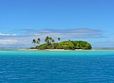
Islands in the Pacific Ocean are of four basic types: continental islands, high islands, coral reefs and uplifted coral platforms. Continental islands lie outside the andesite line and include New Guinea, the islands of New Zealand, and the Philippines. Some of these islands are structurally associated with nearby continents. High islands are of volcanic origin, and many contain active volcanoes. Among these areBougainville,Hawaii, and the Solomon Islands.[65]
Thecoral reefsof the South Pacific are low-lying structures that have built up on basaltic lava flows under the ocean's surface. One of the most dramatic is theGreat Barrier Reefoff northeastern Australia with chains of reef patches. A second island type formed of coral is the uplifted coral platform, which is usually slightly larger than the low coral islands. Examples includeBanaba(formerly Ocean Island) andMakateain the Tuamotu group ofFrench Polynesia.[66][67]
-
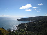
 Ladrilleros Beach inColombiaon the coast ofChocó natural region
 -
 Tahuna maru islet,French Polynesia
 -
 Los Molinoson the coast ofSouthern Chile


Water characteristics[edit]

The volume of the Pacific Ocean, representing about 50.1 percent of the world's oceanic water, has been estimated at some 714 million cubic kilometers (171 million cubic miles).[68]Surface water temperatures in the Pacific can vary from −1.4 °C (29.5 °F), the freezing point of seawater, in the poleward areas to about 30 °C (86 °F) near the equator.[69]Salinityalso varies latitudinally, reaching a maximum of 37 parts per thousand in the southeastern area. The water near the equator, which can have a salinity as low as 34 parts per thousand, is less salty than that found in the mid-latitudes because of abundant equatorial precipitation throughout the year. The lowest counts of less than 32 parts per thousand are found in the far north as less evaporation of seawater takes place in these frigid areas.[70]The motion of Pacific waters is generally clockwise in theNorthern Hemisphere(theNorth Pacific gyre) and counter-clockwise in theSouthern Hemisphere.TheNorth Equatorial Current,driven westward alonglatitude 15°Nby thetrade winds,turns north near the Philippines to become the warm Japan orKuroshio Current.[71]
Turning eastward at about45°N,the Kuroshio forks and some water moves northward as theAleutian Current,while the rest turns southward to rejoin the North Equatorial Current.[72]The Aleutian Current branches as it approaches North America and forms the base of a counter-clockwise circulation in theBering Sea.Its southern arm becomes the chilled slow, south-flowingCalifornia Current.[73]TheSouth Equatorial Current,flowing west along the equator, swings southward east ofNew Guinea,turns east at about50°S,and joins the main westerly circulation of the South Pacific, which includes the Earth-circlingAntarctic Circumpolar Current.As it approaches the Chilean coast, the South Equatorial Current divides; one branch flows aroundCape Hornand the other turns north to form the Peru orHumboldt Current.[74]
Climate[edit]


The climate patterns of the Northern and Southern Hemispheres generally mirror each other. Thetrade windsin the southern and eastern Pacific are remarkably steady while conditions in the North Pacific are far more varied with, for example, cold winter temperatures on the east coast of Russia contrasting with the milder weather offBritish Columbiaduring the winter months due to the preferred flow ofocean currents.[75]
In the tropical and subtropical Pacific, theEl Niño Southern Oscillation(ENSO) affects weather conditions. To determine the phase of ENSO, the most recent three-monthsea surface temperatureaverage for the area approximately 3,000 km (1,900 mi) to the southeast ofHawaiiis computed, and if the region is more than 0.5 °C (0.9 °F) above or below normal for that period, then anEl NiñoorLa Niñais considered in progress.[76]
In the tropical western Pacific, themonsoonand the relatedwet seasonduring the summer months contrast with dry winds in the winter which blow over the ocean from the Asian landmass.[77]Worldwide,tropical cycloneactivity peaks in late summer, when the difference between temperatures aloft and sea surface temperatures is the greatest; however, each particular basin has its own seasonal patterns. On a worldwide scale, May is the least active month, while September is the most active month. November is the only month in which all thetropical cyclone basinsare active.[78]The Pacific hosts the two most activetropical cyclone basins,which are the northwestern Pacific and the eastern Pacific.Pacific hurricanesform south of Mexico, sometimes striking the western Mexican coast and occasionally the Southwestern United States between June and October, whiletyphoonsforming in the northwestern Pacific moving into southeast and east Asia from May to December. Tropical cyclones also form in theSouth Pacific basin,where they occasionally impact island nations.[79]
In the arctic, icing from October to May can present a hazard for shipping while persistent fog occurs from June to December.[80]A climatological low in the Gulf of Alaska keeps the southern coast wet and mild during the winter months. TheWesterliesand associatedjet streamwithin the Mid-Latitudes can be particularly strong, especially in the Southern Hemisphere, due to the temperature difference between the tropics and Antarctica,[81]which records the coldest temperature readings on the planet. In the Southern hemisphere, because of the stormy and cloudy conditions associated withextratropical cyclonesriding the jet stream, it is usual to refer to the Westerlies as the Roaring Forties, Furious Fifties and Shrieking Sixties according to the varying degrees of latitude.[82]
Geology[edit]


The ocean was first mapped byAbraham Ortelius;he called it Maris Pacifici followingFerdinand Magellan's description of it as "a pacific sea" during his circumnavigation from 1519 to 1522. To Magellan, it seemed much more calm (pacific) than the Atlantic.[83]
Theandesite lineis the most significant regional distinction in the Pacific. A petrologic boundary, it separates the deeper,maficigneous rockof the Central Pacific Basin from the partially submerged continental areas offelsicigneous rock on its margins.[84]The andesite line follows the western edge of the islands off California and passes south of theAleutian arc,along the eastern edge of theKamchatka Peninsula,theKuril Islands,Japan, theMariana Islands,theSolomon Islands,and New Zealand'sNorth Island.[85][86]
The dissimilarity continues northeastward along the western edge of theAndesCordilleraalong South America to Mexico, returning then to the islands off California. Indonesia, the Philippines, Japan, New Guinea, and New Zealand lie outside the andesite line.
Within the closed loop of the andesite line are most of the deep troughs, submerged volcanic mountains, and oceanic volcanic islands that characterize the Pacific basin. Here basaltic lavas gently flow out of rifts to build huge dome-shaped volcanic mountains whose eroded summits form island arcs, chains, and clusters. Outside the andesite line, volcanism is of the explosive type, and the PacificRing of Fireis the world's foremost belt of explosivevolcanism.[61]The Ring of Fire is named after the several hundred active volcanoes that sit above the various subduction zones.
The Pacific Ocean is the only ocean which is mostly bounded bysubductionzones. Only the central part of the North American coast and the Antarctic and Australian coasts have no nearby subduction zones.
Geological history[edit]
The Pacific Ocean was born 750 million years ago at the breakup ofRodinia,although it is generally called thePanthalassauntil the breakup ofPangea,about 200 million years ago.[87]The oldest Pacific Ocean floor is only around 180Maold, with older crust subducted by now.[88]
Seamount chains[edit]
The Pacific Ocean contains several longseamountchains, formed byhotspot volcanism.These include theHawaiian–Emperor seamount chainand theLouisville Ridge.
Economy[edit]
The exploitation of the Pacific's mineral wealth is hampered by the ocean's great depths. In shallow waters of the continental shelves off the coasts of Australia and New Zealand,petroleumandnatural gasare extracted, andpearlsare harvested along the coasts of Australia, Japan,Papua New Guinea,Nicaragua, Panama, and the Philippines, although in sharply declining volume in some cases.[89]
Fishing[edit]
Fishare an important economic asset in the Pacific. The shallower shoreline waters of the continents and the more temperate islands yieldherring,salmon,sardines,snapper,swordfish,andtuna,as well asshellfish.[90]Overfishinghas become a serious problem in some areas. Overfishing leads to depleted fish populations and closed fisheries, causing both economic and ecologic consequences.[91]For example, catches in the rich fishing grounds of theOkhotsk Seaoff the Russian coast have been reduced by at least half since the 1990s as a result of overfishing.[92]
Environment[edit]


The Northwestern Pacific Ocean is most susceptible to micro plastic pollution due to its proximity to highly populated countries like Japan and China.[94]The quantity of small plastic fragments floating in the north-east Pacific Ocean increased a hundredfold between 1972 and 2012.[95]The ever-growingGreat Pacific garbage patchbetween California and Japan is three times the size of France.[96]An estimated 80,000 metric tons of plastic inhabit the patch, totaling 1.8 trillion pieces.[97]
Marine pollutionis a generic term for the harmful entry into the ocean of chemicals or particles. The main culprits are those using the rivers for disposing of their waste.[98]The rivers then empty into the ocean, often also bringing chemicals used asfertilizersin agriculture. The excess of oxygen-depleting chemicals in the water leads tohypoxiaand the creation of adead zone.[99]
Marine debris,also known as marine litter, is human-created waste that has ended up floating in a lake, sea, ocean, or waterway. Oceanic debris tends to accumulate at the center of gyres and coastlines, frequently washing aground where it is known as beach litter.[98]
In addition, the Pacific Ocean has served as the crash site of satellites, includingMars 96,Fobos-Grunt,andUpper Atmosphere Research Satellite.
Nuclear waste[edit]

From 1946 to 1958,Marshall Islandsserved as thePacific Proving Grounds,designated by the United States, and played host to a total of 67nuclear testsconducted across various atolls.[101][102]Severalnuclear weaponswere lost in the Pacific Ocean,[103]including one-megaton bomb that was lost during the1965 Philippine Sea A-4 incident.[104]
In 2021, thedischarge of radioactive water from the Fukushima nuclear plantinto the Pacific Ocean over a course of 30 years was approved by the Japanese Cabinet. The Cabinet concluded the radioactive water would have been diluted to drinkable standard.[105]Apart from dumping,leakage of tritium into the Pacificwas estimated to be between 20 and 40 trillionBqsfrom 2011 to 2013, according to the Fukushima plant.[106]
Deep Sea Mining[edit]
An emerging threat for the Pacific ocean is the development of deep-sea mining. Deep-sea mining is aimed at extractingmanganese nodulesthat contain minerals such as magnesium, nickel, copper, zinc and cobalt. The largest deposits of these are found in the Pacific Ocean between Mexico and Hawaii in the Clarion Clipperton Fracture Zone.[107]
Deep-sea mining for manganese nodules appears to have drastic consequences for the ocean. It disrupts deep-sea ecosystems and may cause irreversible damage to fragile marine habitats.[108]Sediment stirring and chemical pollution threaten various marine animals. In addition, the mining process can lead to greenhouse gas emissions and promote further climate change. Preventing deep-sea mining is therefore important to ensure the long-term health of the ocean.
Major ports and harbors[edit]
This sectionneeds expansion.You can help byadding to it.(December 2020) |
List of major ports[edit]
- Acapulco
- Auckland
- Bangkok
- Busan
- Callao
- Cebu City
- Dalian
- Guangzhou
- Haiphong
- Ho Chi Minh City
- Hong Kong
- Honolulu
- Jakarta
- Johor Bahru
- Kaohsiung
- Keelung
- Long Beach
- Los Angeles
- Manila
- Melbourne
- Nagoya
- Nakhodka
- Oakland
- Osaka
- Panama City
- Portland
- San Diego
- San Francisco
- Seattle
- Shanghai
- Singapore
- Sydney
- Tianjin
- Tokyo
- Valparaíso
- Vancouver
- Vladivostok
- Yokohama
List of seas, gulfs and bays by surface area[edit]
- Philippine Sea:5,695,000 km2(2,199,000 sq mi)
- Coral Sea:4,791,000 km2(1,850,000 sq mi)
- South China Sea:3,500,000 km2(1,400,000 sq mi)
- Tasman Sea:2,300,000 km2(890,000 sq mi)
- Bering Sea:2,000,000 km2(770,000 sq mi)
- Sea of Okhotsk:1,583,000 km2(611,000 sq mi)
- Gulf of Alaska:1,533,000 km2(592,000 sq mi)
- East China Sea:1,249,000 km2(482,000 sq mi)
- Sea of Japan:978,000 km2(378,000 sq mi)
- Solomon Sea:720,000 km2(280,000 sq mi)
- Arafura Sea:650,000 km2(250,000 sq mi)
- Banda Sea:470,000 km2(180,000 sq mi)
- Yellow Sea:380,000 km2(150,000 sq mi)
- Gulf of Thailand:320,000 km2(120,000 sq mi)
- Java Sea:320,000 km2(120,000 sq mi)
- Gulf of Carpentaria:300,000 km2(120,000 sq mi)
- Celebes Sea:280,000 km2(110,000 sq mi)
- Sulu Sea:260,000 km2(100,000 sq mi)
- Bismarck Sea:250,400 km2(96,700 sq mi)
- Flores Sea:240,000 km2(93,000 sq mi)
- Molucca Sea:200,000 km2(77,000 sq mi)
- Gulf of Anadyr:200,000 km2(77,000 sq mi)
- Gulf of California:160,000 km2(62,000 sq mi)
- Gulf of Tonkin:126,250 km2(48,750 sq mi)
- Halmahera Sea:95,000 km2(37,000 sq mi)
- Bohai Sea:78,000 km2(30,000 sq mi)
- Gulf of Papua:70,400 km2(27,200 sq mi)
- Koro Sea:58,000 km2(22,000 sq mi)
- Bali Sea:45,000 km2(17,000 sq mi)
- Savu Sea:35,000 km2(14,000 sq mi)
- Bohol Sea29,000 km2(11,000 sq mi)
- Seto Inland Sea:23,203 km2(8,959 sq mi)
- Sibuyan Sea22,400 km2(8,600 sq mi)
- Seram Sea12,000 km (7,500 mi)
- Visayan Sea11,850 km2(4,580 sq mi)
- Gulf of Panama2,400 km2(930 sq mi)
- Manila Bay:2,000 km2(770 sq mi)
- Tokyo Bay:1,500 km2(580 sq mi)
List of islands in the Pacific[edit]
Theories of natural delimitation between the Atlantic and Pacific oceans[edit]

Scientific researchers have proposed delimiting the boundary between the Atlantic and Pacific oceans by two different natural boundaries,by the Shackleton Fracture Zone[109]andby the Scotia Arc[110][111][112]the former being more current than the latter.
See also[edit]
- Asia-Pacific Economic Cooperation
- List of rivers of the Americas by coastline#Pacific Ocean coast
- Pacific Alliance
- Pacific coast
- Mikhail Tikhanov
- Pacific Time Zone
- Seven Seas
- Trans-Pacific Partnership
- War of the Pacific
- Natural delimitation between the Pacific and South Atlantic oceans by the Shackleton Fracture Zone
- Natural delimitation between the Pacific and South Atlantic oceans by the Scotia Arc
References[edit]
- ^abc"Pacific Ocean".Britannica Concise.2008: Encyclopædia Britannica, Inc.
- ^"The Coriolis Effect".National Oceanic and Atmospheric Administration.Retrieved8 April2022.
- ^Administration, US Department of Commerce, National Oceanic and Atmospheric."How big is the Pacific Ocean?".oceanexplorer.noaa.gov.Retrieved18 October2018.
{{cite web}}:CS1 maint: multiple names: authors list (link) - ^"Deepest Submarine Dive in History, Five Deeps Expedition Conquers Challenger Deep"(PDF).
- ^"CONFIRMED: Horizon Deep Second Deepest Point on the Planet"(PDF).
- ^
 One or more of the preceding sentences incorporates text from a publication now in thepublic domain:Herbermann, Charles, ed. (1913). "Ferdinand Magellan".Catholic Encyclopedia.New York: Robert Appleton Company.
- ^"The Marginal Seas Of The Pacific Ocean".World Atlas. 23 November 2018.Retrieved8 April2022.
- ^O'Connor, Sue; Hiscock, Peter (2018). "The Peopling of Sahul and Near Oceania". In Cochrane, Ethan E; Hunt, Terry L. (eds.).The Oxford handbook of prehistoric Oceania.New York.ISBN978-0199925070.
{{cite book}}:CS1 maint: location missing publisher (link) - ^Jett, Stephen C. (2017).Ancient Ocean Crossings: Reconsidering the Case for Contacts with the Pre-Columbian Americas.University of Alabama Press. pp. 168–171.ISBN978-0817319397.Archivedfrom the original on 26 July 2020.Retrieved4 June2020.
- ^Mahdi, Waruno (2017)."Pre-Austronesian Origins of Seafaring in Insular Southeast Asia".In Acri, Andrea; Blench, Roger; Landmann, Alexandra (eds.).Spirits and Ships: Cultural Transfers in Early Monsoon Asia.ISEAS – Yusof Ishak Institute. pp. 325–440.ISBN978-9814762755.Archivedfrom the original on 26 July 2020.Retrieved4 June2020.
- ^Winter, Olaf; Clark, Geoffrey; Anderson, Atholl; Lindahl, Anders (September 2012). "Austronesian sailing to the northern Marianas, a comment on Hung et al. (2011)".Antiquity.86(333): 898–910.doi:10.1017/S0003598X00047992.S2CID161735451.
- ^Heiske, Margit; Alva, Omar; Pereda-Loth, Veronica; Van Schalkwyk, Matthew; Radimilahy, Chantal; Letellier, Thierry; Rakotarisoa, Jean-Aimé; Pierron, Denis (22 January 2021)."Genetic evidence and historical theories of the Asian and African origins of the present Malagasy population".Human Molecular Genetics.30(R1): R72–R78.doi:10.1093/hmg/ddab018.ISSN0964-6906.PMID33481023.
- ^abGray RD, Drummond AJ, Greenhill SJ (January 2009). "Language phylogenies reveal expansion pulses and pauses in Pacific settlement".Science.323(5913): 479–483.Bibcode:2009Sci...323..479G.doi:10.1126/science.1166858.PMID19164742.S2CID29838345.
- ^Pawley A (2002). "The Austronesian dispersal: languages, technologies and people". In Bellwood PS, Renfrew C (eds.).Examining the farming/language dispersal hypothesis.McDonald Institute for Archaeological Research, University of Cambridge. pp. 251–273.ISBN978-1902937205.
- ^Larena, Maximilian (22 March 2021)."Multiple migrations to the Philippines during the last 50,000 years".Proceedings of the National Academy of Sciences of the United States of America.118(13): e2026132118.Bibcode:2021PNAS..11826132L.doi:10.1073/pnas.2026132118.PMC8020671.PMID33753512.
- ^Stanley, David (2004).South Pacific.Avalon Travel. p.19.ISBN978-1-56691-411-6.
- ^Gibbons, Ann."'Game-changing' study suggests first Polynesians voyaged all the way from East Asia ".Science.Archivedfrom the original on 13 April 2019.Retrieved23 March2019.
- ^Van Tilburg, Jo Anne. 1994.Easter Island: Archaeology, Ecology and Culture.Washington D.C.: Smithsonian Institution Press
- ^Langdon, Robert. The Bamboo Raft as a Key to the Introduction of the Sweet Potato in Prehistoric Polynesia,The Journal of Pacific History,Vol. 36, No. 1, 2001
- ^Hannard, Willard A. (1991).Indonesian Banda: Colonialism and its Aftermath in the Nutmeg Islands.Bandanaira:Yayasan Warisan dan Budaya Banda Naira. p. 7.
- ^Milton, Giles(1999).Nathaniel's Nutmeg.London: Sceptre. pp. 5, 7.ISBN978-0-340-69676-7.
- ^Porter, Jonathan. (1996).Macau, the Imaginary City: Culture and Society, 1557 to the Present.Westview Press.ISBN0-8133-3749-6
- ^Ober, Frederick Albion (2010).Vasco Nuñez de Balboa.Library of Alexandria. p. 129.ISBN978-1-4655-7034-5.
- ^Camino, Mercedes Maroto.Producing the Pacific: Maps and Narratives of Spanish Exploration (1567–1606),p. 76. 2005.
- ^Guampedia entry onFerdinand Magellan| url =https://www.guampedia.com/ferdinand-magellan/
- ^"Life in the sea: Pacific Ocean",Oceanário de Lisboa. Retrieved 9 June 2013.
- ^Galvano, Antonio(2004) [1563].The Discoveries of the World from Their First Original Unto the Year of Our Lord 1555, issued by the Hakluyt Society.Kessinger Publishing. p. 168.ISBN978-0-7661-9022-1.[permanent dead link]
- ^Kratoska, Paul H. (2001).South East Asia, Colonial History: Imperialism before 1800, Volume 1 de South East Asia, Colonial History.Taylor & Francis. pp. 52–56.[1]
- ^Whiteway, Richard Stephen (1899).The rise of Portuguese power in India, 1497–1550.Westminster: A. Constable. p.333.
- ^Steven Thomas,"Portuguese in Japan".Steven's Balagan. 25 April 2006.Retrieved22 May2015.
- ^Henderson, James D.; Delpar, Helen; Brungardt, Maurice Philip; Weldon, Richard N. (2000).A Reference Guide to Latin American History.M.E. Sharpe. p.28.ISBN978-1-56324-744-6.
- ^abFernandez-Armesto, Felipe (2006).Pathfinders: A Global History of Exploration.W.W. Norton & Company. pp.305–307.ISBN978-0-393-06259-5.
- ^J.P. Sigmond and L.H. Zuiderbaan (1979)Dutch Discoveries of Australia.Rigby Ltd, Australia. pp. 19–30ISBN0-7270-0800-5
- ^Primary Australian History: Book F [B6] Ages 10–11.R.I.C. Publications. 2008. p. 6.ISBN978-1-74126-688-7.
- ^Lytle Schurz, William (1922), "The Spanish Lake",The Hispanic American Historical Review,5(2): 181–194,doi:10.2307/2506024,JSTOR2506024
- ^Williams, Glyndwr (2004).Captain Cook: Explorations And Reassessments.Boydell Press. p. 143.ISBN978-1-84383-100-6.
- ^"Library Acquires Copy of 1507 Waldseemüller World Map – News Releases (Library of Congress)".Loc.gov.Retrieved20 April2013.
- ^Marty, Christoph."Charles Darwin's Travels on the HMS Beagle".Scientific American.Retrieved23 March2018.
- ^"The Voyage of HMS Challenger".www.interactiveoceans.washington.edu.Retrieved23 March2018.
- ^A Synopsis of the Cruise of the U.S.S. "Tuscarora": From the Date of Her Commission to Her Arrival in San Francisco, Cal. Sept. 2d, 1874.Cosmopolitan printing Company. 1874.
- ^Johnston, Keith (1881)."A Physical, Historical, Political, & Descriptive Geography".Nature.22(553): 95.Bibcode:1880Natur..22Q..95..doi:10.1038/022095a0.S2CID4070183.
- ^abBernard Eccleston, Michael Dawson. 1998.The Asia-Pacific Profile.Routledge. p. 250.
- ^William Sater,Chile and the United States: Empires in Conflict,1990 by the University of Georgia Press,ISBN0-8203-1249-5
- ^Tewari, Nita; Alvarez, Alvin N. (2008).Asian American Psychology: Current Perspectives.CRC Press. p. 161.ISBN978-1-84169-749-9.
- ^The Covenant to Establish a Commonwealth of the Northern Mariana Islands in Political Union With the United States of America,Pub. L.94–241,90Stat.263,enactedMarch 24, 1976
- ^"Area of Earth's Land Surface",The Physics Factbook.Retrieved 9 June 2013.
- ^Nuttall, Mark (2005).Encyclopedia of the Arctic: A–F.Routledge. p. 1461.ISBN978-1-57958-436-8.
- ^"International Journal of Oceans and Oceanography, Volume 15 Number 1, 2021, Determining the Areas and Geographical Centers of Pacific Ocean and its Northern and Southern Halves, pp 25–31, Arjun Tan".Research India Publications.Retrieved18 July2022.
- ^"Plate Tectonics".Bucknell University.Archivedfrom the original on 25 February 2014.Retrieved9 June2013.
- ^Young, Greg (2009).Plate Tectonics.Capstone. p. 9.ISBN978-0-7565-4232-0.
- ^International Hydrographic Organization (1953)."Limits of Oceans and Seas".Nature.172(4376): 484.Bibcode:1953Natur.172R.484..doi:10.1038/172484b0.S2CID36029611.
- ^Agno, Lydia (1998).Basic Geography.Goodwill Trading Co., Inc. p. 25.ISBN978-971-11-0165-7.
- ^"Pacific Ocean: The trade winds",Encyclopædia Britannica.Retrieved 9 June 2013.
- ^Shirley Rousseau Murphy(1979).The Ring of Fire.Avon.ISBN978-0-380-47191-1.
- ^Bryant, Edward (2008).Tsunami: The Underrated Hazard.Springer. p. 26.ISBN978-3-540-74274-6.
- ^"The Map That Named America".www.loc.gov.Retrieved3 December2014.
- ^Ribero, Diego,Carta universal en que se contiene todo lo que del mundo se ha descubierto fasta agora / hizola Diego Ribero cosmographo de su magestad, ano de 1529, e[n] Sevilla,W. Griggs,retrieved30 September2017
- ^K, Harsh (19 March 2017)."This ocean has most of the islands in the world".Mysticalroads.Archived fromthe originalon 2 August 2017.Retrieved6 April2017.
- ^Ishihara, Masahide; Hoshino, Eiichi; Fujita, Yoko (2016).Self-determinable Development of Small Islands.Springer. p. 180.ISBN978-981-10-0132-1.
- ^United States.National Oceanic and Atmospheric Administration;Western Pacific Regional Fishery Management Council(2009).Toward an Ecosystem Approach for the Western Pacific Region: from Species-based Fishery Management Plans to Place-based Fishery Ecosystem Plans: Environmental Impact Statement.Evanston, IL: Northwestern University. p. 60.
- ^abAcademic American encyclopedia.Grolier Incorporated. 1997. p. 8.ISBN978-0-7172-2068-7.
- ^Lal, Brij Vilash; Fortune, Kate (2000).The Pacific Islands: An Encyclopedia.University of Hawaii Press. p. 63.ISBN978-0-8248-2265-1.
- ^West, Barbara A. (2009).Encyclopedia of the Peoples of Asia and Oceania.Infobase Publishing. p. 521.ISBN978-1-4381-1913-7.
- ^Dunford, Betty; Ridgell, Reilly (1996).Pacific Neighbors: The Islands of Micronesia, Melanesia, and Polynesia.Bess Press. p. 125.ISBN978-1-57306-022-6.
- ^Gillespie, Rosemary G.; Clague, David A. (2009).Encyclopedia of Islands.University of California Press. p. 706.ISBN978-0-520-25649-1.
- ^"Coral island",Encyclopædia Britannica.Retrieved 22 June 2013.
- ^"Nauru".Charting the Pacific.ABC Radio Australia. 2005.
- ^"PWLF.org – The Pacific WildLife Foundation – The Pacific Ocean".Archived fromthe originalon 21 April 2012.Retrieved23 August2013.
- ^Mongillo, John F. (2000).Encyclopedia of Environmental Science.University Rochester Press. p. 255.ISBN978-1-57356-147-1.
- ^"Pacific Ocean: Salinity",Encyclopædia Britannica.Retrieved 9 June 2013.
- ^"Wind Driven Surface Currents: Equatorial Currents Background",Ocean Motion. Retrieved 9 June 2013.
- ^"Kuroshio",Encyclopædia Britannica.Retrieved 9 June 2013.
- ^"Aleutian Current",Encyclopædia Britannica.Retrieved 9 June 2013.
- ^"South Equatorial Current",Encyclopædia Britannica.Retrieved 9 June 2013.
- ^"Pacific Ocean: Islands",Encyclopædia Britannica.Retrieved 13 June 2013.
- ^Climate Prediction Center(30 June 2014)."ENSO: Recent Evolution, Current Status and Predictions"(PDF).National Oceanic and Atmospheric Administration.pp. 5, 19–20.Retrieved30 June2014.
- ^Glossary of Meteorology (2009).Monsoon.Archived22 March 2008 at theWayback MachineAmerican Meteorological Society. Retrieved on 16 January 2009.
- ^Atlantic Oceanographic and Meteorological Laboratory – Hurricane Research Division."Frequently Asked Questions: When is hurricane season?".National Oceanic and Atmospheric Administration.Retrieved25 July2006.
- ^Chand, Savin S.; Dowdy, Andrew; Bell, Samuel; Tory, Kevin (2020), Kumar, Lalit (ed.),"A Review of South Pacific Tropical Cyclones: Impacts of Natural Climate Variability and Climate Change",Climate Change and Impacts in the Pacific,Springer Climate, Cham: Springer International Publishing, pp. 251–273,doi:10.1007/978-3-030-32878-8_6,ISBN978-3-030-32878-8,S2CID212780026,retrieved25 October2023
- ^"Pacific Ocean",World Factbook,CIA. Retrieved 13 June 2013.
- ^John P. Stimac.Air pressure and wind.Retrieved on 8 May 2008.
- ^Walker, Stuart (1998).The sailor's wind.W.W. Norton & Company. p.91.ISBN978-0-393-04555-0.
- ^Turnbull, Alexander (2006).Map New Zealand: 100 Magnificent Maps from the Collection of the Alexander Turnbull Library.Godwit. p. 8.ISBN978-1-86962-126-1.
- ^Trent, D. D.; Hazlett, Richard; Bierman, Paul (2010).Geology and the Environment.Cengage Learning. p. 133.ISBN978-0-538-73755-5.
- ^Lal, Brij Vilash; Fortune, Kate (2000).The Pacific Islands: An Encyclopedia.University of Hawaii Press. p. 4.ISBN978-0-8248-2265-1.
- ^Mueller-Dombois, Dieter (1998).Vegetation of the Tropical Pacific Islands.Springer. p. 13.ISBN978-0-387-98313-4.
- ^"GEOL 102 The Proterozoic Eon II: Rodinia and Pannotia".Geol.umd.edu. 5 January 2010.Retrieved31 October2010.
- ^Mussett, Alan E.; Khan, M. Aftab (2000).Looking into the Earth: An Introduction to Geological Geophysics.Cambridge University Press. p. 332.ISBN978-0-521-78574-7.
- ^"Pacific Ocean: Fisheries",Encyclopædia Britannica.Retrieved 12 June 2013.
- ^"Pacific Ocean: Commerce and Shipping",The Columbia Electronic Encyclopedia,6th edition. Retrieved 14 June 2013.
- ^Burgess, Matthew G (16 September 2013)."Predicting overfishing and extinction threats in multispecies fisheries".Proceedings of the National Academy of Sciences.110(40): 15943–15948.Bibcode:2013PNAS..11015943B.doi:10.1073/pnas.1314472110.PMC3791778.PMID24043810.
- ^"Pacific Ocean Threats & Impacts: Overfishing and Exploitation"ArchivedMay 12, 2013, at theWayback Machine,Center for Ocean Solutions. Retrieved 14 June 2013.
- ^"Great Pacific Garbage Patch".Marine Debris Division – Office of Response and Restoration.NOAA. 11 July 2013.Archivedfrom the original on 17 April 2014.
- ^Pan, Zhong; Liu, Qianlong; Sun, Yan; Sun, Xiuwu; Lin, Hui (1 September 2019)."Environmental implications of microplastic pollution in the Northwestern Pacific Ocean".Marine Pollution Bulletin.146:215–224.Bibcode:2019MarPB.146..215P.doi:10.1016/j.marpolbul.2019.06.031.ISSN0025-326X.PMID31426149.S2CID196691104.
- ^Plastic waste in the North Pacific is an ongoing concernBBC 9 May 2012
- ^"'Great Pacific Garbage Patch' is massive floating island of plastic, now 3 times the size of France ".ABC News.23 March 2018.
- ^"'Great Pacific garbage patch' 16 times bigger than previously thought, say scientists ".The Independent.23 March 2018.Archivedfrom the original on 24 May 2022.
- ^abHandwerk, Brian (4 September 2009)."Photos: Giant Ocean-Trash Vortex Documented – A First".National Geographic. Archived fromthe originalon 19 November 2010.
- ^Gerlach, Sebastian A. (1975).Marine Pollution(in German). Berlin: Springer.
- ^Đại nguyệt quy nghĩa (3 November 2020)."Nguyên phát の処 lý thủy, gian thủ tương “Ẩm んでもいい?” Đông điện の thuyết minh は "[Prime Minister Suga asks if the treated radioactive water is drinkable. Here is TEPCO's response].Asahi Shimbun.
- ^"Marshall Islands marks 71 years since start of US nuclear tests on Bikini".Radio New Zealand.1 March 2017.
- ^Lewis, Renee (28 July 2015)."Bikinians evacuated 'for good of mankind' endure lengthy nuclear fallout".Al-Jazeera.
- ^Thaler, Andrew David (26 July 2018)."How many nuclear weapons are at the bottom of the sea. An (almost certainly incomplete) census of broken arrows over water".Southern Fried Science.
- ^Richard Halloran (26 May 1981)."U.S. discloses accidents involving nuclear weapons".The New York Times.
- ^"Fukushima: Japan approves releasing wastewater into ocean".BBC.13 April 2021.
- ^Hsu, Jeremy (13 August 2013)."Radioactive Water Leaks from Fukushima: What We Know".Scientific American.
- ^'PEW - The Clarion-Clipperton Zone - Valuable minerals and many unusual species can be found on the eastern Pacific Ocean seafloor'
- ^Jochen Halfar, Rodney M. Fujita (2007)."Danger of Deep-Sea Mining".Science.316(5827): 987.doi:10.1126/science.1138289.Archived fromthe originalon 21 June 2021.
- ^Juan Ignacio Ipinza Mayor; Cedomir Marangunic Damianovic (2021)."ALGUNAS CONSECUENCIAS JURÍDICAS DE LA INVOCACIÓN POR PARTE DE CHILE DE LA" TEORÍA DE LA DELIMITACIÓN NATURAL DE LOS OCÉANOS "EN EL DIFERENDO SOBRE LA PLATAFORMA CONTINENTAL AUSTRAL".ANEPE(in Spanish).
- ^Barros González, Guillermo (1987)."El Arco de Scotia, separación natural de los océanos Pacífico y Atlántico"(PDF).Revista de Marina(in Spanish).Retrieved22 March2021.
- ^Passarelli, Bruno (1998).El delirio armado: Argentina-Chile, la guerra que evitó el Papa(in Spanish). Editorial Sudamericana. p. 48.ISBN978-9-5007-1469-3.
- ^Santibañez, Rafael (1969). "El Canal Beagle y la delimitación de los océanos".Los derechos de Chile en el Beagle(in Spanish). Santiago: Editorial Andrés Bello. pp. 95–109.OCLC1611130.Retrieved22 March2021.
Further reading[edit]
- Barkley, Richard A. (1968).Oceanographic Atlas of the Pacific Ocean.Honolulu:University of Hawaii Press.
- prepared by the Special Publications Division, National Geographic Society. (1985).Blue Horizons: Paradise Isles of the Pacific.Washington, DC:National Geographic Society.ISBN978-0-87044-544-6.
- Cameron, Ian (1987).Lost Paradise: The Exploration of the Pacific.Topsfield, MA: Salem House.ISBN978-0-88162-275-1.
- Couper, A.D., ed. (1989).Development and Social Change in the Pacific Islands.London: Routledge.ISBN978-0-415-00917-1.
- Gilbert, John (1971).Charting the Vast Pacific.London: Aldus.ISBN978-0-490-00226-5.
- Igler, David (2013).The Great Ocean: Pacific Worlds from Captain Cook to the Gold Rush.New York: Oxford University Press.ISBN978-0-19-991495-1.
- Jones, Eric, Lionel Frost, and Colin White.Coming Full Circle: An Economic History of the Pacific Rim(Westview Press, 1993)
- Lower, J. Arthur (1978).Ocean of Destiny: A Concise History of the North Pacific, 1500–1978.Vancouver:University of British Columbia Press.ISBN978-0-7748-0101-0.
- Napier, W.; Gilbert, J.; Holland, J. (1973).Pacific Voyages.Garden City, NY: Doubleday.ISBN978-0-385-04335-9.
- Nunn, Patrick D. (1998).Pacific Island Landscapes: Landscape and Geological Development of Southwest Pacific Islands, Especially Fiji, Samoa and Tonga[email protected].ISBN978-982-02-0129-3.
- Oliver, Douglas L. (1989).The Pacific Islands(3rd ed.). Honolulu: University of Hawaii Press.ISBN978-0-8248-1233-1.
- Paine, Lincoln.The Sea and Civilization: A Maritime History of the World(2015).
- Ridgell, Reilly (1988).Pacific Nations and Territories: The Islands of Micronesia, Melanesia, and Polynesia(2nd ed.). Honolulu: Bess Press.ISBN978-0-935848-50-2.
- Samson, Jane.British imperial strategies in the Pacific, 1750–1900(Ashgate Publishing, 2003).
- Soule, Gardner (1970).The Greatest Depths: Probing the Seas to 20,000 feet (6,100 m) and Below.Philadelphia: Macrae Smith.ISBN978-0-8255-8350-6.
- Spate, O.H.K. (1988).Paradise Found and Lost.Minneapolis:University of Minnesota Press.ISBN978-0-8166-1715-9.
- Terrell, John (1986).Prehistory in the Pacific Islands: A Study of Variation in Language, Customs, and Human Biology.Cambridge: Cambridge University Press.ISBN978-0-521-30604-1.
Historiography[edit]
- Calder, Alex, et al. eds.Voyages and Beaches: Pacific Encounters, 1769–1840(U of Hawai‘i Press, 1999)
- Davidson, James Wightman. "Problems of Pacific history."Journal of Pacific History1#1 (1966): 5–21.
- Dickson, Henry Newton(1911)..Encyclopædia Britannica.Vol. 20 (11th ed.). pp. 434–441.
- Dirlik, Arif. "The Asia-Pacific Idea: Reality and Representation in the Invention of a Regional Structure",Journal of World History3#1 (1992): 55–79.
- Dixon, Chris, and David Drakakis-Smith. "The Pacific Asian Region: Myth or Reality?"Geografiska Annaler: Series B, Human Geography77#@ (1995): 75+
- Dodge, Ernest S.New England and the South Seas(Harvard UP, 1965).
- Flynn, Dennis O., Arturo Giráldez, and James Sobredo, eds.Studies in Pacific History: Economics, Politics, and Migration(Ashgate, 2002).
- Gulliver, Katrina. "Finding the Pacific world."Journal of World History22#1 (2011): 83–100.online
- Korhonen, Pekka. "The Pacific Age in World History",Journal of World History7#1 (1996): 41–70.
- Munro, Doug.The Ivory Tower and Beyond: Participant Historians of the Pacific(Cambridge Scholars Publishing, 2009).
- "Recent Literature in Discovery History."Terrae Incognitae,annual feature in January issue since 1979; comprehensive listing of new books and articles.
- Routledge, David. "Pacific history as seen from the Pacific Islands."Pacific Studies8#2 (1985): 81+online
- Samson, Jane. "Pacific/Oceanic History" inKelly Boyd, ed. (1999).Encyclopedia of Historians and Historical Writing vol 2.Taylor & Francis. pp. 901–902.ISBN978-1-884964-33-6.
- Stillman, Amy Ku‘uleialoha. "Pacific-ing Asian Pacific American History",Journal of Asian American Studies7#3 (2004): 241–270.
External links[edit]
 Definitionsfrom Wiktionary
 Mediafrom Commons
 Quotationsfrom Wikiquote
 Datafrom Wikidata
- EPIC Pacific Ocean Data Collection Viewableon-line collection of observational data
- NOAA In-situ Ocean Data Viewerplot and download ocean observations
- NOAA PMEL Argo profiling floats Realtime Pacific Ocean data
- NOAA TAOEl Niñodata Realtime Pacific Ocean El Niño buoy data
- NOAA Ocean Surface Current Analyses– Realtime (OSCAR) Near-realtime Pacific Ocean Surface Currents derived from satellite altimeter and scatterometer data
| International | |
|---|---|
| National | |
| Other | |