
Yokohama
Yokohama
Hoành bang thị | |
|---|---|
| City of Yokohama | |
 Flag  Seal | |
 | |
 Map ofKanagawa Prefecturewith Yokohama highlighted in purple | |
 Yokohama  Yokohama Yokohama (Asia) | |
| Coordinates:35°26′39″N139°38′17″E/ 35.44417°N 139.63806°E | |
| Country | Japan |
| Region | Kantō |
| Prefecture | Kanagawa Prefecture |
| Government | |
| • Mayor | Takeharu Yamanaka |
| Area | |
| • Total | 437.38 km2(168.87 sq mi) |
| Population (January 1, 2023) | |
| • Total | 3,769,595 |
| • Density | 8,606/km2(22,290/sq mi) |
| Time zone | UTC+9(Japan Standard Time) |
| – Tree | Camellia,Chinquapin,Sangoju Sasanqua,Ginkgo,Zelkova |
| – Flower | Dahlia Rose |
| Address | 6-50-10 Honchō, Naka-ku, Yokohama-shi, Kanagawa-ken 231-0005 |
| Website | www |


| Yokohama | |||||
|---|---|---|---|---|---|
| Japanese name | |||||
| Kyūjitai | Hoành tân | ||||
| Shinjitai | Hoành bang | ||||
| |||||
Yokohama(Japanese:Hoành bang,pronounced[jokohama])is thesecond-largest cityinJapanby population[1]and by area, and the country's most populousmunicipality.[a]It is the capital and most populous city inKanagawa Prefecture,with a population of 3.7 million in 2023. It lies onTokyo Bay,south ofTokyo,in theKantō regionof the main island ofHonshu.Yokohama is also the major economic, cultural, and commercial hub of theGreater Tokyo Areaalong theKeihin Industrial Zone.
Yokohama was one of the cities to open for trade with theWestfollowing the 1859 end of thepolicy of seclusionand has since been known as a cosmopolitan port city, afterKobeopened in 1853. Yokohama is the home of many Japan's firsts in theMeiji period,including the first foreign trading port and Chinatown (1859), European-style sport venues (1860s), English-language newspaper (1861), confectionery and beer manufacturing (1865), daily newspaper (1870), gas-powered street lamps (1870s), railway station (1872), and power plant (1882). Yokohama developed rapidly as Japan's prominentport cityfollowing the end of Japan's relative isolation in the mid-19th century and is today one of its major ports along withKobe,Osaka,Nagoya,Fukuoka,Tokyo andChiba.
Yokohama is the largest port city and high tech industrial hub in the Greater Tokyo Area and the Kantō region. The city proper is headquarters to companies such asIsuzu,Nissan,JVCKenwood,Keikyu,Koei Tecmo,Sotetsu,Salesforce JapanandBank of Yokohama.Famous landmarks in Yokohama includeMinato Mirai 21,Nippon Maru Memorial Park,Yokohama Chinatown,Motomachi Shopping Street,Yokohama Marine Tower,Yamashita Park,andŌsanbashi Pier.
Etymology
[edit]Yokohama ( hoành bang ) means "horizontal beach".[2]The current area surrounded by Maita Park, theŌoka Riverand the Nakamura River have been a gulf divided by a sandbar from the open sea. This sandbar was the original Yokohama fishing village. Since the sandbar protruded perpendicularly from the land, or horizontally when viewed from the sea, it was called a "horizontal beach".[3]
History
[edit]Opening of the Treaty Port (1859–1868)
[edit]Before the Western foreigners arrived, Yokohama was a small fishing village up to the end of the feudalEdo period,when Japan helda policy of national seclusion,having little contact with foreigners.[4]A major turning point in Japanese history happened in 1853–54, when CommodoreMatthew Perryarrived just south of Yokohama with a fleet of American warships, demanding that Japan open several ports for commerce, and theTokugawa shogunateagreed by signing theTreaty of Peace and Amity.[5]
It was initially agreed that one of the ports to be opened to foreign ships would be the bustling town ofKanagawa-juku(in what is nowKanagawa Ward) on theTōkaidō,a strategic highway that linkedEdoto Kyoto and Osaka. However, theTokugawa shogunatedecided that Kanagawa-juku was too close to the Tōkaidō for comfort, and port facilities were instead built across the inlet in the sleepy fishing village of Yokohama. ThePort of Yokohamawas officially opened on June 2, 1859.[6]
Yokohama quickly became the base of foreign trade in Japan. Foreigners initially occupied the low-lying district of the city calledKannai,residential districts later expanding as the settlement grew to incorporate much of the elevatedYamatedistrict overlooking the city, commonly referred to by English-speaking residents asThe Bluff.Under pressure from United States and United Kingdom officials, the Tokugawa government built a commercial sex district which opened on November 10, 1859, with 6 brothels and 200 indentured sex workers.[7]: 68 The area of Yokohama with the highest concentration of brothels was known as Bloodtown.[7]: 67
Kannai,the foreign trade and commercial district (literally,inside the barrier), was surrounded by a moat, foreign residents enjoying extraterritorial status both within and outside the compound. Interactions with the local population, particularly young samurai, outside the settlement inevitably caused problems; theNamamugi Incident,one of the events that preceded thedownfall of the shogunate,took place in what is nowTsurumi Wardin 1862, and prompted theBombardment of Kagoshimain 1863.
To protect British commercial and diplomatic interests in Yokohama amilitary garrisonwas established in 1862. With the growth in trade increasing numbers of Chinese also came to settle in the city.[8]Yokohama was the scene of many notable firsts for Japan including the growing acceptance of western fashion, photography by pioneers such asFelice Beato,Japan's first English language newspaper, theJapan Heraldpublished in 1861 and in 1865 the first ice cream confectionery andbeerto be produced in Japan.[9]Recreational sports introduced to Japan by foreign residents in Yokohama included European stylehorse racingin 1862,cricketin 1863[10]andrugby unionin 1866. A great fire destroyed much of the foreign settlement on November 26, 1866, andsmallpoxwas a recurrent public health hazard, but the city continued to grow rapidly – attracting foreigners and Japanese alike.
- Gallery
-
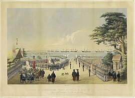 Landing of CommodorePerryand men to meet the Imperial commissioners at Yokohama, 14 July 1853
 -
 Foreign ships in Yokohama harbor in 1861
 -
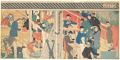 A foreign trading house in Yokohama in 1861


Meiji and Taisho periods (1868–1923)
[edit]After theMeiji Restorationof 1868, the port was developed for tradingsilk,the main trading partner being Great Britain. Western influence and technological transfer contributed to the establishment of Japan's first daily newspaper (1870), first gas-powered street lamps (1872) and Japan's firstrailwayconstructed in the same year to connect Yokohama toShinagawaandShinbashiin Tokyo. In 1872Jules Verneportrayed Yokohama, which he had never visited, in an episode of his widely read novelAround the World in Eighty Days,capturing the atmosphere of the fast-developing, internationally oriented Japanese city.
In 1887, a British merchant,Samuel Cocking,built the city's first power plant. At first for his own use, this coal power plant became the basis for the Yokohama Cooperative Electric Light Company. The city was officially incorporated on April 1, 1889.[11]By the time theextraterritorialityof foreigner areas was abolished in 1899, Yokohama was the most international city in Japan, with foreigner areas stretching from Kannai to theBluffarea and the largeYokohama Chinatown.
The early 20th century was marked by rapid growth of industry. Entrepreneurs built factories along reclaimed land to the north of the city towardKawasaki,which eventually grew to be theKeihin Industrial Area.The growth of Japanese industry brought affluence, and many wealthy trading families constructed sprawling residences there, while the rapid influx of population from Japan and Korea also led to the formation of Kojiki-Yato, then the largest slum in Japan.
- Gallery
-
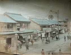 Street scenec. 1880
 -
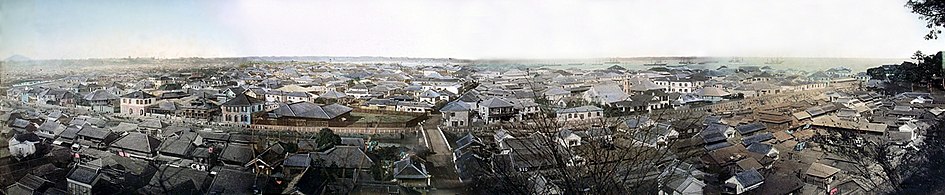 Yokohamac. 1880
 -
 Yokohama Red Brick Warehousewas built in 1913.


Great Kantō earthquake and the Second World War (1923–1945)
[edit]- Gallery
-
 Crown PrinceHirohito(later Emperor) visited Yokohama immediately after the1923 Great Kantō earthquake.
 -
 View of Yokohama after the bombing in 1945


Much of Yokohama was destroyed on September 1, 1923, by theGreat Kantō earthquake.The Yokohama police reported casualties at 30,771 dead and 47,908 injured, out of a pre-earthquake population of 434,170.[12]Fuelled by rumors of rebellion and sabotage, vigilante mobs thereupon murdered many Koreans in the Kojiki-yato slum.[13]Many people believed that Koreans usedblack magicto cause the earthquake.Martial lawwas in place until November 19. Rubble from the quake was used to reclaim land for parks, the most famous being theYamashita Parkon the waterfront which opened in 1930.
Yokohama was rebuilt, only to be destroyed again by U.S. air raids during World War II. The first bombing was in the April 18, 1942Doolittle Raid.An estimated 7,000–8,000 people were killed in a single morning on May 29, 1945, in what is now known as the Great Yokohama Air Raid, whenB-29sfirebombed the city and in just one hour and nine minutes, reducing 42% of it to rubble.[11]
Postwar growth and development
[edit]During theAmerican occupation,Yokohama was a major transshipment base for American supplies and personnel, especially during theKorean War.After the occupation, most local U.S. naval activity moved from Yokohama to an American base in nearbyYokosuka.
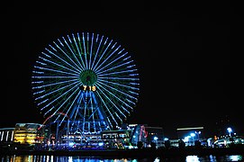
Four years after theTreaty of San Franciscosigned, the city was designated bygovernment ordinanceon September 1, 1956.[citation needed]The city's tram andtrolleybussystem was abolished in 1972, the same year as the opening of the first line ofYokohama Municipal Subway.Construction ofMinato Mirai 21( "Port Future 21" ), a major urban development project on reclaimed land started in 1983, nicknamed the "PhiladelphiaandBostonof the Orient "was compared toCenter City, PhiladelphiaandDowntown Bostonlocated in theEast Coast of the United States.Minato Mirai 21 hosted the Yokohama Exotic Showcase in 1989, which saw the first public operation ofmaglev trainsin Japan and the opening ofCosmo Clock 21,then the tallestFerris wheelin the world. The 860-metre-long (2,820 ft)Yokohama Bay Bridgeopened in the same year. In 1993, Minato Mirai 21 saw the opening of theYokohama Landmark Tower,thesecond-tallest building in Japan.
The2002 FIFA World Cupfinal was held in June at theInternational Stadium Yokohama.In 2009, the city marked the 150th anniversary of the opening of the port and the 120th anniversary of the commencement of the City Administration. An early part in the commemoration project incorporated the FourthTokyo International Conference on African Development(TICAD IV), which was held in Yokohama in May 2008. In November 2010, Yokohama hosted theAsia-Pacific Economic Cooperation(APEC) meeting.
- Gallery
-
 In 1951, during theKorean War,a troopship, theUSSGeneral George M. Randall(AP-115),departs Yokohama, repatriating war dead to the U.S.
 -
 Yokohama Landmark Tower,Japan'sthird-tallest building,was built in 1993.
 -
 TheMinato Mirai 21project, also known as the "PhiladelphiaandBostonof the Orient ", started in 1983.


Geography
[edit]
Topography
[edit]Yokohama has a total area of 437.38 km2(168.87 sq mi) at an elevation of 5 metres (16 ft) above sea level. It is the capital ofKanagawa Prefecture,bordered to the east byTokyo Bayand located in the middle of theKantō plain.The city is surrounded by hills and the characteristic mountain system of the island ofHonshū,so its growth has been limited and it has had to gain ground from the sea. This also affects the population density, one of the highest in Japan with 8,500 inhabitants per km2.
The highest points within the urban boundary are Omaruyama (156 m [512 ft]) and Mount Enkaizan (153 m [502 ft]). The main river is theTsurumi River,which begins in the Tama Hills and empties into thePacific Ocean.[14]
These municipalities surround Yokohama:Kawasaki,Yokosuka,Zushi,Kamakura,Fujisawa,Yamato,Machida.
Geology
[edit]The city is very prone to natural phenomena such asearthquakesandtropical cyclonesbecause the island ofHonshūhas a high level of seismic activity, being in the middle of the PacificRing of Fire.
Most seismic movements are of low intensity and are generally not perceived by people. However, Yokohama has experienced two major tremors that reflect the evolution ofEarthquake engineering:the1923 Great Kantō earthquakedevastated the city and caused more than 100,000 fatalities throughout the region,[15]while the2011 Tōhoku earthquake and tsunami,with its epicenter on the east coast, was felt in the locality but only material damage was lamented because most buildings were already prepared to withstand them.[16]
Climate
[edit]Yokohama features ahumid subtropical climate(Köppen:Cfa) with hot, humid summers and chilly winters.[17]Weatherwise, Yokohama has a pattern of rain, clouds and sun, although in winter, it is surprisingly sunny, more so than Southern Spain. Winter temperatures rarely drop below freezing, while summer can seem quite warm, because of the effects of humidity.[18]The coldest temperature was on 24 January 1927 when −8.2 °C (17.2 °F) was reached, whilst the hottest day was 11 August 2013 at 37.4 °C (99.3 °F). The highest monthly rainfall was in October 2004 with 761.5 millimetres (30.0 in), closely followed by July 1941 with 753.4 millimetres (29.66 in), whilst December and January have recorded no measurable precipitation three times each.
| Climate data for Yokohama (1991−2020 normals, extremes 1896−present) | |||||||||||||
|---|---|---|---|---|---|---|---|---|---|---|---|---|---|
| Month | Jan | Feb | Mar | Apr | May | Jun | Jul | Aug | Sep | Oct | Nov | Dec | Year |
| Record high °C (°F) | 20.8 (69.4) |
24.8 (76.6) |
24.5 (76.1) |
28.7 (83.7) |
31.3 (88.3) |
36.1 (97.0) |
37.2 (99.0) |
37.4 (99.3) |
36.2 (97.2) |
32.4 (90.3) |
26.2 (79.2) |
23.7 (74.7) |
37.4 (99.3) |
| Mean daily maximum °C (°F) | 10.2 (50.4) |
10.8 (51.4) |
14.0 (57.2) |
18.9 (66.0) |
23.1 (73.6) |
25.5 (77.9) |
29.4 (84.9) |
31.0 (87.8) |
27.3 (81.1) |
22.0 (71.6) |
17.1 (62.8) |
12.5 (54.5) |
20.2 (68.4) |
| Daily mean °C (°F) | 6.1 (43.0) |
6.7 (44.1) |
9.7 (49.5) |
14.5 (58.1) |
18.8 (65.8) |
21.8 (71.2) |
25.6 (78.1) |
27.0 (80.6) |
23.7 (74.7) |
18.5 (65.3) |
13.4 (56.1) |
8.7 (47.7) |
16.2 (61.2) |
| Mean daily minimum °C (°F) | 2.7 (36.9) |
3.1 (37.6) |
6.0 (42.8) |
10.7 (51.3) |
15.5 (59.9) |
19.1 (66.4) |
22.9 (73.2) |
24.3 (75.7) |
21.0 (69.8) |
15.7 (60.3) |
10.1 (50.2) |
5.2 (41.4) |
13.0 (55.4) |
| Record low °C (°F) | −8.2 (17.2) |
−6.8 (19.8) |
−4.6 (23.7) |
−0.5 (31.1) |
3.6 (38.5) |
9.2 (48.6) |
13.3 (55.9) |
15.5 (59.9) |
11.2 (52.2) |
2.2 (36.0) |
−2.4 (27.7) |
−5.6 (21.9) |
−8.2 (17.2) |
| Averageprecipitationmm (inches) | 64.7 (2.55) |
64.7 (2.55) |
139.5 (5.49) |
143.1 (5.63) |
152.6 (6.01) |
188.8 (7.43) |
182.5 (7.19) |
139.0 (5.47) |
241.5 (9.51) |
240.4 (9.46) |
107.6 (4.24) |
66.4 (2.61) |
1,730.8 (68.14) |
| Average snowfall cm (inches) | 4 (1.6) |
4 (1.6) |
0 (0) |
0 (0) |
0 (0) |
0 (0) |
0 (0) |
0 (0) |
0 (0) |
0 (0) |
0 (0) |
0 (0) |
9 (3.5) |
| Average precipitation days(≥ 0.5 mm) | 5.7 | 6.3 | 11.0 | 10.7 | 11.1 | 13.5 | 12.0 | 8.8 | 12.7 | 12.1 | 8.6 | 6.2 | 118.8 |
| Averagerelative humidity(%) | 53 | 54 | 60 | 65 | 70 | 78 | 78 | 76 | 76 | 71 | 65 | 57 | 67 |
| Mean monthlysunshine hours | 192.7 | 167.2 | 168.8 | 181.2 | 187.4 | 135.9 | 170.9 | 206.4 | 141.2 | 137.3 | 151.1 | 178.1 | 2,018.3 |
| Source: Japan Meteorological Agency[19] | |||||||||||||
Cityscape
[edit]-
 Yokohama night view (2014)
 -
 View from Mosaic Mall Kohoku (2015)
 -
 View from theYokohama Bay Bridge(2007)
 -
 View fromHikawa Maru(2014)


Demographics
[edit]| Year | Pop. | ±% |
|---|---|---|
| 1870 | 64,602[20] | — |
| 1880 | 72,630 | +12.4% |
| 1890 | 132,627 | +82.6% |
| 1900 | 196,653 | +48.3% |
| 1910 | 403,303 | +105.1% |
| 1920 | 422,942 | +4.9% |
| 1930 | 620,306 | +46.7% |
| 1940 | 968,091 | +56.1% |
| 1950 | 951,188 | −1.7% |
| 1960 | 1,375,710 | +44.6% |
| 1970 | 2,238,264 | +62.7% |
| 1980 | 2,773,674 | +23.9% |
| 1990 | 3,220,331 | +16.1% |
| 2000 | 3,426,651 | +6.4% |
| 2010 | 3,688,773 | +7.6% |
| 2020 | 3,777,491 | +2.4% |
The city's population is 3,772,726 as of 1 June 2024, making it the second-most populated city in the country afterTokyo's 23 special wards.Among Yokohama's 18 wards, the most inhabited wasKohokuwith a population of 364,760, followed byAoba(308,379),Tsurumi(297,230), andTotsuka(282,601). In terms of population density,NishiandMinamiare the most densely populated, with a per square kilometre population exceeding 15,000.[21]Of Yokohama's population, 1,548,077 work outside the city, while 1,226,618 workers commute from outside the city. As these numbers suggest, some of Yokohama's residential areas are commuter suburbs (or "bed towns" as known in Japanese) for those who work in other major cities, primarily Tokyo.[22]
Immigration
[edit]As of June 2024, Yokohama's population includes 121,042 foreign nationals, making up 3.2% of the total population, with the number having grown significantly in recent years. While all three countries with the number of nationals living in Yokohama as citizens exceeding 10,000 are all in Asia (China,South Korea,Vietnam), other major countries of origin for Yokohama's non-Japanese residents includeBrazil(2,823), theUnited States(2,793),Peru(1,312), theUnited Kingdom(840), andGermany(770).[23]There is no official survey of the citizens' countries of birth, hence these numbers do not include naturalized citizens, but they include foreign nationals born outside their country of citizenship.
Administration
[edit]

Municipal adminsitration
[edit]Yokohama is one of the 20designated citiesin the country, which means the city has many powers that usually belong to prefectural governments, while having wards as subdivisions with administrative functions. Yokohama city consists of 18 wards, with its government seat inNaka Ward.TheYokohama City Councilconsists of 86 members elected from a total of 18 Wards. TheLDPhas minority control with 36 seats. The incumbent mayor isTakeharu Yamanaka,who defeated his predecessorFumiko Hayashiin the2021 Yokohama mayoral election.
Wards
[edit]Yokohama has 18wards(ku):
| Wards of Yokohama | ||||||
|---|---|---|---|---|---|---|
| Place Name | Map of Yokohama | |||||
| Rōmaji | Kanji | Population | Land area in km2 | Pop. density
per km2 |
||
| 1 | Aoba-ku | Thanh diệp khu | 302,643 | 35.14 | 8,610 |  |
| 2 | Asahi-ku | Húc khu | 249,045 | 32.77 | 7,600 | |
| 3 | Hodogaya-ku | Bảo thổ ヶ cốc khu | 205,887 | 21.81 | 9,400 | |
| 4 | Isogo-ku | Cơ tử khu | 163,406 | 19.17 | 8,520 | |
| 5 | Izumi-ku | Tuyền khu | 155,674 | 23.51 | 6,620 | |
| 6 | Kanagawa-ku | Thần nại xuyên khu | 230,401 | 23.88 | 9,650 | |
| 7 | Kanazawa-ku | Kim trạch khu | 209,565 | 31.01 | 6,760 | |
| 8 | Kōhoku-ku | Cảng bắc khu | 332,488 | 31.40 | 10,588 | |
| 9 | Kōnan-ku | Cảng nam khu | 221,536 | 19.87 | 11,500 | |
| 10 | Midori-ku | Lục khu | 176,038 | 25.42 | 6,900 | |
| 11 | Minami-ku | Nam khu | 197,019 | 12.67 | 15,500 | |
| 12 | Naka-ku(administrative center) | Trung khu | 146,563 | 20.86 | 7,030 | |
| 13 | Nishi-ku | Tây khu | 93,210 | 7.04 | 13,210 | |
| 14 | Sakae-ku | Vinh khu | 124,845 | 18.55 | 6,750 | |
| 15 | Seya-ku | Lại cốc khu | 126,839 | 17.11 | 7,390 | |
| 16 | Totsuka-ku | Hộ trủng khu | 274,783 | 35.70 | 7,697 | |
| 17 | Tsurumi-ku | Hạc kiến khu | 270,433 | 33.23 | 8,140 | |
| 18 | Tsuzuki-ku | Đô trúc khu | 211,455 | 27.93 | 7,535 | |
Economy
[edit]In 2020, Yokohama's total gross regional product was 14.06 trillion yen or US$133 billion, a 1.9 per cent decrease compared to the previous year due to theCOVID-19 pandemic.This converts to US$35,107 per citizen, below the national average. A large number of Yokohama's citizens work outside the city (693,064 in 2020), primarily inTokyo,and the economic value they generate outside the city does not contribute to Yokohama's economic output. The largest contributors to this figure were wholesale and retail (17.8%), healthcare (11.7%), and academic, professional, or technological services (11.0%).[22]
Major companies headquartered
[edit]-
-
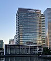
 JVCKenwoodheadquarters inKanagawa-ku
 -
 Koei Tecmoheadquarters inKōhoku-ku
 -
 Keikyu Groupheadquarters in Nishi-ku
 -
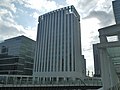
 Sotetsuheadquarters in Nishi-ku
 -
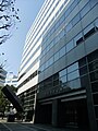
 Isuzuheadquarters in Nishi-ku


Culture and sights
[edit]
Yokohama's cultural and tourist sights include:
- Yokohama Chinatown
- Yokohama Three Towers
- Yamashita Park(at the harbor)
- Harbor View Park
- TheHikawa Maru,historic passenger and cargo ship
- Yokohama Marine Tower
- Yokohama Triennale
- Minato Mirai 21
- Landmark Tower,296 m high, second tallest skyscraper in Japan
- Nippon Maru,museum ship
- Yokohama Stadium(theYokohama DeNA BayStarsPro baseballteams's home field)
- Yokohama Foreign Cemetery
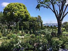
- Sankei-enGarden
- Kishine-Park
- Kanazawa Bunko,preserves the cultural heritage of the Hōjō clan
- Zō-no-Hana Terrace ( tượng の tị テラス)[24]
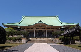
- Gumyōji,oldest temple in the city
Museums
[edit]
There are 42 museums in the city area, including.[25]
- CupNoodles Museum(Momofuku AndōInstant Ramen Museum): Several-floors of interactive exhibits related to the invention of theJapanese instant noodle soup,including soup kitchens where you can try the culture-specific noodle soups.
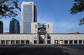
- Kanagawa Prefectural Museum of Cultural History:Located in the historicYokohama Specie Bankbuilding.
- Kanazawa Bunko:Traditional Japanese and Chinese art objects, many dating from the Kamakura period.
- MatsuriMuseum: Dedicated to the shrine festivals (Japanese Matsuri) taking place in Yokohama.
- Silk Museum: Exhibits focusing on the production and processing of silk; including many clothes.
- Yokohama Archives of History:Located in the former British Consulate building with exhibits related to port development and the arrival ofMatthew Perry.
- Yokohama Museum of Art:Founded in 1989, featuring modern works by well-known international and Japanese artists.
Gallery
[edit]-

-
-
-

-
 Yokohama Three TowersandRonald ReaganBoulevard.
 -
 Harbor View Park towards theYokohama Bay Bridge
 -

-

-

-

-

-
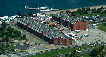
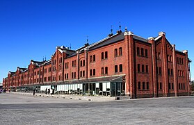 Yokohama Red Brick WarehouseandDouglas MacArthurMemorial Square
 -
 Yokohama World Porters
 -
 Mitsui Outlet Park Yokohama Bayside
 -
 Matthew C. PerryZoo (formerly Yokohama Municipal Kanazawa Zoo)
 -

-
-

-
 Yokohama Foreign General Cemetery
 -
-

-

-
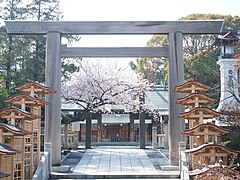 Iseyama Kotai Shrine
 -


Excursion destinations
[edit]In 2016, 46,017,157 tourists visited the city, 13.1% of whom were overnight guests.[25]
- Kodomo no kuni: Means "Children's country". A nice destination to spend an eventful day with the family. Lots of space for walking and playing. There is also a petting zoo.
- Nogeyama Zoo: One of the few zoos that do not charge admission. It has a large number of animals and a petting zoo where children can play with small animals.
- Zoorasia: Nice zoo with lots of play options for children. However, in this zoo admission costs.
- Yokohama Hakkeijima Sea Paradise: A large park with an aquarium. Otherwise rides, shops, restaurants, etc.
- Since 2020, after six years of development, a giant robot namedGundam,which is 18 meters high and weighs 25 tons, has been watching over the port area as a tourist attraction. The giant robot, in which there is a cockpit and whose hands are each two meters long, is based as a figure on a science fiction television series, can move and sink to its knees.[26]The giant robot was manufactured by the company "Gundam Factory Yokohama" under Managing Director Shin Sasaki.
- Kamonyama Park
Sports
[edit]-
 Yokohama Stadiumexterior
 -
 Yokohama Stadiumcrowd
 -
 Yokohama Arenaexterior
 -
 Nissan Stadiumexterior
 -
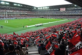 Nissan Stadiumcrowd


- Baseball:Yokohama DeNA BayStars
- Association football:Yokohama F. Marinos(J1 League),Yokohama FC(J2 League),YSCC Yokohama(J3 League), NHK Yokohama FC Seagulls (Nadeshiko League Div.2)
- Velodrome:Kagetsu-en Velodrome
- Basketball:Yokohama B-Corsairs
- Rugby Union:Yokohama Eagles
- Tennis:Ai Sugiyama
- American football:Yokohama Harbors
Transport
[edit]
Yokohama is serviced by theTōkaidō Shinkansen,a high-speed rail line with a stop atShin-Yokohama Station.Yokohama Stationis also a major station, with two million passengers daily. TheYokohama Municipal Subway,Minatomirai LineandKanazawa Seaside Lineprovide metro services.
Air transport
[edit]Yokohama does not have an airport, but is served by Tokyo's two main airportsHaneda Airportwhich is 17.4 km away andNarita International Airportwhich is 77 km away.
Maritime transport
[edit]Yokohama is the world's 31st largest seaport in terms of total cargo volume, at 121,326 freight tons as of 2011[update],and is ranked 37th in terms of TEUs (Twenty-foot equivalent units).[27]
In 2013,APM TerminalsYokohama facility was recognized as the most productive container terminal in the world averaging 163 crane moves per hour, per ship between the vessel's arrival and departure at the berth.[28]
Rail transport
[edit]Railway stations
[edit]- ■East Japan Railway Company (JR East)
- ■Tōkaidō Main Line
- ■Yokosuka Line
- – Yokohama –Hodogaya–Higashi-Totsuka– Totsuka –
- ■Keihin-Tōhoku Line
- –Tsurumi–Shin-Koyasu–Higashi-Kanagawa– Yokohama
- ■Negishi Line
- Yokohama –Sakuragichō–Kannai–Ishikawachō–Yamate–Negishi–Isogo–Shin-Sugita–Yōkōdai–Kōnandai–Hongōdai–
- ■Yokohama Line
- Higashi-Kanagawa –Ōguchi–Kikuna–Shin-Yokohama–Kozukue–Kamoi–Nakayama–Tōkaichiba–Nagatsuta–
- ■Nambu Line
- –Yakō–
- ■Tsurumi Line
- Main Line:Tsurumi –Kokudō–Tsurumi-Ono–Bentembashi–Asano–Anzen–
- Umi-Shibaura Branch:Asano –Shin-Shibaura–Umi-Shibaura
- ■Central Japan Railway Company (JR Central)
- ■Tōkaidō Shinkansen
- – Shin-Yokohama –
- ■Keikyu
- ■Keikyu Main Line
- ■Keikyu Zushi Line
- Kanazawa-Hakkei –Mutsuura–
- ■Tokyu Railways
- ■Tōyoko Line
- –Hiyoshi–Tsunashima–Ōkurayama– Kikuna –Myōrenji–Hakuraku–Higashi-Hakuraku–Tammachi– Yokohama
- ■Meguro Line
- – Hiyoshi
- ■Den-en-toshi Line
- ■Kodomonokuni Line
- Nagatsuta –Onda–Kodomonokuni
- ■Sagami Railway
- ■Sagami Railway Main Line
- ■Izumino Line
- Futamata-gawa –Minami-Makigahara–Ryokuentoshi–Yayoidai–Izumino–Izumi-chūō–Yumegaoka
- ■Yokohama City Transportation Bureau (Yokohama Municipal Subway)
- ■Blue Line
- –Shimoiida–Tateba–Nakada–Odoriba– Totsuka –Maioka–Shimonagaya–Kaminagaya–Kōnan-Chūō– Kami-Ōoka –Gumyōji–Maita–Yoshinochō–Bandōbashi–Isezakichōjamachi– Kannai – Sakuragichō –Takashimachō– Yokohama –Mitsuzawa-shimochō–Mitsuzawa-kamichō–Katakurachō–Kishine-kōen– Shin-Yokohama –Kita Shin-Yokohama–Nippa–Nakamachidai–Center Minami–Center Kita–Nakagawa–Azamino
- ■Green Line
- Nakayama –Kawawachō–Tsuzuki-Fureai-no-Oka– Center Minami – Center Kita –Kita-Yamata–Higashi-Yamata–Takata–Hiyoshi-Honchō– Hiyoshi
- ■Yokohama New Transit
- ■Kanazawa Seaside Line
- Shin-Sugita –Nambu-Shijō–Torihama–Namiki-Kita–Namiki-Chūō–Sachiura–Sangyō-Shinkō-Center–Fukuura–Shidai-Igakubu–Hakkeijima–Uminokōen-Shibaguchi–Uminokōen-Minamiguchi–Nojimakōen– Kanazawa-Hakkei
Education
[edit]Public elementary and middle schools are operated by the city of Yokohama. There are nine public high schools which are operated by the Yokohama City Board of Education,[29]and a number of public high schools which are operated by theKanagawa Prefectural Board of Education.Yokohama National Universityis a leading university in Yokohama which is also one of the highest ranking national universities in Japan.
- 46,388 children attend the 260 kindergartens.
- Almost 386,000 students are taught in 351 primary schools.
- There are 16 universities includingYokohama National University.The number of students is around 83,000.
- 19 public libraries had 9.5 million loans in 2016.[25]
In popular culture
[edit]- Yukio Mishima's novelThe Sailor Who Fell from Grace with the Seais set mainly in Yokohama. Mishima describes the city's port and its houses, and the Western influences that shaped them.
- From Up on Poppy Hillis a 2011Studio Ghiblianimated drama film directed byGorō Miyazakiset in theYamatedistrict of Yokohama. The film is based on the serialized Japanese comic book of the same name.
- The main setting ofJames Clavell's bookGai-Jinis in historical Yokohama.
- Vermilion City in the Kanto region from the Pokémon franchise is based on Yokohama. During the closing ceremony of the 2022Pokémon World ChampionshipsinLondon,Yokohama was announced as the 2023 host city by using footage of Vermilion City fromPokémon Red, Blue, and Yellow.The 2023 World Championships were held at thePacifico Yokohamabetween August 11–13, 2023. In the video game division, the host country won the finals of all three age divisions.
- One of thePretty Curecrossover movies takes place in Yokohama. In the fourth movie of the series,Pretty Cure All Stars New Stage: Friends of the Future,the Pretty Cure appear standing on top of theCosmo Clock 21inMinato Mirai.
- The main setting of the Japanesevisual novelseriesMuv-Luv,first a school and then, in an alternate history, a military base is built in Yokohama with the objective of carrying out the Alternative IV Plan meant to save humanity.
- InCommand & Conquer: Red Alert 3,Yokohama is under siege by the Soviet Union and Allied Nations to stop the Empire of The Rising Sun. The player must defend Yokohama and then lead a counterattack as the Empire.
- The mangaBungo Stray Dogsis set in Yokohama.
- The Japanese mixed-media project,Hamatoratakes place in Yokohama.
- The final battles inGodzilla vs. Mothra(1992) andGodzilla, Mothra and King Ghidorah: Giant Monsters All-Out Attack(2001) take place in Yokohama.
- InMy Hero Academia,it is the location of the Nomu Warehouse where they created artificial Humans (a.k.a. Nomus).
- Sumaru City in thePersona 2duology is based on Yokohama.
- Miyabi City inThe Caligula Effectis based on Yokohama, including depictions of landmarks such as an unfinished Landmark Tower andYokohama Hakkeijima Sea Paradise(referred to in game as Sea Paraiso).
- The video gameYakuza: Like a Dragonis set in Isezaki Ijincho, a fictional district in Yokohama based onIsezakichō.
- Yokohama is also represented in the multimedia project byKing Records,Hypnosis Mic: Division Rap Battle
- Yokohama is the main setting of Japanese manga and anime seriesKomi Can't Communicate.Multiple of the cities' landmarks are featured on the manga, most notably in the more recently released chapters.
- Yokohama is the setting of the animeAfter the Rainas well as manga series with the same title byJun Mayuzuki.
- In April 2022, The Yokohama Convention & Visitors Bureau announced the launch of a new interactive website to aid in the tourism and MICE elements of the city.[30]
- Akira Kurosawa's 1963 filmHigh and lowwas filmed and set in Yokohama.
International relations
[edit]
Twin towns – sister cities
[edit] Constanța,Constanța County,Romania, since October 1977
 Lyon,Auvergne-Rhône-Alpes,France, since April 1959
 Manila,Philippines, since July 1965
 Mumbai,Maharashtra,India, since June 1965
 Odesa,Odesa Oblast,Ukraine, since July 1965
 San Diego,CA,United States, since October 1957
 Shanghai,China, since November 1973
 Vancouver,BC,Canada, since July 1965
Yokohama also cooperates with:
- Los Angeles,CA,United States
Partner cities
[edit] Abidjan,Ivory Coast
- Beijing,China, since May 2006
 Brisbane,Queensland,Australia, since June 2008
 Busan,South Korea, since June 2006
 Frankfurt,Hesse,Germany, since September 2011
 Hanoi,Vietnam, since November 2007
- Ho Chi Minh City,Vietnam, since October 2007
- Incheon,South Korea, since December 2009
- Melbourne,Victoria,Australia
 Seberang Perai,Penang,Malaysia, since August 2016[32]
 Taipei,Taiwan, since May 2006
 Tel Aviv,Israel, since July 2012
- Tianjin,China, since May 2008
Sister ports
[edit] Port of Barcelona,Spain,since November 1989
- Port of Dalian,friendship port treaty, since September 1990
- Port of Hamburg,Germany, since October 1992
- Port of Melbourne,Australia, since May 1986
- Port of Oakland,United States, since May 1980
- Port of Vancouver,Canada, since May 1981
- Port of Shanghai,friendship port treaty, since October 1983
Notable people
[edit]- Lily Abegg,journalist
- Jo Asakura, member of Japanese boy group&Team
- TheBrahman Brothers,professional wrestlers
- Toru Furuya,singer and voice actor
- Shigetoshi Hasebe,football manager and former player
- Tamon Honda,professional wrestler
- Joe Higuchi,professional wrestler
- Antonio Inoki,professional wrestler and politician
- Naoya Inoue,boxer
- Yuma Kagiyama,figure skater
- Shinobu Kandori,politician and professional wrestler
- Crystal Kay,singer
- Hana Kimura,professional wrestler
- Kyoko Kimura,professional wrestler
- Masahiko Kondō,singer and racing driver
- Miki Koyama,racing driver
- Takehito Koyasu,singer and voice actor
- Ryuji Kumita,racing driver and CEO ofB-Max Racing
- Keisuke Kunimoto,racing driver
- Yuji Kunimoto,racing driver
- Natsumi Maki,known by ring nameNatsupoi,professional wrestler
- Hiro Matsuda,professional wrestler
- Yūta Mochizuki,actor
- Akinori Ogata,racing driver
- Radwimps,alternative rock band
- Takuro Shinohara,racing driver
- Minoru Suzuki,professional wrestler
- Kuniaki Takahashi,drifting driver
- Yasuto Wakizaka,footballer
- Yuta Watanabe,NBA player for theToronto Raptors
- Miki Yamane,footballer
References
[edit]Citations
[edit]- ^"YOKOHAMA | Meaning & Definition for UK English | Lexico.com".En.oxforddictionaries.com.Archivedfrom the original on April 1, 2019.RetrievedFebruary 19,2022.
- ^"Memories of old Honmoku".The Japan Times.May 19, 1999.Archivedfrom the original on April 15, 2021.RetrievedMarch 3,2021.
- ^"Yokohama City History, pg. 3"(PDF).Archived(PDF)from the original on July 9, 2018.RetrievedJuly 9,2018.
- ^Der Große Brockhaus.16. edition. Vol. 6. F. A. Brockhaus, Wiesbaden 1955, p. 82
- ^"Official Yokohama city website it is fresh".City.yokohama.jp. Archived fromthe originalon June 12, 2010.RetrievedMay 5,2010.
- ^Arita, Erika, "Happy Birthday Yokohama!ArchivedAugust 31, 2010, at theWayback Machine",The Japan Times,May 24, 2009, p. 7.
- ^abDriscoll, Mark W. (2020).The Whites are Enemies of Heaven: Climate Caucasianism and Asian Ecological Protection.Durham:Duke University Press.ISBN978-1-4780-1121-7.
- ^Fukue, Natsuko, "Chinese immigrants played vital roleArchivedAugust 24, 2010, at theWayback Machine",Japan Times,May 28, 2009, p. 3.
- ^Matsutani, Minoru, "Yokohama – city on the cutting edgeArchivedAugust 26, 2010, at theWayback Machine",Japan Times,May 29, 2009, p. 3.
- ^Galbraith, Michael (June 16, 2013)."Death threats sparked Japan's first cricket game".Japan Times.Archivedfrom the original on April 1, 2019.RetrievedApril 1,2016.
- ^ab"Interesting Tidbits of Yokohama".Yokohama Convention & Visitors Bureau.Archived fromthe originalon May 5, 2009.RetrievedFebruary 7,2009.
- ^Hammer, Joshua. (2006).Yokohama Burning: The Deadly 1923 Earthquake and Fire that Helped Forge the Path to World War II,p. 143.ArchivedFebruary 5, 2017, at theWayback Machine
- ^Hammer,pp. 149ArchivedFebruary 5, 2017, at theWayback Machine-170.
- ^"Tsurumi River Multipurpose Retarding Basin".japanriver.or.jp.Archivedfrom the original on September 26, 2017.RetrievedJanuary 9,2016.
- ^"Collection of 1923 Japan earthquake massacre testimonies released".hani.co.kr.September 3, 2013.Archivedfrom the original on March 4, 2016.RetrievedJanuary 8,2016.
- ^"FNN Remembering 3/11: Yokohama station and surrounding areas at time of earthquake occurrence".fnn-news.com.Archivedfrom the original on March 5, 2016.RetrievedJanuary 10,2016.
- ^"Yokohama, Japan Köppen Climate Classification (Weatherbase)".Weatherbase.Archivedfrom the original on December 21, 2019.RetrievedJuly 9,2019.
- ^"Yokohama Weather, When to Go and Yokohama Climate Information".world-guides.com.Archivedfrom the original on April 30, 2012.RetrievedJanuary 11,2010.
- ^Khí tượng sảnh / bình niên trị ( niên ・ nguyệt ごとの trị ).Japan Meteorological Agency.Archivedfrom the original on May 17, 2021.RetrievedMay 19,2021.
- ^Japanese Imperial Commission (1878).Le Japon à l'exposition universelle de 1878. Géographie et histoire du Japon(in French).
- ^"Lệnh hòa 6(2024) niên nhân khẩu ・ thế đái sổ".www.city.yokohama.lg.jp(in Japanese).RetrievedJuly 27,2024.
- ^ab"Yokohama's Economy in Data"(PDF).www.city.yokohama.lg.jp.Retrieved July 27, 2024.
- ^"Lệnh hòa 6(2024) niên ngoại quốc nhân の nhân khẩu".www.city.yokohama.lg.jp(in Japanese).RetrievedJuly 27,2024.
- ^"Webseite des Kulturzentrums".Archivedfrom the original on April 17, 2021.RetrievedApril 16,2021.
- ^abc"Statistical Booklet Book of Yokohama 2018"(PDF).www.city.yokohama.lg.jp.Archived fromthe original(PDF)on October 16, 2018.RetrievedNovember 2,2020.
- ^Tagesthemen.Beitrag in der Nachrichtensendung der ARD, Moderation:Ingo Zamperoni,30. November 2020, 35 Min. Eine Produktion vonDas Erste
- ^"Ports & World Trade".www.aapa-ports.org.Archivedfrom the original on May 4, 2011.RetrievedJuly 3,2014.
- ^"Chinese Ports Lead the World in Berth Productivity, JOC Group Inc. Data Shows".Press Release.AXIO Data Group. JOC Inc. June 24, 2014.Archivedfrom the original on April 6, 2017.RetrievedMarch 20,2015.
- ^"Official Yokohama city website".City.yokohama.jp. Archived fromthe originalon June 19, 2010.RetrievedMay 5,2010.
- ^"Virtual Yokohama: Interactive Website Launched".Business Wire.April 28, 2022.RetrievedApril 29,2022.
- ^"Yokohama's Sister/Friendship Cities".city.yokohama.lg.jp.Yokohama.Archivedfrom the original on February 3, 2021.RetrievedFebruary 25,2021.
- ^"MPSP sets sights on city status".The Star.August 1, 2016.Archivedfrom the original on July 5, 2018.RetrievedJuly 4,2018.
Sources
[edit]- Hammer, Joshua (2006).Yokohama Burning: The Deadly 1923 Earthquake and Fire that Helped Forge the Path to World War IIArchivedJune 23, 2016, at theWayback Machine.New York:Simon & Schuster.ISBN978-0-7432-6465-5(cloth).
- Heilbrun, Jacob."Aftershocks"ArchivedJanuary 15, 2018, at theWayback Machine.The New York Times,September 17, 2006.
Notes
[edit]- ^AlthoughTokyohas over 10 million more people than Yokohama, there has been no singleTokyo municipalitysince 1943.
External links
[edit]- Official Website(in Japanese)
- Yokohama Tourism Website(in English)
 Geographic data related toYokohamaatOpenStreetMap
| |||||||||||||||||||||||||||||||||||